Fraud Blocker Skip to main content

Home > Sheffield City Archives > Maps and Plans

Maps and Plans Collection (page 2)

208 items

We are proud to offer this selection in partnership with Sheffield City Archives

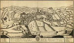
Background imageMaps and Plans Collection: North perspective view of the town of Sheffield, c. 1737

North perspective view of the town of Sheffield, c. 1737
Inscription reads: 'To the Worshipful the Master Wardens, Searchers and Assistants of the Corporation of Cutlers in Hallamshire in the County of York

Background imageMaps and Plans Collection: Plan showing the connexion of canals and navigable rivers by the proposed north-eastern Canal

Plan showing the connexion of canals and navigable rivers by the proposed north-eastern Canal, 19th cent
By C. Smith, Strand. From Bristol in the south to York in the north, Liverpool in the west and Hull in the east) From an original at Sheffield Libraries: arc02904

Background imageMaps and Plans Collection: A map of the land belonging to Wortley Forges, 1746

A map of the land belonging to Wortley Forges, 1746
Marked: Three Acres, Two Acres, the High Road, Staniland Holme, Smithy Mires, River Dun [River Don], garden, Five Acres, Dusting Close, Back Meadows, Shop Croft, Nether Forge

Background imageMaps and Plans Collection: Part of the United Provinces with the marches of the different divisions of the Prussian army in

Part of the United Provinces with the marches of the different divisions of the Prussian army in September 1787
Prussian invasion of Holland (Netherlands). From an original at Sheffield Libraries: arc02905

Background imageMaps and Plans Collection: Map of Joseph Machens Farm at Wadsley Bridge, Sheffield, 1790

Map of Joseph Machens Farm at Wadsley Bridge, Sheffield, 1790
Full title: A map of Joseph Machens Farm at Wadsley Bridge held of the Duke of Norfolk with other intermediate lands Scale 4 chains : 1 inch [20 inches : 1 mile]. Surveyor: William Fairbank II

Background imageMaps and Plans Collection: Upper ground floor plan of new Castle Market, Haymarket / Waingate, 1958

Upper ground floor plan of new Castle Market, Haymarket / Waingate, 1958
Image from New Market Building, Sheffield Markets Committee, 1958 (Sheffield Local Studies Library: 352.9 SSTF)

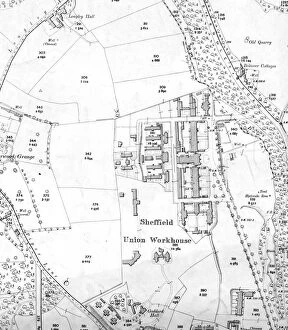
Background imageMaps and Plans Collection: Sheffield Workhouse, Fir Vale, later Northern General Hospital on Ordnance Survey map, 1905

Sheffield Workhouse, Fir Vale, later Northern General Hospital on Ordnance Survey map, 1905
Scale 25 inches : 1 mile.Sheet 288.16.Also shows Longley Hall, Goddard Hall and Bolsover Cottages

Background imageMaps and Plans Collection: Street map of Nether Hallam

Street map of Nether Hallam
Undated but before 1897 as it shows Hillsborough Hall and grounds which were acquired by the City Council in that year and the grounds opened as Hillsborough Park

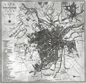
Background imageMaps and Plans Collection: A Plan of Sheffield in 1823 (with Ralph Goslings map of Sheffield in 1736 in top right hand corner)

A Plan of Sheffield in 1823 (with Ralph Goslings map of Sheffield in 1736 in top right hand corner), 1823
By John Leather.Scale 700 yards : 2.2 inches.Original at Local Studies Library: S2S

Background imageMaps and Plans Collection: Map of the West Riding of Yorkshire, divided into Wapentakes and Boroughs

Map of the West Riding of Yorkshire, divided into Wapentakes and Boroughs, and shewing all its Railways, Roads, Rivers
By J H Franks for William Whites Directory of the West Riding.Scale 15 miles : 2.7 inches.Original at Local Studies Library: E3M

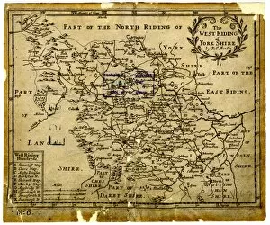
Background imageMaps and Plans Collection: The West Riding of Yorkshire, 1701

The West Riding of Yorkshire, 1701
By Robert Morden.Scale 10 small miles : 1 1/8 inches.Original at Local Studies Library: E3VS

Background imageMaps and Plans Collection: Roads at Lodge Moor Hospital: A plan showing carriageways and ash paths, early 20th cent

Roads at Lodge Moor Hospital: A plan showing carriageways and ash paths, early 20th cent
Surveyor: Sheffield City Council.Scale: 60 feet : 1 inch.Original at Sheffield Local Studies Library:s (9) 5 L

Background imageMaps and Plans Collection: A Map of Norwood Hall Estate in the Township of Brightside Bierlow

A Map of Norwood Hall Estate in the Township of Brightside Bierlow and some adjoining Lands of the Duke of Norfolk
Norwood Hall and Grounds (later known as Bishopholme), Norwood Lane later named Herries Road.Original at Sheffield Local Studies Library:s (15) 1 L

Background imageMaps and Plans Collection: King Edward VII Crippled Childrens Institution, Rivelin Valley Road - block plan, 1913

King Edward VII Crippled Childrens Institution, Rivelin Valley Road - block plan, 1913
Architect: Arthur William Kenyon, ARIBA, 8a George Street, Sheffield.Scale 30 feet : 1 inch.Original at Sheffield City Archives ref. CA206/38355h

Background imageMaps and Plans Collection: Gallery floor plan of new Castle Market, Haymarket / Waingate, 1958

Gallery floor plan of new Castle Market, Haymarket / Waingate, 1958
Image from New Market Building, Sheffield Markets Committee, 1958 (Sheffield Local Studies Library: 352.9 SSTF)

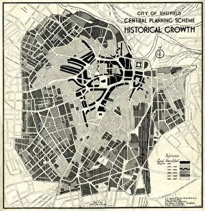
Background imageMaps and Plans Collection: City of Sheffield Central Planning Scheme, Historical Growth, 1938

City of Sheffield Central Planning Scheme, Historical Growth, 1938
Shows how Sheffield developed from 1736 onwards.Published by Sheffield City Council, Town Planning CommitteeScale: 208.33 feet : 1 inch.Size: 52 x 45 cm.Original at Sheffield Local Studies Library

Background imageMaps and Plans Collection: Floor plan of Norton Hall, 1848

Floor plan of Norton Hall, 1848
Detail from map of Norton Estate as allotted for sale (see y10811).Sheffield Local Studies Library:s (25) 6A L

Background imageMaps and Plans Collection: Plan of Broombank House and other freehold property situate in Clarkehouse Lane belonging to

Plan of Broombank House and other freehold property situate in Clarkehouse Lane belonging to the late Francis Newton
All that valuable freehold residence called Broombank, situate in Clarkehouse Lane... with the large yard, coach house, stable (for three horses), outbuildings, pleasure and kitchen gardens

Background imageMaps and Plans Collection: Plan of the Moorhall Estate to be sold by auction, 1861

Plan of the Moorhall Estate to be sold by auction, 1861
Moor Hall mansion and estate with moorland and grouse shooting. The ancient and substantial freehold messuage or mansion called Moor Hall [More Hall] situate in a Bradfield a with the gardens

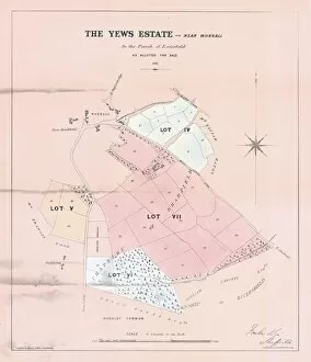
Background imageMaps and Plans Collection: Plan of the Yews Estate, near Worrall, for sale by auction, 1862

Plan of the Yews Estate, near Worrall, for sale by auction, 1862
Lot 4 farm house, barn, stable, cowhouse, outbuildings, garden and yard (including Oxley Field and Middlewood Field).Lot 5 Great Langhouse Field, Far Langhouse Field

Background imageMaps and Plans Collection: Plan of freehold estates in the hamlets of Owlerton and Wadsley in the township of Bradfield in

Plan of freehold estates in the hamlets of Owlerton and Wadsley in the township of Bradfield in the parish of
Lot 1 a parcel of pasture land with a valuable frontage to the Halifax and Sheffield turnpike Road, called the Kittling Troughs

Background imageMaps and Plans Collection: Plan of Freehold Estate at Crookes Moor [Crookesmoor] belonging to the executors of the late P

Plan of Freehold Estate at Crookes Moor [Crookesmoor] belonging to the executors of the late P Ashberry esquire
Scale: 30 feet : 1 inch.Surveyor: T. H. Jenkinson.Original at Sheffield Local Studiess (5) 2 L

Background imageMaps and Plans Collection: Map of the Pitsmoor district in the Parish of Sheffield, 1846

Map of the Pitsmoor district in the Parish of Sheffield, 1846
Size 21 x 15 cm. Original at Local Studies Library: S(15)4VS

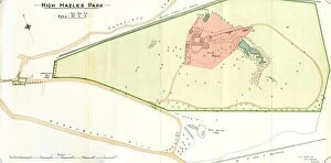
Background imageMaps and Plans Collection: Plan of High Hazels Park, 1897

Plan of High Hazels Park, 1897
Image from Sheffield City Council, General Purposes and Parks Committee - Plans and Description of Parks and Recreation Grounds (Local Studies Library 352.7 SQ)

Background imageMaps and Plans Collection: Plan of Attercliffe Recreation Ground (Worthing Road / Ripon Street / Woodbourn_Road), 1897

Plan of Attercliffe Recreation Ground (Worthing Road / Ripon Street / Woodbourn_Road), 1897
Image from Sheffield City Council, General Purposes and Parks Committee - Plans and Description of Parks and Recreation Grounds (Local Studies Library 352.7 SQ)

Background imageMaps and Plans Collection: Site of Sheffield Castle as shown on Ordnance Survey map, 1890

Site of Sheffield Castle as shown on Ordnance Survey map, 1890
Scale: 1:500. Sheet CCXCIV.8.12

Background imageMaps and Plans Collection: Ordnance Survey map of south Sheffield copied by the Germans, and marked with bombing targets

Ordnance Survey map of south Sheffield copied by the Germans, and marked with bombing targets
Original at Sheffield City Archives MD7731/6 and Sheffield Local Studies Librarys 26 M/3

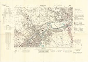
Background imageMaps and Plans Collection: Ordnance Survey map of east end of Sheffield (and Rotherham) copied by the Germans

Ordnance Survey map of east end of Sheffield (and Rotherham) copied by the Germans, and marked with bombing targets
Original at Sheffield City Archives MD7731/2 and Sheffield Local Studies Librarys 26 M/2

Background imageMaps and Plans Collection: Plan of an enlargement of the [General] Cemetery and of a new road leading thereto

Plan of an enlargement of the [General] Cemetery and of a new road leading thereto
Scale 1 inch : 90 yards.Surveyors: Flockton, Lee and Flockton, engineers.Original at Sheffield City Archives: FC/P/SheD/596S

Background imageMaps and Plans Collection: Map of the South Yorkshire Coal Railway, and of the Canals and Railways communicating with

Map of the South Yorkshire Coal Railway, and of the Canals and Railways communicating with the district, 1846
By C. Bartholomew, Civil Engineer.Scale 2 miles : 1 inch.Original at Sheffield City Archives: BM/71

Background imageMaps and Plans Collection: Map of Sheffield (S[outh]) Woodhouse Rix[s]on, Werksgruppe fur 3 Edelstahlwerke

Map of Sheffield (S[outh]) Woodhouse Rix[s]on, Werksgruppe fur 3 Edelstahlwerke
Map title translates as Sheffield (S[outh]) Woodhouse Rixon, Group of 3 high-grade steel works.Forms a section of Ordnance Survey map

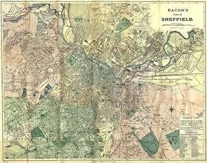
Background imageMaps and Plans Collection: Bacon's large scale plan of Sheffield, c.1890s

Bacon's large scale plan of Sheffield, c.1890s
Published by G W Bacon & Co Ltd. c. 1890s. Scale [7.4 inches : 1 mile]. Shows Borough wards. Dimensions of original: 70 x 55 cm. Original at Sheffield Libraries: y15494

Background imageMaps and Plans Collection: Plan of Freehold Property situate in High Street belonging to William Younge, 1847

Plan of Freehold Property situate in High Street belonging to William Younge, 1847
Surveyor: James Harrison.Scale: 100 feet : 12.4 inches.Original at Sheffield Local Studies Library:s (20)s L

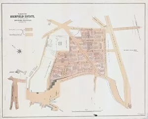
Background imageMaps and Plans Collection: Plan of the Highfield Estate as laid out for Building Purposes, 1873

Plan of the Highfield Estate as laid out for Building Purposes, 1873
Surveyor: Holmes and Johnson.Scale: 200 feet : 3 inches.Original at Sheffield Local Studies Library:s (22)s L

Background imageMaps and Plans Collection: Plan of the Turkish, Swimming and other baths, Convent Walk, Sheffield; for sale, 1890

Plan of the Turkish, Swimming and other baths, Convent Walk, Sheffield; for sale, 1890
Surveyor: The Sheffield Bath Co Ltd.Scale: 10 feet : 1 inch.Original at Sheffield Local Studies Library:s (20) 57 L

Background imageMaps and Plans Collection: Map of the Vicarage Croft in Sheffield a, 1756

Map of the Vicarage Croft in Sheffield a, 1756
Original at Sheffield Local Studies Library:s (20) 1 L

Background imageMaps and Plans Collection: Plan of three lots of freehold property belonging to the administratrix of the late Samuel Cocker

Plan of three lots of freehold property belonging to the administratrix of the late Samuel Cocker, 1850
Original at Sheffield Local Studies Library:s (16) 1 L

Background imageMaps and Plans Collection: Proposed street improvement between Commercial Street and Market Street

Proposed street improvement between Commercial Street and Market Street
Original at Sheffield Local Studies Library

Background imageMaps and Plans Collection: Plan of H I Dixon esquires Stumperlow Estate as proposed to be laid out for building purposes, 1886

Plan of H I Dixon esquires Stumperlow Estate as proposed to be laid out for building purposes, 1886
Original at Sheffield Local Studies Library:s (9) 9 L

Background imageMaps and Plans Collection: King Edward VII Crippled Childrens Institution, Rivelin Valley Road - central portion of ground

King Edward VII Crippled Childrens Institution, Rivelin Valley Road - central portion of ground plan, 1913
Architect: Arthur William Kenyon, ARIBA, 8a George Street, Sheffield.Scale 8 feet : 1 inch.Original at Sheffield City Archives ref. CA206/38355a

Background imageMaps and Plans Collection: Plan of part of the town of Sheffield comprising the site of the present and proposed Corn

Plan of part of the town of Sheffield comprising the site of the present and proposed Corn
Original at Sheffield Local Studies Library:s (19) 1 L

Background imageMaps and Plans Collection: City of Sheffield Markets, 1924

City of Sheffield Markets, 1924
Original at Sheffield Local Studies Library:s (19) 22 L

Background imageMaps and Plans Collection: Plan of freehold and leasehold property situate at Sharrow Head and Heeley to be sold by auction

Plan of freehold and leasehold property situate at Sharrow Head and Heeley to be sold by auction, 1851
Full details are recorded in the sale particulars.Lot 1 freehold capital; mansion house, outbuildings, pleasure grounds and garden, known as Sharrow Head

Background imageMaps and Plans Collection: Office floor plan of new Castle Market, Haymarket / Waingate, 1958

Office floor plan of new Castle Market, Haymarket / Waingate, 1958
Image from New Market Building, Sheffield Markets Committee, 1958 (Sheffield Local Studies Library: 352.9 SSTF)

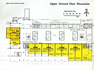
Background imageMaps and Plans Collection: Upper ground floor mezzanine plan of new Castle Market, Haymarket / Waingate, 1958

Upper ground floor mezzanine plan of new Castle Market, Haymarket / Waingate, 1958
Image from New Market Building, Sheffield Markets Committee, 1958 (Sheffield Local Studies Library: 352.9 SSTF)

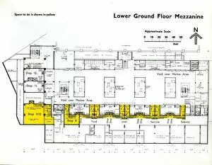
Background imageMaps and Plans Collection: Lower ground floor mezzanine plan of new Castle Market, Haymarket / Waingate, 1958

Lower ground floor mezzanine plan of new Castle Market, Haymarket / Waingate, 1958
Image from New Market Building, Sheffield Markets Committee, 1958 (Sheffield Local Studies Library: 352.9 SSTF)

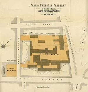
Background imageMaps and Plans Collection: Plan of Freehold Property in Sheffield known as Roscoe Works as advertised for Sale by Auction, 1888

Plan of Freehold Property in Sheffield known as Roscoe Works as advertised for Sale by Auction, 1888
(Sheffield Local Studies Library: Sale Plans 13 Nov 1888)

Background imageMaps and Plans Collection: Plan of freehold and leasehold property in the parish of Ecclesfield, 1869

Plan of freehold and leasehold property in the parish of Ecclesfield, 1869
cale 3 chains : 1 inch. Printed by Pawson and Brailsford. Lot 1 - freehold steel furnace at Grenoside... containing five holes with coke sheds and other buildings and yard


All Professionally Made to Order for Quick Shipping


-

Why Choose Us?

We are a leading provider of Art Prints and Photo Gifts since 2003, working in partnership with a range of Sporting Clubs, Charities, Museums and Picture Libraries. A large share of profits from any of their images will go directly towards supporting that charity or club. Our archive of images is carefully curated to bring you a wide range of subjects, including landscapes, wildlife, architecture, and more. We ship from our partner labs in the UK, USA, EU (Netherlands) and Australia.
+

How do I place an order?

Ordering is quick & easy - Just follow 5 Simple Steps:
  1. Find your image: Use our search box or browse our online photo Collections to find the image you want.

  2. Choose your print format: Select your desired product and add it to your cart.

  3. Enter your details: If you're a returning customer, simply enter your email address and password, and we'll fill in your billing and shipping address details. All personal details are held securely and are fully GDPR compliant. As standard, we remove all Personally Identifiable Information after 12 months.

  4. Pay for your purchase: We use state-of-the-art security for online shopping and do not have access to your card details.

  5. Sit back and relax: We'll email you confirmation of your order and when it's dispatched. Registered customers can also track orders in the 'My Account' area.

+

How do I pay for an order?

You can pay for your order with most of the major credit and debit cards, or PayPal. For added security, major financial institutions process payment details separately and securely on our behalf. We do not have access to your online payment card details. Online payments are preferred however we do take phone orders. For UK customers only we accept cheques issued against a UK bank.
+

Is my data safe?

We take data security very seriously. We do not have access to your full card details and all payments are requested over a fully secure connection. Additionally, we fully comply with current European and GDPR legislation, and automatically remove all personal data after at most 12 months (unless you have an account with us and have signed in recently). We also have a strict opt-in policy and would never sell your personal details. Your data is only used to fulfill your order promptly and efficiently.
+

Is wall art ready to hang?

For quick and easy installation all wall art, including framed prints, canvas prints and metal prints are supplied with a ready to hang solution on the back. Generally, saw tooth hangers are applied as they allow wall art to hang flush against the wall. The serrated edge of the hanger prevents the frame from shifting or tilting when hung.
+

Are the photo prints fade resistant?

Yes, we use archival quality photo paper photographic paper for vivid reproduction Prints are an accurate representations of the original artwork, which is preserved for artistic character and authenticity. We guarantee they match previews shown on our web site