Fraud Blocker Skip to main content

Home > Science > Space Exploration > Satellite Imagery

Satellite Imagery Collection (page 6)

Satellite imagery is a type of that involves the use of satellites to capture images of Earth from space

611 items

Background imageSatellite Imagery Collection: Aerial View of Great Barrier Reef

Aerial View of Great Barrier Reef

Background imageSatellite Imagery Collection: Credit Provided by the SeaWiFS Project, NASA / Goddard Space Flight Centre, and ORBIMAGE The cold

Credit Provided by the SeaWiFS Project, NASA / Goddard Space Flight Centre, and ORBIMAGE The cold
Credit Provided by the SeaWiFS Project, NASA/Goddard Space Flight Centre, and ORBIMAGE The cold, productive waters of the Greenland Sea and Norwegian Sea are revealed in this SeaWiFS image

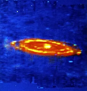
Background imageSatellite Imagery Collection: Andromeda Galaxy (M 31) - spiral. Infrared image made by IRAS (Infrared Astronomical Satellite)

Andromeda Galaxy (M 31) - spiral. Infrared image made by IRAS (Infrared Astronomical Satellite). Furthest object visible to the naked eye. NASA photograph

Background imageSatellite Imagery Collection: Barents Sea July 19th, 2003, as seen by MODIS. Image courtesy of Jacques Descloitres

Barents Sea July 19th, 2003, as seen by MODIS. Image courtesy of Jacques Descloitres, MODIS Land Rapid Response Team at NASA GSFC

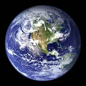
Background imageSatellite Imagery Collection: Satellite view of the Earth with North America in centre of the image. Credit: NASA

Satellite view of the Earth with North America in centre of the image. Credit: NASA. Science Earth Geology Oceanography

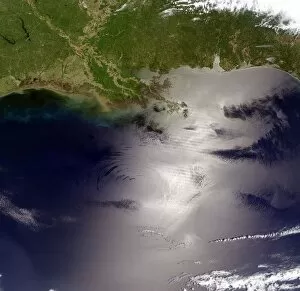
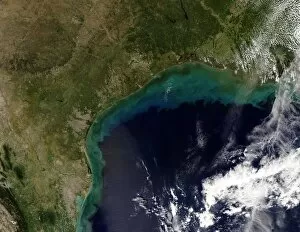
Background imageSatellite Imagery Collection: view of the Gulf of Mexico from the Moderate Resolution Imaging Spectroradiometer

view of the Gulf of Mexico from the Moderate Resolution Imaging Spectroradiometer (MODIS) on NASAs Terra satellite

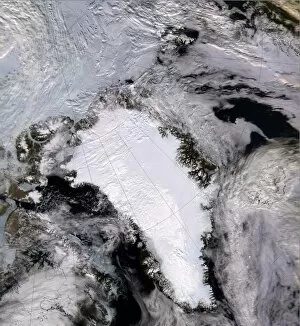
Background imageSatellite Imagery Collection: Satellite image of a snow and ice-covered Greenland in 2000. Credit NASA

Satellite image of a snow and ice-covered Greenland in 2000. Credit NASA

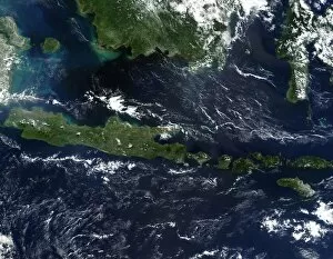
Background imageSatellite Imagery Collection: True-colour satellite image of Indonesia mid-May 2002. As burning season was not

True-colour satellite image of Indonesia mid-May 2002. As burning season was not fully underway in the region, skies over the island of Borneo, Malaysia at its northwest coast

Background imageSatellite Imagery Collection: Satellite image of eruption of Kliuchevskoi or Klyuchevskaya Sopka volcano, Kamchatka Peninsula

Satellite image of eruption of Kliuchevskoi or Klyuchevskaya Sopka volcano, Kamchatka Peninsula, Russia, 2010. Has been active almost continuously since its first recorded eruption in 1697

Background imageSatellite Imagery Collection: Satellite image of Iceland on 28 January 2004 showing it covered in a blanket of snow

Satellite image of Iceland on 28 January 2004 showing it covered in a blanket of snow and ice which is obscuring the permanent glaciers and icecaps that exist year-round. Credit NASA. Science Winter

Background imageSatellite Imagery Collection: Four Corners region of southwest United States. Forest-covered Rocky Mountains, which

Four Corners region of southwest United States. Forest-covered Rocky Mountains, which still have snow-covered peaks, running through Colorado and into New Mexico. True-colour satellite image

Background imageSatellite Imagery Collection: Coral reef photographed by NASAs Landsat 7 satellite. Credit NASA. Science Geology

Coral reef photographed by NASAs Landsat 7 satellite. Credit NASA. Science Geology Oceanography

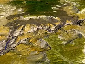
Background imageSatellite Imagery Collection: Satellite thermal emission and reflection image of the Grand Canyon, Arizona, USA

Satellite thermal emission and reflection image of the Grand Canyon, Arizona, USA. Because different minerals reflect different portions of the light spectrum, varying mineral composition is visible

Background imageSatellite Imagery Collection: Satellite image of the Pacific Ocean near Japan with a large brown cloud, possibly

Satellite image of the Pacific Ocean near Japan with a large brown cloud, possibly caused by the eruption of Mount Oyama on Miyakejima island, Japan. Credit NASA. Science Geology Vulcanology

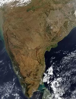
Background imageSatellite Imagery Collection: Satellite view over Indian peninsular. Sri Lanka is just visible under cloud at bottom right

Satellite view over Indian peninsular. Sri Lanka is just visible under cloud at bottom right. Credit: NASA. Science Earth Geology Oceanography

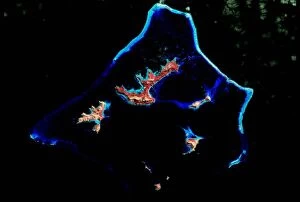
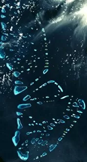
Background imageSatellite Imagery Collection: Satellite view of North and South Malosmadulu Atolls in the Maldives, northern Indian Ocean

Satellite view of North and South Malosmadulu Atolls in the Maldives, northern Indian Ocean, southwest of India, made up of a chain of 1, 192 small coral islands

Background imageSatellite Imagery Collection: Satellite view of the islands of Japan. Credit: NASA. Science Earth Geology Oceanography

Satellite view of the islands of Japan. Credit: NASA. Science Earth Geology Oceanography

Background imageSatellite Imagery Collection: Satellite view of North, Central and South America, set between the Pacific and Atlantic oceans

Satellite view of North, Central and South America, set between the Pacific and Atlantic oceans. Credit: NASA. Science Earth Geology Oceanography

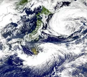
Background imageSatellite Imagery Collection: Satellite view of Japan with snow-covered mountains, Spring greening land at lower levels

Satellite view of Japan with snow-covered mountains, Spring greening land at lower levels. Dust from mainland China blowing over the Sea of Japan, and out into the Pacific Ocean. Credit: NASA

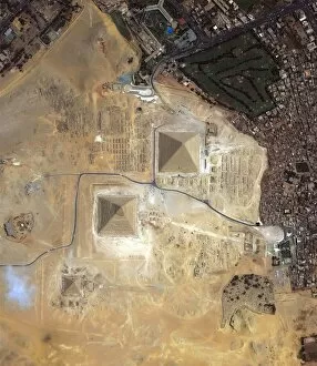
Background imageSatellite Imagery Collection: Satellite view of the Pyramids of Giza, Egypt. Credit NASA

Satellite view of the Pyramids of Giza, Egypt. Credit NASA

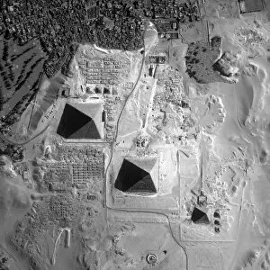
Background imageSatellite Imagery Collection: Satellite view of the Pyramids of Giza, Egypt. Credit NASA

Satellite view of the Pyramids of Giza, Egypt. Credit NASA

Background imageSatellite Imagery Collection: Satellite view of the Gulf Coast, USA - Tamaulipas, Mexico, to New Orleans, Louisiana

Satellite view of the Gulf Coast, USA - Tamaulipas, Mexico, to New Orleans, Louisiana. Credit NASA. Science Earth Geology Oceanography

Background imageSatellite Imagery Collection: Cape Town and Cape of Good Hope, South Africa, in foreground of perspective view

Cape Town and Cape of Good Hope, South Africa, in foreground of perspective view generated from Landsat satellite image and elevation data from the Shuttle Radar Topography Mission (SRTM)

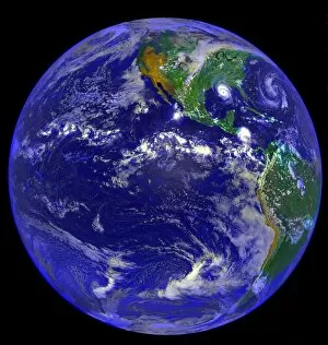
Background imageSatellite Imagery Collection: Satellite image of the Pacific Ocean and North and South America and Hurricane Andrew

Satellite image of the Pacific Ocean and North and South America and Hurricane Andrew, 25 August 1992. Credit NASA

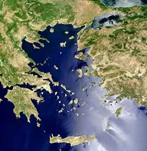
Background imageSatellite Imagery Collection: Satellite view of the Aegean Sea: Crete is island at centre bottom. NASA image. Science

Satellite view of the Aegean Sea: Crete is island at centre bottom. NASA image. Science

Background imageSatellite Imagery Collection: Satellite photograph of the Tasman Sea partially covered by cloud. On left is part

Satellite photograph of the Tasman Sea partially covered by cloud. On left is part of Australia with Tasmania below it. NASA. Science

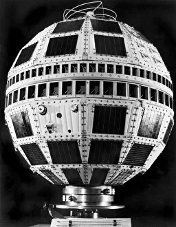
Background imageSatellite Imagery Collection: The TELSTAR Satellite

The TELSTAR Satellite
United States: 1963. The TELSTAR II communications satellite. It is virtually indentical to the TELSTAR I, and was launched on May 7, 1963

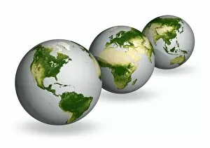
Background imageSatellite Imagery Collection: Earth vegetation globes, artworks C018 / 3559

Earth vegetation globes, artworks C018 / 3559
Earth vegetation globes. Artwork of Earth globes with vegetation cover pictured as a scale, or index of greenness. Greenness is based on several factors: the number and type of plants

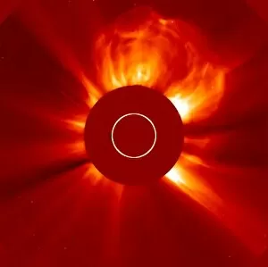
Background imageSatellite Imagery Collection: Solar eruption, SOHO image

Solar eruption, SOHO image
Solar eruption. SOHO (Solar and Heliospheric Observatory) image of a huge coronal mass ejection (CME) from the Sun. The solar disc is obscured to prevent the image being over-exposed

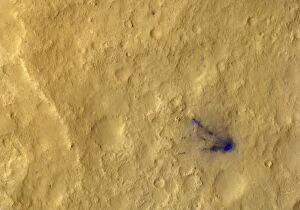
Background imageSatellite Imagery Collection: Curiosity debris on Mars, satellite image C014 / 4941

Curiosity debris on Mars, satellite image C014 / 4941
Curiosity debris on Mars. Colour-enhanced satellite image of impact marks (blue) caused by debris from the landing of NASAs Curiosity rover on Mars

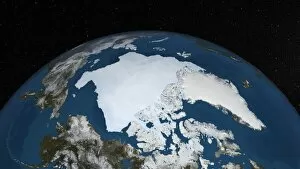
Background imageSatellite Imagery Collection: Arctic ice minimum extent, 2012

Arctic ice minimum extent, 2012
Arctic ice minimum extent. Satellite image showing the Arctic polar ice cap at its annual minimum extent on 16th September 2012

Background imageSatellite Imagery Collection: Columbia Glacier, Alaska, 1989

Columbia Glacier, Alaska, 1989
Columbia Glacier, Alaska. False-colour satellite image of the Columbia Glacier, Alaska, USA, taken in 1989. Columbia Glacier descends from an ice field (top) 3, 050 metres above sea level

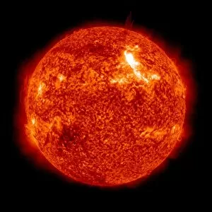
Background imageSatellite Imagery Collection: Solar activity, SDO ultraviolet image

Solar activity, SDO ultraviolet image
Solar activity, Solar Dynamics Observatory (SDO) ultraviolet image. The SDO is an Earth-orbiting spacecraft launched in 2010 by NASA and used to observe the Sun

Background imageSatellite Imagery Collection: Arctic ice minimum extent, 2013 C017 / 3623

Arctic ice minimum extent, 2013 C017 / 3623
Arctic ice minimum extent. Satellite image showing the Arctic polar ice cap at its annual minimum extent on 12th September 2013

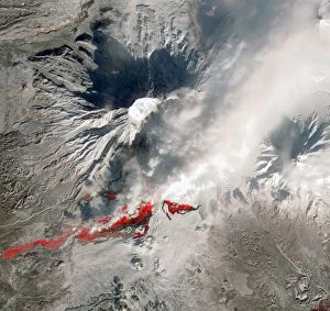
Background imageSatellite Imagery Collection: Plosky Tolbachik volcano erupting, 2013 C016 / 9732

Plosky Tolbachik volcano erupting, 2013 C016 / 9732
Plosky Tolbachik volcano erupting, satellite image. North is at top. This volcano (3682 metres) is located in Russias far eastern Kamchatka Peninsula
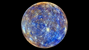
Background imageSatellite Imagery Collection: Mercury hemisphere, MESSENGER image C016 / 9721

Mercury hemisphere, MESSENGER image C016 / 9721
Mercury hemisphere, MESSENGER image. North is at top. This image is centred at longitude 40 degrees West. The colours show chemical and mineralogical differences between the rocks
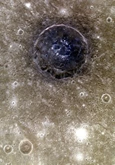
Background imageSatellite Imagery Collection: Atget crater, Mercury, MESSENGER image C016 / 9719

Atget crater, Mercury, MESSENGER image C016 / 9719
Atget crater on Mercury, MESSENGER image. North is at top. This crater, 100 kilometres across, is located in the Caloris Basin on Mercury, the planet closest to the Sun

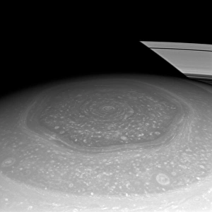
Background imageSatellite Imagery Collection: Saturns north pole region, Cassini image

Saturns north pole region, Cassini image. This north polar hexagon region of the gas giant planet Saturn is in sunlight as spring comes to the planets northern hemisphere

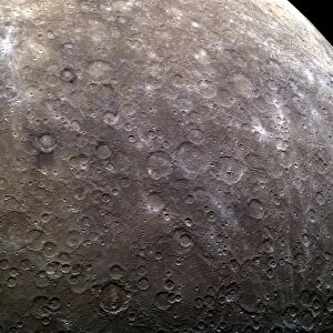
Background imageSatellite Imagery Collection: Craters on Mercury, MESSENGER image C016 / 9720

Craters on Mercury, MESSENGER image C016 / 9720
Craters on Mercury, MESSENGER image. North is towards top left. This area, over 1900 kilometres across, consists mostly of as-yet unnamed craters in the eastern part of the Solitudo Persephones

Background imageSatellite Imagery Collection: Jebel Uweinat mountains, satellite image C016 / 9731

Jebel Uweinat mountains, satellite image C016 / 9731
Jebel Uweinat mountains, satellite image. North is at top. This mountain range (peak elevation: 1934 metres) is located on the Egyptian-Sudanese-Libyan border

Background imageSatellite Imagery Collection: Mercury hemispheres, MESSENGER images C016 / 9723

Mercury hemispheres, MESSENGER images C016 / 9723
Mercury hemispheres, MESSENGER images. Monochrome (left) and colour-filtered (right) images of a hemisphere of Mercury. North is at top and the hemispheres are centred at longitude 285 degrees West

Background imageSatellite Imagery Collection: Iberian Peninsula, satellite image

Iberian Peninsula, satellite image. North is at top. Thunderstorms are visible over the Iberian Peninsula and part of North Africa (lower right)

Background imageSatellite Imagery Collection: Europe at night, satellite image

Europe at night, satellite image
Europe at night. Black marble satellite image of Europe at night. More densely populated areas are brighter. Lights from ships and flares from gas and oil platforms can be seen in the North Sea

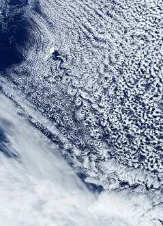
Background imageSatellite Imagery Collection: Cloud vortex street, satellite image

Cloud vortex street, satellite image. North is at top. The island of Jan Mayen (white, upper left) is located in the Arctic Ocean

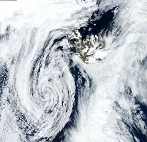
Background imageSatellite Imagery Collection: Low pressure, Iceland, satellite image

Low pressure, Iceland, satellite image. North is at top. The swirl of clouds (lower left) marks an area of low pressure that is centred south-west of Iceland (upper right)

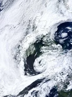
Background imageSatellite Imagery Collection: Low pressure, UK, satellite image

Low pressure, UK, satellite image. North is at top, with land areas outlined in black. The swirl of clouds at lower centre is a lower pressure system centred over South-West England

Background imageSatellite Imagery Collection: Cloud streets, Black Sea, satellite image

Cloud streets, Black Sea, satellite image. North is at top, with the Black Sea outlined in black. Cloud streets are parallel lines of clouds aligned with the wind

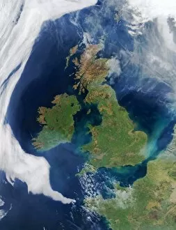
Background imageSatellite Imagery Collection: British Isles, satellite image

British Isles, satellite image. North is at top. Sediment from river run-off discolours water around the coast. Aircraft contrails are visible over the North Sea


All Professionally Made to Order for Quick Shipping


-

Satellite Imagery Collection

Satellite imagery is a type of that involves the use of satellites to capture images of Earth from space. These images are used for a variety of purposes, such as mapping, monitoring natural disasters, and tracking changes in land use, and are be used to detect changes in the environment over time, such as deforestation or urbanization and can also be used to monitor weather patterns and track storms. Additionally, often used for military surveillance and intelligence gathering. Satellite imagery has revolutionized our understanding of Earth's surface features and processes by providing detailed information about our planet's surface from a global perspective. With advances in technology, it has become an invaluable tool for scientists studying climate change and other environmental issues.
+

Our beautiful pictures are available as Framed Prints, Photos, Wall Art and Photo Gifts

Media Storehouse offers a collection of satellite imagery that showcases the beauty and complexity of our planet from above. Our collection features stunning photographs captured by satellites orbiting Earth, providing a unique perspective on natural phenomena such as hurricanes, volcanic eruptions, and wildfires. The images are available as wall art and framed prints in various sizes to suit different spaces. The Satellite Imagery collection is an excellent resource for those interested in space exploration science or simply seeking visually striking artwork for their homes or offices. The images offer a glimpse into the vastness of space while highlighting the intricate details of our planet's landscapes and weather patterns. Whether you're looking to decorate your home with beautiful artwork or seeking inspiration for scientific research projects, our Satellite Imagery collection has something to offer. With its high-quality prints and diverse range of subjects, our collection is sure to impress anyone who appreciates the beauty of our world from above.
+

What are Satellite Imagery (Space Exploration Science) art prints?

Satellite Imagery art prints are high-quality reproductions of satellite images captured by various space exploration missions. These stunning prints showcase the beauty and complexity of our planet, as well as other celestial bodies in our solar system. The images used for these prints are obtained through advanced imaging technologies that capture data from satellites orbiting Earth or other planets. This data is then processed to create detailed visual representations of the terrain, weather patterns, and other features of these locations. These art prints offer a unique perspective on our world and beyond, allowing us to appreciate the intricate details and natural wonders that can only be seen from space. They make great additions to any home or office decor, providing a conversation piece that inspires curiosity about science and exploration. Whether you're interested in astronomy, geography, or simply enjoy beautiful artwork, Satellite Imagery art prints are an excellent choice for anyone looking to add some out-of-this-world flair to their living space.
+

What Satellite Imagery (Space Exploration Science) art prints can I buy from Media Storehouse?

We offer a wide range of Satellite Imagery art prints that are perfect for space exploration enthusiasts. These prints showcase stunning images captured by satellites orbiting the Earth, providing a unique perspective on our planet and beyond. Some of the popular Satellite Imagery art prints available at Media Storehouse include satellite imagery of cities, landscapes, oceans, and even weather patterns. You can also find prints featuring iconic landmarks such as the Great Barrier Reef or Mount Everest. These high-quality art prints are produced using state-of-the-art printing technology to ensure exceptional clarity and detail. They come in various sizes to suit your needs and preferences. Whether you're looking to decorate your home or office with beautiful space-themed artwork or searching for a unique gift for someone special, we have something for everyone. With its vast collection of Satellite Imagery art prints, you're sure to find the perfect piece that captures your imagination.
+

How do I buy Satellite Imagery (Space Exploration Science) art prints?

To buy Satellite Imagery art prints from Media Storehouse, you can browse our extensive collection of high-quality images online. Simply search for the specific image or topic that interests you and select the size and format of print that you prefer. You can choose from a range of options including canvas, framed prints, posters, and photographic prints. Once you have selected your preferred product type and size, simply add it to your cart and proceed to checkout. You will be prompted to enter your shipping information as well as payment details. We offer a wide selection of satellite imagery art prints featuring stunning views of our planet Earth from space. These images are perfect for anyone interested in science or astronomy, or those who simply appreciate beautiful artwork inspired by space exploration. Buying Satellite Imagery art prints from Media Storehouse is an easy process that allows you to enjoy high-quality artwork in the comfort of your own home.
+

How much do Satellite Imagery (Space Exploration Science) art prints cost?

Satellite Imagery art prints can vary in price depending on the size and type of print. There are a variety of options available, from smaller poster-sized prints to larger canvas prints. The cost may also depend on the quality of the image and whether it is a limited edition or not. It's important to note that Satellite Imagery art prints are not just decorative pieces, but they can also serve as educational tools for those interested in space exploration and science. They provide an opportunity to appreciate the beauty and complexity of our universe while learning about different celestial bodies. If you're interested in purchasing Satellite Imagery art prints, there are many options available at varying prices. It's worth doing some research to find a high-quality print that fits your budget and interests.
+

How will my Satellite Imagery (Space Exploration Science) art prints be delivered to me?

We take great care in delivering your Satellite Imagery art prints to you. We use high-quality packaging materials to ensure that your artwork arrives safely and undamaged. Depending on the size of your print, it will be shipped either flat or rolled up in a sturdy tube. We work with trusted shipping partners who provide reliable and efficient delivery services worldwide. Once your order has been processed, we will send you an email confirmation with tracking information so that you can monitor the progress of your shipment. We understand how important it is for our customers to receive their orders promptly and in perfect condition. That's why we go above and beyond to ensure that every aspect of our delivery process is carefully managed and executed. So sit back, relax, and let us take care of everything – from printing your beautiful Satellite Imagery art prints to delivering them right to your doorstep.