Fraud Blocker Skip to main content

Home > North America > United States of America > New York > New York > Maps

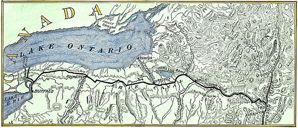
Erie Canal route

Erie Canal route
Sold 13
In Stock
We accept all major payment options so you can pay for the things you need in the way that is most convenient for you

Choose Your Product


North Wind Photo Prints and Wall Art

Erie Canal route

Map of the Erie Canal across New York state, 1800s.
Hand-colored woodcut of a 19th-century illustration. North Wind Picture Archives brings history to life with stock images and hand-colored illustrations. © North Wind Picture Archives

Media ID 5882693

Canal Erie Canal Hudson River Lake Erie Lake Ontario New York Transportation Travel

FEATURES IN THESE COLLECTIONS

> Maps and Charts > Americas

> North America > Related Images

> North America > United States of America > New York > Buffalo

> North America > United States of America > New York > New York > Maps

> North Wind Picture Archives > Maps

SECURE PAYMENTS
We accept all major payment options so you can pay for the things you need in the way that is most convenient for you

Made in UK
Safe Shipping, Easy Returns

FREE PERSONALISATION
We are proud to offer a range of customisation including Cropping, Captions, and Filters. Zoom Cropping can be adjusted in the basket


EDITORS COMMENTS

This print showcases a hand-colored woodcut of a 19th-century illustration depicting the Erie Canal route across New York state. The vintage charm emanating from this piece instantly transports us back to an era where American heritage and tradition were at their peak. With intricate details, the map highlights the extensive transportation network that connected Lake Ontario, Lake Erie, and the Hudson River. The significance of this historic canal cannot be overstated. Serving as a vital artery for trade and travel during its time, it played an instrumental role in shaping the history of North America. As we gaze upon this artful representation, we are reminded of the countless journeys made along these waterways by pioneers seeking new opportunities or simply exploring uncharted territories. The artist's skillful use of colors brings life to every inch of this map, allowing us to appreciate not only its historical value but also its artistic merit. From Buffalo NY to Troy NY, each town along the canal is meticulously labeled with precision and care. As we admire this remarkable piece, let us reflect on how far transportation has come since those early days. The Erie Canal stands as a testament to human ingenuity and determination in conquering vast distances through innovative means. Whether you are a history enthusiast or simply captivated by art from yesteryears, this print will undoubtedly add depth and character to any space it graces.


Framed Prints of Erie Canal route

Introducing the Erie Canal Framed Print from Media Storehouse, a captivating addition to your home or office décor. This exquisite piece, sourced from the North Wind Picture Archives, showcases an intricately detailed hand-colored woodcut of the Erie Canal route in New York state from the 1800s. Journey back in time as you explore the rich history of this iconic waterway that transformed transportation in America. The print is beautifully framed in a tasteful design, ready to hang and bring history to life in your space. Add this unique conversation starter to your collection today.


Photo Prints of Erie Canal route

Discover the rich history of New York state with our exquisite Media Storehouse Photographic Prints featuring the iconic Erie Canal route. This captivating image, sourced from the North Wind Picture Archives, is a hand-colored woodcut of a 19th-century illustration that transports you back in time. The Erie Canal route, intricately depicted in this vintage map, tells a story of engineering marvel and economic growth. Add this stunning print to your home or office to inspire a sense of adventure and appreciation for the past. Each print is meticulously crafted using high-quality materials and vibrant colors, ensuring a long-lasting addition to your collection. Bring history to life with Media Storehouse.


Poster Prints of Erie Canal route

Discover the rich history of New York state with our stunning Erie Canal Poster Print from Media Storehouse, brought to you by North Wind Picture Archives. This captivating 19th-century hand-colored woodcut illustration transports you back in time, showcasing the iconic Erie Canal route in intricate detail. Relive the stories of the past as you display this beautiful work of art in your home or office. The perfect addition to any room, our Erie Canal Poster Print is a timeless piece that will ignite your sense of adventure and appreciation for history. Order yours today and bring a piece of the past into your space.


Jigsaw Puzzles of Erie Canal route

Discover the rich history of America's waterways with our captivating Erie Canal Jigsaw Puzzle from Media Storehouse, brought to you by North Wind Picture Archives. This intricately detailed puzzle showcases a hand-colored woodcut of the Erie Canal route, transporting you back in time to the 1800s. Sail through New York state as you piece together this stunning illustration of the iconic waterway that revolutionized transportation in early America. With vibrant colors and intricate designs, this jigsaw puzzle promises an engaging and rewarding experience for puzzle enthusiasts of all ages. Immerse yourself in history and create a beautiful work of art with the Erie Canal Jigsaw Puzzle from Media Storehouse.

diamond
Made With High Grade Materials
thumb_up
Professional Quality Finish
package_2
Carefully Packed To Aid Safe Arrival

You May Also Like


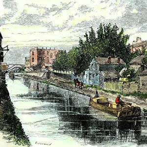
Erie Canal at Schenedtady, New YorkErie Canal at Schenedtady, New York
Add to Basket
Iceland map, 1800sIceland map, 1800s
Add to Basket
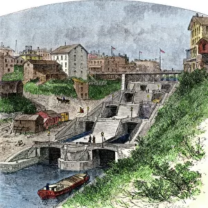
Erie Canal locksErie Canal locks
Add to Basket
MAP OF THE ERIE CANAL. A map of the Erie Canal simplified from the Map of RoutesMAP OF THE ERIE CANAL. A map of the Erie Canal simplified from the Map of Routes
Add to Basket
Opening the Erie Canal, 1825Opening the Erie Canal, 1825
Add to Basket
Ancient Greece and its colonies around the AegeanAncient Greece and its colonies around the Aegean
Add to Basket
Bayeaux Tapestry portraying the Norman ConquestBayeaux Tapestry portraying the Norman Conquest
Add to Basket
Map of Scotland in the 1520sMap of Scotland in the 1520s
Add to Basket
Ireland map, 1870sIreland map, 1870s
Add to Basket
United States in 1860United States in 1860
Add to Basket
Thirteen original colonies in 1776Thirteen original colonies in 1776
Add to Basket
Erie Canal barge at Troy, New YorkErie Canal barge at Troy, New York
Add to Basket

Gallery Wall Inspiration

Thirteen original colonies in 1776
Map of England in 1066
Vancouver Island map, 1870s
Map of ancient Rome
The Hereford Mappa Mundi of 1280 - Jerusalem is at the center
Iceland map, 1800s
Medieval Europe at the start of the Crusades
Scotland map, 1870s
Map of England, 1800s
Map of Britain in 597 AD
Ancient Greece and its colonies around the Aegean
Erie Canal route
Newfoundland, 1870s
Medieval Spain and Portugal map
Ireland map, 1870s
Victoria province, Australia, 1800s
Map of Scotland in the 1520s
Ancient Greek empire
Map of ancient Palestine kingdoms of Judah and Israel
Maps of Italy in ancient times
Map of the Roman Empire
Traditional provinces of Spain
Map of Europe, 1870s
Caribbean islands, 1870s
Map of Europe under the Roman Empire
Map of Cape Colony, South Africa
Plan of Washington DC, 1793

Discover Our Collections


MapsMaps
View Collection
North America Related ImagesNorth America Related Images
View Collection
BuffaloBuffalo
View Collection
MapsMaps
View Collection
AmericasAmericas
View Collection


© Copyright Media Storehouse, All Rights Reserved 2003 - 2024
Facebook     Pinterest     100% Payment Secure     Reviews IO