
Maps Collection
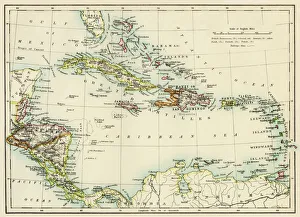
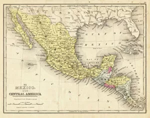
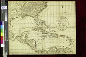
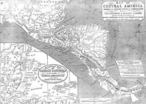
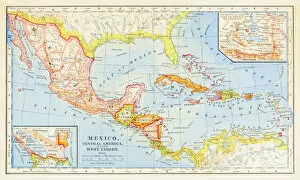
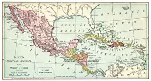
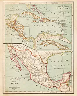
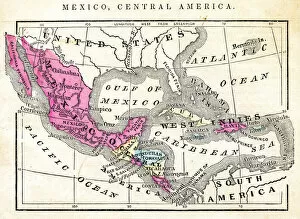
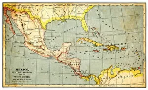
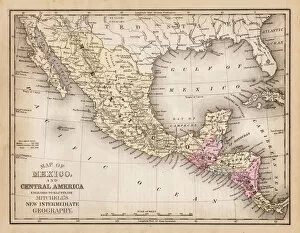
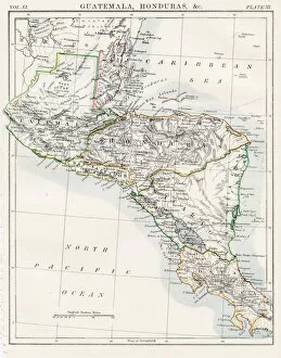
Honduras is a country located in Central America, and is bordered by Guatemala, El Salvador, and Nicaragua to the south, the Caribbean Sea to the north
Choose a picture from our Maps Collection for your Wall Art and Photo Gifts
61 items


All Professionally Made to Order for Quick Shipping
-
Maps Collection
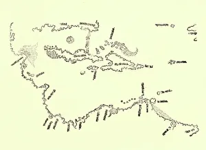
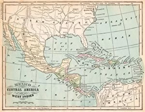
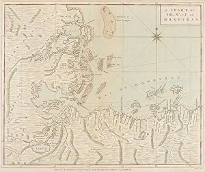
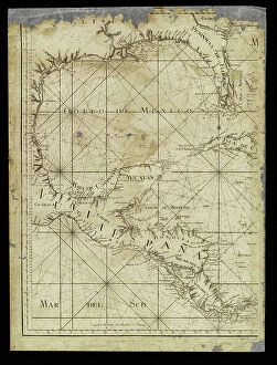
Honduras is a country located in Central America, and is bordered by Guatemala, El Salvador, and Nicaragua to the south, the Caribbean Sea to the north, and the Pacific Ocean to the west. Maps of Honduras North America show its diverse geography which includes mountains, rainforests, beaches, and islands. The country has a population of over nine million people who speak Spanish as their primary language. The capital city of Tegucigalpa is located in central Honduras and is home to many government buildings as well as cultural attractions such as museums and galleries. Other major cities include San Pedro Sula in the northwest region of Honduras and La Ceiba on the Caribbean coast. Maps of Honduras North America also depict its numerous rivers which flow through both mountainous regions and coastal plains providing water for agriculture and power generation facilities throughout the country.
+
Our beautiful pictures are available as Framed Prints, Photos, Wall Art and Photo Gifts
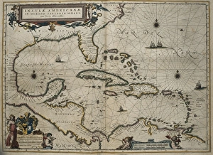
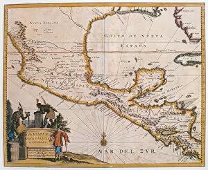
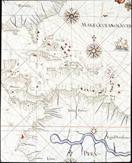
The Maps of Honduras North America collection, available from Media Storehouse, is a stunning range of wall art and framed prints that showcase the beauty and diversity of this Central American country. Our collection features an array of maps that highlight the geography, topography, and political boundaries of Honduras. From antique maps dating back to the 16th century to modern-day representations, our collection offers something for everyone interested in Honduran cartography. Each map is expertly reproduced using high-quality printing techniques on premium paper or canvas. Whether you're looking for a unique piece to decorate your home or seeking inspiration for your next adventure in Honduras, these maps are sure to impress. They offer a fascinating glimpse into the history and culture of this vibrant nation while also serving as functional tools for navigation and exploration. The Maps of Honduras North America collection is a must-have for anyone with an interest in geography, travel, or world cultures.
+
What are Maps of Honduras North America art prints?
Maps of Honduras North America art prints are high-quality reproductions of maps that depict the geography, topography, and political boundaries of Honduras. These art prints are created using advanced printing techniques to ensure that every detail is captured accurately and vividly. These maps serve as a valuable resource for historians, geographers, students, and anyone interested in exploring the rich history and culture of Honduras. They provide a visual representation of the country's diverse landscapes, including its mountains, rivers, forests, and coastlines. In addition to their educational value, Maps of Honduras North America art prints also make stunning decorative pieces for homes or offices. Their intricate details and vibrant colors can add depth and character to any space. Whether you're looking to learn more about this fascinating Central American country or simply want to decorate your walls with beautiful artwork inspired by it, Maps of Honduras North America art prints offer something for everyone.
+
What Maps of Honduras North America art prints can I buy from Media Storehouse?
We offer a wide range of Maps of Honduras North America art prints that you can buy. These maps showcase the geographical features, landmarks, and cities of Honduras in detail. You can choose from vintage or contemporary styles to suit your taste and decor. Some popular options include antique maps with intricate details such as topography, rivers, and mountains while others feature modern designs with bold colors and typography. The collection includes different sizes ranging from small to large so you can find the perfect fit for your space. Whether you're looking for a map to hang in your home office or display in a classroom setting, we have something for everyone. In addition to traditional paper prints, there are also canvas prints available which offer a more textured look and feel. The quality of these prints is exceptional ensuring that they will last for years without fading or losing their vibrancy. If you're looking for high-quality Maps of Honduras North America art prints then Media Storehouse is definitely worth checking out.
+
How do I buy Maps of Honduras North America art prints?
To purchase Maps of Honduras North America art prints from Media Storehouse, you can follow a few simple steps. Firstly, visit the website and search for the specific map or artwork you are interested in buying. Once you have found it, select the size and format that suits your needs. You may choose from various options such as canvas prints, framed prints or posters. Next, add the item to your cart and proceed to checkout. At this stage, you will be prompted to enter your personal details and payment information. Ensure that all details are accurate before submitting your order. We offer a secure online shopping experience with multiple payment options including credit/debit cards and PayPal. Once your order has been confirmed, it will be processed by our team of professionals who will ensure its quality before shipping it out to you. Purchasing Maps of Honduras North America art prints from Media Storehouse is a straightforward process involving searching for the desired print on our website followed by selecting size/format then proceeding through checkout with secure payment methods available.
+
How much do Maps of Honduras North America art prints cost?
We offer a wide range of Maps of Honduras North America art prints that vary in price depending on the size and type of print. The cost can also depend on whether you choose to have the print framed or unframed. However, Media Storehouse strives to offer affordable prices for their high-quality art prints, making them accessible to everyone who appreciates fine art. Whether you're looking for a small print to add some character to your home office or a large statement piece for your living room, there is an option available at Media Storehouse that will fit your budget and style preferences. With so many options available, it's easy to find the perfect Maps of Honduras North America art print that will complement any space in your home or office while adding a touch of sophistication and elegance.
+
How will my Maps of Honduras North America art prints be delivered to me?
Your Maps of Honduras North America art prints will be delivered to you in a safe and secure manner. Media Storehouse takes great care in packaging your artwork to ensure that it arrives at your doorstep undamaged. The art prints are carefully rolled up and placed inside a sturdy tube, which is then sealed with protective caps on both ends. The delivery process is handled by trusted courier services who specialize in handling fragile items such as artwork. You can expect timely updates on the status of your shipment through email or text notifications. Upon receiving your package, we recommend that you handle the contents with care when unrolling the print from the tube. It's best to lay it flat for a few hours before framing or mounting it on a wall. You can rest assured that your Maps of Honduras North America art prints will be delivered to you safely and efficiently so that you can enjoy them for years to come.