
Maps Collection
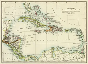
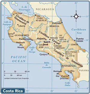
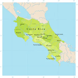
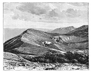
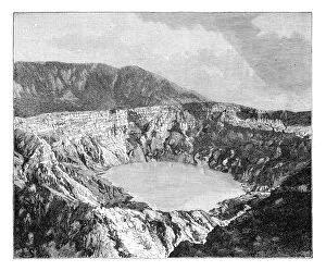
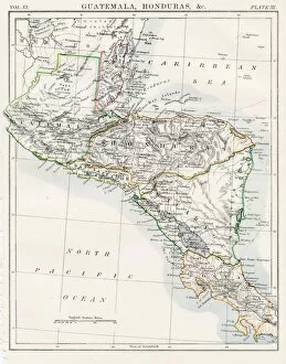
Costa Rica is a small country located in Central America, bordered by Nicaragua to the north and Panama to the south, and is known for its lush rainforests
Choose a picture from our Maps Collection for your Wall Art and Photo Gifts
41 items


All Professionally Made to Order for Quick Shipping
-
Maps Collection
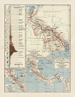
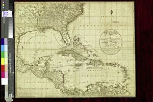
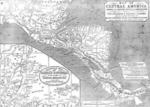
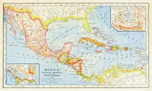
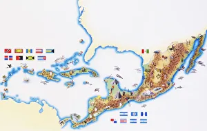
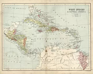
Costa Rica is a small country located in Central America, bordered by Nicaragua to the north and Panama to the south, and is known for its lush rainforests, stunning beaches, and diverse wildlife. Maps of Costa Rica North America provide detailed information about the geography of this beautiful country. They include physical features such as mountains, rivers, lakes, and volcanoes; political boundaries; cities and towns; roads; national parks; protected areas; airports; and more. With these maps, travelers can plan their trips with ease while also gaining insight into Costa Rica's unique culture and history. Maps of Costa Rica North America are essential tools for anyone looking to explore this vibrant nation.
+
Our beautiful pictures are available as Framed Prints, Photos, Wall Art and Photo Gifts
The Maps of Costa Rica North America collection from Media Storehouse is a stunning assortment of wall art and framed prints that showcase the beauty and diversity of this Central American country. Our collection features a wide range of maps, including topographical maps, road maps, and political maps, all highlighting different aspects of Costa Rica's geography and culture. Each print in our collection is expertly crafted using high-quality materials to ensure that it will last for years to come. Whether you're looking for a unique piece to decorate your home or want to give a special gift to someone who loves travel and adventure, the Maps of Costa Rica North America collection has something for everyone. With its vibrant colors, intricate details, and rich history, our collection captures the essence of one of the most beautiful countries in the world. So why wait? Explore the Maps of Costa Rica North America today and discover all that this amazing destination has to offer.
+
What are Maps of Costa Rica North America art prints?
Maps of Costa Rica North America art prints are high-quality reproductions of maps depicting the geography and topography of Costa Rica, a country located in Central America. These art prints showcase the intricate details and features of the region, including its cities, rivers, mountains, and coastlines. These maps are not only useful for navigation purposes but also serve as decorative pieces that can add character to any room or office space. They provide an excellent opportunity for individuals who love travel or have an interest in geography to display their passion through artwork. The Maps of Costa Rica North America art prints come in various sizes and styles to suit different preferences. Some feature vintage designs while others have modern interpretations with vibrant colors. The We offer a wide range of options that cater to diverse tastes and budgets. These art prints are perfect for anyone looking to add a touch of sophistication and elegance to their living spaces while showcasing their appreciation for the beauty and complexity of our world's landscapes.
+
What Maps of Costa Rica North America art prints can I buy from Media Storehouse?
We offer a wide range of Maps of Costa Rica North America art prints that you can purchase. These maps are available in various sizes and styles, including vintage, modern, and contemporary designs. You can choose from different types of maps such as political maps, physical maps or topographic maps. The art prints feature detailed cartography with accurate information about the geography and terrain of Costa Rica. They also showcase the country's major cities, landmarks, national parks and other important features. Whether you're looking for a map to decorate your home or office space or want to gift it to someone who loves traveling or geography, we have got you covered. The high-quality prints are produced using state-of-the-art printing technology on premium quality paper stock ensuring durability and longevity. If you're interested in purchasing Maps of Costa Rica North America art prints then Media Storehouse is an excellent place to start your search.
+
How do I buy Maps of Costa Rica North America art prints?
To buy maps of Costa Rica North America art prints from Media Storehouse, you can browse our online collection and select the desired print. The website offers a wide range of options to choose from, including different sizes and framing options. Once you have selected your preferred print, add it to your cart and proceed to checkout. During the checkout process, you will be prompted to enter your shipping information and payment details. Ensure that all information is accurate before submitting your order. We offer secure payment methods such as credit card or PayPal for convenient transactions. After placing your order, you will receive an email confirmation with details about your purchase. Buying maps of Costa Rica North America art prints from Media Storehouse is a straightforward process that can be completed in just a few clicks. With our extensive collection of high-quality prints, it's easy to find the perfect piece for any space or occasion.
+
How much do Maps of Costa Rica North America art prints cost?
The cost of Maps of Costa Rica North America art prints varies depending on the size, framing options, and quality of the print. However, we offer a wide range of affordable options for customers to choose from. The prices are competitive and reasonable compared to other online stores selling similar products. Media Storehouse is known for providing high-quality art prints that are perfect for home decor or as a gift. We offer various sizes ranging from small to large formats that suit different preferences and budgets. You can also select their preferred frame style or opt for unframed prints. The cost of Maps of Costa Rica North America art prints at Media Storehouse is reasonable and provides value for money. With its extensive collection and excellent customer service, it's an ideal place to purchase beautiful artwork that captures the essence of this stunning location in North America.
+
How will my Maps of Costa Rica North America art prints be delivered to me?
Your Maps of Costa Rica North America art prints will be delivered to you in a safe and secure manner by Media Storehouse. The company takes great care in packaging your artwork to ensure that it arrives at your doorstep undamaged. Your print will be carefully rolled up and placed inside a sturdy cardboard tube, which is then sealed with tape to prevent any moisture or dust from entering. Media Storehouse uses reliable courier services for shipping, so you can expect your package to arrive on time and in good condition. Once the courier has picked up your package, you will receive an email notification with tracking information so that you can monitor its progress. When your Maps of Costa Rica North America art prints arrive, simply unroll them and frame them as desired. With their high-quality printing process, these prints are sure to make a stunning addition to any home or office decor.