
Maps Collection
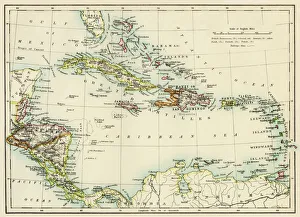
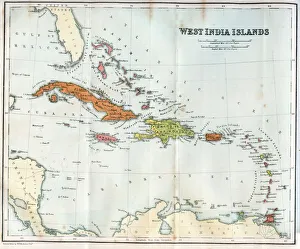
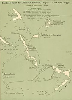
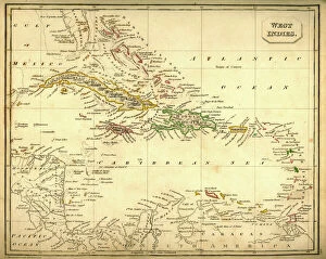
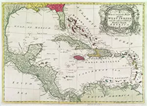
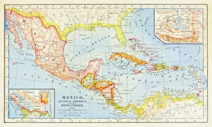
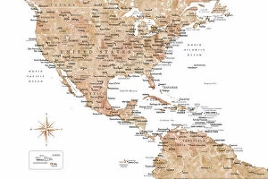
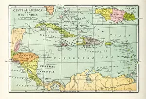
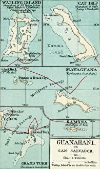
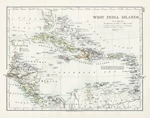
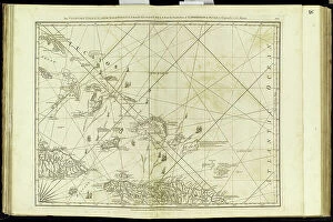
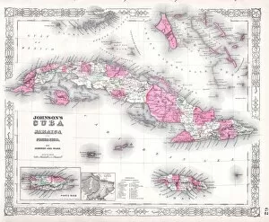
The Bahamas is an archipelago of 700 islands located in the Atlantic Ocean, off the coast of Florida
Choose a picture from our Maps Collection for your Wall Art and Photo Gifts
63 items


All Professionally Made to Order for Quick Shipping
-
Maps Collection
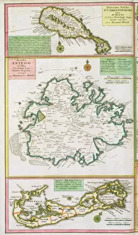
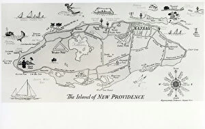
The Bahamas is an archipelago of 700 islands located in the Atlantic Ocean, off the coast of Florida, and is a popular tourist destination due to its beautiful beaches, crystal-clear waters, and vibrant culture. The country’s geography is divided into two main regions: The Great Bahama Bank and The Little Bahama Bank. Maps of The Bahamas North America provide detailed information about the country’s terrain, including its major cities, airports, ports, roads and highways. They also show important landmarks such as lighthouses and national parks. Additionally they can be used to locate dive sites for snorkeling or scuba diving enthusiasts or to plan a fishing trip in one of the many cays that dot the coastline. With its stunning landscapes and rich cultural heritage, The Bahamas are an ideal place for travelers looking for a unique experience in paradise.
+
Our beautiful pictures are available as Framed Prints, Photos, Wall Art and Photo Gifts
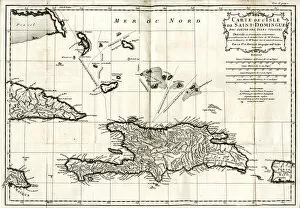
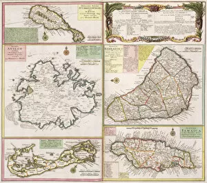
The Maps of The Bahamas North America collection from Media Storehouse offers a wide range of wall art and framed prints depicting the geography, history, and culture of The Bahamas. Our collection features vintage maps dating back to the 18th century as well as contemporary designs that showcase the beauty and diversity of this island nation. From detailed topographical maps to colorful illustrations highlighting popular tourist destinations such as Nassau and Paradise Island, our collection has something for everyone. Whether you're looking to add some tropical flair to your home decor or seeking a unique gift for a travel enthusiast, these high-quality prints are sure to impress. With options ranging from small prints suitable for tabletop displays to large-scale canvases perfect for statement walls, there's no shortage of ways to incorporate these stunning images into your space. The Maps of The Bahamas North America collection is an excellent choice for anyone looking to celebrate the rich history and natural beauty of this beloved Caribbean destination.
+
What are Maps of The Bahamas North America art prints?
Maps of The Bahamas North America art prints are high-quality reproductions of historical maps that depict the geography and topography of The Bahamas. These maps provide a fascinating glimpse into the history and development of this island nation, from its early colonial days to modern times. These art prints are created using state-of-the-art printing technology, which ensures that every detail is captured with stunning clarity and precision. They are printed on archival-grade paper, which means they will last for many years without fading or deteriorating. Whether you're a history buff, an avid traveler, or simply someone who appreciates beautiful artwork, Maps of The Bahamas North America art prints are sure to impress. They make great gifts for friends and family members who love exploring new places or learning about different cultures. So if you're looking for a unique and interesting way to decorate your home or office, consider adding one (or more.) of these beautiful art prints to your collection today.
+
What Maps of The Bahamas North America art prints can I buy from Media Storehouse?
We offer a wide range of Maps of The Bahamas North America art prints that you can buy. These maps are available in various sizes and styles, including vintage, antique, and modern designs. You can choose from different types of maps such as topographical maps, nautical charts, roadmaps, and satellite images. The Maps of The Bahamas North America art prints showcase the beauty and diversity of this region with its stunning coastlines, islands, reefs, and waterways. They also provide valuable information about the geography and history of The Bahamas North America. Whether you're looking for a decorative piece for your home or office or need an educational resource for your classroom or library, we have something to offer. Their high-quality prints are produced using state-of-the-art printing technology on premium paper stock to ensure vibrant colors and sharp details that will last a lifetime.
+
How do I buy Maps of The Bahamas North America art prints?
To buy Maps of The Bahamas North America art prints from Media Storehouse, you can browse our extensive collection of maps and select the one that catches your eye. Once you have found the map you want to purchase, simply add it to your cart and proceed to checkout. You will be prompted to enter your shipping and payment information before finalizing the order. We offer a variety of sizes for their art prints, so make sure to choose the size that best fits your needs. We also offer framing options if you prefer a ready-to-hang piece. If you have any questions or concerns about purchasing Maps of The Bahamas North America art prints from Media Storehouse, don't hesitate to contact our customer service team for assistance. They are available via email or phone and are happy to help with any inquiries you may have.
+
How much do Maps of The Bahamas North America art prints cost?
The cost of Maps of The Bahamas North America art prints varies depending on the size, framing options and materials used. Generally, larger prints tend to be more expensive than smaller ones. Additionally, if you choose to have your print framed or printed on a premium material such as canvas or fine art paper, the price will also increase. However, there are many affordable options available that still offer high-quality reproductions of these beautiful maps. It's important to note that prices may vary between different retailers and sellers offering Maps of The Bahamas North America art prints. It's always a good idea to shop around and compare prices before making a purchase. Some retailers may also offer discounts or promotions from time to time which can help reduce the overall cost. Investing in a Maps of The Bahamas North America art print is an excellent way to add some unique and interesting decor to your home or office space while celebrating the beauty and history of this region.
+
How will my Maps of The Bahamas North America art prints be delivered to me?
Your Maps of The Bahamas North America art prints will be delivered to you in a safe and secure manner by Media Storehouse. We use high-quality packaging materials to ensure that your prints arrive in perfect condition. Our standard delivery method is through postal services, and we also offer express delivery options for urgent orders. We take great care when handling your order, from the moment it is printed until it reaches your doorstep. Our team of professionals ensures that each print is carefully inspected before being dispatched for delivery. You can track the progress of your order online using our tracking system, which provides real-time updates on its status. If you have any questions or concerns about the delivery process, our customer service team is always available to assist you. We are committed to delivering exceptional quality products and services to our customers. We strive to make sure that every aspect of your experience with us exceeds your expectations.