Home > Animals > Birds > Passerines > Finches > Atlantic Canary
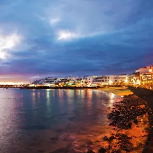
Map of Naos and Arrecife, Lanzarote, Canary Islands

![]()
Wall Art and Photo Gifts from Mary Evans Picture Library
Map of Naos and Arrecife, Lanzarote, Canary Islands
Map of the ports of Naos and Arrecife, Lanzarote, Canary Islands, surveyed by the Spanish Navy in 1853, with outer soundings from a survey of 1835, updated in 1880. Date: 1881
Mary Evans Picture Library makes available wonderful images created for people to enjoy over the centuries
Media ID 14262783
© Mary Evans / Pharcide
1830s 1835 1850s 1853 1881 Atlantic Canaries Canary Chart Charts Lanzarote Maps Navigation Ports Soundings Fathoms
FEATURES IN THESE COLLECTIONS
> Animals
> Birds
> Passerines
> Finches
> Atlantic Canary
> Maps and Charts
> Related Images
> Services
> Royal Navy
EDITORS COMMENTS
1. Title: "Navigating the Waters of Lanzarote: A Victorian-Era Map of Naos and Arrecife Ports, Canary Islands (1881)" 2. Discover the rich maritime history of Lanzarote, an island in the Canary Islands archipelago, through this intricately detailed map of the Naos and Arrecife ports. Dated 1881, this antique chart was surveyed by the Spanish Navy in the late 19th century, merging earlier data from surveys conducted in the 1830s, 1850s, and 1880. 3. The map showcases the coastal landscape of Lanzarote, with the ports of Naos and Arrecife prominently displayed. Naos, a picturesque fishing village, is situated on the eastern coast, while Arrecife, the capital city, lies on the northern tip. The map includes outer soundings from the 1835 survey, providing valuable depth information for navigators. 4. The map's Victorian-era charm is evident in its intricate detailing, with notations for various depths in fathoms and other navigational information. The map also illustrates the islands' geographical features, including the coastline, bays, and inlets. 5. This map offers a fascinating glimpse into the past, providing insights into the maritime history of Lanzarote and the Canary Islands during the Victorian era. It is an essential resource for historians, maritime enthusiasts, and anyone with an interest in the history of navigation and cartography. 6. The map's meticulous detail and historical significance make it a valuable addition to any collection, offering a unique perspective on the coastal landscape of Lanzarote and the importance of seafaring in the late 19th century. 7. Whether you're a historian, a collector, or simply someone with an appreciation for the history of cartography, this map of Naos and Arrecife ports is a must-have addition to your collection. Explore the depths of maritime history with this and intricately detailed Victorian-era map.
MADE IN THE UK
Safe Shipping with 30 Day Money Back Guarantee
FREE PERSONALISATION*
We are proud to offer a range of customisation features including Personalised Captions, Color Filters and Picture Zoom Tools
SECURE PAYMENTS
We happily accept a wide range of payment options so you can pay for the things you need in the way that is most convenient for you
* Options may vary by product and licensing agreement. Zoomed Pictures can be adjusted in the Basket.