Fraud Blocker Skip to main content

Home > Maps and Charts > World

World Collection (page 7)

World maps and charts are visual representations of the Earth's surface, showing geographical features such as continents, oceans, countries, cities

7,897 items

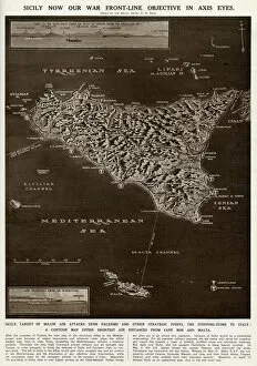
Background imageWorld Collection: Map of Sicily by G. H. Davis

Map of Sicily by G. H. Davis
A contour map of Sicily, giving the shortest air distances from Cape Bon and Malta. At this stage in the Second World War it was a British front-line objective in Axis eyes

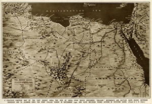
Background imageWorld Collection: Map of the war in North Africa by G. H. Davis

Map of the war in North Africa by G. H. Davis
The war in North Africa: a strategic contour map of the desert arena during the Second World War. Conflict began there in September 1940. Date: 1942

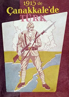
Background imageWorld Collection: Turkish poster celebrating defence of Gallipoli, WW1

Turkish poster celebrating defence of Gallipoli, WW1
Turkish poster celebrating the defence of Gallipoli against the Allies during the First World War. Date: 1915

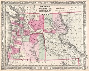
Background imageWorld Collection: 1864, Johnson Map of Washington, Oregon, and Idaho, topography, cartography, geography

1864, Johnson Map of Washington, Oregon, and Idaho, topography, cartography, geography
1864, Johnson Map of Washington, Oregon, and Idaho

Background imageWorld Collection: World eastern hemispheres 1883

World eastern hemispheres 1883
Warrens Common School Geography

Background imageWorld Collection: Wisconsin Michigan map 1881

Wisconsin Michigan map 1881
Coltons Common School Geography 1881 New York Sheldon and Co

Background imageWorld Collection: MAP: LOS ANGELES, 1932. Map of Greater Los Angeles, the wonder city of the world

MAP: LOS ANGELES, 1932. Map of Greater Los Angeles, the wonder city of the world. Lithograph, 1932

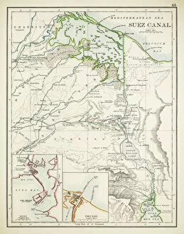
Background imageWorld Collection: Map of Suez Canal 1897

Map of Suez Canal 1897

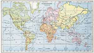
Background imageWorld Collection: Commercial chart of the world map 1875

Commercial chart of the world map 1875
The Independent Course Comprehensive Geography by James Monteith, A.S. Barnes & Co, New York & Chicago 1875

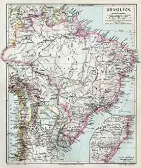
Background imageWorld Collection: Brazil map 1895

Brazil map 1895
Meyers Konversations-Lexikon. Ein Nachschlagewerk des allgemeinen Wissens, 5th edition 17 volumes Bibliographisches Institut - Leipzig 1895-1897

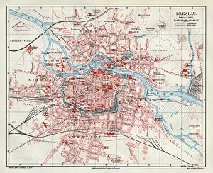
Background imageWorld Collection: Wroclaw city map 1895

Wroclaw city map 1895
Meyers Konversations-Lexikon. Ein Nachschlagewerk des allgemeinen Wissens, 5th edition 17 volumes Bibliographisches Institut - Leipzig 1895-1897

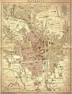
Background imageWorld Collection: Wiesbaden, germany

Wiesbaden, germany
Antique illustration of a Wiesbaden, Germany from 1898

Background imageWorld Collection: WORLD WAR I: BELGIUM, 1918. Map showing the zone of war operations in western Belgium

WORLD WAR I: BELGIUM, 1918. Map showing the zone of war operations in western Belgium, the ports of Ostend and Zeebrugge, the line of battle on 28 September 1918

Background imageWorld Collection: PORTUGUESE MAP OF BRAZIL. Between the Amazon River and the Rio de la Plata, 1519

PORTUGUESE MAP OF BRAZIL. Between the Amazon River and the Rio de la Plata, 1519

Background imageWorld Collection: MAP: NEW ENGLAND COLONIES. Early settlements in New England and distribution of

MAP: NEW ENGLAND COLONIES. Early settlements in New England and distribution of Native American tribes

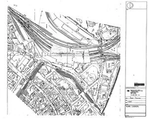
Background imageWorld Collection: 210714LNE

210714LNE
York Station, 210714LNE

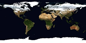
Background imageWorld Collection: World Flat projection map from composite of satellite images. Credit NASA: Science

World Flat projection map from composite of satellite images. Credit NASA: Science Earth Geology Oceanography

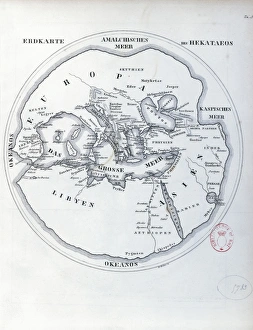
Background imageWorld Collection: Circular world map by Hecataeus of Miletus

Circular world map by Hecataeus of Miletus
Cartography, 6th-5th century b.C. Circular world map by Hecataeus of Miletus

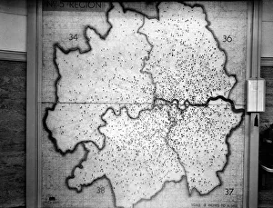
Background imageWorld Collection: WW2 - Map showing Flying Bomb hits during Blitz on London

WW2 - Map showing Flying Bomb hits during Blitz on London in the LCC-London Fire Brigade Control Room at Lambeth HQ, SE1

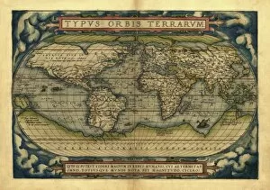
Background imageWorld Collection: Orteliuss world map, 1570

Orteliuss world map, 1570
Orteliuss world map. This world map is from the 1570 first edition of Theatrum orbis terrarum ( Theatre of the World ). Drawn by the Flemish mapmaker Abraham Ortelius (1527-1598)
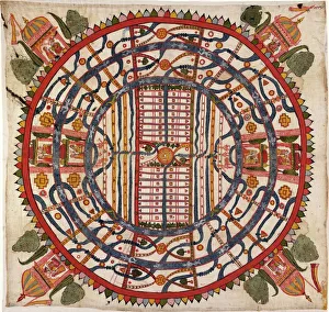
Background imageWorld Collection: Jain cosmological map, 19th century

Jain cosmological map, 19th century. Titled Manusyaloka ( map of the world of man ), this artwork shows the world according to the cosmological traditions of Jainism, an ancient religion of India

Background imageWorld Collection: EXPL2A-00184

EXPL2A-00184
Part of the 1613 Samuel de Champlain map of New France. Hand-colored woodcut of a 19th-century reproduction of the original ma

Background imageWorld Collection: World map, February 2004

World map, February 2004
World Map. Blue Marble: Next Generation cloud-free true-colour composite image of the Earth in February 2004. It is winter in the Northern Hemisphere and large areas of land are covered in snow

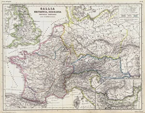
Background imageWorld Collection: Map of the Roman provinces of Gaul, Britannia and Germania (coloured engraving)

Map of the Roman provinces of Gaul, Britannia and Germania (coloured engraving)
7148263 Map of the Roman provinces of Gaul, Britannia and Germania (coloured engraving) by Kiepert, Heinrich (1818-99); Private Collection; (add.info.: Map of the Roman provinces of Gaul)

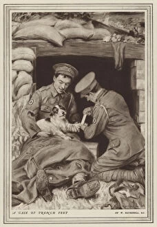
Background imageWorld Collection: British army medics bandaging a dogs paw in the trenches, World War I (litho)

British army medics bandaging a dogs paw in the trenches, World War I (litho)
7149431 British army medics bandaging a dogs paw in the trenches, World War I (litho) by Hatherell, William (1855-1928) (after); Private Collection; (add.info)

Background imageWorld Collection: The Roman Emperor Caligula entertaining his favourite horse, Incitatus, at supper (engraving)

The Roman Emperor Caligula entertaining his favourite horse, Incitatus, at supper (engraving)
7148832 The Roman Emperor Caligula entertaining his favourite horse, Incitatus, at supper (engraving) by English School, (19th century); Private Collection; (add.info)

Background imageWorld Collection: The Plum Pudding in Danger or State Epicures taking un Petit Souper, 1805 (engraving)

The Plum Pudding in Danger or State Epicures taking un Petit Souper, 1805 (engraving)
7088732 The Plum Pudding in Danger or State Epicures taking un Petit Souper, 1805 (engraving) by Gillray, James (1757-1815); Private Collection; (add.info)

Background imageWorld Collection: Map showing the principal world trade shipping routes, 1912 (colour litho)

Map showing the principal world trade shipping routes, 1912 (colour litho)
CHT277054 Map showing the principal world trade shipping routes, 1912 (colour litho) by French School, (20th century); Private Collection; (add.info)

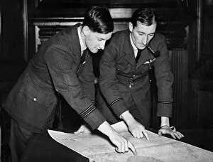
Background imageWorld Collection: Some of the pilots of the Coastal Command of the Royal Air Force who took part in

Some of the pilots of the Coastal Command of the Royal Air Force who took part in the location of the Altmark during the Second World War. February 1940

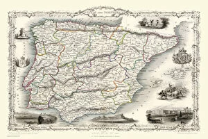
Background imageWorld Collection: Spain & Portugal 1851

Spain & Portugal 1851
A fine facimile artworked from an antique original map of Spain and Portugal, issued as part of the 1851 edition of John Tallis and Companys " The Illustrated Atlas

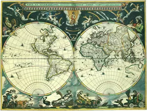
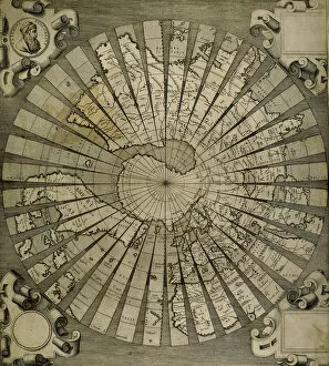
Background imageWorld Collection: Nova et Accuratissima Totius Terrarum

Nova et Accuratissima Totius Terrarum
Double Hemisphere Map 1662, Blaeu, Joan

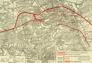
Background imageWorld Collection: positions in the Battle of Verdun, northern France, First World War, 1916, (c1920)

positions in the Battle of Verdun, northern France, First World War, 1916, (c1920)
French and German positions in the Battle of Verdun, northern France, First World War, 1916, (c1920). Solid red line indicates French

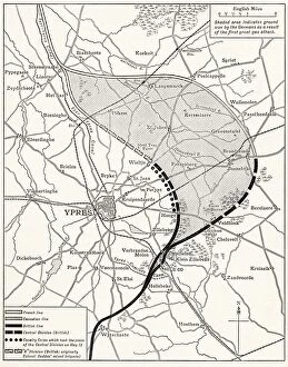
Background imageWorld Collection: Map Showing The Ypres Salient Before And After The Second Battle Of Ypres April And May 13 1915

Map Showing The Ypres Salient Before And After The Second Battle Of Ypres April And May 13 1915. From The Great World War A History Volume Iii, Published 1916

Background imageWorld Collection: Map Of The World Showing In Red The Extent Of The British Empire In 1901

Map Of The World Showing In Red The Extent Of The British Empire In 1901

Background imageWorld Collection: World map by Claudius Ptolemy (90-168). Engraving, 16th cent

World map by Claudius Ptolemy (90-168). Engraving, 16th cent
Claudius Ptolemy (90-168) Greco-Egyptian geographer. World map. Engraving, 16th century

Background imageWorld Collection: WWI photo frame showing the Western Front with map

WWI photo frame showing the Western Front with map
First World War photo frame showing the Western Front with map of France and Belgium. Also shows the names of Allied Generals and various towns and cities. Trench Art. Date: 1914-1918

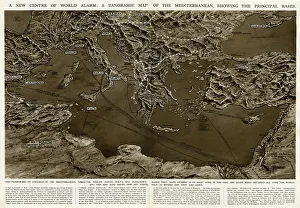
Background imageWorld Collection: Panoramic map of Mediterranean by G. H. Davis

Panoramic map of Mediterranean by G. H. Davis
A new centre of world alarm during the Second World War: a panoramic map of the Mediterranean, showing the principal bases

Background imageWorld Collection: Strategic importance of Crete and Cyprus by G. H. Davis

Strategic importance of Crete and Cyprus by G. H. Davis
The Eastern Mediterranean: maps showing the strategic importance of Crete and Cyprus during the Second World War. Date: 1941

Background imageWorld Collection: Antique map of Nile River

Antique map of Nile River

Background imageWorld Collection: Peru, Ecuador, Colombia, Venezuela, lithograph, published in 1877

Peru, Ecuador, Colombia, Venezuela, lithograph, published in 1877
Ancient map of Peru, Ecuador, Colombia, and Venezuela. Lithograph, published in 1877

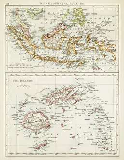
Background imageWorld Collection: Map of Fiji Sumatra Borneo 1897

Map of Fiji Sumatra Borneo 1897
Map of Fiji, Borneo, Sumatra, java

Background imageWorld Collection: Western Hemisphere map 1856

Western Hemisphere map 1856
Colton and Fitchs Modern School Geography by George W. Fitch - New York 1856

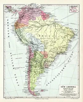
Background imageWorld Collection: South America political map 1895

South America political map 1895
Meyers Konversations-Lexikon. Ein Nachschlagewerk des allgemeinen Wissens, 5th edition 17 volumes Bibliographisches Institut - Leipzig 1895-1897

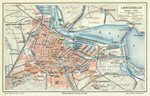
Background imageWorld Collection: Amsterdam city map 1895

Amsterdam city map 1895
Meyers Konversations-Lexikon. Ein Nachschlagewerk des allgemeinen Wissens, 5th edition 17 volumes Bibliographisches Institut - Leipzig 1895-1897

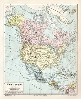
Background imageWorld Collection: North America political map 1895

North America political map 1895
Meyers Konversations-Lexikon. Ein Nachschlagewerk des allgemeinen Wissens, 5th edition 17 volumes Bibliographisches Institut - Leipzig 1895-1897

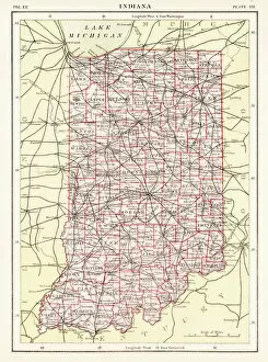
Background imageWorld Collection: Indiana USA map 1881

Indiana USA map 1881
Encyclopedia Britannica 9th Edition Vol XII Philadelphia j.M. Stoddart & Co 1881

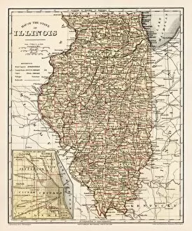
Background imageWorld Collection: Illinois map 1881

Illinois map 1881
Encyclopedia Britannica 9th Edition Vol XII Philadelphia j.M. Stoddart & Co 1881

Background imageWorld Collection: Romania

Romania
Antique map of Romania


All Professionally Made to Order for Quick Shipping


-

World Collection

World maps and charts are visual representations of the Earth's surface, showing geographical features such as continents, oceans, countries, cities, rivers and mountains. They have been used for centuries to aid navigation, exploration and education. Maps can be created using various techniques including satellite imagery or hand-drawn illustrations. Charts are graphical representations of data that help people understand complex information in a simplified manner. Examples include population growth rates or economic indicators by country. Both maps and charts are important tools for understanding our world and making informed decisions about global issues such as climate change or international trade policies.
+

Our beautiful pictures are available as Framed Prints, Photos, Wall Art and Photo Gifts

The World collection from Media Storehouse is a stunning array of wall art and framed prints that showcase the beauty and diversity of our planet. Featuring an extensive range of maps, charts, and diagrams, our collection offers something for everyone – from vintage world maps to modern satellite imagery. Each print is carefully crafted using high-quality materials to ensure that it looks great in any setting. Whether you're looking for a piece to decorate your home or office, or simply want to add some visual interest to your space, the World collection has something for you. With its wide variety of styles and subjects, our collection is perfect for anyone who loves travel, geography, history or science. So why not explore the world from the comfort of your own home with one of these beautiful prints?
+

What are World (Maps and Charts) art prints?

World maps and charts art prints are high-quality reproductions of historical or contemporary maps and charts that depict the geography, topography, political boundaries, and other features of different regions of the world. These prints can be used for decorative purposes in homes, offices, schools, museums, libraries or any other setting where a visual representation of global locations is needed. World maps and charts art prints come in various sizes to suit different spaces and preferences. They may feature antique designs from centuries ago or modern interpretations with updated information on countries' borders and names. Some popular styles include vintage world maps with sepia tones or muted colors; colorful political maps highlighting specific regions such as Europe or Africa; nautical charts showing ocean depths and currents; or satellite images displaying terrain details. Whether you're a history buff looking to decorate your study room with an old-world map print or a traveler seeking inspiration for your next adventure destination, World Maps & Charts Art Prints offer something for everyone's taste.
+

What World (Maps and Charts) art prints can I buy from Media Storehouse?

We offer a wide range of World Maps and Charts art prints that are perfect for decorating your home or office. You can choose from vintage maps, antique charts, modern world maps, satellite images of the earth, and many more options. These art prints come in various sizes to suit your needs and preferences. The collection includes detailed maps of different countries and continents such as Europe, Africa, Asia, North America, South America among others. The prints also feature famous landmarks like the Eiffel Tower in Paris or the Statue of Liberty in New York City. Moreover, you can find educational charts on topics like geography or astronomy that are ideal for classrooms. Our World Maps and Charts art prints are printed using high-quality materials to ensure they last a long time without fading or losing their vibrancy. They make great gifts for anyone who loves travel or wants to learn more about our planet's geography.
+

How do I buy World (Maps and Charts) art prints?

To purchase World art prints from Media Storehouse, you can browse our extensive collection of high-quality images online. Once you have found the print that you would like to buy, simply add it to your cart and proceed to checkout. At this point, you will be prompted to enter your shipping and payment information. We offer a variety of sizes for their art prints, so be sure to select the size that best fits your needs. You may also have the option to choose between different paper types or finishes. Once your order has been processed, Media Storehouse will carefully package your print and ship it directly to your doorstep. Whether you are looking for a unique piece of wall decor or a thoughtful gift for someone special, World art prints from Media Storehouse are an excellent choice for anyone who loves geography or history.
+

How much do World (Maps and Charts) art prints cost?

We offer a wide range of World Maps and Charts art prints that are available at varying prices. The cost of our World Maps and Charts art prints depends on the size, quality, and type of print you choose. We have different options such as canvas prints, framed prints, photographic prints, and poster prints. Our World Maps and Charts art prints come in various sizes ranging from small to large formats. The price also varies depending on whether you want a black-and-white or colored print. Our collection features vintage maps as well as contemporary designs that cater to different tastes. We take pride in providing high-quality products at affordable prices without compromising on the quality of our artwork. You can be sure that every piece is carefully crafted with attention to detail using premium materials. The cost of our World Maps and Charts art prints is reasonable considering their quality and uniqueness. Whether you're looking for a statement piece for your home or office space or an educational tool for your classroom, we have something for everyone's budget.
+

How will my World (Maps and Charts) art prints be delivered to me?

We take great care in delivering your World art prints to you. We use a trusted courier service to ensure that your order arrives safely and on time. Your print will be carefully packaged in protective materials to prevent any damage during transit. We offer a range of delivery options for our customers, including standard shipping and express delivery for those who need their order sooner. Once your order has been dispatched, you will receive an email with tracking information so that you can keep track of its progress. Our team is committed to providing excellent customer service, so if you have any questions or concerns about the delivery of your World art prints, please do not hesitate to get in touch with us. We are always happy to help.