
Switzerland Collection
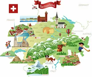
Switzerland is a landlocked country in Western Europe, bordered by France to the west, Germany to the north, Austria and Liechtenstein to the east
Choose a picture from our Switzerland Collection for your Wall Art and Photo Gifts
543 items


All Professionally Made to Order for Quick Shipping
-
Switzerland Collection
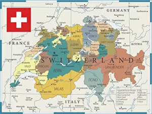
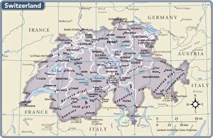
Switzerland is a landlocked country in Western Europe, bordered by France to the west, Germany to the north, Austria and Liechtenstein to the east, and Italy to the south and has a population of approximately 8.5 million people and covers an area of 41,290 square kilometers. The country is known for its stunning natural beauty with mountains such as the Matterhorn and Jungfrau attracting tourists from all over the world. It also boasts a strong economy with industries such as banking, pharmaceuticals, and tourism contributing significantly to its GDP. Its political system is characterized by direct democracy where citizens can vote directly on laws or policies through referendums or initiatives.
+
Our beautiful pictures are available as Framed Prints, Photos, Wall Art and Photo Gifts
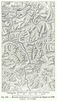
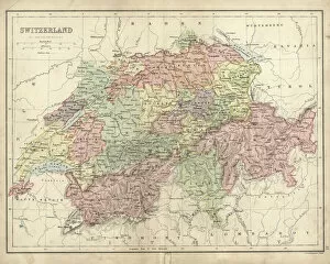
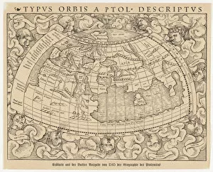
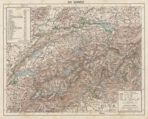
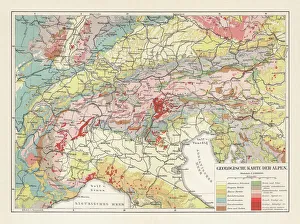
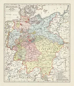
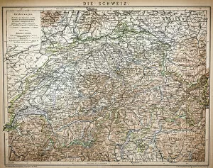
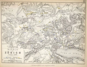
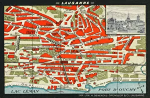
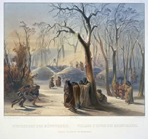
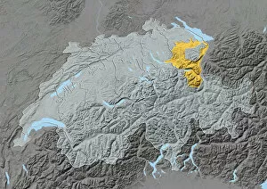
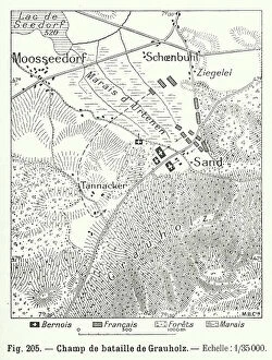
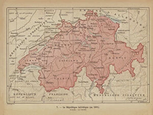
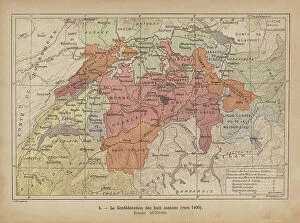
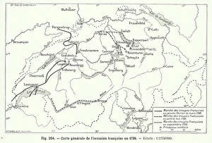
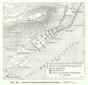
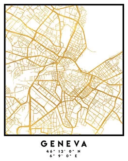
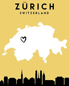
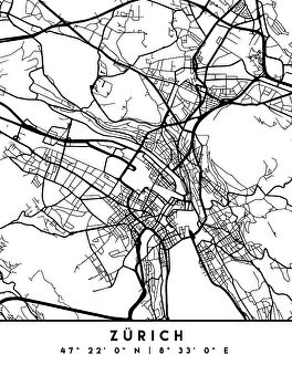
The Switzerland collection from Media Storehouse is a stunning compilation of vintage maps and charts that depict the beautiful country of Switzerland. Our collection features an array of historical maps, including topographical maps, city plans, and geological surveys that date back to the 19th century. These prints are perfect for anyone who loves history or geography and wants to add a touch of sophistication to their home decor. Each print in our collection has been carefully selected for its unique aesthetic appeal, making it easy to find something that suits your personal style. Whether you're looking for a detailed map of Zurich or a panoramic view of the Swiss Alps, there's something here for everyone. All prints in our collection are available as high-quality wall art or framed prints, ensuring that they will look great wherever you choose to display them. With such a wide variety of options available, the Switzerland collection from Media Storehouse is sure to impress even the most discerning art lover.
+
What are Switzerland (Maps and Charts) art prints?
Switzerland art prints are high-quality reproductions of antique maps and charts depicting various regions, cities, and landmarks in Switzerland. These prints showcase the intricate details of historical cartography with accurate depictions of topography, borders, rivers, lakes, and other geographical features. The collection includes a wide range of vintage maps from different periods dating back to the 16th century. Some notable examples include detailed city plans of Zurich or Geneva as well as panoramic views of the Swiss Alps. These art prints are perfect for those who appreciate history or have an interest in geography. They can be used to decorate homes or offices with a touch of sophistication while also serving as educational tools for students studying Swiss culture or history. Switzerland art prints offer a unique way to explore the beauty and diversity of this European country through stunning visual representations that capture its rich heritage.
+
What Switzerland (Maps and Charts) art prints can I buy from Media Storehouse?
We offer a wide range of Switzerland art prints, including maps and charts. You can choose from vintage maps that showcase the country's topography, political boundaries, and cities. These prints are perfect for history buffs or anyone who wants to add a touch of nostalgia to their home decor. For those interested in more contemporary designs, Media Storehouse also has modern map prints that feature bold colors and intricate details. These pieces are ideal for adding a pop of color to any room or office space. In addition to maps, Media Storehouse also offers charts that highlight various aspects of Switzerland's culture and geography. From ski resort locations to wine regions, these prints provide an informative yet stylish way to decorate your walls. No matter what type of Switzerland art print you're looking for, we have something for everyone. With high-quality printing techniques and durable materials used in each piece, you can be sure that your purchase will last for years to come.
+
How do I buy Switzerland (Maps and Charts) art prints?
To purchase Switzerland art prints from Media Storehouse, you can browse our extensive collection of high-quality images online. Once you have found the print that you would like to buy, simply select the size and format that suits your needs. You can choose from a range of options including canvas prints, framed prints, and photographic prints. When placing your order, be sure to provide accurate shipping information so that your print can be delivered promptly. Payment is typically made through a secure online checkout process using a credit or debit card. We offer a wide variety of beautiful art prints featuring stunning landscapes and iconic landmarks from around the world. Whether you are looking for something to decorate your home or office, or as a gift for someone special, there is sure to be an image in our collection that will suit your taste and style.
+
How much do Switzerland (Maps and Charts) art prints cost?
We offer a wide range of Switzerland Maps and Charts art prints at various prices. Our collection includes vintage maps, topographical charts, and modern designs that showcase the beauty of Switzerland's landscapes and cities. The cost of our art prints varies depending on the size, material, and framing options you choose. We have affordable options for those who are looking for budget-friendly pieces as well as high-end prints for collectors or those who want to make a statement in their home or office decor. Our selection caters to different tastes and preferences so you can find something that suits your style. Whether you're looking for a minimalist black-and-white design or an intricate map with colorful details, we've got you covered. Browse our website to discover our full range of Switzerland Maps and Charts art prints today.
+
How will my Switzerland (Maps and Charts) art prints be delivered to me?
We offer a range of delivery options for your Switzerland art prints. Our standard delivery service is reliable and efficient, ensuring that your prints arrive safely at your doorstep. We also offer express delivery for those who need their prints in a hurry. All our art prints are carefully packaged to ensure they arrive in perfect condition. They are rolled up and placed in sturdy tubes to protect them during transit. Once you receive your print, simply unroll it and frame it as desired. We take great pride in providing high-quality products and excellent customer service. If you have any questions or concerns about the delivery of your Switzerland art prints, please don't hesitate to contact us. Our friendly team will be happy to assist you with any queries you may have.