Fraud Blocker Skip to main content

Home > Maps and Charts > Spain

Spain Collection (page 2)

Spain is a country located in southwestern Europe

1,783 items

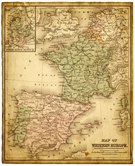
Background imageSpain Collection: western europe 1867

western europe 1867
a map of Western europe from 1867, overlay with grunge burnt texture paper

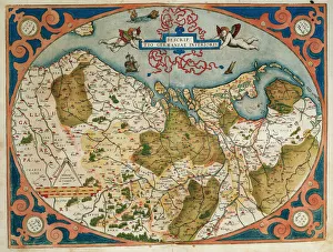
Background imageSpain Collection: Map of Germany and current Netherlands. Theatrum Orbis Terra
Map of Germany and current Netherlands. Theatrum Orbis Terrarum by Abraham Ortelius (1527-1598). First Edition. Antwerp, 1574. Library of Catalonia. Barcelona. Spain

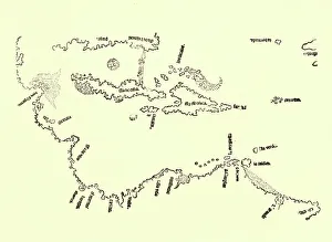
Background imageSpain Collection: MAP: CARIBBEAN, 1511. The first map to show Bermuda, also showing coastline detail

MAP: CARIBBEAN, 1511. The first map to show Bermuda, also showing coastline detail of the Bay Islands of Honduras at Guanaca and Florida (labeled Isla de Beimenhi)

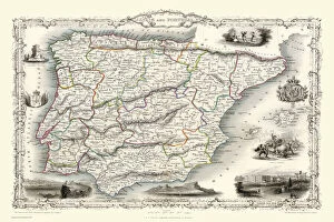
Background imageSpain Collection: Spain & Portugal 1851

Spain & Portugal 1851
A fine facimile artworked from an antique original map of Spain and Portugal, issued as part of the 1851 edition of John Tallis and Companys " The Illustrated Atlas

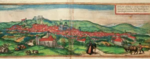
Background imageSpain Collection: Spain. Castile and Leon. Burgos. Map, 1576 at Civitates

Spain. Castile and Leon. Burgos. Map, 1576 at Civitates Orbis Terrarum by Georg Braun (1541-1622) and Franz Hogenberg (1536-1590). Salamanca University Library

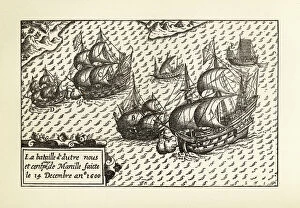
Background imageSpain Collection: Engraving of Van Noort Landing in Manila Bay, Philippines, 1600

Engraving of Van Noort Landing in Manila Bay, Philippines, 1600
Very Rare, Beautifully Illustrated Antique Engraved Victorian Illustration of Historical Engraving of Van Noort Landing in Manila Bay, Philippines, 1600. Copyright has expired on this artwork

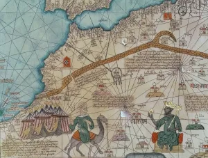
Background imageSpain Collection: Detail from the Catalan Atlas, 1375 (vellum) (detail of 151844)

Detail from the Catalan Atlas, 1375 (vellum) (detail of 151844)
XZL387496 Detail from the Catalan Atlas, 1375 (vellum) (detail of 151844) by Cresques, Abraham (1325-87); Bibliotheque Nationale, Paris

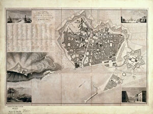
Background imageSpain Collection: Barcelona (19th c. ). Geometrical map, by Jos項

Barcelona (19th c. ). Geometrical map, by Jos項
Barcelona (19th c.). Geometrical map, by Jos頍 as y Vila. SPAIN. Barcelona. Historical Archive of Barcelona

Background imageSpain Collection: Map of Nueva Espa񡠨1767) by Jos頁ntonio Alzate

Map of Nueva Espa񡠨1767) by Jos頁ntonio Alzate
Map of Nueva Espa񡠨 1767) by Jos頁 ntonio Alzate. Addressed to the Cardinal and General Inquisitor Francisco Antonio de Lorenzana. SPAIN. Madrid. Navy Museum

Background imageSpain Collection: Plan of the city of Montpellier, 1572 (coloured engraving)

Plan of the city of Montpellier, 1572 (coloured engraving)
AIS5365892 Plan of the city of Montpellier, 1572 (coloured engraving) by Braun, Georg (1541-1622) and Hogenberg, Franz (1535-90); Biblioteca Universidad, Salamanca

Background imageSpain Collection: Map of Valencia, from Civitates Orbis Terrarum

Map of Valencia, from Civitates Orbis Terrarum
STC138966 Map of Valencia, from Civitates Orbis Terrarum by Georg Braun (1541-1622) and Frans Hogenberg (1535-90) c.1572-1617 (coloured engraving) by Hoefnagel

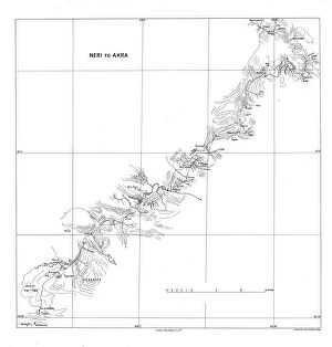
Background imageSpain Collection: Neri to Akra, c1915. Creator: Stanfords Geographical Establishment

Neri to Akra, c1915. Creator: Stanfords Geographical Establishment
Neri to Akra, c1915. Map showing the journey of British writer, soldier and diplomatic advisor Mark Sykes in Turkey, (at that time part of the Ottoman Empire)

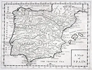
Background imageSpain Collection: 19Th Century Map Showing Provinces And Cities Of Roman Spain

19Th Century Map Showing Provinces And Cities Of Roman Spain

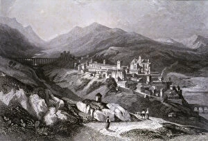
Background imageSpain Collection: View of the city of Plasencia (Caceres), engraving in Voyage Pittoresque en

View of the city of Plasencia (Caceres), engraving in Voyage Pittoresque en Espagne et en Portugal, 1840, by Emile Begin

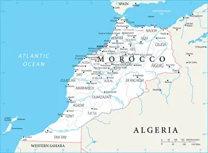
Background imageSpain Collection: Reference Map of Morocco

Reference Map of Morocco
Morocco is a country in the western Maghreb region of North Africa. Morocco is bordered by the Atlantic Ocean in west, by the Mediterranean Sea in north

Background imageSpain Collection: Antique map of Spain and Portugal

Antique map of Spain and Portugal from 1891 with a detail of Santander

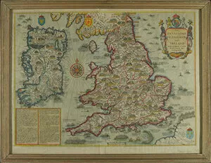
Background imageSpain Collection: The Invasions of England and Ireland With al [sic] their Civ

The Invasions of England and Ireland With al [sic] their Civ
Map: The Invasions of England and Ireland With al [sic] their Civill [sic] Wars since the Conquest Corn Danckertsz sculpsit [London] George Humble, 1627 (c)

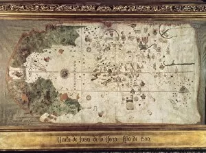
Background imageSpain Collection: Map of countries first discovered by Christopher Columbus (1451-1506) 1500 (gouache

Map of countries first discovered by Christopher Columbus (1451-1506) 1500 (gouache
XIR226789 Map of countries first discovered by Christopher Columbus (1451-1506) 1500 (gouache and pen and ink on paper) (b/w photo) by Cosa, Juan de la (1460-1510); Museo Naval, Madrid

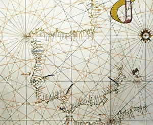
Background imageSpain Collection: Portolan Atlas, 1587. Map of the Iberian Peninsula

Portolan Atlas, 1587. Map of the Iberian Peninsula, the north coastline of Africa and the Vasque Countrys region in France. Made in Messina. Facsimile. Miniature Painting. SPAIN. Madrid

Background imageSpain Collection: Map of Moscow (1836). Original drawing by W. B

Map of Moscow (1836). Original drawing by W. B
" Map of Moscow (1836). Original drawing by W.B. Clarke and engraving by B. Davies, originally published under supervision of the Society for the Diffusion of Useful Knowledge

Background imageSpain Collection: Map of Olivenza

Map of Olivenza
Olivenza, fortress and defence works, Spain c. 1801 Date: c. 1801

Background imageSpain Collection: Map of Olivenza

Map of Olivenza
Olivenza, town and environs, Spain 1802 Date: 1802

Background imageSpain Collection: HSET2A-00123

HSET2A-00123
Map of the principal westward trails in the 1800s. Hand-colored woodcut of a 19th-century illustration

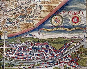
Background imageSpain Collection: Theatrum Orbis Terrarum by Abraham Ortelius, Antwerp, 1574, map of Salzburg and view of the city

Theatrum Orbis Terrarum by Abraham Ortelius, Antwerp, 1574, map of Salzburg and view of the city

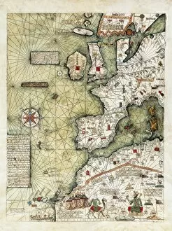
Background imageSpain Collection: CRESQUES, Jafuda (1350-1410); CRESQUES, Abraham

CRESQUES, Jafuda (1350-1410); CRESQUES, Abraham ( -1381). Catalan Atlas. 1375. Third and Fourth Leaves. Map of the world known in the 14th c. (Finisterre and the Mediterranean)

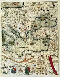
Background imageSpain Collection: CRESQUES, Jafuda (1350-1410); CRESQUES, Abraham

CRESQUES, Jafuda (1350-1410); CRESQUES, Abraham ( -1381). Catalan Atlas. 1375. Third and Fourth Leaves. Map of the world known in the 14th c. (Finisterre and the Mediterranean)

Background imageSpain Collection: Map of Morocco

Map of Morocco
Morocco is a country in the western Maghreb region of North Africa. Morocco is bordered by the Atlantic Ocean in west, by the Mediterranean Sea in north

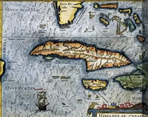
Background imageSpain Collection: ORTELIUS, Abraham (1527-1598). Theatrum Orbis

ORTELIUS, Abraham (1527-1598). Theatrum Orbis Terrarum. 1570. It is considered to be the first modern atlas. Map of the Caribbean Sea with Cuba, Cayman Islands, Jamaica and Florida. 1588

Background imageSpain Collection: Chart by Juan de la Cosa (1500). SPAIN. Madrid

Chart by Juan de la Cosa (1500). SPAIN. Madrid. Navy Museum

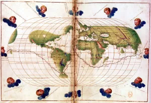
Background imageSpain Collection: Map of Magellans round the world voyage, 1519-1521

Map of Magellans round the world voyage, 1519-1521. A Portuguese-born navigator sponsored by Spain, Ferdinand Magellan (c1480-1521)

Background imageSpain Collection: Map of the Mediterranean French odds (Galia Narbonense), 1570 (engraving)

Map of the Mediterranean French odds (Galia Narbonense), 1570 (engraving)
AIS5366577 Map of the Mediterranean French odds (Galia Narbonense), 1570 (engraving); (add.info.: Strong water in colors, 1570, by Christophe Plantin (1514 or 1520-1589), Antwerp (Netherlands)

Background imageSpain Collection: Map of Callao & Lima, 1778 (print)

Map of Callao & Lima, 1778 (print)
7339807 Map of Callao & Lima, 1778 (print) by Surville, Luis de (fl.1777); 35x46 cm; National Maritime Museum, London, UK; (add.info.: Creator)

Background imageSpain Collection: English Gulf, South American Pacific Coast, 1685 (manuscript)

English Gulf, South American Pacific Coast, 1685 (manuscript)
7339777 English Gulf, South American Pacific Coast, 1685 (manuscript) by Hack, William (17th Century); 40x50 cm; National Maritime Museum, London

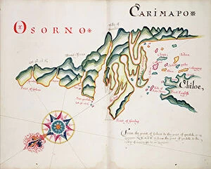
Background imageSpain Collection: Osorno and Carimapo, South American Pacific coast, 1685 (manuscript)

Osorno and Carimapo, South American Pacific coast, 1685 (manuscript)
7339775 Osorno and Carimapo, South American Pacific coast, 1685 (manuscript) by Hack, William (17th Century); 40x50 cm; National Maritime Museum, London

Background imageSpain Collection: Tirao [and] Tolten, 1685 (manuscript)

Tirao [and] Tolten, 1685 (manuscript)
7339774 Tirao [and] Tolten, 1685 (manuscript) by Hack, William (17th Century); 40.5x5 cm; National Maritime Museum, London

Background imageSpain Collection: Map of Chile compiled by Jesuits, 1646 (engraving)

Map of Chile compiled by Jesuits, 1646 (engraving)
7339494 Map of Chile compiled by Jesuits, 1646 (engraving) by Unknown Artist, (17th century); 35x46 cm; National Maritime Museum, London

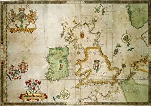
Background imageSpain Collection: The track of the Armada around Britain and Ireland, 1590 (print, paper, engraving)

The track of the Armada around Britain and Ireland, 1590 (print, paper, engraving)
7340786 The track of the Armada around Britain and Ireland, 1590 (print, paper, engraving) by Adams, Robert (1540-95) (after); 54.5x79.5 cm; National Maritime Museum, London

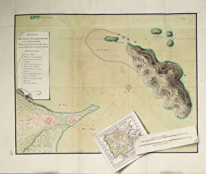
Background imageSpain Collection: A plan of St Philips Castle and fortifications in the island of Minorca, 1780 (paper)

A plan of St Philips Castle and fortifications in the island of Minorca, 1780 (paper)
7340466 A plan of St Philips Castle and fortifications in the island of Minorca, 1780 (paper) by Faden, William (1750-1836); 47.5x63 cm; National Maritime Museum, London

Background imageSpain Collection: Nieuwe pascaert, van de suyt syde van Yrlandt beginnende van Blasques tot ande Hoeck van Waterfoort

Nieuwe pascaert, van de suyt syde van Yrlandt beginnende van Blasques tot ande Hoeck van Waterfoort
7340067 Nieuwe pascaert, van de suyt syde van Yrlandt beginnende van Blasques tot ande Hoeck van Waterfoort. A chart bound in van Keulen's 'Great and Newly Enlarged Sea Atlas' or Waterworld

Background imageSpain Collection: Pas-caert van de Canael, tusschen Engelandt en Vranckryck, van Pleymuyen tot an de Sorlinges

Pas-caert van de Canael, tusschen Engelandt en Vranckryck, van Pleymuyen tot an de Sorlinges
7340065 Pas-caert van de Canael, tusschen Engelandt en Vranckryck, van Pleymuyen tot an de Sorlinges, als mede van Portbimel tot aen Heyssant, 1682 (engraving) by Keulen

Background imageSpain Collection: Pas-caert van Texel tot aen de Hoofden, 1661 (print, paper)

Pas-caert van Texel tot aen de Hoofden, 1661 (print, paper)
7340060 Pas-caert van Texel tot aen de Hoofden, 1661 (print, paper) by Doncker, Hendrick (c.1626-99); 46.5x57.5 cm; National Maritime Museum, London

Background imageSpain Collection: A general chart of the northern navigation, 1675 (coloured engraving)

A general chart of the northern navigation, 1675 (coloured engraving)
7340043 A general chart of the northern navigation, 1675 (coloured engraving) by Seller, John (1632-97); 43.5x54 cm; National Maritime Museum, London

Background imageSpain Collection: El Viejo, 1682 (paper)

El Viejo, 1682 (paper)
7340748 El Viejo, 1682 (paper) by Ringrose, Basil (c.1653-83); 16x20 cm; National Maritime Museum, London, UK; (add.info.: Creator: Basil Ringrose From a book of sailing directions of 110ff)

Background imageSpain Collection: The Carybsche Eylanden of Barbados to the bend of Mexico, 1656 (engraving)

The Carybsche Eylanden of Barbados to the bend of Mexico, 1656 (engraving)
7340058 The Carybsche Eylanden of Barbados to the bend of Mexico, 1656 (engraving) by Colom, Arnold (1624-68) & Colom, Jacob Aertsz (1600-73); 55x64 cm; National Maritime Museum, London

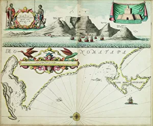
Background imageSpain Collection: A chart of Guinea describing the sea coast from Cape de Verde to Cape Bona Esperanca

A chart of Guinea describing the sea coast from Cape de Verde to Cape Bona Esperanca, 1677 (coloured engraving)
7340049 A chart of Guinea describing the sea coast from Cape de Verde to Cape Bona Esperanca, 1677 (coloured engraving) by Seller, John (1632-97); 43x54 cm; National Maritime Museum, London

Background imageSpain Collection: The Spanish and English fleets near Plymouth on 30 - 31 July, 1588, c.1590 (coloured engraving)

The Spanish and English fleets near Plymouth on 30 - 31 July, 1588, c.1590 (coloured engraving)
7340024 The Spanish and English fleets near Plymouth on 30 - 31 July, 1588, c.1590 (coloured engraving) by Adams, Robert (1540-95) (after); 38x50 cm; National Maritime Museum, London

Background imageSpain Collection: A description of the sea coastes, of the land of Algarbe, and a parte of the Condado with their

A description of the sea coastes, of the land of Algarbe, and a parte of the Condado with their shew & opening
7340014 A description of the sea coastes, of the land of Algarbe, and a parte of the Condado with their shew & opening, c.1588 (drawing) by Janszoon Waghenaer

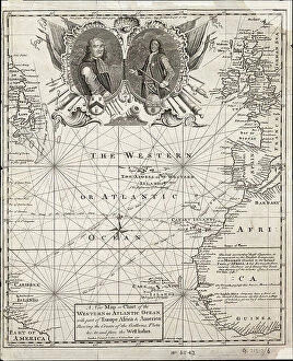
Background imageSpain Collection: A new map or chart of the western or Atlantic ocean with part of Europe, Africa and America

A new map or chart of the western or Atlantic ocean with part of Europe, Africa and America
7295401 A new map or chart of the western or Atlantic ocean with part of Europe, Africa and America: showing the course of the galleons to and from the West Indies, 1740 (engraving) by Bowen


All Professionally Made to Order for Quick Shipping


-

Spain Collection

Spain is a country located in southwestern Europe, bordered by Portugal to the west and France to the northeast and has a population of approximately 47 million people and its capital city is Madrid. Spain's geography includes mountain ranges such as the Pyrenees and Sierra Nevada, as well as coastal regions along both the Mediterranean Sea and Atlantic Ocean. The country has a diverse economy with industries including tourism, agriculture, manufacturing, and services. Spain is known for its rich history and culture, including famous landmarks like La Sagrada Familia in Barcelona and flamenco dancing in Andalusia.
+

Our beautiful pictures are available as Framed Prints, Photos, Wall Art and Photo Gifts

The Spain collection from Media Storehouse is a stunning assortment of wall art and framed prints that showcase the beauty, history, and culture of Spain. Our collection features an array of maps and charts that depict different regions, cities, landmarks, and historical events in Spain. These pieces are perfect for those who love to travel or have a passion for geography. From vintage-style maps to contemporary designs, the Spain collection offers something for everyone's taste. Each piece is printed on high-quality paper using archival inks to ensure long-lasting color vibrancy. The frames are made with premium materials such as wood or metal to provide durability while complementing the artwork. Whether you're looking for a unique gift or want to add some character to your home decor, our collection has plenty of options. With its rich history and diverse landscapes, Spain is truly a country worth exploring - let these beautiful maps and charts take you there.
+

What are Spain (Maps and Charts) art prints?

Spain art prints are a collection of high-quality, visually stunning prints that showcase the beauty and intricacies of Spain's geography. These prints feature detailed maps and charts that highlight the country's diverse regions, cities, landmarks, and topography. They are perfect for anyone who loves to explore new places or has an interest in history, geography or travel. These art prints are created using state-of-the-art printing technology on premium quality paper to ensure their longevity and durability. They come in various sizes to suit different preferences and can be framed or mounted according to individual taste. Whether you're looking for a unique piece of wall decor for your home or office space or want to gift someone with a special memento from Spain, these art prints offer something for everyone. With their intricate details and vibrant colors, they capture the essence of this beautiful country like no other medium can.
+

What Spain (Maps and Charts) art prints can I buy from Media Storehouse?

We offer a wide variety of Spain art prints for purchase. These prints range from vintage maps of Spain to modern charts depicting the country's geography, landmarks, and attractions. Some popular options include antique city plans of Madrid or Barcelona, detailed topographical maps highlighting the Pyrenees Mountains or Andalusian coastlines, and colorful illustrations showcasing Spanish culture such as flamenco dancing or bullfighting. In addition to traditional paper prints, Media Storehouse also offers canvas and framed options for many of their Spain pieces. You can choose from a range of sizes to fit their space needs, whether they are looking for a small accent piece or a large statement print. We provide an extensive selection of high-quality Spain art prints that cater to various tastes and preferences.
+

How do I buy Spain (Maps and Charts) art prints?

To buy Spain art prints from Media Storehouse, you can browse our extensive collection of artwork online. Simply search for "Spain Maps and Charts" in the search bar on our website to find a range of options available. Once you have found the print that you like, select the size and format that suits your needs. We offer a variety of printing options including canvas, framed prints, posters, and photographic prints. You can choose between different sizes as well as finishes such as gloss or matte. Once you have made your selection, add it to your cart and proceed to checkout where you will be prompted to enter your payment details. After completing the purchase process, your order will be processed by our team who will ensure that it is printed according to your specifications before being shipped out for delivery. Buying Spain art prints from Media Storehouse is an easy process with plenty of options available for customization so that you can get exactly what you want.
+

How much do Spain (Maps and Charts) art prints cost?

We offer a wide range of Spain art prints at varying prices. Our collection includes vintage maps, antique charts, and contemporary designs that capture the beauty and history of this fascinating country. The cost of our Spain art prints depends on various factors such as size, framing options, and printing materials. We use high-quality paper stock to ensure that our prints are long-lasting and vibrant in color. Our you can choose from different sizes ranging from small to large formats depending on their preferences. We also offer custom framing services for those who want to display their artwork in style. Our Spain art prints are perfect for home or office decor, gifts for friends or family members who love travel or history buffs interested in exploring the rich cultural heritage of Spain. With our extensive collection of Spain art prints available at affordable prices, you're sure to find something that suits your taste.
+

How will my Spain (Maps and Charts) art prints be delivered to me?

Your Spain art prints will be delivered to you in a secure and protective packaging. We take great care in ensuring that your artwork arrives at your doorstep in perfect condition. We use high-quality materials for our packaging to prevent any damage during transit. The delivery method may vary depending on your location and the size of the print(s). For smaller prints, we usually ship them via standard mail or courier service. Larger prints may require special handling and will be shipped using a different carrier. Once your order is dispatched, you will receive an email notification with tracking information so that you can monitor its progress until it reaches you. If there are any issues with delivery, please do not hesitate to contact us as we are always happy to assist our customers. Rest assured that your Spain art prints will be delivered safely and securely to your chosen address.