Fraud Blocker Skip to main content

Home > Maps and Charts > Serbia

Serbia Collection (page 2)

Serbia is a landlocked country located in southeastern Europe, bordered by Hungary to the north, Romania and Bulgaria to the east

173 items

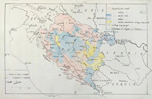
Background imageSerbia Collection: Map of Bosnia with details of the areas occupied by minority ethnic groups, 1910 (pen

Map of Bosnia with details of the areas occupied by minority ethnic groups, 1910 (pen
CHT344067 Map of Bosnia with details of the areas occupied by minority ethnic groups, 1910 (pen, ink & w/c) by French School, (20th century); Archives du Ministere des Affaires Etrangeres, Paris

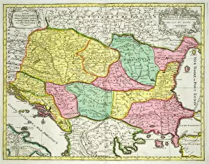
Background imageSerbia Collection: Map of the Kingdom of Hungary and the States which are United to its Crown, pub

Map of the Kingdom of Hungary and the States which are United to its Crown, pub
STC101845 Map of the Kingdom of Hungary and the States which are United to its Crown, pub. by Jan Barend Elwe, Amsterdam, 1742 (engraving) by Dutch School

Background imageSerbia Collection: Turkey in Europe (engraving)

Turkey in Europe (engraving)
1614316 Turkey in Europe (engraving) by English School, (19th century); Private Collection; (add.info.: Turkey in Europe. Illustration for The Illustrated London News, 31 October 1885)

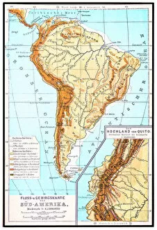
Background imageSerbia Collection: South America, river and mountains map

South America, river and mountains map
Illustrator of a South America, river and mountains map

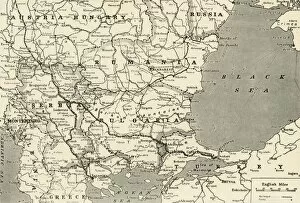
Background imageSerbia Collection: Balkan States

Balkan States
Map of Rumania, Bulgaria, Serbia, Montenegro

Background imageSerbia Collection: Map Showing the Relation of Serbia to Neighbouring States, 1916. Creator: Unknown

Map Showing the Relation of Serbia to Neighbouring States, 1916. Creator: Unknown
Map Showing the Relation of Serbia to Neighbouring States, 1916. The Serbian campaign was fought from late July 1914, when Austria-Hungary invaded Serbia at the outset of World War I

Background imageSerbia Collection: General Map of the Balkan Operations in the Autumn of 1916, 1917. Creator: Unknown

General Map of the Balkan Operations in the Autumn of 1916, 1917. Creator: Unknown
General Map of the Balkan Operations in the Autumn of 1916, 1917. The Balkans campaign was fought between the Central Powers and the Allies

Background imageSerbia Collection: Central Europe and the Mediterranean, 1919. Creator: London Geographical Institute

Central Europe and the Mediterranean, 1919. Creator: London Geographical Institute
Central Europe and the Mediterranean, 1919. Showing naval dockyards, fortified coastal towns, and forts. From " The History of the Great European War: its causes and effects", Vol

Background imageSerbia Collection: Map To Illustrate the Eastern Battle Fronts, 1919. Creator: George Philip & Son Ltd

Map To Illustrate the Eastern Battle Fronts, 1919. Creator: George Philip & Son Ltd
Map To Illustrate the Eastern Battle Fronts, 1919. Map showing areas of eastern Europe and the Balkans which saw fighting during the First World War, 1914-1919, including Italy, Austria-Hungary

Background imageSerbia Collection: Map To Illustrate the Serbian Retreat, 1919. Creator: George Philip & Son Ltd

Map To Illustrate the Serbian Retreat, 1919. Creator: George Philip & Son Ltd
Map To Illustrate the Serbian Retreat, 1919. During the Serbian armys 1915 retreat through the mountains of Albania in the First World War, some 240, 000 died from cold, starvation, disease

Background imageSerbia Collection: The Carpathian Passes, 1919. Creator: Unknown

The Carpathian Passes, 1919. Creator: Unknown
The Carpathian Passes, 1919. Map showing mountain passes in the Carpathians, a mountain range which stretches from present-day Czech Republic, through Slovakia, Poland, Hungary, Ukraine

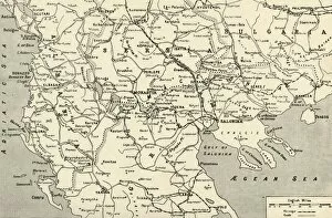
Background imageSerbia Collection: Map of Salonica Front, 1919. Creator: George Philip & Son Ltd

Map of Salonica Front, 1919. Creator: George Philip & Son Ltd
Map of Salonica Front, 1919. Map showing parts of Serbia, Albania, Bulgaria and Greece during the First World War, 1914-1919

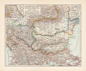
Background imageSerbia Collection: Balkan States: Romania, Bulgaria, Serbia and Montenegro, lithograph, published 1897

Balkan States: Romania, Bulgaria, Serbia and Montenegro, lithograph, published 1897
Ancient map of the Balkan States: Romania, Bulgaria, Serbia and Montenegro. Lithograph, published in 1897

Background imageSerbia Collection: Map of the Kingdom of Hungary, 1742 (hand coloured engraving)

Map of the Kingdom of Hungary, 1742 (hand coloured engraving)
XCF306032 Map of the Kingdom of Hungary, 1742 (hand coloured engraving) by Mortier, Pierre (Pieter) (1661-1711) (after); 48x57 cm; Private Collection; French, out of copyright

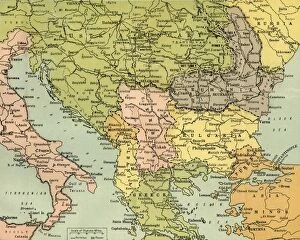
Background imageSerbia Collection: Map of the Balkan Peninsula, 1902. Creator: Unknown

Map of the Balkan Peninsula, 1902. Creator: Unknown
Map of the Balkan Peninsula, 1902. Showing Bosnia, Servia (Serbia), Romania, Bulgaria, and Turkish-occupied Greece, with inset of Constantinople (Istanbul). From The Century Atlas of the World

Background imageSerbia Collection: Rumania, Bulgaria, Serva and Montenegro, c1906, (1907)

Rumania, Bulgaria, Serva and Montenegro, c1906, (1907). From The Worlds History, Volume V, by Dr. H. F. Helmolt. [William Heinemann, London, 1907]

Background imageSerbia Collection: Historic city map of Belgrade, Serbia, wood engraving, published 1897

Historic city map of Belgrade, Serbia, wood engraving, published 1897
Historic city map of Belgrade - capital and largest city of Serbia. Wood engraving, published in 1897

Background imageSerbia Collection: Anti-German cartoon, map of Europe, WW1

Anti-German cartoon, map of Europe, WW1
The tailors of strafe street. An anti-German cartoon showing the German Kaiser Wilhelm II and his son, Crown Prince Wilhelm, in a tailors shop during the First World War

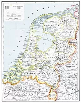
Background imageSerbia Collection: Netherlands map

Netherlands map
illustration of a Netherlands map

Background imageSerbia Collection: Congo map, central Africa from 1895

Congo map, central Africa from 1895
Illustration of a Congo map, central Africa from 1895

Background imageSerbia Collection: City map of Thessaloniki, Greece

City map of Thessaloniki, Greece
Illustration of a city map of Thessaloniki, Greece

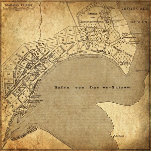
Background imageSerbia Collection: Dar es Salaam, Tanzania

Dar es Salaam, Tanzania
Antique illustration of a Dar es Salaam, Tanzania

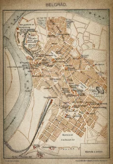
Background imageSerbia Collection: Belgrade map 1893

Belgrade map 1893
Antique illustration of a Belgrade map 1893

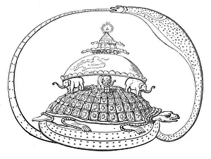
Background imageSerbia Collection: Hindu concept of the universe

Hindu concept of the universe, showing it encircled by a serpent, the symbol of eternity. Mount Meru represents paradise, earth

Background imageSerbia Collection: Bucharest map

Bucharest map
Illustration of a Bucharest map

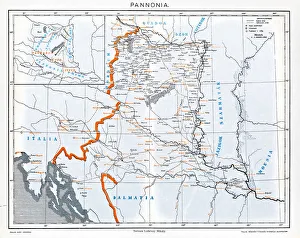
Background imageSerbia Collection: Pannonia

Pannonia is an ancient country of southern Europe that was south and west of the Danube River, in present-day Austria, Hungary, Slovenia, and Croatia

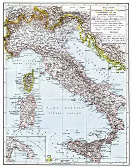
Background imageSerbia Collection: Map of Italy from 1896

Map of Italy from 1896
illustratoion of a Map of Italy from 1896

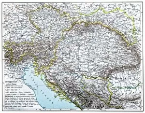
Background imageSerbia Collection: Austro-Hungarian Monarchy map from 1896

Austro-Hungarian Monarchy map from 1896
illustration of a Austro-Hungarian Monarchy map from 1896

Background imageSerbia Collection: Map of Palestine

Map of Palestine
Illustration of a map of Palestine

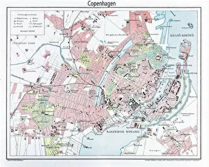
Background imageSerbia Collection: Engraving: Map of Copenhagen from 1895

Engraving: Map of Copenhagen from 1895
illustration of a Engraving: Map of Copenhagen from 1895

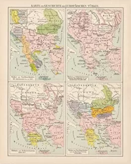
Background imageSerbia Collection: Ottoman Empire, 14th-19th century, lithograph, published in 1878

Ottoman Empire, 14th-19th century, lithograph, published in 1878
Ancient map of the history of European Turkey, 15th - 19th century. Lithograph, published in 1878

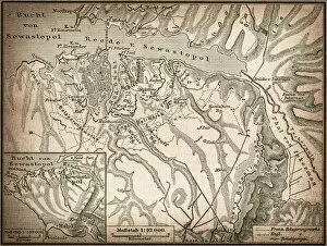
Background imageSerbia Collection: Sevastopol or Sebastopol

Sevastopol or Sebastopol
Antique illustration map of a Sevastopol or Sebastopol

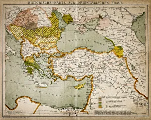
Background imageSerbia Collection: Historical map of the Oriental part of world

Historical map of the Oriental part of world
Antique illustration of a Historical map of the Oriental part of world

Background imageSerbia Collection: Abyssinia, Eritrea and South Arabia

Abyssinia, Eritrea and South Arabia
Antique illustration of a Abyssinia, Eritrea and South Arabia

Background imageSerbia Collection: Ethnic map of Africa

Ethnic map of Africa
Antique illustration of a ethnic map of Africa

Background imageSerbia Collection: Alexandria in the first century before and after Christ

Alexandria in the first century before and after Christ
Antique illustration of a Alexandria in the first century before and after Christ

Background imageSerbia Collection: Belovar-koros, Croatio map from 1893

Belovar-koros, Croatio map from 1893
Antique illustration of a Belovar-koros, Croatio map from 1893

Background imageSerbia Collection: SAN STEFANO TREATY MAP. The first publication of the map showing the territorial

SAN STEFANO TREATY MAP. The first publication of the map showing the territorial changes effected by the treaty between Russia and Turkey signed at San Stefano, 3 March 1878

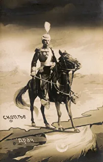
Background imageSerbia Collection: King Peter I of Serbia - capture of Durres from the Ottomans

King Peter I of Serbia - capture of Durres from the Ottomans
King Peter I of Serbia (1844-1921, reigned from 1903 - 1921) in all his regal finery on horseback astride the border of Serbia and Albania

Background imageSerbia Collection: MAP: DANUBE. French map, 18th century, with instructions for navigating the Danube River upstream

MAP: DANUBE. French map, 18th century, with instructions for navigating the Danube River upstream from Orsova, Romania

Background imageSerbia Collection: 1738, Ratelband Map of the Balkans, Bosnia, Serbia, Bulgaria, Rumania, topography

1738, Ratelband Map of the Balkans, Bosnia, Serbia, Bulgaria, Rumania, topography
1738, Ratelband Map of the Balkans, Bosnia, Serbia, Bulgaria, Rumania

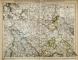
Background imageSerbia Collection: Westphalia, Hesse-nassau and Grand Duchy of Hesse Rhine Province

Westphalia, Hesse-nassau and Grand Duchy of Hesse Rhine Province
Illustration of a Westphalia, Hesse-nassau and Grand Duchy of Hesse Rhine Province

Background imageSerbia Collection: Map of Jerusalem

Map of Jerusalem
Illustration of a Map of Jerusalem

Background imageSerbia Collection: Pest old map

Pest old map
Illustration of a Pest old map

Background imageSerbia Collection: Budapest city map

Budapest city map
Illustration of a Budapest city map

Background imageSerbia Collection: Brasov man

Brasov man
Illustration of a Brasov map

Background imageSerbia Collection: Bosporus map

Bosporus map
Illustration of a Bosporus map

Background imageSerbia Collection: Buda and Pest old map

Buda and Pest old map
Budapest, a famously, is the combination of the cities Buda and Pest


All Professionally Made to Order for Quick Shipping


-

Serbia Collection

Serbia is a landlocked country located in southeastern Europe, bordered by Hungary to the north, Romania and Bulgaria to the east, North Macedonia to the south, Kosovo and Montenegro to the southwest. The capital city is Belgrade. The country has a population of approximately 7 million people and covers an area of 88,361 square kilometers. Serbia's economy relies heavily on agriculture and manufacturing industries such as automotive production. The official language spoken is Serbian while its currency is Serbian dinar (RSD). Tourist attractions include historic landmarks like Kalemegdan Fortress and Stari Grad district in Belgrade as well as natural wonders like Djavolja Varos rock formations.
+

Our beautiful pictures are available as Framed Prints, Photos, Wall Art and Photo Gifts

The Serbia collection from Media Storehouse is a stunning assortment of wall art and framed prints that showcase the beauty and history of Serbia. Our collection features an array of maps, charts, and illustrations that depict the country's geography, landmarks, culture, and traditions. Each piece in our collection is carefully crafted to capture the essence of Serbia's rich heritage. From vintage maps depicting ancient cities to modern-day aerial views showcasing its bustling metropolises, our collection offers something for everyone. Whether you're looking for a unique addition to your home decor or a thoughtful gift for someone special, these prints are sure to impress. With high-quality printing techniques used on premium paper stock, each print in our collection is designed to last for years without fading or losing its vibrancy. So why not bring a touch of Serbian charm into your home with one of these beautiful pieces?
+

What are Serbia (Maps and Charts) art prints?

Serbia art prints are high-quality reproductions of vintage maps and charts depicting the geography, topography, and historical landmarks of Serbia. These art prints showcase the intricate details of old cartographic techniques that were used to create these maps centuries ago. They feature a range of styles from hand-drawn illustrations to colorful lithographs, providing a unique insight into the country's past. These art prints are perfect for history buffs, collectors, or anyone who appreciates beautiful artwork. They can be displayed in homes or offices as decorative pieces or used as educational tools for students studying geography or history. We offer a wide selection of Serbia art prints in various sizes and formats such as canvas prints, framed prints, and poster prints. Each print is carefully produced using archival-grade materials to ensure long-lasting quality. With their rich colors and intricate details, these art prints make excellent gifts for anyone interested in Serbian culture or history.
+

What Serbia (Maps and Charts) art prints can I buy from Media Storehouse?

We offer a wide range of Serbia Maps and Charts art prints that are perfect for those who love to explore the world through visual representations. These art prints showcase various maps and charts of Serbia, including historical maps, topographical maps, political maps, and more. You can choose from different sizes and formats such as canvas prints or framed prints to suit your preferences. The high-quality printing technology used by Media Storehouse ensures that every detail is captured in these beautiful art pieces. Whether you're looking for a unique addition to your home decor or an educational tool for your classroom, there's something for everyone in this collection. With so many options available at Media Storehouse, you'll surely find the perfect Serbia Maps and Charts art print that suits your style and taste.
+

How do I buy Serbia (Maps and Charts) art prints?

To buy Serbia art prints from Media Storehouse, you can browse our extensive collection of high-quality images online. Once you have found the print that you want to purchase, simply add it to your cart and proceed to checkout. During the checkout process, you will be prompted to enter your shipping information and payment details. We offer a variety of printing options for their art prints, including canvas prints, framed prints, and poster prints. You can choose the size and format that best suits your needs. Our website is easy to navigate with a search bar at the top where you can type in 'Serbia Maps' or 'Serbia Charts' which will bring up all relevant results. We also offer customer support if needed through email or phone. Buying Serbia art prints from Media Storehouse is a straightforward process that allows you to easily find and purchase beautiful artwork for your home or office.
+

How much do Serbia (Maps and Charts) art prints cost?

We offer a wide range of Serbia art prints at varying prices. Our collection includes high-quality prints featuring detailed maps and charts that showcase the beauty and history of Serbia. The cost of our art prints depends on various factors such as size, framing options, and quality. We strive to provide affordable yet premium quality art prints to our customers. Our team sources the best materials for printing to ensure that each piece is vibrant, sharp, and long-lasting. We also offer different sizes to cater to different preferences and budgets. Whether you're looking for a small print or a large one with intricate details, we have something for everyone. Our Serbia art prints are perfect for adding character to your home or office space while showcasing your love for this beautiful country's culture and heritage.
+

How will my Serbia (Maps and Charts) art prints be delivered to me?

We take great care in ensuring that your Serbia art prints are delivered to you safely and securely. We use high-quality packaging materials to protect your print during transit, including sturdy cardboard tubes for rolled prints and flat-pack boxes for mounted prints. Once your order has been processed, our team will carefully package your print and arrange for it to be shipped directly to you. Depending on the size of your print and your location, we may use a range of shipping methods such as standard postal services or courier delivery. When you receive your Serbia art print from us, it will be ready for framing or display straight away. We pride ourselves on delivering high-quality products that meet the needs of our customers, so if you have any questions about delivery or anything else related to our service please don't hesitate to get in touch with us.