Fraud Blocker Skip to main content

Home > Maps and Charts > Related Images

Related Images Collection (page 2)

49,990 items

Background imageRelated Images Collection: Map of France - Vector

Map of France - Vector illustration

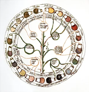
Background imageRelated Images Collection: Medieval urine wheel

Medieval urine wheel. Labelled in Latin, this 15th century diagram shows some of the possible colours of urine (outer edge of circle) to help doctors diagnose urine-related diseases

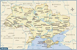
Background imageRelated Images Collection: Ukraine country map

Ukraine country map
2011 edition

Background imageRelated Images Collection: Japan country map

Japan country map
2011 edition

Background imageRelated Images Collection: California Highway Map

California Highway Map
Reference Maps, Top Sellers Art Prints, 103312667

Background imageRelated Images Collection: Mappa Mundi, ink and colors on parchment, created in London about 1265

Mappa Mundi, ink and colors on parchment, created in London about 1265
Cartography, 13th century. Mappa Mundi, Medieval map, London about 1265. Ink and colors on parchment. The maps diameter is 9 cm

Background imageRelated Images Collection: Apostle Pauls Missionary Journeys, lithograph, published in 1886

Apostle Pauls Missionary Journeys, lithograph, published in 1886
Apostle Pauls Missionary Journeys: 1st (green); 2nd (red); 3rd (blue); last to Rome (yellow). Lithograph, published in 1886. Paul travelled over 10, 000 miles proclaiming the gospel of Jesus Christ

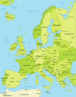
Background imageRelated Images Collection: Detailed map of Europe

Detailed map of Europe
url=http:/istockphoto/search/lightbox/12455888]

Background imageRelated Images Collection: New Zealand country map

New Zealand country map
2011 edition

Background imageRelated Images Collection: Map of the Clans and Tartans of Scotland

Map of the Clans and Tartans of Scotland
This map of Scotland indicates the general sphere of influence held by the clans and considerable families at the beginning of the 17th century

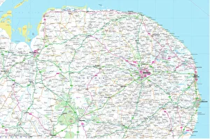
Background imageRelated Images Collection: Norfolk County Road Map

Norfolk County Road Map
A detailed map of the glorious county of Norfolk in England. Derived from high quality Collins Bartholomew map data showing larger villages

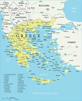
Background imageRelated Images Collection: Map of Greece - Vector

Map of Greece - Vector illustration

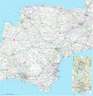
Background imageRelated Images Collection: Devon County Road Map

Devon County Road Map
A detailed map of the glorious county of Devon in England. Derived from high quality Collins Bartholomew map data showing larger villages

Background imageRelated Images Collection: Map of the Battle of Waterloo, 18th June 1815 (19th century)

Map of the Battle of Waterloo, 18th June 1815 (19th century). Battle plan showing the positions of the British and French armies at the outset of the battle

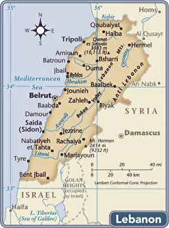
Background imageRelated Images Collection: Lebanon country map

Lebanon country map
2011 edition

Background imageRelated Images Collection: Map of Ireland 1897

Map of Ireland 1897
Map of Ireland

Background imageRelated Images Collection: Mappa Mundi, c. 1290 (vellum)

Mappa Mundi, c. 1290 (vellum)
BAL62567 Mappa Mundi, c.1290 (vellum) by Richard of Haldingham (Richard de Bello) (fl.c.1260-1305); Hereford Cathedral, Herefordshire, UK; English, out of copyright

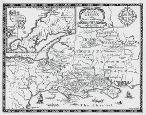
Background imageRelated Images Collection: Map of the Wessex of the Novels and Poems of Thomas Hardy (engraving)

Map of the Wessex of the Novels and Poems of Thomas Hardy (engraving)
6026362 Map of the Wessex of the Novels and Poems of Thomas Hardy (engraving) by Walker, Emery (1851-1933); Private Collection; (add.info.: Map of the Wessex of the Novels and Poems of Thomas Hardy)

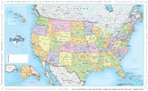
Background imageRelated Images Collection: USA Traveler Map

USA Traveler Map
A vibrant and detailed map of USA including state boundaries, state capitals, major cities and towns overlaid on a subtle relief background

Background imageRelated Images Collection: Northumberland County Road Map

Northumberland County Road Map
A detailed map of the glorious county of Northumberland in England. Derived from high quality Collins Bartholomew map data showing larger villages

Background imageRelated Images Collection: Cornwall map 1884

Cornwall map 1884
Encyclopedia Britannica 9th Edition New York Charles Scribners and Sons 1884 Vol VI

Background imageRelated Images Collection: Map or Chart of the Caledonian Canal, or Inland Navigation from the Western to the Eastern Sea by

Map or Chart of the Caledonian Canal, or Inland Navigation from the Western to the Eastern Sea by Fort William
Plan showing the Caledonian Canal from Fort William to Inverness including nearby lochs, rivers and settlements. Ordered by the House of Commons and printed by W. & A. K. Johnston Limited, Edinburgh

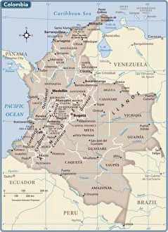
Background imageRelated Images Collection: Colombia country map

Colombia country map
2011 edition

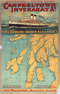
Background imageRelated Images Collection: Campbeltown Inveraray & c. SECR poster, 1914

Campbeltown Inveraray & c. SECR poster, 1914
Poster produced for South-Eastern & Chatham Railway (SECR) to promote tours of the west coast of Scotland on the turbine steamers, King Edward and Queen Alexandra

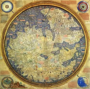
Background imageRelated Images Collection: Fra Mauro map (1460). The Fra Mauro Map orientation (South at the top). is considered

Fra Mauro map (1460). The Fra Mauro Map orientation (South at the top). is considered
Fra Mauro map (1460). The Fra Mauro Map orientation (South at the top).is considered the greatest memorial of medieval cartography. by the Venetian monk Fra Mauro

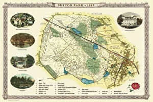
Background imageRelated Images Collection: Old Map of Sutton Park near Sutton Coldfield 1885

Old Map of Sutton Park near Sutton Coldfield 1885
PL017

Background imageRelated Images Collection: Pictorial Story Map of Scotland

Pictorial Story Map of Scotland
This map has been remastered from an original published by Colortext, it was one of a series they labelled aeStory MapAE. It combines pictorial images

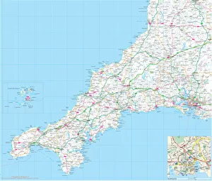
Background imageRelated Images Collection: Cornwall County Road Map

Cornwall County Road Map
A detailed map of the glorious county of Cornwall in England. Derived from high quality Collins Bartholomew map data showing larger villages

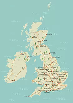
Background imageRelated Images Collection: Simple UK map

Simple UK map
A simple UK map with roads and major towns and cities named. There is a very slight grunge texture on sea and land, this is on separate layers and are easy to remove. 11 layers in all

Background imageRelated Images Collection: China country map

China country map
2011 edition

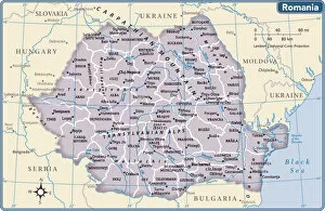
Background imageRelated Images Collection: Romania country map

Romania country map
2011 edition

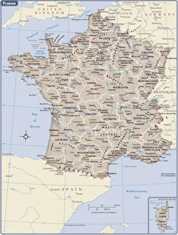
Background imageRelated Images Collection: France country map

France country map
2011 edition

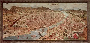
Background imageRelated Images Collection: Map of Florence known as Della Catena Map of Florence, Attributed to Francesco di Lorenzo

Map of Florence known as Della Catena Map of Florence, Attributed to Francesco di Lorenzo Rosselli, 1470, illustration
Cartography, Italy, 15th century. Map of Florence known as The Della Catena Map of Florence. Attributed to Francesco di Lorenzo Rosselli, 1470

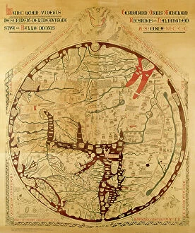
Background imageRelated Images Collection: Hereford mappa mundi (world map)

Hereford mappa mundi (world map)
3849688 Hereford mappa mundi (world map) by Richard of Haldingham (Richard de Bello) (fl.c.1260-1305); 158x133 cm; (add.info.: Hereford mappa mundi (world map)

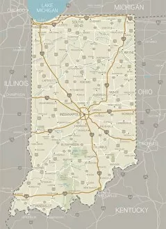
Background imageRelated Images Collection: Indiana Map

Indiana Map
A detailed map of Indiana state with cities, roads, major rivers, and lakes plus National Forests. Includes neighboring states and surrounding water

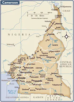
Background imageRelated Images Collection: Cameroon country map

Cameroon country map
2011 edition

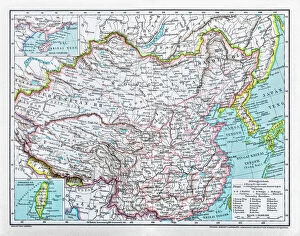
Background imageRelated Images Collection: China map

China map
illustration of a South Eastern Asia map

Background imageRelated Images Collection: Old Caucasus map

Old Caucasus map
Antique map of Caucasus

Background imageRelated Images Collection: A Map of the Lake District, LMS poster, 1923-1947

A Map of the Lake District, LMS poster, 1923-1947
Poster produced for London, Midland & Scottish Railway (LMS) to promote rail travel to the Lake District. Artwork by Arthur Watts (1883-1935), who studied at the Slade Art School and in Antwerp

Background imageRelated Images Collection: Old Map of Wolverhampton 1750 by Isaac Taylor

Old Map of Wolverhampton 1750 by Isaac Taylor
J066

Background imageRelated Images Collection: USA Political Map

USA Political Map
This very clean and clear USA political map shows each State in a different colour as well as principal cities and towns divided into six separate population bands

Background imageRelated Images Collection: Washington DC City Map

Washington DC City Map
A street level map of central Washington D.C. based on USGS topo map data. Covers from Manor Park in the north to Washington Highlands in the south

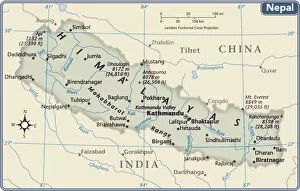
Background imageRelated Images Collection: Nepal country map

Nepal country map
2011 edition

Background imageRelated Images Collection: Lake Tahoe Area Map

Lake Tahoe Area Map
2010 edition. South Lake Tahoe and North Lake Tahoe are comprised of small cities and towns located in California and Nevada

Background imageRelated Images Collection: Antique map of Ireland

Antique map of Ireland, 1864

Background imageRelated Images Collection: Londonderry, BR poster, 1953

Londonderry, BR poster, 1953
Poster produced by British Railways (BR) to promote rail and sea services to Londonderry. Artwork by Kerry Lee

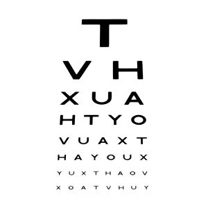
Background imageRelated Images Collection: Eyesight test chart

Eyesight test chart

Background imageRelated Images Collection: Continental drift after 250 million years

Continental drift after 250 million years, showing the supercontinent of Pangea Ultima, which was named for the ancient supercontinent of Pangea


All Professionally Made to Order for Quick Shipping


-

Why Choose Us?

We are a leading provider of Art Prints and Photo Gifts since 2004, working in partnership with a range of Sporting Clubs, Charities, Museums and Picture Libraries. A large share of profits from any of their images will go directly towards supporting that charity or club. Our archive of images is carefully curated to bring you a wide range of subjects, including landscapes, wildlife, architecture, and more. We ship from our partner labs in the UK, USA, EU (Netherlands) and Australia.
+

How do I place an order?

Ordering is quick & easy - Just follow 5 Simple Steps:
  1. Find your image: Use our search box or browse our online photo Collections to find the image you want.

  2. Choose your print format: Select your desired product and add it to your cart.

  3. Enter your details: If you're a returning customer, simply enter your email address and password, and we'll fill in your billing and shipping address details. All personal details are held securely and are fully GDPR compliant. As standard, we remove all Personally Identifiable Information after 12 months.

  4. Pay for your purchase: We use state-of-the-art security for online shopping and do not have access to your card details.

  5. Sit back and relax: We'll email you confirmation of your order and when it's dispatched. Registered customers can also track orders in the 'My Account' area.

+

How do I pay for an order?

You can pay for your order with most of the major credit and debit cards, or PayPal. For added security, major financial institutions process payment details separately and securely on our behalf. We do not have access to your online payment card details. Online payments are preferred however we do take phone orders. For UK customers only we accept cheques issued against a UK bank.
+

Is my data safe?

We take data security very seriously. We do not have access to your full card details and all payments are requested over a fully secure connection. Additionally, we fully comply with current European and GDPR legislation, and automatically remove all personal data after at most 12 months (unless you have an account with us and have signed in recently). We also have a strict opt-in policy and would never sell your personal details. Your data is only used to fulfill your order promptly and efficiently.
+

Is wall art ready to hang?

For quick and easy installation all wall art, including framed prints, canvas prints and metal prints are supplied with a ready to hang solution on the back. Generally, saw tooth hangers are applied as they allow wall art to hang flush against the wall. The serrated edge of the hanger prevents the frame from shifting or tilting when hung.
+

Are the photo prints fade resistant?

Yes, we use archival quality photo paper photographic paper for vivid reproduction Prints are an accurate representations of the original artwork, which is preserved for artistic character and authenticity. We guarantee they match previews shown on our web site