Fraud Blocker Skip to main content

Glass Coaster > Maps and Charts > India

India Glass Coaster Collection (#9)

Discover the beauty of India with our India Maps and Charts Glass Coasters collection from Media Storehouse. These elegant coasters showcase intricate and detailed maps and charts of India, bringing a touch of culture and history to your table. Each coaster is made of high-quality glass, providing a clear and vibrant display of the designs. Ideal for adding a unique and conversational piece to your home decor, these coasters make a perfect gift for travel enthusiasts, history buffs, or anyone who appreciates the rich heritage of India.

India is a country located in South Asia, bordered by Pakistan to the west, China and Nepal to the north, Bhutan to the northeast

691 Glass Coasters

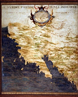
Background imageIndia Glass Coaster Collection: Map of the Indostan (Hindustan) at the top of the Ganges, c. 1567. (mural painting)

Map of the Indostan (Hindustan) at the top of the Ganges, c. 1567. (mural painting)
LRI4595583 Map of the Indostan (Hindustan) at the top of the Ganges, c.1567. (mural painting) by Danti, Egnazio (1536-86); Palazzo Vecchio, Florence

Background imageIndia Glass Coaster Collection: India-rubber (colour litho)

India-rubber (colour litho)
3648664 India-rubber (colour litho) by English School, (20th century); Private Collection; (add.info.: India-rubber. Illustration for Atlas of the Worlds Commerce compiled from the latest official)

Background imageIndia Glass Coaster Collection: Map to Illustrate Polos Chapters on India, Map to Illustrate Polos Chapters on the Malay Countries

Map to Illustrate Polos Chapters on India, Map to Illustrate Polos Chapters on the Malay Countries (colour litho)
3628582 Map to Illustrate Polos Chapters on India, Map to Illustrate Polos Chapters on the Malay Countries (colour litho) by English School

Background imageIndia Glass Coaster Collection: India, population and products (colour litho)

India, population and products (colour litho)
6025445 India, population and products (colour litho) by English School, (20th century); Private Collection; (add.info.: India, population and products)

Background imageIndia Glass Coaster Collection: Catalan Atlas, Sheet 11, 1375 (pen with coloured inks on parchment)

Catalan Atlas, Sheet 11, 1375 (pen with coloured inks on parchment)
5054644 Catalan Atlas, Sheet 11, 1375 (pen with coloured inks on parchment) by Cresques, Abraham (1325-87); Bibliotheque Nationale, Paris, France; (add.info.: World map made in Majorca)

Background imageIndia Glass Coaster Collection: Portuguese in Goa, illustration from Jan Huyghen van Linschoten

Portuguese in Goa, illustration from Jan Huyghen van Linschoten
LIT389179 Portuguese in Goa, illustration from Jan Huyghen van Linschoten, His Discourse of Voyages into the East and West Indies, 1579-92 (colour engraving) by Doetechum, Johannes Baptista van

Background imageIndia Glass Coaster Collection: Map of the Indian Peninsula, 1733 (hand-coloured engraving)

Map of the Indian Peninsula, 1733 (hand-coloured engraving)
619431 Map of the Indian Peninsula, 1733 (hand-coloured engraving) by Homann Heirs Company (1724-1848); Private Collection; (add.info)

Background imageIndia Glass Coaster Collection: Plan of the City of Lucknow, from Cassells Illustrated History of England

Plan of the City of Lucknow, from Cassells Illustrated History of England
STC394736 Plan of the City of Lucknow, from Cassells Illustrated History of England (engraving) by English School, (19th century) (after); Private Collection; (add.info)

Background imageIndia Glass Coaster Collection: Plan of the Battle of Futtehpore, 12th July 1857, from Cassell

Plan of the Battle of Futtehpore, 12th July 1857, from Cassell
STC394732 Plan of the Battle of Futtehpore, 12th July 1857, from Cassells Illustrated History of England (engraving) by English School

Background imageIndia Glass Coaster Collection: 1860s Japan - portrait of a group of southern officers Felice or Felix Beato

1860s Japan - portrait of a group of southern officers Felice or Felix Beato (1832 - 29 January 1909), Italian-British photographer working mostly in India, Japan, China

Background imageIndia Glass Coaster Collection: Plan of the Attack on Delhi (engraving)

Plan of the Attack on Delhi (engraving)
1609238 Plan of the Attack on Delhi (engraving) by English School, (19th century); Private Collection; (add.info.: Plan of the Attack on Delhi)

Background imageIndia Glass Coaster Collection: Map of Asia, early 19th century

Map of Asia, early 19th century. Showing Asia Minor, Arabia, Persia, Siberia, Tartary, Thibet, Hindoostan, Further India, China, Formosa, Japan. Handcoloured copperplate engraving from Rev

Background imageIndia Glass Coaster Collection: Scenes from the history of the United States

Scenes from the history of the United States
William Penn making a treaty in 1682 with the Lenape Native Americans 82, Benjamin Franklin drawing electricity from the sky in a thunderstorm 83

Background imageIndia Glass Coaster Collection: Chart of the Coasts, Sindh and Cutch, Surveyed by Lieutenant A. M

Chart of the Coasts, Sindh and Cutch, Surveyed by Lieutenant A. M
XCF291080 Chart of the Coasts, Sindh and Cutch, Surveyed by Lieutenant A. M. Grieve, 1848-50, 1868 (colour litho) by English School, (19th century); Private Collection; English, out of copyright

Background imageIndia Glass Coaster Collection: East Indies: Sea and coastal chart extending from Southern India to Japan by the way of

East Indies: Sea and coastal chart extending from Southern India to Japan by the way of
BON111060 East Indies: Sea and coastal chart extending from Southern India to Japan by the way of the East Indian archipelago (coloured engraving) by Wit

Background imageIndia Glass Coaster Collection: Map of India and Southeastern Asia; Il Disegno Della Terza Parte Dell Asia

Map of India and Southeastern Asia; Il Disegno Della Terza Parte Dell Asia
1195417 Map of India and Southeastern Asia; Il Disegno Della Terza Parte Dell Asia, 1561 (engraving) by Gastaldi, Giacomo (c.1500-66) (after); 48x73, 2 cm; Private Collection; (add.info.: Gastaldi)

Background imageIndia Glass Coaster Collection: Map of Africa, Arabia and India (double-page), 1695-1702 (hand-coloured engraving)

Map of Africa, Arabia and India (double-page), 1695-1702 (hand-coloured engraving)
986321 Map of Africa, Arabia and India (double-page), 1695-1702 (hand-coloured engraving) by Jaillot, Alexis-Hubert (1632-1712); 63x102

Background imageIndia Glass Coaster Collection: Asia (colour litho)

Asia (colour litho)
5996935 Asia (colour litho) by English School, (20th century); Private Collection; (add.info.: Asia. Illustration from The Modern World Encyclopedia)

Background imageIndia Glass Coaster Collection: Map of the City and Portuguese Port of Goa, India, detail of port and merchant shipping

Map of the City and Portuguese Port of Goa, India, detail of port and merchant shipping
STC110751 Map of the City and Portuguese Port of Goa, India, detail of port and merchant shipping, 1595 (engraving) (detail of 110750) by Doetechum, Johannes Baptista van

Background imageIndia Glass Coaster Collection: Map of the Coast of Malabar, East Indies, 1672 (engraving)

Map of the Coast of Malabar, East Indies, 1672 (engraving)
STC434932 Map of the Coast of Malabar, East Indies, 1672 (engraving) by Dutch School, (17th century); Private Collection; (add.info)

Background imageIndia Glass Coaster Collection: Plan of the Battle of Bithoor, 16th August 1857, from Cassell

Plan of the Battle of Bithoor, 16th August 1857, from Cassell
STC394735 Plan of the Battle of Bithoor, 16th August 1857, from Cassells Illustrated History of England (engraving) by English School

Background imageIndia Glass Coaster Collection: Sketch of the Battle of Aliwal, 28th January 1846, from Cassell

Sketch of the Battle of Aliwal, 28th January 1846, from Cassell
STC394724 Sketch of the Battle of Aliwal, 28th January 1846, from Cassells Illustrated History of England (engraving) by English School

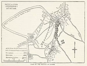
Background imageIndia Glass Coaster Collection: Plan of the Battle of Dubba (Hyderabad) 24th March 1843

Plan of the Battle of Dubba (Hyderabad) 24th March 1843
STC394719 Plan of the Battle of Dubba (Hyderabad) 24th March 1843, illustration from Cassells Illustrated History of England (engraving) by English School

Background imageIndia Glass Coaster Collection: Plan of the Battle of Meanee, illustration from Cassell

Plan of the Battle of Meanee, illustration from Cassell
STC394717 Plan of the Battle of Meanee, illustration from Cassells Illustrated History of England (engraving) by English School

Background imageIndia Glass Coaster Collection: Plan of the attack on Sholapore, illustration from Cassell

Plan of the attack on Sholapore, illustration from Cassell
876379 Plan of the attack on Sholapore, illustration from Cassells Illustrated History of India by James Grant, pub. 1879 (litho) by English School

Background imageIndia Glass Coaster Collection: Map of Sixteenth Century India, from the Sala del Mappamondo

Map of Sixteenth Century India, from the Sala del Mappamondo
BEN95817 Map of Sixteenth Century India, from the Sala del Mappamondo (Hall of the World Maps) c.1574-5 (fresco) by Vecchi, Giovanni de (1536-1615) (and workshop); Villa Farnese, Caprarola, Voterbo

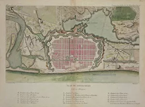
Background imageIndia Glass Coaster Collection: Plan of Pondicherry, from Voyage aux Indes et la Chine, engraved by Poisson

Plan of Pondicherry, from Voyage aux Indes et la Chine, engraved by Poisson
STC189216 Plan of Pondicherry, from Voyage aux Indes et la Chine, engraved by Poisson, published 1782 (colour engraving) by Sonnerat

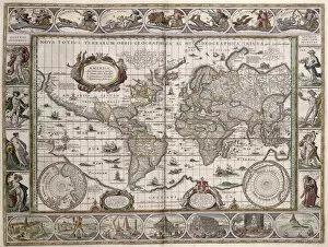
Background imageIndia Glass Coaster Collection: World Map, from Le Theatre du Monde or Nouvel Atlas

World Map, from Le Theatre du Monde or Nouvel Atlas
CHT172438 World Map, from Le Theatre du Monde or Nouvel Atlas, 1645 (coloured engraving) by Blaeu, Willem (1571-1638); Bibliotheque des Arts Decoratifs, Paris

Background imageIndia Glass Coaster Collection: The Island of Saint Helena, illustration from Linschotens Itinerario

The Island of Saint Helena, illustration from Linschotens Itinerario
741395 The Island of Saint Helena, illustration from Linschotens Itinerario, 1596 (engraving) by van Linschoten, J.H. (1563-1611); Bibliotheque Nationale, Paris

Background imageIndia Glass Coaster Collection: Wheat, growing countries (colour litho)

Wheat, growing countries (colour litho)
3648598 Wheat, growing countries (colour litho) by English School, (20th century); Private Collection; (add.info.: Wheat, growing countries)

Background imageIndia Glass Coaster Collection: Density of population, 1906, Western hemisphere, Eastern hemisphere, United States, India

Density of population, 1906, Western hemisphere, Eastern hemisphere, United States, India, Europe (colour litho)
3648577 Density of population, 1906, Western hemisphere, Eastern hemisphere, United States, India, Europe (colour litho) by English School

Background imageIndia Glass Coaster Collection: Plan of the Siege Operations and Defences of the City of Delhi

Plan of the Siege Operations and Defences of the City of Delhi, as they existed 15 August 1857 (engraving)
2785861 Plan of the Siege Operations and Defences of the City of Delhi, as they existed 15 August 1857 (engraving) by English School

Background imageIndia Glass Coaster Collection: Track-chart of 15th and 16th Century exploration and discovery (litho)

Track-chart of 15th and 16th Century exploration and discovery (litho)
3622418 Track-chart of 15th and 16th Century exploration and discovery (litho) by American School, (19th century); Private Collection; (add.info)

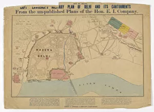
Background imageIndia Glass Coaster Collection: Capt Lawrences Military Plan of Delhi and its Cantonments from the un-published

Capt Lawrences Military Plan of Delhi and its Cantonments from the un-published
3062946 Capt Lawrences Military Plan of Delhi and its Cantonments from the un-published plans of the Hon E I Company, c.1860 (coloured engraving) by English School

Background imageIndia Glass Coaster Collection: Map exhibiting the present partition of the country dependent on Fort St

Map exhibiting the present partition of the country dependent on Fort St
3062959 Map exhibiting the present partition of the country dependent on Fort St. George into military divisions with several stations of troops, 1843 (pen, ink & w/c on paper) by English School

Background imageIndia Glass Coaster Collection: Sketch Map of India Illustrating the History from the Earliest Period to the Battle of Plassy

Sketch Map of India Illustrating the History from the Earliest Period to the Battle of Plassy (engraving)
973075 Sketch Map of India Illustrating the History from the Earliest Period to the Battle of Plassy (engraving) by English School

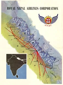
Background imageIndia Glass Coaster Collection: Poster, Royal Nepal Airlines Corporation

Poster, Royal Nepal Airlines Corporation, with a map showing routes. 1958

Background imageIndia Glass Coaster Collection: The Ashanti Expedition on the Gold Coast (b / w photo)

The Ashanti Expedition on the Gold Coast (b / w photo)
1100466 The Ashanti Expedition on the Gold Coast (b/w photo) by English photographer, (19th century) (after); Private Collection; (add.info.: The Ashanti Expedition on the Gold Coast)

Background imageIndia Glass Coaster Collection: Seat of the War in India (engraving)

Seat of the War in India (engraving)
1101799 Seat of the War in India (engraving) by English School, (19th century); Private Collection; (add.info.: Seat of the War in India)

Background imageIndia Glass Coaster Collection: Map of the Strait of Malacca (engraving)

Map of the Strait of Malacca (engraving)
1105530 Map of the Strait of Malacca (engraving) by Dower, John (fl.c.1845-55); Private Collection; (add.info.: Map of the Strait of Malacca)

Background imageIndia Glass Coaster Collection: The Russian Annexation of Merv, Map showing the Advances of Russia towards India in the Years

The Russian Annexation of Merv, Map showing the Advances of Russia towards India in the Years 1734, 1836, 1863, 1867
1061495 The Russian Annexation of Merv, Map showing the Advances of Russia towards India in the Years 1734, 1836, 1863, 1867, 1874, 1876, 1881, 1884 (engraving) by English School

Background imageIndia Glass Coaster Collection: Map of the border of the West Indies and Unknown Lands, c. 1567. (mural painting)

Map of the border of the West Indies and Unknown Lands, c. 1567. (mural painting)
LRI4595686 Map of the border of the West Indies and Unknown Lands, c.1567. (mural painting) by Danti, Egnazio (1536-86); Palazzo Vecchio, Florence

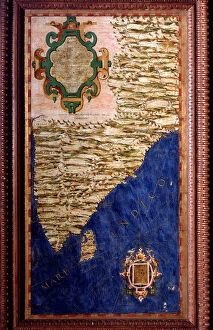
Background imageIndia Glass Coaster Collection: Map of India, c. 1567. (mural painting)

Map of India, c. 1567. (mural painting)
LRI4595565 Map of India, c.1567. (mural painting) by Danti, Egnazio (1536-86); Palazzo Vecchio, Florence, Italy; (add.info.: India Map made by Egnazio Danti (1536-1586) mathematician

Background imageIndia Glass Coaster Collection: Position and Armament of the British Batteries before Delhi (engraving)

Position and Armament of the British Batteries before Delhi (engraving)
1609144 Position and Armament of the British Batteries before Delhi (engraving) by English School, (19th century); Private Collection; (add.info)

Background imageIndia Glass Coaster Collection: Map of India, shewing the Railways finished, in Progress and Intended

Map of India, shewing the Railways finished, in Progress and Intended, the Cotton and Coal Districts (engraving)
1610284 Map of India, shewing the Railways finished, in Progress and Intended, the Cotton and Coal Districts (engraving) by Dower, John (fl.c.1845-55); Private Collection; (add.info.: Map of India)

Background imageIndia Glass Coaster Collection: Map of Afghanistan and the Adjacent Territories of Russian Turkestan, Persia, and India (engraving)

Map of Afghanistan and the Adjacent Territories of Russian Turkestan, Persia, and India (engraving)
1591060 Map of Afghanistan and the Adjacent Territories of Russian Turkestan, Persia, and India (engraving) by English School

Background imageIndia Glass Coaster Collection: Pilgrimage map of Vraj (Vraj Yatra) and the Yamuna river, Rajasthan, North India, c

Pilgrimage map of Vraj (Vraj Yatra) and the Yamuna river, Rajasthan, North India, c
3927654 Pilgrimage map of Vraj (Vraj Yatra) and the Yamuna river, Rajasthan, North India, c.1850 (pigment on cotton) by Indian School

Background imageIndia Glass Coaster Collection: A Pichhavai of the Vraj Parikrama Jatra, India, Rajasthan (pigment on fabric)

A Pichhavai of the Vraj Parikrama Jatra, India, Rajasthan (pigment on fabric)
3928353 A Pichhavai of the Vraj Parikrama Jatra, India, Rajasthan (pigment on fabric) by Indian School, (19th century); 168x120 cm; Private Collection; (add.info)


All Professionally Made to Order for Quick Shipping


-

India Glass Coaster Collection

India is a country located in South Asia, bordered by Pakistan to the west, China and Nepal to the north, Bhutan to the northeast, Bangladesh and Myanmar to the east and has a population of over 1.3 billion people with Hindi being its official language. India's economy is one of the fastest-growing economies in the world with agriculture as its main source of income for many rural areas. The country has a diverse culture that includes various religions such as Hinduism, Islam, Christianity and Sikhism among others. It also boasts several famous landmarks including Taj Mahal and Red Fort which attract millions of tourists every year.
+

Our beautiful Wall Art and Photo Gifts include Framed Prints, Photo Prints, Poster Prints, Canvas Prints, Jigsaw Puzzles, Metal Prints and so much more

The India collection from Media Storehouse offers a diverse range of wall art and framed prints that showcase the rich cultural heritage of India. Our collection features an extensive selection of vintage maps, charts, and illustrations that depict various regions, cities, landmarks, and historical events in India. From ancient temples to bustling marketplaces, our collection captures the vibrant colors and intricate details of Indian culture. Whether you're looking for a stunning piece to adorn your home or office space or searching for a unique gift for someone special, our collection has something to offer. Each print is carefully crafted using high-quality materials to ensure longevity and durability. With its wide range of styles and sizes available at affordable prices, the India collection from Media Storehouse is an excellent choice for anyone who wants to add some Indian flair to their decor.
+

What are India (Maps and Charts) art prints?

India art prints are a collection of high-quality, visually stunning prints that showcase the diverse geography and rich history of India. These prints feature detailed maps, charts, and illustrations that depict various regions, cities, landmarks, and historical events in India. These art prints are perfect for anyone who is interested in Indian culture or history. They can be used to decorate homes or offices with an exotic touch or as educational tools for schools or libraries. The vibrant colors and intricate details make them ideal conversation starters. We offer a wide range of India art prints that cater to different tastes and preferences. From vintage-style maps to modern-day illustrations, there is something for everyone. All our art prints are printed on high-quality paper using state-of-the-art printing technology to ensure maximum clarity and durability. India art prints are beautiful works of art that capture the essence of India's geography and history in a visually appealing way.
+

What India (Maps and Charts) art prints can I buy from Media Storehouse?

We offer a wide range of India maps and charts art prints that are perfect for decorating your home or office. You can choose from vintage maps, antique charts, and modern designs that showcase the beauty and diversity of India's geography. Some popular options include detailed topographical maps of regions like the Himalayas, Rajasthan, and Kerala. These prints feature intricate contour lines that highlight the country's mountain ranges, rivers, lakes, and forests. You can also find colorful political maps that show India's states and territories along with major cities and landmarks. These prints are great for educational purposes or as a unique gift for someone who loves geography. In addition to traditional map designs, Media Storehouse also offers artistic interpretations of India's landscapes such as abstract paintings inspired by the Taj Mahal or vibrant illustrations depicting wildlife in national parks. There is something for everyone when it comes to India maps and charts art prints at Media Storehouse.
+

How do I buy India (Maps and Charts) art prints?

To buy India art prints from Media Storehouse, you can browse our extensive collection of artwork online. Once you have found the print that you like, simply add it to your cart and proceed to checkout. You will be prompted to enter your shipping information and payment details. We offer a variety of sizes for each print, so make sure to select the size that best suits your needs. We also offer framing options if you prefer a ready-to-hang piece of art. Their India art prints are high-quality reproductions of vintage maps and charts, perfect for adding a touch of history and culture to any room in your home or office. Buying India art prints from Media Storehouse is easy and convenient. With their vast selection of artwork available at your fingertips, you're sure to find the perfect piece for your space.
+

How much do India (Maps and Charts) art prints cost?

India art prints are a popular choice for those who want to add an exotic touch to their home or office décor. The cost of these prints can vary depending on the size, quality, and type of paper used. Generally speaking, larger prints will be more expensive than smaller ones, while high-quality papers such as archival or museum-grade may also increase the price. It's important to note that India art prints come in a variety of styles and designs, so prices can differ based on the specific artwork being purchased. Some prints may feature intricate details or vibrant colors that make them stand out from others. Ultimately, the cost of India art prints is determined by several factors including size, quality, design complexity among other things. However it is possible to find affordable options without compromising on quality if you shop around carefully.
+

How will my India (Maps and Charts) art prints be delivered to me?

Your India art prints will be delivered to you in a safe and secure manner by our trusted delivery partners. We take great care in packaging your artwork to ensure that it arrives at your doorstep in pristine condition. Your print will be carefully rolled up and placed inside a sturdy cardboard tube, which is then sealed with tape to prevent any damage during transit. Once your order has been dispatched, we will provide you with a tracking number so that you can monitor the progress of your delivery online. You can expect your artwork to arrive within the estimated timeframe provided at checkout. We pride ourselves on providing excellent customer service, so if for any reason you are not satisfied with the condition of your print upon arrival, please do not hesitate to contact us and we will work with you to resolve the issue as quickly as possible.