
India Collection
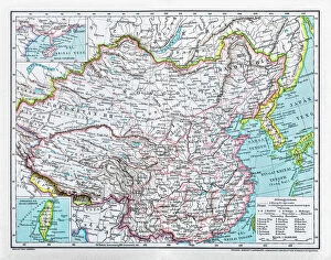
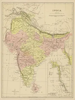
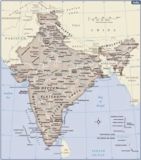
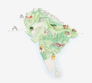
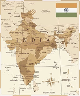
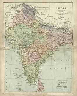
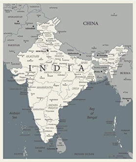
India is a country located in South Asia, bordered by Pakistan to the west, China and Nepal to the north, Bhutan to the northeast
Choose a picture from our India Collection for your Wall Art and Photo Gifts
872 items


All Professionally Made to Order for Quick Shipping
-
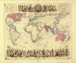
India Collection
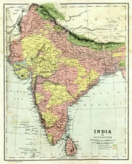
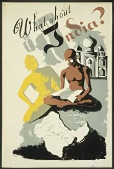
India is a country located in South Asia, bordered by Pakistan to the west, China and Nepal to the north, Bhutan to the northeast, Bangladesh and Myanmar to the east and has a population of over 1.3 billion people with Hindi being its official language. India's economy is one of the fastest-growing economies in the world with agriculture as its main source of income for many rural areas. The country has a diverse culture that includes various religions such as Hinduism, Islam, Christianity and Sikhism among others. It also boasts several famous landmarks including Taj Mahal and Red Fort which attract millions of tourists every year.
+
Our beautiful pictures are available as Framed Prints, Photos, Wall Art and Photo Gifts
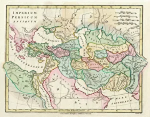
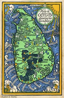
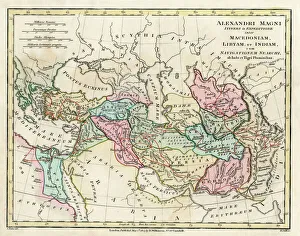
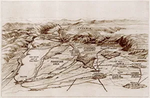
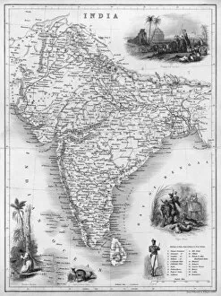
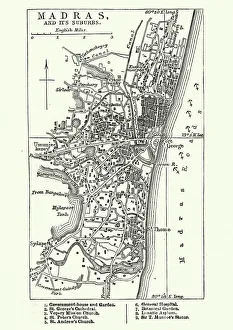
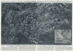
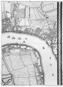
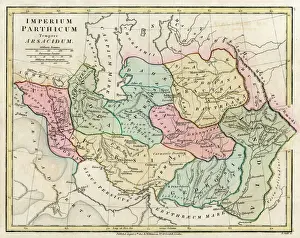
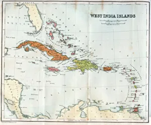
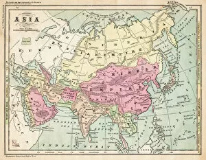
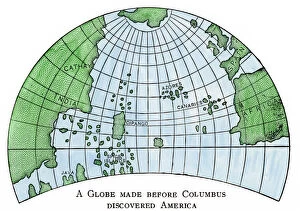
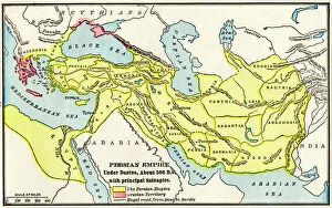
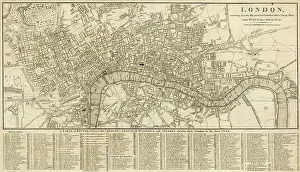
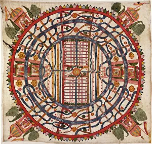
The India collection from Media Storehouse offers a diverse range of wall art and framed prints that showcase the rich cultural heritage of India. Our collection features an extensive selection of vintage maps, charts, and illustrations that depict various regions, cities, landmarks, and historical events in India. From ancient temples to bustling marketplaces, our collection captures the vibrant colors and intricate details of Indian culture. Whether you're looking for a stunning piece to adorn your home or office space or searching for a unique gift for someone special, our collection has something to offer. Each print is carefully crafted using high-quality materials to ensure longevity and durability. With its wide range of styles and sizes available at affordable prices, the India collection from Media Storehouse is an excellent choice for anyone who wants to add some Indian flair to their decor.
+
What are India (Maps and Charts) art prints?
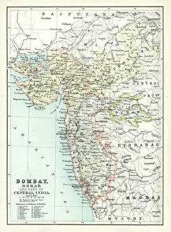
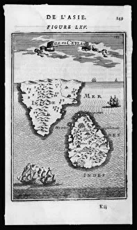
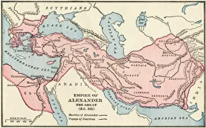
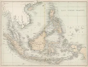
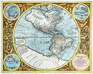
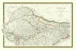
India art prints are a collection of high-quality, visually stunning prints that showcase the diverse geography and rich history of India. These prints feature detailed maps, charts, and illustrations that depict various regions, cities, landmarks, and historical events in India. These art prints are perfect for anyone who is interested in Indian culture or history. They can be used to decorate homes or offices with an exotic touch or as educational tools for schools or libraries. The vibrant colors and intricate details make them ideal conversation starters. We offer a wide range of India art prints that cater to different tastes and preferences. From vintage-style maps to modern-day illustrations, there is something for everyone. All our art prints are printed on high-quality paper using state-of-the-art printing technology to ensure maximum clarity and durability. India art prints are beautiful works of art that capture the essence of India's geography and history in a visually appealing way.
+
What India (Maps and Charts) art prints can I buy from Media Storehouse?
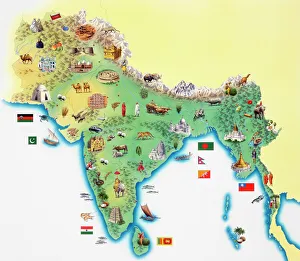
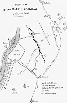
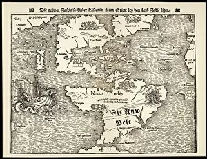
We offer a wide range of India maps and charts art prints that are perfect for decorating your home or office. You can choose from vintage maps, antique charts, and modern designs that showcase the beauty and diversity of India's geography. Some popular options include detailed topographical maps of regions like the Himalayas, Rajasthan, and Kerala. These prints feature intricate contour lines that highlight the country's mountain ranges, rivers, lakes, and forests. You can also find colorful political maps that show India's states and territories along with major cities and landmarks. These prints are great for educational purposes or as a unique gift for someone who loves geography. In addition to traditional map designs, Media Storehouse also offers artistic interpretations of India's landscapes such as abstract paintings inspired by the Taj Mahal or vibrant illustrations depicting wildlife in national parks. There is something for everyone when it comes to India maps and charts art prints at Media Storehouse.
+
How do I buy India (Maps and Charts) art prints?
To buy India art prints from Media Storehouse, you can browse our extensive collection of artwork online. Once you have found the print that you like, simply add it to your cart and proceed to checkout. You will be prompted to enter your shipping information and payment details. We offer a variety of sizes for each print, so make sure to select the size that best suits your needs. We also offer framing options if you prefer a ready-to-hang piece of art. Their India art prints are high-quality reproductions of vintage maps and charts, perfect for adding a touch of history and culture to any room in your home or office. Buying India art prints from Media Storehouse is easy and convenient. With their vast selection of artwork available at your fingertips, you're sure to find the perfect piece for your space.
+
How much do India (Maps and Charts) art prints cost?
India art prints are a popular choice for those who want to add an exotic touch to their home or office décor. The cost of these prints can vary depending on the size, quality, and type of paper used. Generally speaking, larger prints will be more expensive than smaller ones, while high-quality papers such as archival or museum-grade may also increase the price. It's important to note that India art prints come in a variety of styles and designs, so prices can differ based on the specific artwork being purchased. Some prints may feature intricate details or vibrant colors that make them stand out from others. Ultimately, the cost of India art prints is determined by several factors including size, quality, design complexity among other things. However it is possible to find affordable options without compromising on quality if you shop around carefully.
+
How will my India (Maps and Charts) art prints be delivered to me?
Your India art prints will be delivered to you in a safe and secure manner by our trusted delivery partners. We take great care in packaging your artwork to ensure that it arrives at your doorstep in pristine condition. Your print will be carefully rolled up and placed inside a sturdy cardboard tube, which is then sealed with tape to prevent any damage during transit. Once your order has been dispatched, we will provide you with a tracking number so that you can monitor the progress of your delivery online. You can expect your artwork to arrive within the estimated timeframe provided at checkout. We pride ourselves on providing excellent customer service, so if for any reason you are not satisfied with the condition of your print upon arrival, please do not hesitate to contact us and we will work with you to resolve the issue as quickly as possible.