Fraud Blocker Skip to main content

Glass Coaster > Maps and Charts > Hungary

Hungary Glass Coaster Collection (#4)

Introducing our Hungary collection of Glass Coasters from Media Storehouse. These elegant coasters showcase intricate maps and charts of Hungary, adding a touch of sophistication to any table setting. Crafted from high-quality glass, they not only protect your surfaces from water rings and heat marks but also make for stunning decor pieces. Each coaster features a unique design, making this set a must-have for anyone with an appreciation for geography and fine home accessories. Perfect for personal use or as a thoughtful gift, these coasters are sure to impress.

Hungary is a landlocked country located in Central Europe, bordered by Austria, Slovakia, Ukraine, Romania, Serbia, Croatia and Slovenia

201 Glass Coasters

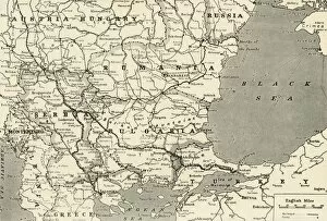
Background imageHungary Glass Coaster Collection: Balkan States

Balkan States
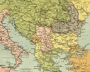
Map of Rumania, Bulgaria, Serbia, Montenegro

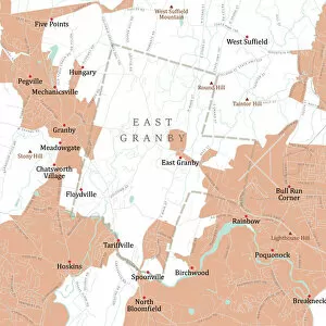
Background imageHungary Glass Coaster Collection: CT Hartford East Granby Vector Road Map

CT Hartford East Granby Vector Road Map. All source data is in the public domain. U.S. Census Bureau Census Tiger. Used Layers: areawater, linearwater, roads, rails, cousub, pointlm, uac10

Background imageHungary Glass Coaster Collection: CT Hartford Granby Vector Road Map

CT Hartford Granby Vector Road Map. All source data is in the public domain. U.S. Census Bureau Census Tiger. Used Layers: areawater, linearwater, roads, rails, cousub, pointlm, uac10

Background imageHungary Glass Coaster Collection: Charnwood LE12 5 Map

Charnwood LE12 5 Map
Postcode Sector Map of Charnwood LE12 5

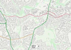
Background imageHungary Glass Coaster Collection: Dudley DY9 7 Map

Dudley DY9 7 Map
Postcode Sector Map of Dudley DY9 7

Background imageHungary Glass Coaster Collection: German & Austrian Frontiers with Russia, First World War, (c1920). Creator: Unknown

German & Austrian Frontiers with Russia, First World War, (c1920). Creator: Unknown
German & Austrian Frontiers with Russia, First World War, (c1920). Map of eastern Europe and the Baltic coast. From "The Great World War: A History", Volume VII, edited by Frank A Mumby

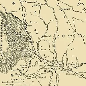
Background imageHungary Glass Coaster Collection: The Russo-Roumanian Retreat to the Sereth Line, First World War, c1916, (c1920)

The Russo-Roumanian Retreat to the Sereth Line, First World War, c1916, (c1920). Map of Russian and Romanian positions in eastern Europe

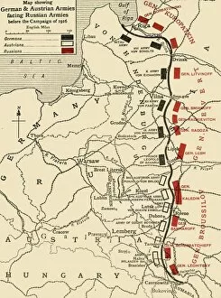
Background imageHungary Glass Coaster Collection: Map showing German & Austrian Armies facing Russian Armies before the Campaign of 1916, (c1920)

Map showing German & Austrian Armies facing Russian Armies before the Campaign of 1916, (c1920). Creator: Unknown
Map showing German & Austrian Armies facing Russian Armies before the Campaign of 1916, (c1920). Positions of the adversarial armies in eastern Europe during the First World War

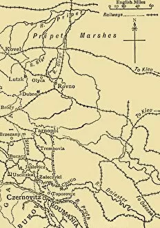
Background imageHungary Glass Coaster Collection: Map illustrating General Ivanoffs operations... First World War, 1915, (c1920)

Map illustrating General Ivanoffs operations... First World War, 1915, (c1920)
Map illustrating General Ivanoffs operations south of the Pripet Marshes and in Galicia, Eastern Europe, First World War, 1915, (c1920)

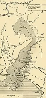
Background imageHungary Glass Coaster Collection: Map showing the Area over which the Italians advanced into Austrian Territory... 1915, (c1920)

Map showing the Area over which the Italians advanced into Austrian Territory... 1915, (c1920)
Map showing the Area over which the Italians advanced into Austrian Territory on the Isonzo Front in 1915, (c1920). The city of Trieste, which had been part the Austro-Hungarian Empire

Background imageHungary Glass Coaster Collection: The Eastern Area of the Great War, 1915. Creator: Unknown

The Eastern Area of the Great War, 1915. Creator: Unknown
The Eastern Area of the Great War, 1915. The Eastern Front was a frontier between the Russian Empire and Romania on one side and the Austro-Hungarian Empire, Bulgaria

Background imageHungary Glass Coaster Collection: Map Showing the Relation of Serbia to Neighbouring States, 1916. Creator: Unknown

Map Showing the Relation of Serbia to Neighbouring States, 1916. Creator: Unknown
Map Showing the Relation of Serbia to Neighbouring States, 1916. The Serbian campaign was fought from late July 1914, when Austria-Hungary invaded Serbia at the outset of World War I

Background imageHungary Glass Coaster Collection: Map of Poland Showing Position of Conflicting Nations on July 24th, 1915, 1916. Creator: Unknown

Map of Poland Showing Position of Conflicting Nations on July 24th, 1915, 1916. Creator: Unknown
Map of Poland Showing Position of Conflicting Nations on July 24th, 1915, 1916. Because of its geographical position between fighting powers

Background imageHungary Glass Coaster Collection: The Principal Railways of Europe and Asia Minor, 1916. Creator: Unknown

The Principal Railways of Europe and Asia Minor, 1916. Creator: Unknown
The Principal Railways of Europe and Asia Minor, 1916. From " The War Illustrated Album De Luxe - Volume VI. The Spring and Summer Campaign of 1916", edited by J. A. Hammerton

Background imageHungary Glass Coaster Collection: Map of the Trentino Front, 1916. Creator: Unknown

Map of the Trentino Front, 1916. Creator: Unknown
Map of the Trentino Front, 1916. On the Italian Front a series of battles at the border between Austria-Hungary and Italy were fought between 1915 and 1918

Background imageHungary Glass Coaster Collection: Map Indicating the Area of the Rumanian Campaign, 1917. Creator: Unknown

Map Indicating the Area of the Rumanian Campaign, 1917. Creator: Unknown
Map Indicating the Area of the Rumanian Campaign, 1917. From " The War Illustrated Album De Luxe - Volume VII. The Autumn Campaign of 1916", edited by J. A. Hammerton

Background imageHungary Glass Coaster Collection: Relief Map of Gorizia and the Carso Plateau, 1917. Creator: Unknown

Relief Map of Gorizia and the Carso Plateau, 1917. Creator: Unknown
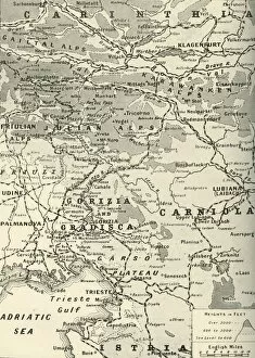
Relief Map of Gorizia and the Carso Plateau, 1917. General Cadornas forces took the fighting north of Gorizia on the volcanic Carso plateau which had been fortified by the Austrians

Background imageHungary Glass Coaster Collection: General Map of the Balkan Operations in the Autumn of 1916, 1917. Creator: Unknown

General Map of the Balkan Operations in the Autumn of 1916, 1917. Creator: Unknown
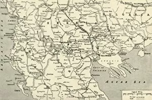
General Map of the Balkan Operations in the Autumn of 1916, 1917. The Balkans campaign was fought between the Central Powers and the Allies

Background imageHungary Glass Coaster Collection: Area of General Cadornas Triumph on the Lower Isonzo, 1917. Creator: Unknown

Area of General Cadornas Triumph on the Lower Isonzo, 1917. Creator: Unknown
Area of General Cadornas Triumph on the Lower Isonzo, 1917. The Battles of the Isonzo were fought between Austro-Hungarian

Background imageHungary Glass Coaster Collection: The Polish Campaign, 1914, (c1920). Creator: Unknown

The Polish Campaign, 1914, (c1920). Creator: Unknown
The Polish Campaign, 1914, (c1920)....map illustrating the struggle for Warsaw, October-December (1914), showing German and Austro-Hungarian lines of advance during the First World War

Background imageHungary Glass Coaster Collection: Land taken by Germany from Russia, First World War, 1915, (c1920). Creator: Unknown

Land taken by Germany from Russia, First World War, 1915, (c1920). Creator: Unknown
Land taken by Germany from Russia, First World War, 1915, (c1920). The Germanic Slice out of Russian Territory to the end of the Summer Campaign of 1915...territory gained by the Germans

Background imageHungary Glass Coaster Collection: Poland, 1815-1914, (c1920). Creator: John Bartholomew & Son

Poland, 1815-1914, (c1920). Creator: John Bartholomew & Son
Poland, 1815-1914, (c1920). Map showing Polish territory from the end of the 18th century until the First World War: Poland as constituted in 1815, and Poland before partition of 1772

Background imageHungary Glass Coaster Collection: East-European Theatre of War, 1914-1918, (c1920). Creator: John Bartholomew & Son

East-European Theatre of War, 1914-1918, (c1920). Creator: John Bartholomew & Son
East-European Theatre of War, 1914-1918, (c1920). Map of Eastern Europe during the First World War, showing parts of Germany, Russia and Austria-Hungary

Background imageHungary Glass Coaster Collection: Eger, c1740. Creator: A GlaBer

Eger, c1740. Creator: A GlaBer
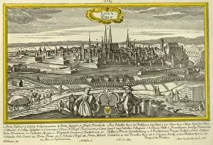
Eger, c1740. The city of Eger in Hungary (Egra in Latin), with the river, churches, castles, and principal landmarks indicated. From " Europaische Stadteansichten" by Martin Engelbrecht

Background imageHungary Glass Coaster Collection: Central Europe and the Mediterranean, 1919. Creator: London Geographical Institute

Central Europe and the Mediterranean, 1919. Creator: London Geographical Institute
Central Europe and the Mediterranean, 1919. Showing naval dockyards, fortified coastal towns, and forts. From " The History of the Great European War: its causes and effects", Vol

Background imageHungary Glass Coaster Collection: Map of Central Europe, Showing the Principal Theatre of War, 1919

Map of Central Europe, Showing the Principal Theatre of War, 1919. Europe during the First World War, 1914-1919. From " The History of the Great European War: its causes and effects", Vol

Background imageHungary Glass Coaster Collection: Map To Illustrate the Eastern Battle Fronts, 1919. Creator: George Philip & Son Ltd

Map To Illustrate the Eastern Battle Fronts, 1919. Creator: George Philip & Son Ltd
Map To Illustrate the Eastern Battle Fronts, 1919. Map showing areas of eastern Europe and the Balkans which saw fighting during the First World War, 1914-1919, including Italy, Austria-Hungary

Background imageHungary Glass Coaster Collection: Map of the Italian Fighting Front, 1919. Creator: George Philip & Son Ltd

Map of the Italian Fighting Front, 1919. Creator: George Philip & Son Ltd
Map of the Italian Fighting Front, 1919. Map showing north-eastern Italy, the Trentino and part of southern Austria during the First World War, 1914-1919

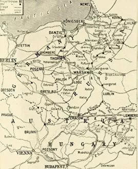
Background imageHungary Glass Coaster Collection: The Eastern Frontier, 1919. Creator: London Geographical Institute

The Eastern Frontier, 1919. Creator: London Geographical Institute
The Eastern Frontier, 1919. Map showing parts of Germany, Prussia, Russia and Austria during the First World War, 1914-1919, with fortified towns and main railway lines indicated

Background imageHungary Glass Coaster Collection: The Carpathian Passes, 1919. Creator: Unknown

The Carpathian Passes, 1919. Creator: Unknown
The Carpathian Passes, 1919. Map showing mountain passes in the Carpathians, a mountain range which stretches from present-day Czech Republic, through Slovakia, Poland, Hungary, Ukraine

Background imageHungary Glass Coaster Collection: Map of the Kingdom of Hungary, 1742 (hand coloured engraving)

Map of the Kingdom of Hungary, 1742 (hand coloured engraving)
XCF306032 Map of the Kingdom of Hungary, 1742 (hand coloured engraving) by Mortier, Pierre (Pieter) (1661-1711) (after); 48x57 cm; Private Collection; French, out of copyright

Background imageHungary Glass Coaster Collection: Map of the kingdom of Hungary, printed by Godfried (coloured engraving)

Map of the kingdom of Hungary, printed by Godfried (coloured engraving)
CZA229119 Map of the kingdom of Hungary, printed by Godfried (coloured engraving) by Lipszki, Jan (fl.1590-1610) (after); 69x46 cm; Czartoryski Museum, Cracow, Poland; Hungarian, out of copyright

Background imageHungary Glass Coaster Collection: Map of Austria-Hungary, 1902. Creator: Unknown

Map of Austria-Hungary, 1902. Creator: Unknown
Map of Austria-Hungary, 1902. The Austro-Hungarian Empire including Bosnia, Transylvania, Bohemia, Dalmatia, Silesia, with inset of Vienna. From The Century Atlas of the World

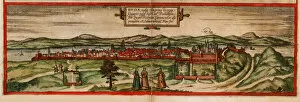
Background imageHungary Glass Coaster Collection: Buda, vulgo Ofen (From: Civitates orbis terrarium), 1572. Artist: Braun, Georg (1541-1622)

Buda, vulgo Ofen (From: Civitates orbis terrarium), 1572. Artist: Braun, Georg (1541-1622)
Buda, vulgo Ofen (From: Civitates orbis terrarium), 1572. Private Collection

Background imageHungary Glass Coaster Collection: Feldmarschall Conrad von Hotzen, 1934

Feldmarschall Conrad von Hotzen, 1934. Feldmarschall Franz Xaver Joseph Conrad Graf von Hotzendorf (1852-1925), Austrian Field Marshal

Background imageHungary Glass Coaster Collection: Map of Austria-Hungary, c1910s. Artist: Emery Walker Ltd

Map of Austria-Hungary, c1910s. Artist: Emery Walker Ltd
Map of Austria-Hungary, c1910s

Background imageHungary Glass Coaster Collection: Galicia and the Carpathian Passes, 1915

Galicia and the Carpathian Passes, 1915. The Battle of Galicia, also known as the Battle of Lemberg, was a major battle between Russia

Background imageHungary Glass Coaster Collection: Map of Europe at the Napoleonic Wars of Liberty (1813)

Map of Europe at the Napoleonic Wars of Liberty (1813)
Map of Central Europe at the beginning of the Napoleonic Wars of Liberty in 1813. Lithograph, published in 1897

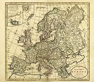
Background imageHungary Glass Coaster Collection: Antique Map of Europe, 1785

Antique Map of Europe, 1785
An accurate map of Europe from the best authorities. London: C. Dilly & G. Robinson: 1785. Original size: 35.7 x 37.4 cm. Coloured, Inset: Spitsbergen, East and West Greenland, and Iceland

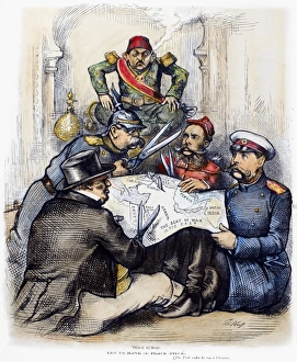
Background imageHungary Glass Coaster Collection: RUSSO-TURKISH WAR, 1877. Peace Rumors. American cartoon by Thomas Nast, 1877

RUSSO-TURKISH WAR, 1877. Peace Rumors. American cartoon by Thomas Nast, 1877, showing Britain, Germany, Austria-Hungary and Russia carving up the Ottoman Empire as a powerless Turkey looks on

Background imageHungary Glass Coaster Collection: In Rome, c67, Scene 6 from Imre Madachs poem The Tragedy of Man (engraving)

In Rome, c67, Scene 6 from Imre Madachs poem The Tragedy of Man (engraving)
7173229 In Rome, c67, Scene 6 from Imre Madachs poem The Tragedy of Man (engraving) by Zichy, Mihaly von (1827-1906); Private Collection; (add.info.: In Rome, c67)

Background imageHungary Glass Coaster Collection: Outside Paradise, Scene 15 from Imre Madachs poem The Tragedy of Man (engraving)

Outside Paradise, Scene 15 from Imre Madachs poem The Tragedy of Man (engraving)
7173215 Outside Paradise, Scene 15 from Imre Madachs poem The Tragedy of Man (engraving) by Zichy, Mihaly von (1827-1906); Private Collection; (add.info)

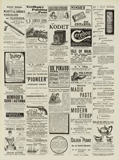
Background imageHungary Glass Coaster Collection: Page of Advertisements (engraving)

Page of Advertisements (engraving)
1056492 Page of Advertisements (engraving) by English School, (19th century); Private Collection; (add.info.: Page of Advertisements)

Background imageHungary Glass Coaster Collection: Renaissance map of Europe, Jacopo Russo (after), 1528

Renaissance map of Europe, Jacopo Russo (after), 1528
2910988 Renaissance map of Europe, Jacopo Russo (after), 1528 by Russo, Jacopo (15th century); (add.info.: Renaissance map of Europe, Jacopo Russo, 1528, showing John ZAapolya)

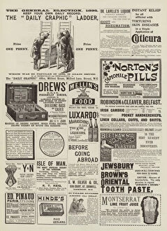
Background imageHungary Glass Coaster Collection: Page of Advertisements (engraving)

Page of Advertisements (engraving)
1056409 Page of Advertisements (engraving) by English School, (19th century); Private Collection; (add.info.: Page of Advertisements)

Background imageHungary Glass Coaster Collection: The Galician Campaign, First World War, c1915, (c1920). Creator: Unknown

The Galician Campaign, First World War, c1915, (c1920). Creator: Unknown
The Galician Campaign, First World War, c1915, (c1920). Part of Russian Poland, Galicia, the Carpathian Mountains and the Austrian border

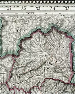
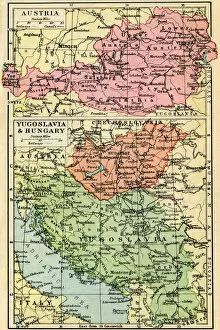
Background imageHungary Glass Coaster Collection: A 1930s Map Of Austria, Top And Yugosalvia And Hungary, Bottom

A 1930s Map Of Austria, Top And Yugosalvia And Hungary, Bottom

Background imageHungary Glass Coaster Collection: Map of Germany, after the Peace of Westphalia in 1648

Map of Germany, after the Peace of Westphalia in 1648. Lithograph, published in 1897


All Professionally Made to Order for Quick Shipping


-

Hungary Glass Coaster Collection

Hungary is a landlocked country located in Central Europe, bordered by Austria, Slovakia, Ukraine, Romania, Serbia, Croatia and Slovenia. The country has a population of approximately 9.8 million people and its capital city is Budapest. Hungary's economy is heavily reliant on exports and foreign investment with industries such as automotive manufacturing being major contributors to the country's GDP. The Hungarian currency is the forint (HUF) and the official language spoken is Hungarian. A rich cultural heritage with influences from various civilizations including Roman Empire, Ottoman Empire and Habsburg Monarchy which can be seen in its architecture and cuisine.
+

Our beautiful Wall Art and Photo Gifts include Framed Prints, Photo Prints, Poster Prints, Canvas Prints, Jigsaw Puzzles, Metal Prints and so much more

The Hungary collection from Media Storehouse is a stunning collection of wall art and framed prints that showcase the beauty, history, and culture of Hungary. Our collection features an array of maps and charts that depict the country's geography, topography, landmarks, cities, towns, rivers, lakes, mountains, forests and more. Each print in our collection is carefully crafted to provide a unique perspective on Hungary's rich heritage. From vintage maps dating back to the 16th century to modern-day satellite images capturing every detail of the landscape - there is something for everyone in this impressive range. Whether you're looking for a beautiful piece of artwork to adorn your home or office walls or searching for a thoughtful gift for someone special who loves all things Hungarian - Media Storehouse has got you covered with their Hungary collection. With high-quality printing techniques used on premium paper stock materials - these prints are sure to impress anyone who sees them.
+

What are Hungary (Maps and Charts) art prints?

Hungary art prints are high-quality reproductions of vintage maps and charts depicting Hungary. These prints showcase the intricate details of historical cartography, highlighting the country's geography, topography, landmarks, and cities. We offer a unique perspective on Hungary's past and present landscapes, allowing viewers to explore its rich history through visual representation. These art prints are perfect for those who appreciate both history and aesthetics. They make great additions to any home or office decor as they add character and sophistication to any space. Additionally, these prints can serve as educational tools for students studying geography or history. We offer a wide selection of Hungary art prints in various sizes that cater to different preferences. Our collection includes antique maps from renowned cartographers such as Gerard Mercator, Johann Baptist Homann, John Speed, among others. Each print is carefully reproduced using state-of-the-art printing technology to ensure maximum quality and longevity.
+

What Hungary (Maps and Charts) art prints can I buy from Media Storehouse?

We offer a wide range of Hungary maps and charts art prints that are perfect for decorating your home or office space. You can choose from a variety of styles, including vintage maps, satellite images, and modern designs. Some popular options include the Budapest city map, Danube River chart, and Hungarian wine regions map. These art prints are available in different sizes to suit your needs and preferences. They are printed on high-quality paper using advanced printing techniques to ensure vibrant colors and sharp details. Whether you're looking for a unique gift idea or want to add some personality to your living space, we have something for everyone. In addition to Hungary maps and charts art prints, Media Storehouse also offers a vast collection of artwork from around the world. From iconic landmarks to stunning landscapes, there's no shortage of beautiful pieces to choose from. Browse our selection today and find the perfect piece for your home or office.
+

How do I buy Hungary (Maps and Charts) art prints?

To purchase Hungary art prints from Media Storehouse, you can browse our extensive collection of high-quality images online. Once you have found the print that you would like to purchase, simply select the size and format that suits your needs. You can choose from a range of options including canvas prints, framed prints or unframed prints. To complete your order, add the item to your cart and proceed to checkout. At this stage, you will be prompted to enter your shipping details and payment information. We accept a variety of payment methods including credit cards and PayPal. Once your order has been processed, it will be printed on demand using state-of-the-art printing technology before being shipped directly to your door. With a wide selection of Hungary art prints available at Media Storehouse, finding the perfect piece for your home or office is easy.
+

How much do Hungary (Maps and Charts) art prints cost?

We offer a wide range of Hungary maps and charts art prints that are available at varying prices. Our collection includes vintage and contemporary designs featuring different regions, cities, landmarks, and attractions in Hungary. The cost of each print depends on various factors such as the size, quality of paper or canvas used, printing technique employed, and the complexity of the artwork. We have affordable options for those who want to decorate their homes or offices with beautiful Hungarian art prints without breaking the bank. On the other hand, we also have premium-quality prints for collectors or enthusiasts who value high-resolution images and archival-grade materials. Regardless of your budget or preference, you can find a Hungary map or chart art print that suits your needs at Media Storehouse. We take pride in our extensive selection of artworks from around the world that cater to diverse tastes and interests.
+

How will my Hungary (Maps and Charts) art prints be delivered to me?

We take great care in delivering your Hungary art prints to you. We use high-quality packaging materials to ensure that your print arrives in perfect condition. Your print will be carefully rolled and placed into a sturdy tube for protection during transit. We work with trusted delivery partners who offer reliable and secure shipping services. Once your order has been dispatched, you will receive a tracking number so that you can keep an eye on the progress of your delivery. Our aim is to provide our customers with a hassle-free experience when it comes to receiving their artwork. If for any reason there are issues with the delivery or if the product arrives damaged, please do not hesitate to contact us and we will do everything we can to resolve the issue as quickly as possible. You can expect a professional service from Media Storehouse when it comes to delivering your Hungary art prints.