Fraud Blocker Skip to main content

Home > Maps and Charts > France

France Collection (page 8)

France is a country located in Western Europe and has a total area of 643,801 square kilometers and a population of approximately 67 million people

11,167 items

Background imageFrance Collection: First World War: France, Patriotic Map showing a girl representing the republic with her Frygian

First World War: France, Patriotic Map showing a girl representing the republic with her Frygian hat, swords and flag
LUX4740700 First World War: France, Patriotic Map showing a girl representing the republic with her Frygian hat, swords and flag, asking the army to delivate France, 1915

Background imageFrance Collection: First World War: France, Patriotic Map showing a French soldier thinking of post-war

First World War: France, Patriotic Map showing a French soldier thinking of post-war and returning to his family, 1916
LUX4739914 First World War: France, Patriotic Map showing a French soldier thinking of post-war and returning to his family

Background imageFrance Collection: First World War: France, Patriotic Map showing a Belgian soldier

First World War: France, Patriotic Map showing a Belgian soldier and a French soldier in uniform in a bucolic
LUX4740665 First World War: France, Patriotic Map showing a Belgian soldier and a French soldier in uniform in a bucolic and rustic underwood watchful for the sound of the advancing Germans

Background imageFrance Collection: First World War: France, Patriotic Map showing a soldier separated from his fiance by a sprig of

First World War: France, Patriotic Map showing a soldier separated from his fiance by a sprig of lily of the valley
LUX4740455 First World War: France, Patriotic Map showing a soldier separated from his fiance by a sprig of lily of the valley and titled: 'The flowers of the soldier' and declaring

Background imageFrance Collection: First World War: France, Patriotic Map showing a soldier kissing his fiance on the forehead

First World War: France, Patriotic Map showing a soldier kissing his fiance on the forehead
LUX4740341 First World War: France, Patriotic Map showing a soldier kissing his fiance on the forehead, titled: 'The best for a hairy kissing his wife on the fronts'

Background imageFrance Collection: First World War: France, Patriotic Map showing Joffre as an officer pointing at a young child

First World War: France, Patriotic Map showing Joffre as an officer pointing at a young child dresses up as a soldier
LUX4739684 First World War: France, Patriotic Map showing Joffre as an officer pointing at a young child dresses up as a soldier and telling him

Background imageFrance Collection: First World War: France, Patriotic Map showing a German officer taken prisoner by French officers

First World War: France, Patriotic Map showing a German officer taken prisoner by French officers including Joffre
LUX4739563 First World War: France, Patriotic Map showing a German officer taken prisoner by French officers including Joffre

Background imageFrance Collection: First World War: France, Patriotic Map showing a child with a flag

First World War: France, Patriotic Map showing a child with a flag and lead soldiers doing salvation and saying
LUX4739020 First World War: France, Patriotic Map showing a child with a flag and lead soldiers doing salvation and saying: 'Like Dad I do military salvation'

Background imageFrance Collection: First World War: France, Patriotic Map showing a little girl making national knitting for her

First World War: France, Patriotic Map showing a little girl making national knitting for her father, 1915
LUX4739009 First World War: France, Patriotic Map showing a little girl making national knitting for her father, 1915; (add.info.: World War I - War 14-18 (1914-1918) - World War I (WWI or WW1)

Background imageFrance Collection: First World War: France, Patriotic Map showing a Belgian soldier, an English soldier

First World War: France, Patriotic Map showing a Belgian soldier, an English soldier
LUX4739527 First World War: France, Patriotic Map showing a Belgian soldier, an English soldier and a French soldier shaking hands, entitled 'united against the barbarian'

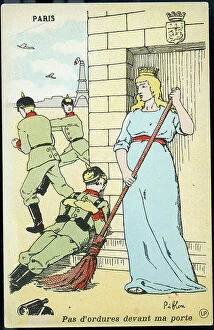
Background imageFrance Collection: First World War: France, Patriotic Map showing the city of Paris throwing the Germans out of these

First World War: France, Patriotic Map showing the city of Paris throwing the Germans out of these walls
LUX4739374 First World War: France, Patriotic Map showing the city of Paris throwing the Germans out of these walls, titled: 'No garbage before my door', 1914

Background imageFrance Collection: First World War: France, Patriotic Map showing France posing with a French flag next to a cannon 75

First World War: France, Patriotic Map showing France posing with a French flag next to a cannon 75
LUX4739365 First World War: France, Patriotic Map showing France posing with a French flag next to a cannon 75, entitled 'Our Glorious 75'

Background imageFrance Collection: First World War: France, Patriotic Map showing a gargoyle of cathedrale transforms into German

First World War: France, Patriotic Map showing a gargoyle of cathedrale transforms into German general entitled
LUX4738708 First World War: France, Patriotic Map showing a gargoyle of cathedrale transforms into German general entitled

Background imageFrance Collection: First World War: France, Patriotic Map showing the reunion of France and Alsace

First World War: France, Patriotic Map showing the reunion of France and Alsace
LUX4739315 First World War: France, Patriotic Map showing the reunion of France and Alsace, titled: 'Le Reve de Deroulede' with poem and profile of the writer

Background imageFrance Collection: First World War: France, Patriotic Map showing the life of the hairy on permission, 1916

First World War: France, Patriotic Map showing the life of the hairy on permission, 1916
LUX4739253 First World War: France, Patriotic Map showing the life of the hairy on permission, 1916; (add.info.: World War I - War 14-18 (1914-1918) - World War I (WWI or WW1): France

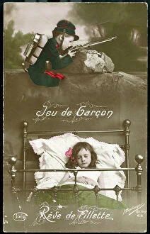
Background imageFrance Collection: First World War: France, Patriotic Map showing a little boy dresses as a soldier

First World War: France, Patriotic Map showing a little boy dresses as a soldier
LUX4738365 First World War: France, Patriotic Map showing a little boy dresses as a soldier and looking behind a rock the enemy with his rifle, above a little girl sleeping in his bed, 1916

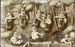
Background imageFrance Collection: First World War: France, Patriotic Map showing new nes with hairy helmets in shell casings at

First World War: France, Patriotic Map showing new nes with hairy helmets in shell casings at the bottom of a trench
LUX4738265 First World War: France, Patriotic Map showing new nes with hairy helmets in shell casings at the bottom of a trench playing war

Background imageFrance Collection: First World War: France, Patriotic Map showing a mother speaking of her father has her baby

First World War: France, Patriotic Map showing a mother speaking of her father has her baby sleeping in a bed decor by
LUX4738077 First World War: France, Patriotic Map showing a mother speaking of her father has her baby sleeping in a bed decor by a flag

Background imageFrance Collection: First World War: France, Patriotic Map showing in the park of a field hospital a child disguises

First World War: France, Patriotic Map showing in the park of a field hospital a child disguises as a nurse comforting
LUX4738031 First World War: France, Patriotic Map showing in the park of a field hospital a child disguises as a nurse comforting a wounded with his cane

Background imageFrance Collection: First World War: France, Patriotic propaganda map showing with humor the restrictions imposed by

First World War: France, Patriotic propaganda map showing with humor the restrictions imposed by war: butter map, 1916
LUX4737080 First World War: France, Patriotic propaganda map showing with humor the restrictions imposed by war: butter map

Background imageFrance Collection: French map of the Transvaal at the outbreak of the Boer War in South Africa, 1899

French map of the Transvaal at the outbreak of the Boer War in South Africa, 1899
3479681 French map of the Transvaal at the outbreak of the Boer War in South Africa, 1899; Universal History Archive/UIG

Background imageFrance Collection: portrait of man: Portrait of Monsieur de C. with his Michelin card, 1917, Courcay

portrait of man: Portrait of Monsieur de C. with his Michelin card, 1917, Courcay, France - Autochrome anonymous
LUX4697136 portrait of man: Portrait of Monsieur de C. with his Michelin card, 1917, Courcay, France - Autochrome anonymous; Private Collection; (add.info.: portrait of man)

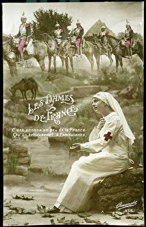
Background imageFrance Collection: First World War: France, postcard, photo studio in a bucolic decor

First World War: France, postcard, photo studio in a bucolic decor, a nurse thinks of the French soldiers fighting
LUX4735884 First World War: France, postcard, photo studio in a bucolic decor, a nurse thinks of the French soldiers fighting

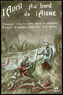
Background imageFrance Collection: First World War: France, Humorous map of April 1 showing French fishermen catching German soldiers

First World War: France, Humorous map of April 1 showing French fishermen catching German soldiers fish with white
LUX4735017 First World War: France, Humorous map of April 1 showing French fishermen catching German soldiers fish with white bread

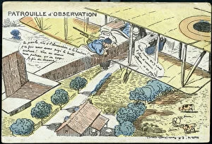
Background imageFrance Collection: First World War: France, Comedy map showing an observation patrol at work, 1917

First World War: France, Comedy map showing an observation patrol at work, 1917
LUX4734543 First World War: France, Comedy map showing an observation patrol at work, 1917; (add.info.: World War I - War 14-18 (1914-1918) - World War I (WWI or WW1): France

Background imageFrance Collection: First World War: France, Military Correspondence Map France-Russia, 1915

First World War: France, Military Correspondence Map France-Russia, 1915
LUX4734166 First World War: France, Military Correspondence Map France-Russia, 1915; (add.info.: First World War - War 14-18 (1914-1918) - World War I (WWI or WW1): France

Background imageFrance Collection: First World War: France, Humoristic patriotic map showing the coal map, 1917

First World War: France, Humoristic patriotic map showing the coal map, 1917
LUX4735637 First World War: France, Humoristic patriotic map showing the coal map, 1917, coal map: the flambant is reserved for lovers, the balls to the hens, the rooster of the chickens

Background imageFrance Collection: First World War 1914-1918 (14-18): Letter K as kilometre. Map of countries at war extending over

First World War 1914-1918 (14-18): Letter K as kilometre. Map of countries at war extending over 3000 km
DUV4201478 First World War 1914-1918 (14-18): Letter K as kilometre. Map of countries at war extending over 3000 km. Engraving in " Alphabet of the Great War 1914-1916

Background imageFrance Collection: Letter M: marriage; mayor; town hall; world map; trunk; mandolin; maries; macon; house; mill;

Letter M: marriage; mayor; town hall; world map; trunk; mandolin; maries; macon; house; mill; medallion; military;
DUV4199550 Letter M: marriage; mayor; town hall; world map; trunk; mandolin; maries; macon; house; mill; medallion; military; coat

Background imageFrance Collection: First World War 1914-1918 (14-18): Letter J as Joffre. Victory of the Battle of the Marne by

First World War 1914-1918 (14-18): Letter J as Joffre. Victory of the Battle of the Marne by the marechal of France
DUV4201483 First World War 1914-1918 (14-18): Letter J as Joffre. Victory of the Battle of the Marne by the marechal of France, Joseph Joffre (1852-1931)

Background imageFrance Collection: Portrait of Louis Joachim Tullius Visconti French architect (1791-1853)

Portrait of Louis Joachim Tullius Visconti French architect (1791-1853). Goblin tapestry panel adorning the Gallery of
ETI4397250 Portrait of Louis Joachim Tullius Visconti French architect (1791-1853). Goblin tapestry panel adorning the Gallery of Apollo. Created by A

Background imageFrance Collection: portrait of man: Mr de C with his Michelin card in the Parc de la Branchoire, 1917

portrait of man: Mr de C with his Michelin card in the Parc de la Branchoire, 1917, Chambray-les-Tours
LUX4698066 portrait of man: Mr de C with his Michelin card in the Parc de la Branchoire, 1917, Chambray-les-Tours, France - Autochrome anonymous; Private Collection; (add.info.: portrait of man)

Background imageFrance Collection: France, Lorraine, Vosges (88), Epinal: A view of the Basilica of Saint-Maurice-d'Epinal

France, Lorraine, Vosges (88), Epinal: A view of the Basilica of Saint-Maurice-d'Epinal (11th-13th century)
LUX4703801 France, Lorraine, Vosges (88), Epinal: A view of the Basilica of Saint-Maurice-d'Epinal (11th-13th century), a map sold for the benefit of war orphans, 1880; (add.info.: France, Lorraine)

Background imageFrance Collection: French map of territories controlled by the colonial empires in Africa, 1899

French map of territories controlled by the colonial empires in Africa, 1899
3480879 French map of territories controlled by the colonial empires in Africa, 1899; (add.info.: French map of territories controlled by the colonial empires in Africa 1899)

Background imageFrance Collection: First World War: Patriotic map showing a soldier offering flowers at his fiance in front of a huge

First World War: Patriotic map showing a soldier offering flowers at his fiance in front of a huge pendulum entitled
LUX4745351 First World War: Patriotic map showing a soldier offering flowers at his fiance in front of a huge pendulum entitled 'The Hour'

Background imageFrance Collection: First World War: Patriotic map showing a smiling soldier in a bucolic and comfortable dream trench

First World War: Patriotic map showing a smiling soldier in a bucolic and comfortable dream trench
LUX4745350 First World War: Patriotic map showing a smiling soldier in a bucolic and comfortable dream trench, writing to his fiance

Background imageFrance Collection: First World War: Patriotic map showing an alpine hunter arms on a table comfortably settles in a

First World War: Patriotic map showing an alpine hunter arms on a table comfortably settles in a bucolic trench
LUX4745272 First World War: Patriotic map showing an alpine hunter arms on a table comfortably settles in a bucolic trench

Background imageFrance Collection: First World War: Patriotic map showing Easter eggs decorates with a bouquet of patriotic flowers

First World War: Patriotic map showing Easter eggs decorates with a bouquet of patriotic flowers
LUX4745228 First World War: Patriotic map showing Easter eggs decorates with a bouquet of patriotic flowers and the flags of the allies, 1917

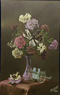
Background imageFrance Collection: First World War: Patriotic Map showing a composition of a vase containing a patriotic bouquet

First World War: Patriotic Map showing a composition of a vase containing a patriotic bouquet and a model of cannon 75
LUX4745199 First World War: Patriotic Map showing a composition of a vase containing a patriotic bouquet and a model of cannon 75

Background imageFrance Collection: First World War: Patriotic map showing a couple of Alsatian listening to a gramophone Samber

First World War: Patriotic map showing a couple of Alsatian listening to a gramophone Samber and Meuse music, 1916
LUX4744623 First World War: Patriotic map showing a couple of Alsatian listening to a gramophone Samber and Meuse music, 1916; (add.info)

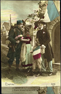
Background imageFrance Collection: First World War: Patriotic map showing the welcome of the Alsatian family to the French soldier

First World War: Patriotic map showing the welcome of the Alsatian family to the French soldier who came to
LUX4744543 First World War: Patriotic map showing the welcome of the Alsatian family to the French soldier who came to the Delivres and entitled Finally

Background imageFrance Collection: Female American mathematician and astronomer at work, at the Paris Observatory, 1850

Female American mathematician and astronomer at work, at the Paris Observatory, 1850
3478832 Female American mathematician and astronomer at work, at the Paris Observatory, 1850; (add.info.: Miss Klumpke an American mathematician and astronomer at work on the Carte du Ciel)

Background imageFrance Collection: Map of the siege of Gibraltar (taken by English) by French and spanish forces, 1782

Map of the siege of Gibraltar (taken by English) by French and spanish forces, 1782
1759247 Map of the siege of Gibraltar (taken by English) by French and spanish forces, 1782; (add.info.: Map of the siege of Gibraltar (taken by English) by French and spanish forces

Background imageFrance Collection: Map of the castle gardens, and streets around the castle in Versailles France, c. 1690 (engraving)

Map of the castle gardens, and streets around the castle in Versailles France, c. 1690 (engraving)
1702791 Map of the castle gardens, and streets around the castle in Versailles France, c. 1690 (engraving)

Background imageFrance Collection: map of Paris in 1551 : on the upper right is the Bastille, in the bottom right is the town hall

map of Paris in 1551 : on the upper right is the Bastille, in the bottom right is the town hall, engraving by Truchet
1749806 map of Paris in 1551 : on the upper right is the Bastille, in the bottom right is the town hall, engraving by Truchet; (add.info.: map of Paris in 1551 : on the upper right is the Bastille)

Background imageFrance Collection: Map of area of Rennes-le-Chateau, France, where priest Beranger Sauniere (1852-1917)

Map of area of Rennes-le-Chateau, France, where priest Beranger Sauniere (1852-1917)
1752355 Map of area of Rennes-le-Chateau, France, where priest Beranger Sauniere (1852-1917) said to have found treasure of Templar or Cathars; (add.info.: Map of area of Rennes-le-Chateau, France)

Background imageFrance Collection: project of square and town hall on Malaquet bank along the Seine river in Paris

project of square and town hall on Malaquet bank along the Seine river in Paris, map by architect Patte 18th century
1749462 project of square and town hall on Malaquet bank along the Seine river in Paris, map by architect Patte 18th century; (add.info)

Background imageFrance Collection: Map of Cairo (with occupied area by the French) and the outskirts around 1798-1801 campaign of

Map of Cairo (with occupied area by the French) and the outskirts around 1798-1801 campaign of Egypt of
1753144 Map of Cairo (with occupied area by the French) and the outskirts around 1798-1801 campaign of Egypt of NapoleonBonaparte; (add.info)


All Professionally Made to Order for Quick Shipping


-

France Collection

France is a country located in Western Europe and has a total area of 643,801 square kilometers and a population of approximately 67 million people. The capital city is Paris, which is also the largest city in the country. France is known for its rich history, culture, cuisine, fashion and art and has diverse landscapes ranging from mountains to beaches and forests to vineyards. The economy is one of the largest in the world with major industries including tourism, agriculture, aerospace and technology. The country also has an extensive transportation network consisting of highways, railways and airports connecting it to other parts of Europe and beyond.
+

Our beautiful pictures are available as Framed Prints, Photos, Wall Art and Photo Gifts

The France collection from Media Storehouse is a stunning array of wall art and framed prints featuring maps and charts of various regions in France. Our collection showcases the beauty of French geography, highlighting its diverse landscapes, cities, rivers, mountains, and coastlines. From vintage maps to contemporary designs, our collection offers a wide range of styles to suit any taste or decor. Each print is expertly crafted using high-quality materials that ensure longevity and durability. The prints are available in different sizes to fit any space or wall size. Whether you're looking for an eye-catching focal point for your living room or office or want to add some French charm to your bedroom or kitchen walls, the France collection has something for everyone. Our collection is perfect for anyone who loves France's rich history and culture or wants to bring a touch of French elegance into their home.
+

What are France (Maps and Charts) art prints?

France art prints are high-quality reproductions of historical maps and charts depicting various regions of France. These prints showcase the intricate details and artistic styles of cartographers from different eras, providing a unique glimpse into the country's rich history. These art prints are perfect for those who appreciate vintage aesthetics or have an interest in geography, history, or French culture. They can be used to decorate homes, offices, classrooms, or any space that could benefit from a touch of sophistication and intellectual curiosity. We offer a wide selection of France art prints in various sizes and formats to suit different preferences. You can choose between framed or unframed options depending on their needs. With our commitment to quality printing techniques using archival materials ensures that these art prints will last for years without fading or deteriorating over time.
+

What France (Maps and Charts) art prints can I buy from Media Storehouse?

We offer a wide variety of France Maps and Charts art prints that are perfect for adding a touch of sophistication to any room. These art prints feature detailed maps and charts depicting the geography, history, culture, and landmarks of France. Whether you're looking for vintage or contemporary designs, we have something to suit every taste. Some popular options include antique maps of Paris, historical charts detailing the French Revolution, colorful illustrations showcasing famous French cities like Marseille or Lyon, and intricate topographical maps highlighting the diverse landscapes of France. These high-quality art prints are available in various sizes and formats such as canvas prints or framed prints. They make great gifts for anyone who loves travel or is interested in French culture. With so many beautiful options to choose from at Media Storehouse, you're sure to find the perfect addition to your home decor collection.
+

How do I buy France (Maps and Charts) art prints?

To buy France art prints from Media Storehouse, you can browse our extensive collection of artwork online. Once you have found the print that you would like to purchase, simply add it to your cart and proceed to checkout. During the checkout process, you will be prompted to enter your shipping information and payment details. We offer a range of sizes for their art prints, so make sure to select the size that best fits your needs. Additionally, we offer various framing options if you would like your print framed before delivery. Once your order has been placed, Media Storehouse will carefully package and ship your artwork directly to you. Their high-quality printing process ensures that each print is produced with vibrant colors and sharp detail. Whether as a gift or for personal use in decorating your home or office space, buying France art prints from Media Storehouse is an easy way to add beautiful artwork inspired by French culture into any setting.
+

How much do France (Maps and Charts) art prints cost?

We offer a wide range of France art prints at varying prices. Our collection includes vintage maps, antique charts, and contemporary illustrations that capture the beauty and history of France. The cost of our art prints depends on various factors such as size, framing options, and printing materials. We use high-quality paper stock to ensure that our art prints are long-lasting and retain their vibrant colors for years to come. Our you can choose from different sizes ranging from small to large formats depending on their preferences. Our France art prints make great gifts for friends or family members who love travel or have an interest in geography. They also add character to any living space or office setting with their unique designs. The cost of our France art prints is reasonable considering the quality of our products. We strive to provide affordable yet exceptional artwork that meets the needs of all our customers without compromising on quality.
+

How will my France (Maps and Charts) art prints be delivered to me?

We take great care in ensuring that your France art prints are delivered to you safely and securely. We use high-quality packaging materials to protect your artwork during transit, so you can be sure that it will arrive in pristine condition. All of our art prints are carefully rolled and placed into a sturdy cardboard tube for shipping. This ensures that the print is protected from any damage or creases during transportation. The tube is then sealed with tape to prevent any moisture or dust from entering. Once your order has been dispatched, you will receive an email notification with tracking information so you can keep track of its progress. Our delivery partners are reliable and experienced in handling delicate items like art prints, so you can rest assured that your order is in good hands. We strive to provide a seamless delivery experience for all our customers, ensuring their satisfaction with every purchase they make through us.