Fraud Blocker Skip to main content

Home > Maps and Charts > France

France Collection (page 5)

France is a country located in Western Europe and has a total area of 643,801 square kilometers and a population of approximately 67 million people

13,078 items

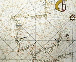
Background imageFrance Collection: Portolan Atlas, 1587. Map of the Iberian Peninsula

Portolan Atlas, 1587. Map of the Iberian Peninsula, the north coastline of Africa and the Vasque Countrys region in France. Made in Messina. Facsimile. Miniature Painting. SPAIN. Madrid

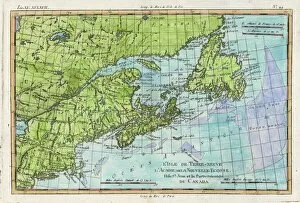
Background imageFrance Collection: Map / N America / Canada

Map / N America / Canada
The east coast of North America from New York to Newfoundland, showing habitats of Eskimaux, native American peoples, and the French colonies of Acadie, etc

Background imageFrance Collection: Map of French Railway Lines

Map of French Railway Lines

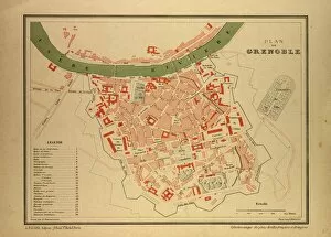
Background imageFrance Collection: Map of Grenoble, France

Map of Grenoble, France

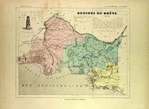
Background imageFrance Collection: Map of Bouches Du Rhone, France

Map of Bouches Du Rhone, France

Background imageFrance Collection: West Indies and Caribbean Map

West Indies and Caribbean Map
This Caribbean map covers an area from Dallas in the north to Esmeraldes in the south and from Mexico City in the west to French Guiana in the east

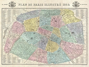
Background imageFrance Collection: 1864, Garnier Map of Pairs, France w-Monuments, topography, cartography, geography

1864, Garnier Map of Pairs, France w-Monuments, topography, cartography, geography
1864, Garnier Map of Pairs, France w-Monuments

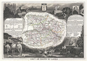
Background imageFrance Collection: 1852, Levasseur Map of the Department De Maine et Loire, France, topography, cartography

1852, Levasseur Map of the Department De Maine et Loire, France, topography, cartography
1852, Levasseur Map of the Department De Maine et Loire, France

Background imageFrance Collection: Map of Savoie, 1896, France

Map of Savoie, 1896, France

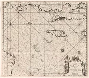
Background imageFrance Collection: Sea chart of the south coast of Cuba and Jamaica, Jan Luyken, Claes Jansz Voogt

Sea chart of the south coast of Cuba and Jamaica, Jan Luyken, Claes Jansz Voogt, Johannes van Keulen (I), 1684 - 1799

Background imageFrance Collection: Australia Map Gotha, Justus Perthes, 1872, Atlas

Australia Map Gotha, Justus Perthes, 1872, Atlas. Perthes, Johan Georg Justus 1749 aa 1816, German publisher, was born in Rudolstadt in 1749
Background imageFrance Collection: World map showing the spread of the plague (colour litho)

World map showing the spread of the plague (colour litho)
8663630 World map showing the spread of the plague (colour litho) by French School, (20th century); Private Collection; (add.info.: World map showing the spread of the plague)

Background imageFrance Collection: Map of the Mediterranean French odds (Galia Narbonense), 1570 (engraving)

Map of the Mediterranean French odds (Galia Narbonense), 1570 (engraving)
AIS5366577 Map of the Mediterranean French odds (Galia Narbonense), 1570 (engraving); (add.info.: Strong water in colors, 1570, by Christophe Plantin (1514 or 1520-1589), Antwerp (Netherlands)

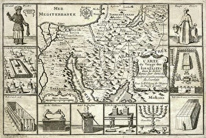
Background imageFrance Collection: Map of the journey of the Israelites, since their exit from Egypt, 1739 (engraving)

Map of the journey of the Israelites, since their exit from Egypt, 1739 (engraving)
8822197 Map of the journey of the Israelites, since their exit from Egypt, 1739 (engraving); Private Collection; (add.info)

Background imageFrance Collection: Chart of the eastern Mediterrean, c.1600 (manuscript)

Chart of the eastern Mediterrean, c.1600 (manuscript)
7339793 Chart of the eastern Mediterrean, c.1600 (manuscript) by Unknown Artist, (17th century); 47x35 cm; National Maritime Museum, London

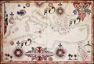
Background imageFrance Collection: Chart of the western Mediterrean, c.1600 (manuscript)

Chart of the western Mediterrean, c.1600 (manuscript)
7339787 Chart of the western Mediterrean, c.1600 (manuscript) by Unknown Artist, (17th century); 47x35 cm; National Maritime Museum, London

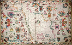
Background imageFrance Collection: Chart of Mediterranean, Black and Caspian Seas, c.1620 (manuscript)

Chart of Mediterranean, Black and Caspian Seas, c.1620 (manuscript)
7339783 Chart of Mediterranean, Black and Caspian Seas, c.1620 (manuscript) by Unknown Artist, (17th century); 41x60 cm; National Maritime Museum, London

Background imageFrance Collection: Map of Islington, Westminster, City and Southwark, 1746 (coloured engraving)

Map of Islington, Westminster, City and Southwark, 1746 (coloured engraving)
7340509 Map of Islington, Westminster, City and Southwark, 1746 (coloured engraving) by Rocque, John (c.1704-d.1762); 51x67 cm; National Maritime Museum, London

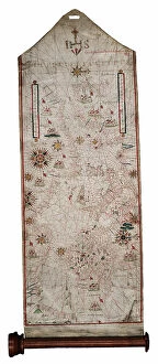
Background imageFrance Collection: [Mediterranean Sea], 1656 (Vellum, Wood)

[Mediterranean Sea], 1656 (Vellum, Wood)
7340492 [Mediterranean Sea], 1656 (Vellum, Wood) by Cavallini, Giovanni Batia (fl.1656); 195x55 cm; National Maritime Museum, London

Background imageFrance Collection: Map of Bay of Biscay and English Channel, 1596 (vellum)

Map of Bay of Biscay and English Channel, 1596 (vellum)
7340489 Map of Bay of Biscay and English Channel, 1596 (vellum) by Hood, Thomas (16th century); 40x53 cm; National Maritime Museum, London

Background imageFrance Collection: Nieuwe pascaert, van de suyt syde van Yrlandt beginnende van Blasques tot ande Hoeck van Waterfoort

Nieuwe pascaert, van de suyt syde van Yrlandt beginnende van Blasques tot ande Hoeck van Waterfoort
7340067 Nieuwe pascaert, van de suyt syde van Yrlandt beginnende van Blasques tot ande Hoeck van Waterfoort. A chart bound in van Keulen's 'Great and Newly Enlarged Sea Atlas' or Waterworld

Background imageFrance Collection: Pas-caert van de Canael, tusschen Engelandt en Vranckryck, van Pleymuyen tot an de Sorlinges

Pas-caert van de Canael, tusschen Engelandt en Vranckryck, van Pleymuyen tot an de Sorlinges
7340065 Pas-caert van de Canael, tusschen Engelandt en Vranckryck, van Pleymuyen tot an de Sorlinges, als mede van Portbimel tot aen Heyssant, 1682 (engraving) by Keulen

Background imageFrance Collection: Pas-caert van Texel tot aen de Hoofden, 1661 (print, paper)

Pas-caert van Texel tot aen de Hoofden, 1661 (print, paper)
7340060 Pas-caert van Texel tot aen de Hoofden, 1661 (print, paper) by Doncker, Hendrick (c.1626-99); 46.5x57.5 cm; National Maritime Museum, London

Background imageFrance Collection: A general chart of the islands of Guernsey and Jersey, Sark, Herm, Jethou and Alderney

A general chart of the islands of Guernsey and Jersey, Sark, Herm, Jethou and Alderney
7340131 A general chart of the islands of Guernsey and Jersey, Sark, Herm, Jethou and Alderney, with Cape la Hague and the Caskets, 1779 (print) by Sayer

Background imageFrance Collection: A general chart of the northern navigation, 1675 (coloured engraving)

A general chart of the northern navigation, 1675 (coloured engraving)
7340043 A general chart of the northern navigation, 1675 (coloured engraving) by Seller, John (1632-97); 43.5x54 cm; National Maritime Museum, London

Background imageFrance Collection: Systeme de Copernic, 1761 (engraving)

Systeme de Copernic, 1761 (engraving)
7340112 Systeme de Copernic, 1761 (engraving) by Desnos, Louis-Charles (c.1725-c.1800); 55.2x39.1 cm; National Maritime Museum, London

Background imageFrance Collection: Map of Northolt, Harrow and Wembley, 1746 (coloured engraving)

Map of Northolt, Harrow and Wembley, 1746 (coloured engraving)
7340516 Map of Northolt, Harrow and Wembley, 1746 (coloured engraving) by Rocque, John (c.1704-d.1762); 51x67 cm; National Maritime Museum, London

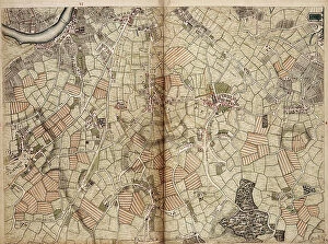
Background imageFrance Collection: Map of Vauxhall, Clapham, Peckham and Dulwich, 1746 (coloured engraving)

Map of Vauxhall, Clapham, Peckham and Dulwich, 1746 (coloured engraving)
7340511 Map of Vauxhall, Clapham, Peckham and Dulwich, 1746 (coloured engraving) by Rocque, John (c.1704-d.1762); 51x67 cm; National Maritime Museum, London

Background imageFrance Collection: Mediterranean and Black Seas 1546, 1546 (Vellum)

Mediterranean and Black Seas 1546, 1546 (Vellum)
7340469 Mediterranean and Black Seas 1546, 1546 (Vellum) by Maggiolo, Jacopo Vesconte (1475-1549/61); 47x72 cm; National Maritime Museum, London, UK; (add.info.: Creator: Maggiolo)

Background imageFrance Collection: Plan of the harbour, fort, town and environs of Fort Royal in Martinique, 1793 (engraving)

Plan of the harbour, fort, town and environs of Fort Royal in Martinique, 1793 (engraving)
7340437 Plan of the harbour, fort, town and environs of Fort Royal in Martinique, 1793 (engraving) by Booth, William (18th century); 88x70 cm; National Maritime Museum, London

Background imageFrance Collection: The British Channel with a part of the Atlantic Ocean and of the Coast of Ireland, 1788 (print)

The British Channel with a part of the Atlantic Ocean and of the Coast of Ireland, 1788 (print)
7340084 The British Channel with a part of the Atlantic Ocean and of the Coast of Ireland, 1788 (print) by Sayer, Robert (1724/5-94); 44.2x92.9 cm; National Maritime Museum, London

Background imageFrance Collection: Justus Danckers's atlas: Hungary and Greece, c.1688 (coloured engraving)

Justus Danckers's atlas: Hungary and Greece, c.1688 (coloured engraving)
7340066 Justus Danckers's atlas: Hungary and Greece, c.1688 (coloured engraving) by Danckertsz, Justus (1635-1701); 50x59 cm; National Maritime Museum, London

Background imageFrance Collection: The Carybsche Eylanden of Barbados to the bend of Mexico, 1656 (engraving)

The Carybsche Eylanden of Barbados to the bend of Mexico, 1656 (engraving)
7340058 The Carybsche Eylanden of Barbados to the bend of Mexico, 1656 (engraving) by Colom, Arnold (1624-68) & Colom, Jacob Aertsz (1600-73); 55x64 cm; National Maritime Museum, London

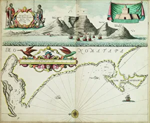
Background imageFrance Collection: A chart of Guinea describing the sea coast from Cape de Verde to Cape Bona Esperanca

A chart of Guinea describing the sea coast from Cape de Verde to Cape Bona Esperanca, 1677 (coloured engraving)
7340049 A chart of Guinea describing the sea coast from Cape de Verde to Cape Bona Esperanca, 1677 (coloured engraving) by Seller, John (1632-97); 43x54 cm; National Maritime Museum, London

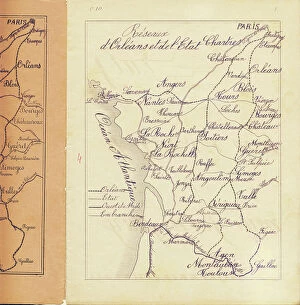
Background imageFrance Collection: Middle course: map of the rail networks of Orleans and the State, c.1880-90 (print)

Middle course: map of the rail networks of Orleans and the State, c.1880-90 (print)
8713434 Middle course: map of the rail networks of Orleans and the State, c.1880-90 (print); 22 x 17 cm; Private Collection; (add.info.: in "Practical method of writing-reading by A)

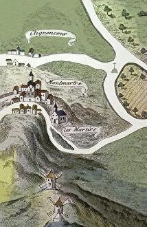
Background imageFrance Collection: Montmartre Abbey, 16th century (engraving)

Montmartre Abbey, 16th century (engraving)
8698354 Montmartre Abbey, 16th century (engraving); (add.info.: Geography. France. Montmartre Abbey in Paris. Map, France, 16th cent.); © Archives Charmet

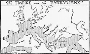
Background imageFrance Collection: Map showing the Roman Empire and the Barbarians, 1936

Map showing the Roman Empire and the Barbarians, 1936
7125144 Map showing the Roman Empire and the Barbarians, 1936; (add.info.: Map showing the Roman Empire and the Barbarians)

Background imageFrance Collection: Map showing The Louisiana Purchase. The acquisition of the Louisiana territory

Map showing The Louisiana Purchase. The acquisition of the Louisiana territory (828,000 square miles)
UIG5419728 Map showing The Louisiana Purchase. The acquisition of the Louisiana territory (828,000 square miles) by the United States from France in 1803

Background imageFrance Collection: Map from 1898 showing the territorial growth of the United States of America

Map from 1898 showing the territorial growth of the United States of America
UIG5419650 Map from 1898 showing the territorial growth of the United States of America. From The History of Our Country, published 1900 ©UIG/Leemage

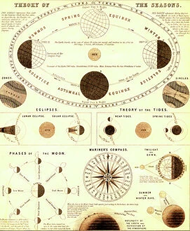
Background imageFrance Collection: The solar system.Theory of the seasons. 1865 (engraving)

The solar system.Theory of the seasons. 1865 (engraving)
8766902 The solar system.Theory of the seasons. 1865 (engraving); Private Collection; (add.info.: The solar system.Theory of the seasons.Engraved by J)

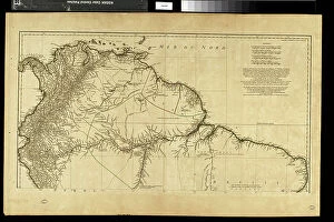
Background imageFrance Collection: Geography map: representation of the northern part of South America (Brazil, Venezuela)

Geography map: representation of the northern part of South America (Brazil, Venezuela)
VEN5030250 Geography map: representation of the northern part of South America (Brazil, Venezuela, Peru) from the Atlas " Amerique meridionale" by French cartographer Jean-Baptiste

Background imageFrance Collection: Map of New France and Canada, 1597. 19th century coloring engraving

Map of New France and Canada, 1597. 19th century coloring engraving
NWI4851909 Map of New France and Canada, 1597. 19th century coloring engraving.; (add.info.: Map of New France and Canada, 1597. 19th century coloring engraving.); Photo © North Wind Pictures

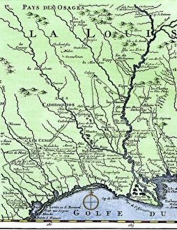
Background imageFrance Collection: The western itinerary of the expedition to Louisiana (United States)

The western itinerary of the expedition to Louisiana (United States) of 1539 by Hernando De Soto (1500-1542)
NWI4852599 The western itinerary of the expedition to Louisiana (United States) of 1539 by Hernando De Soto (1500-1542, Spanish conquistador), based on the map of Guillaume Delisle (1675-1726)

Background imageFrance Collection: United States of America Independence War (1775-1783): Route of American ships 'Ranger'

United States of America Independence War (1775-1783): Route of American ships "Ranger"
NWI4842352 United States of America Independence War (1775-1783): Route of American ships "Ranger" and "Bonhomme Richard" near the British islands during the war

Background imageFrance Collection: Map of the Isthmus of Panama (Republic of Panama), from the general history of voyages, 1754

Map of the Isthmus of Panama (Republic of Panama), from the general history of voyages, 1754
NWI4846857 Map of the Isthmus of Panama (Republic of Panama), from the general history of voyages, 1754, by Antoine Francois Prevost, dit d'Exiles (1697-1763) or Abbe Prevost - Colorisee engraving

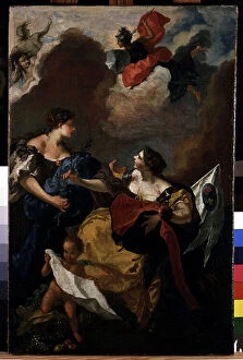
Background imageFrance Collection: Union of the Proxy of Provence at the Consulate of Aix. Painting by Michel Francois Dandre Bardon

Union of the Proxy of Provence at the Consulate of Aix. Painting by Michel Francois Dandre Bardon (1700-1783)
JEB4846094 Union of the Proxy of Provence at the Consulate of Aix. Painting by Michel Francois Dandre Bardon (1700-1783). 18th century. Oil on canvas, 66 x 43 cm

Background imageFrance Collection: The still Indian village of Hochelaga, site of Montreal, Canada

The still Indian village of Hochelaga, site of Montreal, Canada. Map of Marc Lescarbot (1570-1641), 1609
NWI4850311 The still Indian village of Hochelaga, site of Montreal, Canada. Map of Marc Lescarbot (1570-1641), 1609. Colouring engraving of the 19th century.; (add.info)

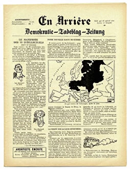
Background imageFrance Collection: Back, Satirical in N & B, War of 14 -18, Press/Media, Germany Prussia

Back, Satirical in N & B, War of 14 -18, Press/Media, Germany Prussia
ICA4849062 Back, Satirical in N & B, War of 14 -18, Press/Media, Germany Prussia; (add.info.: Back, Satirical in N & B, War of 14 -18, Press/Media, Germany Prussia); Photo © Caricadoc


All Professionally Made to Order for Quick Shipping


-

France Collection

France is a country located in Western Europe and has a total area of 643,801 square kilometers and a population of approximately 67 million people. The capital city is Paris, which is also the largest city in the country. France is known for its rich history, culture, cuisine, fashion and art and has diverse landscapes ranging from mountains to beaches and forests to vineyards. The economy is one of the largest in the world with major industries including tourism, agriculture, aerospace and technology. The country also has an extensive transportation network consisting of highways, railways and airports connecting it to other parts of Europe and beyond.
+

Our beautiful pictures are available as Framed Prints, Photos, Wall Art and Photo Gifts

The France collection from Media Storehouse is a stunning array of wall art and framed prints featuring maps and charts of various regions in France. Our collection showcases the beauty of French geography, highlighting its diverse landscapes, cities, rivers, mountains, and coastlines. From vintage maps to contemporary designs, our collection offers a wide range of styles to suit any taste or decor. Each print is expertly crafted using high-quality materials that ensure longevity and durability. The prints are available in different sizes to fit any space or wall size. Whether you're looking for an eye-catching focal point for your living room or office or want to add some French charm to your bedroom or kitchen walls, the France collection has something for everyone. Our collection is perfect for anyone who loves France's rich history and culture or wants to bring a touch of French elegance into their home.
+

What are France (Maps and Charts) art prints?

France art prints are high-quality reproductions of historical maps and charts depicting various regions of France. These prints showcase the intricate details and artistic styles of cartographers from different eras, providing a unique glimpse into the country's rich history. These art prints are perfect for those who appreciate vintage aesthetics or have an interest in geography, history, or French culture. They can be used to decorate homes, offices, classrooms, or any space that could benefit from a touch of sophistication and intellectual curiosity. We offer a wide selection of France art prints in various sizes and formats to suit different preferences. You can choose between framed or unframed options depending on their needs. With our commitment to quality printing techniques using archival materials ensures that these art prints will last for years without fading or deteriorating over time.
+

What France (Maps and Charts) art prints can I buy from Media Storehouse?

We offer a wide variety of France Maps and Charts art prints that are perfect for adding a touch of sophistication to any room. These art prints feature detailed maps and charts depicting the geography, history, culture, and landmarks of France. Whether you're looking for vintage or contemporary designs, we have something to suit every taste. Some popular options include antique maps of Paris, historical charts detailing the French Revolution, colorful illustrations showcasing famous French cities like Marseille or Lyon, and intricate topographical maps highlighting the diverse landscapes of France. These high-quality art prints are available in various sizes and formats such as canvas prints or framed prints. They make great gifts for anyone who loves travel or is interested in French culture. With so many beautiful options to choose from at Media Storehouse, you're sure to find the perfect addition to your home decor collection.
+

How do I buy France (Maps and Charts) art prints?

To buy France art prints from Media Storehouse, you can browse our extensive collection of artwork online. Once you have found the print that you would like to purchase, simply add it to your cart and proceed to checkout. During the checkout process, you will be prompted to enter your shipping information and payment details. We offer a range of sizes for their art prints, so make sure to select the size that best fits your needs. Additionally, we offer various framing options if you would like your print framed before delivery. Once your order has been placed, Media Storehouse will carefully package and ship your artwork directly to you. Their high-quality printing process ensures that each print is produced with vibrant colors and sharp detail. Whether as a gift or for personal use in decorating your home or office space, buying France art prints from Media Storehouse is an easy way to add beautiful artwork inspired by French culture into any setting.
+

How much do France (Maps and Charts) art prints cost?

We offer a wide range of France art prints at varying prices. Our collection includes vintage maps, antique charts, and contemporary illustrations that capture the beauty and history of France. The cost of our art prints depends on various factors such as size, framing options, and printing materials. We use high-quality paper stock to ensure that our art prints are long-lasting and retain their vibrant colors for years to come. Our you can choose from different sizes ranging from small to large formats depending on their preferences. Our France art prints make great gifts for friends or family members who love travel or have an interest in geography. They also add character to any living space or office setting with their unique designs. The cost of our France art prints is reasonable considering the quality of our products. We strive to provide affordable yet exceptional artwork that meets the needs of all our customers without compromising on quality.
+

How will my France (Maps and Charts) art prints be delivered to me?

We take great care in ensuring that your France art prints are delivered to you safely and securely. We use high-quality packaging materials to protect your artwork during transit, so you can be sure that it will arrive in pristine condition. All of our art prints are carefully rolled and placed into a sturdy cardboard tube for shipping. This ensures that the print is protected from any damage or creases during transportation. The tube is then sealed with tape to prevent any moisture or dust from entering. Once your order has been dispatched, you will receive an email notification with tracking information so you can keep track of its progress. Our delivery partners are reliable and experienced in handling delicate items like art prints, so you can rest assured that your order is in good hands. We strive to provide a seamless delivery experience for all our customers, ensuring their satisfaction with every purchase they make through us.