Fraud Blocker Skip to main content

Home > Maps and Charts > France

France Collection (page 3)

France is a country located in Western Europe and has a total area of 643,801 square kilometers and a population of approximately 67 million people

13,078 items

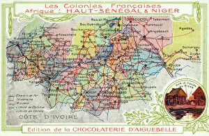
Background imageFrance Collection: Senegal and Niger, French Colonies in Africa - Map

Senegal and Niger, French Colonies in Africa - Map showing main transport routes. Date: circa 1909

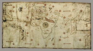
Background imageFrance Collection: The Caverio Map or Caveri Map, circa 1505. This
The Caverio Map or Caveri Map, circa 1505. This map was one of the primary sources used to make the Waldseem� map. Miniature Painting. FRANCE. Paris. National Library

Background imageFrance Collection: Map of Paris

Map of Paris
Bradshaws Plan of Paris, France and map of the environs Date: 19th century

Background imageFrance Collection: Atlas compass, 16th century

Atlas compass, 16th century
Atlas compass in a 1544 copy of the Agnese Atlas. Several copies of this atlas were produced between 1536 and 1564, in Venice, by the Italian mapmaker Battista Agnese

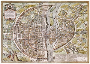
Background imageFrance Collection: PARIS MAP, 1581. Map of Paris, France, by Georg Braun from Civitates Orbis Terarum, 1581

PARIS MAP, 1581. Map of Paris, France, by Georg Braun from Civitates Orbis Terarum, 1581

Background imageFrance Collection: EXPL2A-00284

EXPL2A-00284
Early map of Hudsons Strait and Hudsons Bay, 1662, in Arctic Canada. Hand-colored 19th-century woodcut reproduction

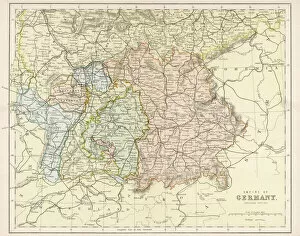
Background imageFrance Collection: Map / Europe / Germany 1880S

Map / Europe / Germany 1880S
Map of the German Empire (southern part) after the war with France, including Alsace and Lorraine

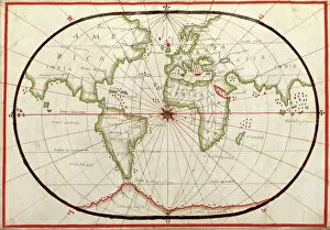
Background imageFrance Collection: Map of the world, 1590

Map of the world, 1590
16th century map of the world. Published around 1590, this map shows the known world, including the new lands being discovered by Europeans exploring across the Atlantic

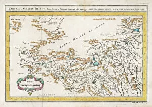
Background imageFrance Collection: Map / China / Tibet 1749

Map / China / Tibet 1749
CARTE DU GRAND THIBET scale in French leagues

Background imageFrance Collection: ABC OF BABAR S, 1939 (illustration)

ABC OF BABAR S, 1939 (illustration)
7206805 ABC OF BABAR S, 1939 (illustration) by Brunhoff, Jean de (1899-1937); 22x16, 5 cm; Private Collection; (add.info.: S: 19 words to find: skis, skiers, jump, saltire, jumpers, bag, plaster)

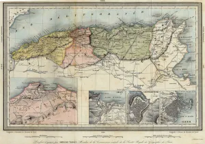
Background imageFrance Collection: Geographic map of Algeria and details of the provinces of Algiers, Oran and Constantine

Geographic map of Algeria and details of the provinces of Algiers, Oran and Constantine
XEE4405752 Geographic map of Algeria and details of the provinces of Algiers, Oran and Constantine, realized by Amboise Tardieu, 19th century

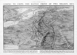
Background imageFrance Collection: The Western Front battleground - map of August 1914

The Western Front battleground - map of August 1914
WW1 - The Western Front battleground - map of August 1914 Date: 1914

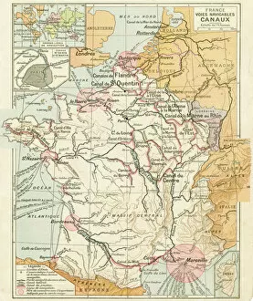
Background imageFrance Collection: France Waterways map 1887

France Waterways map 1887
Map from La Premiere Annee de Geographie par P. Foncin - Paris 1887

Background imageFrance Collection: Map of the Siege of Quebec, Canada 1759

Map of the Siege of Quebec, Canada 1759
Vintage engraving of a Map of the Siege of Quebec, Canada 1759. The Battle of the Plains of Abraham, also known as the Battle of Quebec was a pivotal battle in the Seven Years War

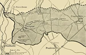
Background imageFrance Collection: Map showing approximately the area gained on the Thiepval Ridge... 1916, (c1920)

Map showing approximately the area gained on the Thiepval Ridge... 1916, (c1920)
Map showing approximately the area gained on the Thiepval Ridge between September 14 and October 31, 1916, (c1920). The British line in northern France during the Battle of the Somme

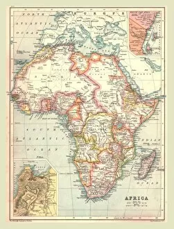
Background imageFrance Collection: Map of Africa, 1902. Creator: Unknown

Map of Africa, 1902. Creator: Unknown
Map of Africa, 1902. Showing colonial possessions including French West Africa and German South West Africa, with insets of Table Bay in South Africa, and British and German East Africa

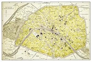
Background imageFrance Collection: Map of Paris 1894

Map of Paris 1894
map/plan of the city of Paris, France

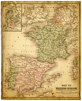
Background imageFrance Collection: western europe map 1883

western europe map 1883
a map of Western europe from 1883

Background imageFrance Collection: western europe 1867

western europe 1867
a map of Western europe from 1867, overlay with grunge burnt texture paper

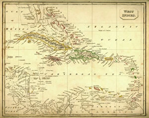
Background imageFrance Collection: Antquie Map of The West Indies

Antquie Map of The West Indies
Vintage map of The West Indies from 1837

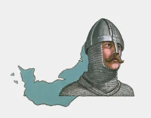
Background imageFrance Collection: Illustration of Rollo and map of Normandy

Illustration of Rollo and map of Normandy

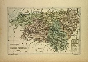
Background imageFrance Collection: Map of Basses-Pyrenees, France

Map of Basses-Pyrenees, France

Background imageFrance Collection: MAP OF COLONIAL AMERICA. Delisles map of colonial America, 1718, showing the Mississippi

MAP OF COLONIAL AMERICA. Delisles map of colonial America, 1718, showing the Mississippi valley in strikingly accurate detail and the first map to use Texas as a place-name

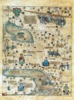
Background imageFrance Collection: Map of Cathay, China, from Catalan Atlas created for Charles V, King of France

Map of Cathay, China, from Catalan Atlas created for Charles V, King of France
Cartography, 14th century. Map of Cathay (China). From Catalan Atlas created for Charles V, King of France, attributed to Abraham and Jafuda Cresques Maiorca (circa 1375)

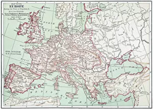
Background imageFrance Collection: MAP OF EUROPE, c1812. A 19th century German map of Europe during the reign of Napoleon I

MAP OF EUROPE, c1812. A 19th century German map of Europe during the reign of Napoleon I, c1812

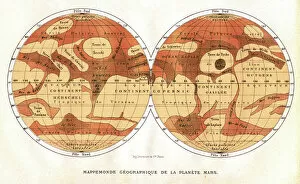
Background imageFrance Collection: Mars map from 1881

Mars map from 1881
Map of Mars, published in Paris in 1881. The first accurate telescope observations of Mars were made in 1877 and 1881 when Mars was at its closest to Earth (a situation called an opposition)

Background imageFrance Collection: EXPL2A-00184

EXPL2A-00184
Part of the 1613 Samuel de Champlain map of New France. Hand-colored woodcut of a 19th-century reproduction of the original ma

Background imageFrance Collection: Sepia vintage map of Lyon France

Sepia vintage map of Lyon France
Rosana Laiz Blursbyai

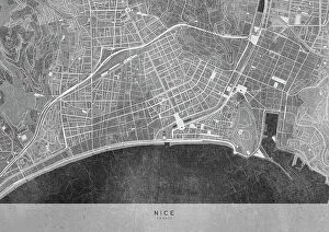
Background imageFrance Collection: Gray vintage map of Nice downtown France

Gray vintage map of Nice downtown France
Rosana Laiz Blursbyai

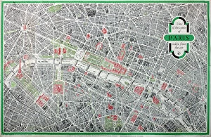
Background imageFrance Collection: Poster, map of the City of Paris

Poster, map of the City of Paris
Poster, three-dimensional map of the City of Paris Date: 1958

Background imageFrance Collection: Map of France

Map of France
Marcus Ward's Home Atlas - London, 1894

Background imageFrance Collection: Robert Delaunay Still Life Portuguese, 1917. Robert Delaunay (1885 - 1941)

Robert Delaunay Still Life Portuguese, 1917. Robert Delaunay (1885 - 1941)
3524399 Robert Delaunay Still Life Portuguese, 1917. Robert Delaunay (1885 - 1941) by Delaunay, Robert (1885-1941); (add.info.: Robert Delaunay Still Life Portuguese, 1917)

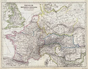
Background imageFrance Collection: Map of the Roman provinces of Gaul, Britannia and Germania (coloured engraving)

Map of the Roman provinces of Gaul, Britannia and Germania (coloured engraving)
7148263 Map of the Roman provinces of Gaul, Britannia and Germania (coloured engraving) by Kiepert, Heinrich (1818-99); Private Collection; (add.info.: Map of the Roman provinces of Gaul)

Background imageFrance Collection: L Aveyron (12), Midi-Pyrenees (Midi Pyrenees) - France and its Colonies

L Aveyron (12), Midi-Pyrenees (Midi Pyrenees) - France and its Colonies. Atlas illustrates one hundred
XEE4144628 L Aveyron (12), Midi-Pyrenees (Midi Pyrenees) - France and its Colonies. Atlas illustrates one hundred and five maps from the maps of the depot of war

Background imageFrance Collection: Ile de La Reunion (Bourbon Island), DOM (overseas department or overseas department)

Ile de La Reunion (Bourbon Island), DOM (overseas department or overseas department) - France and its Colonies
XEE4144389 Ile de La Reunion (Bourbon Island), DOM (overseas department or overseas department) - France and its Colonies

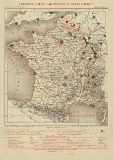
Background imageFrance Collection: France Militaire par Regions de Corps d Armee (engraving)

France Militaire par Regions de Corps d Armee (engraving)
7158174 France Militaire par Regions de Corps d Armee (engraving) by French School, (19th century); Private Collection; (add.info.: France Militaire par Regions de Corps d Armee)

Background imageFrance Collection: The Plum Pudding in Danger or State Epicures taking un Petit Souper, 1805 (engraving)

The Plum Pudding in Danger or State Epicures taking un Petit Souper, 1805 (engraving)
7088732 The Plum Pudding in Danger or State Epicures taking un Petit Souper, 1805 (engraving) by Gillray, James (1757-1815); Private Collection; (add.info)

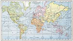
Background imageFrance Collection: Map showing the principal world trade shipping routes, 1912 (colour litho)

Map showing the principal world trade shipping routes, 1912 (colour litho)
CHT277054 Map showing the principal world trade shipping routes, 1912 (colour litho) by French School, (20th century); Private Collection; (add.info)

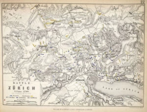
Background imageFrance Collection: Map of the Battle of Zurich, published by William Blackwood and Sons, Edinburgh & London

Map of the Battle of Zurich, published by William Blackwood and Sons, Edinburgh & London
746922 Map of the Battle of Zurich, published by William Blackwood and Sons, Edinburgh & London, 1848 (hand-coloured engraving) by Johnston

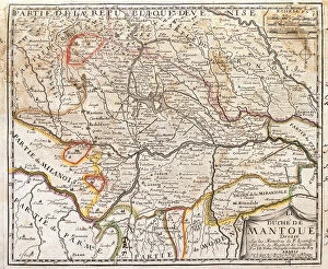
Background imageFrance Collection: Map of the province of Mantova (Italy) (Engraving, 1717)

Map of the province of Mantova (Italy) (Engraving, 1717)
LRI4712986 Map of the province of Mantova (Italy) (Engraving, 1717) by Nolin, Jean-Baptiste (c.1657-1708); Private Collection; (add.info.: Map of the Duche of Mantua (Lombardy)

Background imageFrance Collection: Antique Map of Gaul

Antique Map of Gaul
Antique Map from 1862 of Gaul at the time of Julius Caesar. The Roman proconsul and general Julius Caesar pushed his army into Gaul in 58 BC

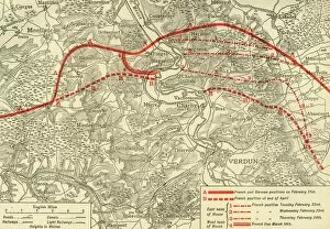
Background imageFrance Collection: positions in the Battle of Verdun, northern France, First World War, 1916, (c1920)

positions in the Battle of Verdun, northern France, First World War, 1916, (c1920)
French and German positions in the Battle of Verdun, northern France, First World War, 1916, (c1920). Solid red line indicates French

Background imageFrance Collection: WWI photo frame showing the Western Front with map

WWI photo frame showing the Western Front with map
First World War photo frame showing the Western Front with map of France and Belgium. Also shows the names of Allied Generals and various towns and cities. Trench Art. Date: 1914-1918

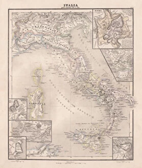
Background imageFrance Collection: Ancent Italy, c. 450 BC, steel engraving, published in 1861

Ancent Italy, c. 450 BC, steel engraving, published in 1861
The territory of Italy around 450 BC with separate maps of Rome, Roman Forum, surrounding area of Rome, Syracuse, Carthage and surrounding area of Pompeji and Naples. Legend in Latin language

Background imageFrance Collection: Romania

Romania
Antique map of Romania

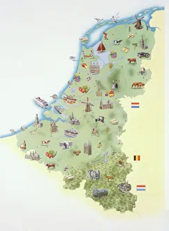
Background imageFrance Collection: Netherlands, map showing distinguishing features and landmarks

Netherlands, map showing distinguishing features and landmarks

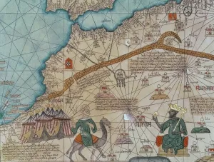
Background imageFrance Collection: Detail from the Catalan Atlas, 1375 (vellum) (detail of 151844)

Detail from the Catalan Atlas, 1375 (vellum) (detail of 151844)
XZL387496 Detail from the Catalan Atlas, 1375 (vellum) (detail of 151844) by Cresques, Abraham (1325-87); Bibliotheque Nationale, Paris

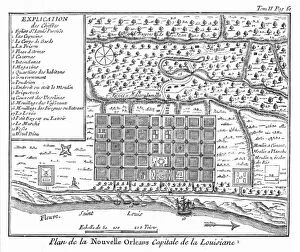
Background imageFrance Collection: Plan of New Orleans, Louisiana, 1718-1720: engraving, French, 1753

Plan of New Orleans, Louisiana, 1718-1720: engraving, French, 1753
NEW ORLEANS, 1718-1720. Plan of New Orleans, Louisiana, 1718-1720: engraving, French, 1753


All Professionally Made to Order for Quick Shipping


-

France Collection

France is a country located in Western Europe and has a total area of 643,801 square kilometers and a population of approximately 67 million people. The capital city is Paris, which is also the largest city in the country. France is known for its rich history, culture, cuisine, fashion and art and has diverse landscapes ranging from mountains to beaches and forests to vineyards. The economy is one of the largest in the world with major industries including tourism, agriculture, aerospace and technology. The country also has an extensive transportation network consisting of highways, railways and airports connecting it to other parts of Europe and beyond.
+

Our beautiful pictures are available as Framed Prints, Photos, Wall Art and Photo Gifts

The France collection from Media Storehouse is a stunning array of wall art and framed prints featuring maps and charts of various regions in France. Our collection showcases the beauty of French geography, highlighting its diverse landscapes, cities, rivers, mountains, and coastlines. From vintage maps to contemporary designs, our collection offers a wide range of styles to suit any taste or decor. Each print is expertly crafted using high-quality materials that ensure longevity and durability. The prints are available in different sizes to fit any space or wall size. Whether you're looking for an eye-catching focal point for your living room or office or want to add some French charm to your bedroom or kitchen walls, the France collection has something for everyone. Our collection is perfect for anyone who loves France's rich history and culture or wants to bring a touch of French elegance into their home.
+

What are France (Maps and Charts) art prints?

France art prints are high-quality reproductions of historical maps and charts depicting various regions of France. These prints showcase the intricate details and artistic styles of cartographers from different eras, providing a unique glimpse into the country's rich history. These art prints are perfect for those who appreciate vintage aesthetics or have an interest in geography, history, or French culture. They can be used to decorate homes, offices, classrooms, or any space that could benefit from a touch of sophistication and intellectual curiosity. We offer a wide selection of France art prints in various sizes and formats to suit different preferences. You can choose between framed or unframed options depending on their needs. With our commitment to quality printing techniques using archival materials ensures that these art prints will last for years without fading or deteriorating over time.
+

What France (Maps and Charts) art prints can I buy from Media Storehouse?

We offer a wide variety of France Maps and Charts art prints that are perfect for adding a touch of sophistication to any room. These art prints feature detailed maps and charts depicting the geography, history, culture, and landmarks of France. Whether you're looking for vintage or contemporary designs, we have something to suit every taste. Some popular options include antique maps of Paris, historical charts detailing the French Revolution, colorful illustrations showcasing famous French cities like Marseille or Lyon, and intricate topographical maps highlighting the diverse landscapes of France. These high-quality art prints are available in various sizes and formats such as canvas prints or framed prints. They make great gifts for anyone who loves travel or is interested in French culture. With so many beautiful options to choose from at Media Storehouse, you're sure to find the perfect addition to your home decor collection.
+

How do I buy France (Maps and Charts) art prints?

To buy France art prints from Media Storehouse, you can browse our extensive collection of artwork online. Once you have found the print that you would like to purchase, simply add it to your cart and proceed to checkout. During the checkout process, you will be prompted to enter your shipping information and payment details. We offer a range of sizes for their art prints, so make sure to select the size that best fits your needs. Additionally, we offer various framing options if you would like your print framed before delivery. Once your order has been placed, Media Storehouse will carefully package and ship your artwork directly to you. Their high-quality printing process ensures that each print is produced with vibrant colors and sharp detail. Whether as a gift or for personal use in decorating your home or office space, buying France art prints from Media Storehouse is an easy way to add beautiful artwork inspired by French culture into any setting.
+

How much do France (Maps and Charts) art prints cost?

We offer a wide range of France art prints at varying prices. Our collection includes vintage maps, antique charts, and contemporary illustrations that capture the beauty and history of France. The cost of our art prints depends on various factors such as size, framing options, and printing materials. We use high-quality paper stock to ensure that our art prints are long-lasting and retain their vibrant colors for years to come. Our you can choose from different sizes ranging from small to large formats depending on their preferences. Our France art prints make great gifts for friends or family members who love travel or have an interest in geography. They also add character to any living space or office setting with their unique designs. The cost of our France art prints is reasonable considering the quality of our products. We strive to provide affordable yet exceptional artwork that meets the needs of all our customers without compromising on quality.
+

How will my France (Maps and Charts) art prints be delivered to me?

We take great care in ensuring that your France art prints are delivered to you safely and securely. We use high-quality packaging materials to protect your artwork during transit, so you can be sure that it will arrive in pristine condition. All of our art prints are carefully rolled and placed into a sturdy cardboard tube for shipping. This ensures that the print is protected from any damage or creases during transportation. The tube is then sealed with tape to prevent any moisture or dust from entering. Once your order has been dispatched, you will receive an email notification with tracking information so you can keep track of its progress. Our delivery partners are reliable and experienced in handling delicate items like art prints, so you can rest assured that your order is in good hands. We strive to provide a seamless delivery experience for all our customers, ensuring their satisfaction with every purchase they make through us.