Fraud Blocker Skip to main content

Home > Maps and Charts > France

France Collection (page 25)

France is a country located in Western Europe and has a total area of 643,801 square kilometers and a population of approximately 67 million people

13,184 items

Background imageFrance Collection: 13819066

13819066

Background imageFrance Collection: 13819067

13819067

Background imageFrance Collection: Sundial, Coaching inn, Launois-sur-Vence, Ardennes, France

Sundial, Coaching inn, Launois-sur-Vence, Ardennes, France
Sundial and route map for postal and courier coaches between Launois and Paris, on a stone plaque at the coaching inn, built 1654, in Launois-sur-Vence, Ardennes, Grand Est, France

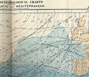
Background imageFrance Collection: RMS Titanic - shipping chart of North Atlantic

RMS Titanic - shipping chart of North Atlantic for the month of April 1912, Sheet 133, Meteorological Office, London. The chart is in colour and displays wind, sea current, sea temperature

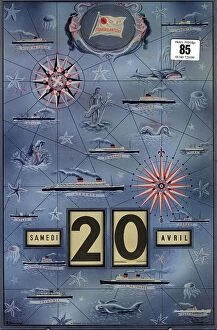
Background imageFrance Collection: Rare CGT Gerrer agent's calendar

Rare CGT Gerrer agent's calendar
Rare CGT Gerrer agent's calendar showing the ships of the line including the Ile de France. 9 x 14 inches

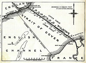
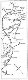
Background imageFrance Collection: Map of proposed railway Channel Tunnel

Map of proposed railway Channel Tunnel, Dover to Calais Date: circa 1850

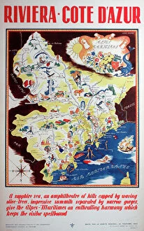
Background imageFrance Collection: Poster, French Riviera, Cote d'Azur, South of France

Poster, French Riviera, Cote d'Azur, South of France
Poster, French Riviera, Cote d'Azur, South of France Date: circa 1935

Background imageFrance Collection: Poster, Terrot Motor Cycles, Dijon, France

Poster, Terrot Motor Cycles, Dijon, France Date: 1926

Background imageFrance Collection: Antique Map of the Cinque Ports, (French: Five Ports) - 19th Century

Antique Map of the Cinque Ports, (French: Five Ports) - 19th Century
Cinque Ports, (French: Five Ports) medieval confederation of English Channel ports in southeastern England, formed to furnish ships and men for the king's service

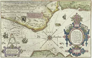
Background imageFrance Collection: Map of the Coast of Flanders, Normandy and England, 1580-81 (engraving)

Map of the Coast of Flanders, Normandy and England, 1580-81 (engraving)
7415458 Map of the Coast of Flanders, Normandy and England, 1580-81 (engraving) by Doetecum, Joannes van (1530-1605); 32 -- 51.2 cm; Rijksmuseum, Amsterdam

Background imageFrance Collection: City map of Strasbourg in 1885, France, Historic, digitally restored reproduction of a 19th

City map of Strasbourg in 1885, France, Historic, digitally restored reproduction of a 19th century original
1900s, 19th-century, accurate, alsace-champagne-ardenne-lorraine, archive, atlas, atlases, black, black-and-white, black-white, character, city maps, concept, concept image, contemporary, copy

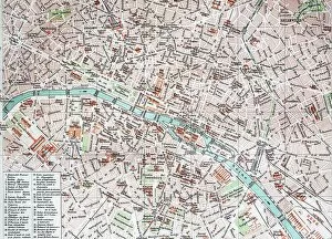
Background imageFrance Collection: Street Map of Paris, 1890, France, Historic, digitally restored reproduction of an original 19th

Street Map of Paris, 1890, France, Historic, digitally restored reproduction of an original 19th century original
1900s, 19th-century, art work, arts, artwork, artworks, black, black-and-white, black-white, card, cards, depiction, depictions, deserted, digital, digitally, drawing, drawings, drawn, early

Background imageFrance Collection: Historic greeting card, birthday card with a child and a basket of flowers, France, 1890, Historic

Historic greeting card, birthday card with a child and a basket of flowers, France, 1890, Historic
1 person, 1900s, 19th-century, art work, arts, artwork, artworks, baskets, bloom, blossoms, children, depiction, depictions, digital, digitally, drawing, drawings, drawn, flowering, flowers, genus

Background imageFrance Collection: Old chromolithograph map of French provinces claimed by Henry VIII - 1512

Old chromolithograph map of French provinces claimed by Henry VIII - 1512
Antique Illustration. Copyright has expired on this artwork. From my own archives, digitally restored

Background imageFrance Collection: Western Europe, from the series Where Our Exports Go [6321242] (colour litho)

Western Europe, from the series Where Our Exports Go [6321242] (colour litho)
MAN464497 Western Europe, from the series Where Our Exports Go [6321242] (colour litho) by Grimmond, William (1884-1952); Manchester Art Gallery, UK; (add.info.: See 6320722, 452963, 452962, 464497)

Background imageFrance Collection: Battle of Green Spring, Map of the land on the left bank of the James River opposite Jamestown in

Battle of Green Spring, Map of the land on the left bank of the James River opposite Jamestown in Virginia where
7411767 Battle of Green Spring, Map of the land on the left bank of the James River opposite Jamestown in Virginia where the battle of July 6

Background imageFrance Collection: Map of Newport and Rhode Island, 1780 (pen, ink, watercolor)

Map of Newport and Rhode Island, 1780 (pen, ink, watercolor)
7408030 Map of Newport and Rhode Island, 1780 (pen, ink, watercolor) by French School, (18th century); 48 x 98 cm; (add.info.: This was a preliminary draft for other French maps of Newport)

Background imageFrance Collection: Map of Newport, Rhode Island, 1780 (pen, ink, watercolor)

Map of Newport, Rhode Island, 1780 (pen, ink, watercolor)
7408031 Map of Newport, Rhode Island, 1780 (pen, ink, watercolor) by French School, (18th century); 58 x 61 cm; (add.info.: Map of the city, port, and harbor of Newport, with part of Rhode Island)

Background imageFrance Collection: Colbert Presenting the Members of the Royal Academy of Sciences to Louis XIV in 1667 (oil on canvas)

Colbert Presenting the Members of the Royal Academy of Sciences to Louis XIV in 1667 (oil on canvas)
JLJ4626852 Colbert Presenting the Members of the Royal Academy of Sciences to Louis XIV in 1667 (oil on canvas) by Testelin

Background imageFrance Collection: Old chromolithograph map of siege of Strasbourg, France

Old chromolithograph map of siege of Strasbourg, France
Copyright has expired on this artwork. From my own archives, digitally restored

Background imageFrance Collection: Old chromolithograph map of Paris, capital and most populous city of France

Old chromolithograph map of Paris, capital and most populous city of France
Antique Illustration, Copyright has expired on this artwork. From my own archives, digitally restored

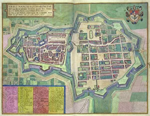
Background imageFrance Collection: Map of Nancy, from Civitates Orbis Terrarum by Georg Braun (1541-1622)

Map of Nancy, from Civitates Orbis Terrarum by Georg Braun (1541-1622) and Frans Hogenberg (1535-90) c
STC138946 Map of Nancy, from Civitates Orbis Terrarum by Georg Braun (1541-1622) and Frans Hogenberg (1535-90) c.1572-1617 (coloured engraving) by Hoefnagel

Background imageFrance Collection: Emperor Albert I of Habsburg (1255-1308) studying the map of France at the time of the conflict

Emperor Albert I of Habsburg (1255-1308) studying the map of France at the time of the conflict between Pope Boniface
ELD4931939 Emperor Albert I of Habsburg (1255-1308) studying the map of France at the time of the conflict between Pope Boniface VIII and King Philip IV of France

Background imageFrance Collection: Universal hydrographic map. Manuscript by Jean Guerard, French geographer. 1734. paris, B. N

Universal hydrographic map. Manuscript by Jean Guerard, French geographer. 1734. paris, B. N
JLJ4592059 Universal hydrographic map. Manuscript by Jean Guerard, French geographer. 1734. paris, B.N. by Guerard, Jean (active 1612-1634); Bibliotheque Nationale, Paris

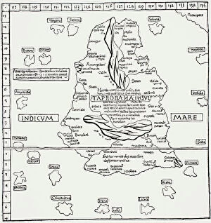
Background imageFrance Collection: Map of Taprobana island, Reduced facsimile of a map in Ptolemy's Geography

Map of Taprobana island, Reduced facsimile of a map in Ptolemy's Geography, in the Latin Edition of 1492
3661329 Map of Taprobana island, Reduced facsimile of a map in Ptolemy's Geography, in the Latin Edition of 1492, from Science and Literature in The Middle Ages by Paul Lacroix pub

Background imageFrance Collection: Representation of a geographic map of France at the end of the 19th century with areas

Representation of a geographic map of France at the end of the 19th century with areas corresponding to diseases
ELD4948341 Representation of a geographic map of France at the end of the 19th century with areas corresponding to diseases (scrofule, phtisia, malaria, goiter and cretinism, pellagre, moth)

Background imageFrance Collection: Old chromolithograph map of France - Northeast part

Old chromolithograph map of France - Northeast part
Antique Illustration, Copyright has expired on this artwork. From my own archives, digitally restored

Background imageFrance Collection: Old chromolithograph map of France - Treaty of Luneville (or Peace of Luneville) - 9 February 1801

Old chromolithograph map of France - Treaty of Luneville (or Peace of Luneville) - 9 February 1801
Antique Illustration, Copyright has expired on this artwork. From my own archives, digitally restored

Background imageFrance Collection: Old chromolithograph map of France after the Treaty of Bretigny

Old chromolithograph map of France after the Treaty of Bretigny and France at the death of Edward III
Antique Illustration, Copyright has expired on this artwork. From my own archives, digitally restored

Background imageFrance Collection: Old chromolithograph map of France under Charles VIII

Old chromolithograph map of France under Charles VIII
Antique Illustration, Copyright has expired on this artwork. From my own archives, digitally restored

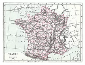
Background imageFrance Collection: Old chromolithograph map of France in Departments, 1790

Old chromolithograph map of France in Departments, 1790
Antique Illustration, Copyright has expired on this artwork. From my own archives, digitally restored

Background imageFrance Collection: Old chromolithograph map of France in Provinces (1769-1789)

Old chromolithograph map of France in Provinces (1769-1789)
Antique Illustration, Copyright has expired on this artwork. From my own archives, digitally restored

Background imageFrance Collection: Old chromolithograph map of France of the accession of Louis XI - 1461

Old chromolithograph map of France of the accession of Louis XI - 1461
Antique Illustration, Copyright has expired on this artwork. From my own archives, digitally restored

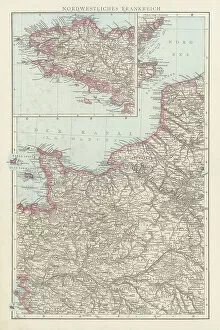
Background imageFrance Collection: Old chromolithograph map of France - Northwest part

Old chromolithograph map of France - Northwest part
Antique Illustration, Copyright has expired on this artwork. From my own archives, digitally restored

Background imageFrance Collection: Old chromolithograph map of France

Old chromolithograph map of France
Antique Illustration, Copyright has expired on this artwork. From my own archives, digitally restored

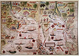
Background imageFrance Collection: The Indes Portuguese nautical atlas. Page of the Atlas Miller manuscript made in 1519 by Pierre

The Indes Portuguese nautical atlas. Page of the Atlas Miller manuscript made in 1519 by Pierre and Georges Reinel
JLJ4595288 The Indes Portuguese nautical atlas. Page of the Atlas Miller manuscript made in 1519 by Pierre and Georges Reinel, Lopo Homem (cartographers) and Antoine de Hollande (miniaturist)

Background imageFrance Collection: Map of the Island of Taprobana

Map of the Island of Taprobana
3786002 Map of the Island of Taprobana by French School, (19th century); (add.info.: Map of the Island of Taprobana - from reduced fac-simile of map in Ptolemy's Georgraphy, Latin edition, 1492)

Background imageFrance Collection: First World War - War 14-18 (1914-1918) - World War I (WWI or WW1): France

First World War - War 14-18 (1914-1918) - World War I (WWI or WW1): France
LUX4740403 First World War - War 14-18 (1914-1918) - World War I (WWI or WW1): France, Patriotic Map showing a drawing of a soldier in a trench watching the front line, titled: listening, 1915

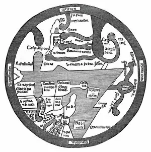
Background imageFrance Collection: Map of the Roman World

Map of the Roman World
3785954 Map of the Roman World by French School, (19th century); (add.info.: Map of the Roman World - from Liber Guidonis, manuscript of 1119)

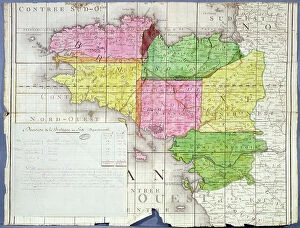
Background imageFrance Collection: Division of Brittany into Six Departments, c. 1789-90 (colour litho)

Division of Brittany into Six Departments, c. 1789-90 (colour litho)
ARH207437 Division of Brittany into Six Departments, c.1789-90 (colour litho) by French School, (18th century); Centre Historique des Archives Nationales, Paris, France; © Archives Charmet

Background imageFrance Collection: Map of Gaul - fragment

Map of Gaul - fragment
3785945 Map of Gaul - fragment by French School, (19th century); (add.info.: Map of Gaul - fragment. From reduced fac-simile of Pentinger's map in 13th century manuscript. (Imperial Library, Vienna)

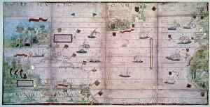
Background imageFrance Collection: Map of the North Atlantic Ocean, 16th century (miniature)

Map of the North Atlantic Ocean, 16th century (miniature)
JLJ4592290 Map of the North Atlantic Ocean, 16th century (miniature) by Hollande, Antoine de (active c.1519); Bibliotheque Nationale, Paris, France; (add.info.: Map of the North Atlantic Ocean)

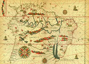
Background imageFrance Collection: Map of South America

Map of South America
3785948 Map of South America by French School, (19th century); (add.info.: Map of South America - from reduced reproduction of map in Spanish atlas by Joan Martines at Messina, 1582)

Background imageFrance Collection: Map of South America 19th Century

Map of South America 19th Century
Vintage map of South America from the 19th Century

Background imageFrance Collection: Kingdom of France Divided into its Governments

Kingdom of France Divided into its Governments
Maps, TR002309

Background imageFrance Collection: Benito Mussolini seizes power in Italy, 1922 (illustration)

Benito Mussolini seizes power in Italy, 1922 (illustration)
7343427 Benito Mussolini seizes power in Italy, 1922 (illustration) by Lecoultre, Marcel (1867-1942); (add.info.: Benito Mussolini (1883-1945), leader of fascism

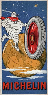
Background imageFrance Collection: Michelin man. (illustration, circa 1930)

Michelin man. (illustration, circa 1930)
5975666 Michelin man. (illustration, circa 1930) by Rossillon, Marius (O'Galop) (1867-1946); Private Collection; (add.info.: Geography. France)

Background imageFrance Collection: Mont Saint Michel

Mont Saint Michel
1837115 Mont Saint Michel by Fer, Nicolas de (1646-1720); (add.info.: The Mont-Saint-Michel (Normandy, France) : map by Nicolas de Fer, France, 1703); Photo © CCI


All Professionally Made to Order for Quick Shipping


-

France Collection

France is a country located in Western Europe and has a total area of 643,801 square kilometers and a population of approximately 67 million people. The capital city is Paris, which is also the largest city in the country. France is known for its rich history, culture, cuisine, fashion and art and has diverse landscapes ranging from mountains to beaches and forests to vineyards. The economy is one of the largest in the world with major industries including tourism, agriculture, aerospace and technology. The country also has an extensive transportation network consisting of highways, railways and airports connecting it to other parts of Europe and beyond.
+

Our beautiful pictures are available as Framed Prints, Photos, Wall Art and Photo Gifts

The France collection from Media Storehouse is a stunning array of wall art and framed prints featuring maps and charts of various regions in France. Our collection showcases the beauty of French geography, highlighting its diverse landscapes, cities, rivers, mountains, and coastlines. From vintage maps to contemporary designs, our collection offers a wide range of styles to suit any taste or decor. Each print is expertly crafted using high-quality materials that ensure longevity and durability. The prints are available in different sizes to fit any space or wall size. Whether you're looking for an eye-catching focal point for your living room or office or want to add some French charm to your bedroom or kitchen walls, the France collection has something for everyone. Our collection is perfect for anyone who loves France's rich history and culture or wants to bring a touch of French elegance into their home.
+

What are France (Maps and Charts) art prints?

France art prints are high-quality reproductions of historical maps and charts depicting various regions of France. These prints showcase the intricate details and artistic styles of cartographers from different eras, providing a unique glimpse into the country's rich history. These art prints are perfect for those who appreciate vintage aesthetics or have an interest in geography, history, or French culture. They can be used to decorate homes, offices, classrooms, or any space that could benefit from a touch of sophistication and intellectual curiosity. We offer a wide selection of France art prints in various sizes and formats to suit different preferences. You can choose between framed or unframed options depending on their needs. With our commitment to quality printing techniques using archival materials ensures that these art prints will last for years without fading or deteriorating over time.
+

What France (Maps and Charts) art prints can I buy from Media Storehouse?

We offer a wide variety of France Maps and Charts art prints that are perfect for adding a touch of sophistication to any room. These art prints feature detailed maps and charts depicting the geography, history, culture, and landmarks of France. Whether you're looking for vintage or contemporary designs, we have something to suit every taste. Some popular options include antique maps of Paris, historical charts detailing the French Revolution, colorful illustrations showcasing famous French cities like Marseille or Lyon, and intricate topographical maps highlighting the diverse landscapes of France. These high-quality art prints are available in various sizes and formats such as canvas prints or framed prints. They make great gifts for anyone who loves travel or is interested in French culture. With so many beautiful options to choose from at Media Storehouse, you're sure to find the perfect addition to your home decor collection.
+

How do I buy France (Maps and Charts) art prints?

To buy France art prints from Media Storehouse, you can browse our extensive collection of artwork online. Once you have found the print that you would like to purchase, simply add it to your cart and proceed to checkout. During the checkout process, you will be prompted to enter your shipping information and payment details. We offer a range of sizes for their art prints, so make sure to select the size that best fits your needs. Additionally, we offer various framing options if you would like your print framed before delivery. Once your order has been placed, Media Storehouse will carefully package and ship your artwork directly to you. Their high-quality printing process ensures that each print is produced with vibrant colors and sharp detail. Whether as a gift or for personal use in decorating your home or office space, buying France art prints from Media Storehouse is an easy way to add beautiful artwork inspired by French culture into any setting.
+

How much do France (Maps and Charts) art prints cost?

We offer a wide range of France art prints at varying prices. Our collection includes vintage maps, antique charts, and contemporary illustrations that capture the beauty and history of France. The cost of our art prints depends on various factors such as size, framing options, and printing materials. We use high-quality paper stock to ensure that our art prints are long-lasting and retain their vibrant colors for years to come. Our you can choose from different sizes ranging from small to large formats depending on their preferences. Our France art prints make great gifts for friends or family members who love travel or have an interest in geography. They also add character to any living space or office setting with their unique designs. The cost of our France art prints is reasonable considering the quality of our products. We strive to provide affordable yet exceptional artwork that meets the needs of all our customers without compromising on quality.
+

How will my France (Maps and Charts) art prints be delivered to me?

We take great care in ensuring that your France art prints are delivered to you safely and securely. We use high-quality packaging materials to protect your artwork during transit, so you can be sure that it will arrive in pristine condition. All of our art prints are carefully rolled and placed into a sturdy cardboard tube for shipping. This ensures that the print is protected from any damage or creases during transportation. The tube is then sealed with tape to prevent any moisture or dust from entering. Once your order has been dispatched, you will receive an email notification with tracking information so you can keep track of its progress. Our delivery partners are reliable and experienced in handling delicate items like art prints, so you can rest assured that your order is in good hands. We strive to provide a seamless delivery experience for all our customers, ensuring their satisfaction with every purchase they make through us.