Fraud Blocker Skip to main content

Home > Maps and Charts > Early Maps

Early Maps Collection (page 7)

Early maps, also known as maps and charts, were created by ancient civilizations to navigate their surroundings

26,995 items

Background imageEarly Maps Collection: Lorgues / Caribbean Map

Lorgues / Caribbean Map
A map showing the travels of Columbus in the Caribbean

Background imageEarly Maps Collection: Atlantis / Map

Atlantis / Map
Map showing Atlantis during the period of its greatest prosperity

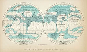
Background imageEarly Maps Collection: French map of the planet Mars

French map of the planet Mars
A French map of the planet Mars, showing two views

Background imageEarly Maps Collection: ABC OF BABAR O, 1939 (illustration)

ABC OF BABAR O, 1939 (illustration)
7206800 ABC OF BABAR O, 1939 (illustration) by Brunhoff, Jean de (1899-1937); 22x16, 5 cm; Private Collection; (add.info.: O: 7 words to find: oranges, orange trees, olive trees, umbrellas, bears)

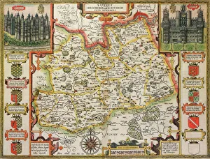
Background imageEarly Maps Collection: Surrey Historical John Speed 1610 Map

Surrey Historical John Speed 1610 Map
A reproduction of John Speeds historical map of the county of Surrey. Originally published as part of his atlas called The Theatre of the Empire of Great Britain in 1610

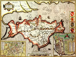
Background imageEarly Maps Collection: Isle of Wight Historical John Speed 1610 Map

Isle of Wight Historical John Speed 1610 Map
A reproduction of John Speeds historical map of the county of Isle of Wight. Originally published as part of his atlas called The Theatre of the Empire of Great Britain in 1610

Background imageEarly Maps Collection: Historical World Events map 1919 UK version

Historical World Events map 1919 UK version
A world map originally published in 1919, reproduced from the internationally famousCollins Bartholomew World Through Timehistoric cartographic archive

Background imageEarly Maps Collection: Historical city map of Prague, Czech Republic, lithograph, published 1897

Historical city map of Prague, Czech Republic, lithograph, published 1897
Historical city map of Prague, capital and largest city of Czech Republic. Lithograph, published in 1897

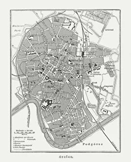
Background imageEarly Maps Collection: Historical city map of Krakow, Poland, wood engraving, published 1897

Historical city map of Krakow, Poland, wood engraving, published 1897
Historical city map of Krakow, Poland. Wood engraving, published in 1897

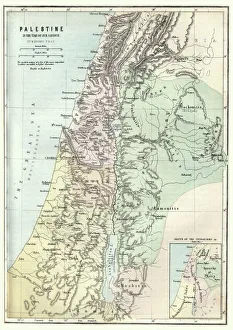
Background imageEarly Maps Collection: Map of Palestine in the time of Jesus Christ

Map of Palestine in the time of Jesus Christ
Vintage engraving of Map of Palestine in the time of Jesus Christ

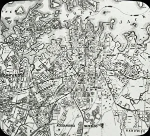
Background imageEarly Maps Collection: Sydney, Australia - Map of Sydney and Port Jackson

Sydney, Australia - Map of Sydney and Port Jackson
Slide showing a map of Sydney and Port Jackson, with the areas of the city labelled.. Boswell Collection. Slide number 5. Sydney is the most populous city in Australia

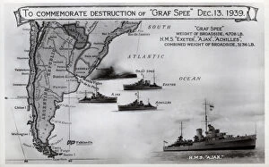
Background imageEarly Maps Collection: Card commemorating Graf Spee destruction, WW2

Card commemorating Graf Spee destruction, WW2
Card commemorating the destruction of the German cruiser, Admiral Graf Spee, on 13 December 1939 by HMS Exeter, Ajax and Achilles following the Battle of the River Plate. Date: 1939

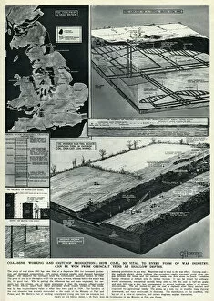
Background imageEarly Maps Collection: Coal mining by G. H. Davis

Coal mining by G. H. Davis
Coal mine working and outcrop production: how coal, so vital to every form of war industry, can be won from opencast veins at shallow depths. Date: 1944

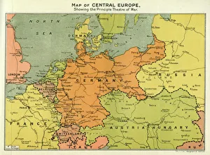
Background imageEarly Maps Collection: Map of Central Europe, World War One

Map of Central Europe, World War One
Map of Central Europe in World War One, showing the Principal Theatre of War. Date: World War One

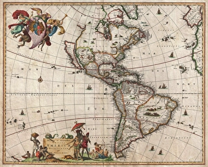
Background imageEarly Maps Collection: 1658, Visscher Map of North America and South America, topography, cartography, geography

1658, Visscher Map of North America and South America, topography, cartography, geography
1658, Visscher Map of North America and South America

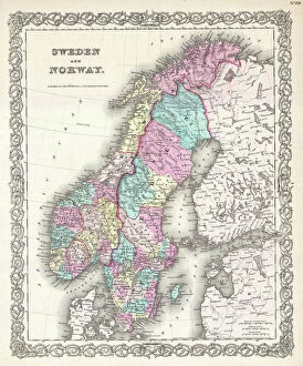
Background imageEarly Maps Collection: 1855, Colton Map of Scandinavia, Norway, Sweden, Finland, topography, cartography

1855, Colton Map of Scandinavia, Norway, Sweden, Finland, topography, cartography
1855, Colton Map of Scandinavia, Norway, Sweden, Finland

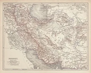
Background imageEarly Maps Collection: Ancient map of Persia, lithograph, published in 1877

Ancient map of Persia, lithograph, published in 1877
Ancient map of Persia. Lithograph, published in 1877

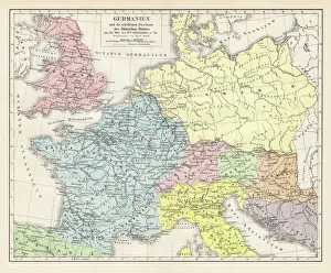
Background imageEarly Maps Collection: Germany and the northern provinces of the roman empire map 1895

Germany and the northern provinces of the roman empire map 1895
Encyclopedia Britannica 9th Edition Vol I New York, Samuel Hall 1878

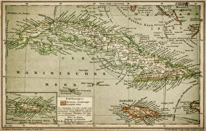
Background imageEarly Maps Collection: Caribbean map

Caribbean map
Antique map of Cuba, Jamaica, Puerto Rico

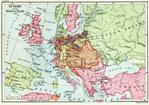
Background imageEarly Maps Collection: Map of Europe after the Peace of Tilsit in 1807, from A Short History of the

Map of Europe after the Peace of Tilsit in 1807, from A Short History of the
KW392529 Map of Europe after the Peace of Tilsit in 1807, from A Short History of the English People by J. R. Green, published 1893 (colour litho) by English School

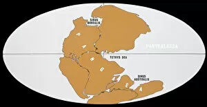
Background imageEarly Maps Collection: Continental Drift

Continental Drift
The world 200 million years ago in Upper Triassic times, showing the single continent of Pangaea and the universal ocean, Panthalassa

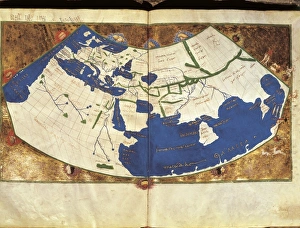
Background imageEarly Maps Collection: PTOLEMY, Claudius Ptolemaeus ( c. AD 100 - c

PTOLEMY, Claudius Ptolemaeus ( c. AD 100 - c
" PTOLEMY, Claudius Ptolemaeus ( c. AD 100 - c. AD 170). Egyptian astronomer, mathematician and geographer. Map of the Ancient World. From the work " Ptolomeus Geographicorum Libri"

Background imageEarly Maps Collection: Albourne Tithe Map, 1838

Albourne Tithe Map, 1838
Surveyed by Willm Bishop Harding, Land Surveyor & Draughtsman of Frome, Somerset, Septr 1838. Copied by Willm Duncum, March 1841.rn26.6 in. to 1 m. Original map sixe 80in. × 48in

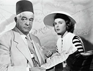
Background imageEarly Maps Collection: FILM: CASABLANCA, 1942. Sidney Greenstreet and Ingrid Bergman in Casablanca directed by Michael

FILM: CASABLANCA, 1942. Sidney Greenstreet and Ingrid Bergman in Casablanca directed by Michael Curtiz, 1942

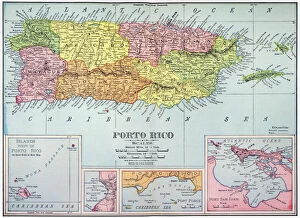
Background imageEarly Maps Collection: MAP: PUERTO RICO, 1900. Map of Puerto Rico printed in the United States, c1900

MAP: PUERTO RICO, 1900. Map of Puerto Rico printed in the United States, c1900

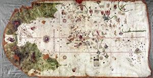
Background imageEarly Maps Collection: NINA: WORLD MAP, 1500. World map, 1500, of Juan de la Cosa, navigator on the Nina on Christopher

NINA: WORLD MAP, 1500. World map, 1500, of Juan de la Cosa, navigator on the Nina on Christopher Columbus second voyage of 1493-94

Background imageEarly Maps Collection: MAP OF THE ROMAN EMPIRE. From the 1595 atlas, Theatrum Orbis Terrarum

MAP OF THE ROMAN EMPIRE. From the 1595 atlas, Theatrum Orbis Terrarum, by Abraham Oertel, also known as Ortelius, featuring portraits of Roma, deity of ancient Rome, and Romulus

Background imageEarly Maps Collection: Apollo 14 astronaut on the Moon

Apollo 14 astronaut on the Moon
Apollo 14 astronaut Edgar D. Mitchell walking on the Moon and studying a map during the Apollo 14 moon landings. The gravity on the Moon is around a sixth of that on earth

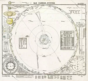
Background imageEarly Maps Collection: Solar system map from 1853

Solar system map from 1853
Historical map of the solar system, published in Germany in 1853. The main diagram shows the orbits of the first seven planets out to Uranus

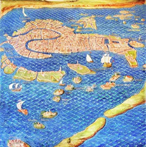
Background imageEarly Maps Collection: 16th century map of Venice

16th century map of Venice showing the lagoon. Venice is a coastal city in the north-east of Italy. The main bulk of Venice is in the upper frame of the image

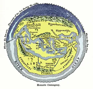
Background imageEarly Maps Collection: Homeric cosmogony

Homeric cosmogony. Map of the Earth based on the myths and knowledge of the Ancient Greeks at the time of Homer (1st or 2nd millennium BC)

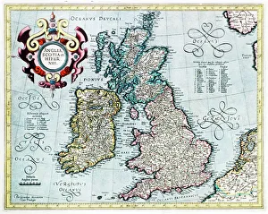
Background imageEarly Maps Collection: 16th century map of the British Isles

16th century map of the British Isles
British Isles, 16th century Dutch map. This shows England, Scotland, Wales and Ireland, though Ireland is not yet accurately mapped. Published in 1595, from work by Gerard Mercator

Background imageEarly Maps Collection: 16th century world map

16th century world map made by Pierre Desceliers in 1546 on a commission by King Francis I for Henri II of France. Most noticeable is that the Northern hemisphere is upside-down

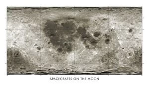
Background imageEarly Maps Collection: Spacecraft on the Moon, lunar map

Spacecraft on the Moon, lunar map
Spacecraft on the Moon. Map showing coloured markers for 34 spacecraft that impacted or landed on the Moon from the 1960s onwards

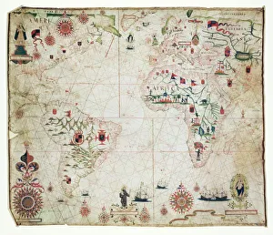
Background imageEarly Maps Collection: 17th Century nautical map of the Atlantic

17th Century nautical map of the Atlantic Ocean. Historical portolan chart showing the Atlantic Ocean and adjacent continents

Background imageEarly Maps Collection: Geological map, South-East England, 1830s

Geological map, South-East England, 1830s. This map, dating from between 1830 and 1833, shows the denudation of The Weald

Background imageEarly Maps Collection: Universe timeline, artwork

Universe timeline, artwork
Big Bang and Evolution of Galaxies - The observable Universe is about 84 billion light years across. According to the standard view of cosmolog

Background imageEarly Maps Collection: Universe timeline, artwork

Universe timeline, artwork
Big Bang and Evolution of Galaxies - The observable Universe is about 84 billion light years across. According to the standard view of cosmolog

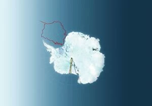
Background imageEarly Maps Collection: Antarctic exploration, route maps

Antarctic exploration, route maps
Antarctic exploration. Map of Antarctica showing the routes taken by Ernest Shackleton (1914 to 1916, red), Roald Amundsen (1911 to 1912, brown), Robert Scott (1911 to 1912)

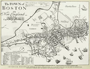
Background imageEarly Maps Collection: BOSTON MAP, 1722. Engraved facsimile by George G. Smith, 1835, of a map of Boston, Massachusetts

BOSTON MAP, 1722. Engraved facsimile by George G. Smith, 1835, of a map of Boston, Massachusetts, by John Bonner, first printed in 1722, showing changes in the citys topography through 1769

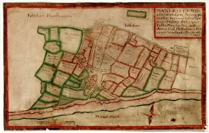
Background imageEarly Maps Collection: Map of the Manor of Middleton, 1606

Map of the Manor of Middleton, 1606
Map of the Manor of Middleton, surveyed by John Norden, showing land in the south-west of the Parish of Middleton, including buildings such as St Nicholas Church that are now under the sea Additional

Background imageEarly Maps Collection: Ancient Mesopotamia

Ancient Mesopotamia
Map of the ancient Tigris and Euphrates region. Printed color 19th-century illustration

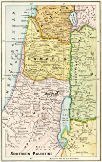
Background imageEarly Maps Collection: Southern Palestine in ancient times

Southern Palestine in ancient times
Map of southern Palestine in ancient times. Printed color lithograph of a 19th-century illustration

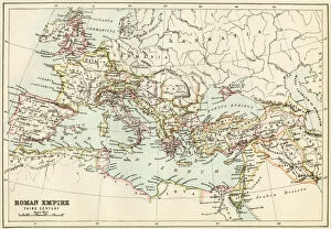
Background imageEarly Maps Collection: Roman Empire, circa 200 AD

Roman Empire, circa 200 AD
Map of the Roman Empire in the third century. Printed color lithograph of a 19th-century illustration

Background imageEarly Maps Collection: WW1 naval blockades

WW1 naval blockades
Map of English and German naval blockades around Britain, France, Belgium, Germany, Denmark and Norway

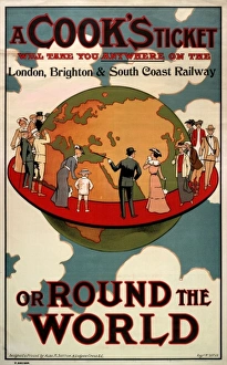
Background imageEarly Maps Collection: A Cooks Ticket will take you anywhere

A Cooks Ticket will take you anywhere
A poster or handbill advertising the fact that a Cooks ticket will take you anywhere on the London, Brighton and South Coast Railway, or round the world

Background imageEarly Maps Collection: A Map of the Island of Chios

A Map of the Island of Chios
A Turkish Map of the Greek Island of Chios, at this point under Ottoman Turkish control. The island is in the Aegean Sea only 5 miles off the coast of Asia Minor

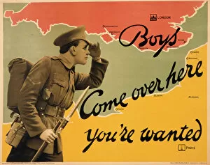
Background imageEarly Maps Collection: World War I recruitment poster

World War I recruitment poster
Poster produced by the Parliamentary Recruiting Committee during World War I, depicting a typical British Tommy in uniform with bayonet fixed, calling across from France to England for more volunteers


All Professionally Made to Order for Quick Shipping


-

Early Maps Collection

Early maps, also known as maps and charts, were created by ancient civilizations to navigate their surroundings. These early cartographers used various techniques such as observation, measurement, and estimation to create accurate depictions of the world around them. The earliest known map dates back to 6th century BCE in Babylonia. As time progressed, more advanced mapping techniques were developed including the use of longitude and latitude lines for navigation purposes. Maps have played a significant role in history by aiding explorers in discovering new lands and helping nations establish boundaries. Today, they can valuable artifacts that provide insight into the past and serve as a reminder of how far cartography has come over time.
+

Our beautiful pictures are available as Framed Prints, Photos, Wall Art and Photo Gifts

The Early Maps collection from Media Storehouse is a fascinating assortment of historical maps and charts that offer an insight into the evolution of cartography. Our collection features antique maps dating back to the 16th century, including world maps, regional maps, city plans, and nautical charts. These meticulously crafted pieces are not only visually stunning but also provide valuable information about the geography, topography, and political boundaries of different regions throughout history. The Early Maps collection offers a unique opportunity for art enthusiasts, historians or anyone interested in exploring the past through visual representation. The prints are available in various sizes and formats such as canvas prints or framed wall art making them suitable for any home or office decor. Whether you're looking to add a touch of vintage charm to your living space or seeking inspiration for research projects on historical geography or navigation techniques - our collection has something for everyone.
+

What are Early Maps (Maps and Charts) art prints?

Early Maps art prints are reproductions of historical maps and charts that were created centuries ago. These maps were originally made by cartographers who used various techniques to accurately depict the geography, topography, and other features of different regions around the world. Early Maps art prints offer a glimpse into how people perceived the world in earlier times, as well as providing valuable information about past civilizations, cultures, and trade routes. These art prints are ideal for history buffs, collectors or anyone who appreciates vintage artwork. They can be displayed in homes or offices to add a touch of elegance and sophistication to any space. We offer a wide variety of Early Maps art prints from different eras such as medieval Europe, ancient Rome or China during the Ming dynasty. These beautiful reproductions provide an opportunity for individuals to own a piece of history while also enjoying stunning works of art that showcase incredible craftsmanship from long ago.
+

What Early Maps (Maps and Charts) art prints can I buy from Media Storehouse?

We offer a wide range of early maps and charts art prints for purchase. These include antique world maps, vintage city plans, historical nautical charts, and topographical surveys from various periods in history. Some of the most popular collections available on Media Storehouse are the 16th-century world maps by Gerardus Mercator and Abraham Ortelius, as well as the 18th-century British county maps by John Speed. In addition to these classic pieces, Media Storehouse also has an extensive collection of rare and unique maps that showcase different regions around the globe. Whether you're looking for a map of ancient Rome or a detailed chart of the Caribbean islands from the 17th century, there is something for everyone at Media Storehouse. All art prints are produced using high-quality materials to ensure they look great on any wall. They come in a variety of sizes and finishes to suit your needs. With so many options available, finding the perfect early map or chart print has never been easier.
+

How do I buy Early Maps (Maps and Charts) art prints?

To buy Early Maps art prints from Media Storehouse, you can browse our online collection of maps and charts. Once you have found the print that you like, simply add it to your cart and proceed to checkout. You will be prompted to enter your shipping information and payment details. After completing your purchase, your print will be printed on high-quality paper using archival inks. We offer a wide range of sizes for their prints so that you can choose the perfect size for your space. We also offer framing options if you prefer to receive a framed print rather than an unframed one. Whether you are looking for antique maps or modern interpretations of historical cartography, we have a vast selection of Early Maps art prints available for purchase. Our easy-to-use website makes it simple to find the perfect piece of artwork for any room in your home or office.
+

How much do Early Maps (Maps and Charts) art prints cost?

We offer a wide range of Early Maps art prints that vary in price depending on the size and type of print you choose. Our prices are competitive and affordable, making it easy for anyone to own a piece of history through our collection of vintage maps and charts. Our Early Maps art prints come in various sizes ranging from small to large, so you can find the perfect fit for your home or office space. We also offer different types of paper finishes such as matte or glossy to suit your preference. Whether you're looking for a unique gift or want to add some character to your living space, our Early Maps art prints are an excellent choice. With their intricate details and historical significance, they make for fascinating conversation starters while adding charm to any room.
+

How will my Early Maps (Maps and Charts) art prints be delivered to me?

We take great care in delivering your Early Maps art prints to you. We use high-quality packaging materials to ensure that your prints are protected during transit. Depending on the size of your order, we may use either a sturdy cardboard tube or a flat package with reinforced corners. We work closely with our trusted delivery partners to ensure that your order arrives safely and on time. Our standard delivery service is reliable and efficient, but if you need your order urgently, we also offer express shipping options for an additional fee. Once your order has been dispatched, you will receive a tracking number so that you can monitor its progress online. If there are any issues with the delivery of your print(s), please do not hesitate to contact us - our friendly customer service team will be happy to assist you in resolving any problems as quickly as possible.