Fraud Blocker Skip to main content

Home > Maps and Charts > Early Maps

Early Maps Collection (page 3)

Early maps, also known as maps and charts, were created by ancient civilizations to navigate their surroundings

27,346 items

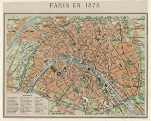
Background imageEarly Maps Collection: Street Map 1878

Street Map 1878
An aerial map of Paris, showing the important monuments and the Seine

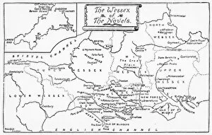
Background imageEarly Maps Collection: Map of Wessex

Map of Wessex
A map of the Wessex of the novels

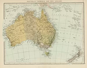
Background imageEarly Maps Collection: Maps / Australia / New Zea

Maps / Australia / New Zea
Map showing Australia, Tasmania, New Zealand and neighbouring islands

Background imageEarly Maps Collection: England in the Ninth Century

England in the Ninth Century
An antique map from 1875 showing the different kingdoms of England in the 9th century

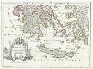
Background imageEarly Maps Collection: 1794, Delisle Map of Southern Ancient Greece, Greeks Isles, and Crete, topography

1794, Delisle Map of Southern Ancient Greece, Greeks Isles, and Crete, topography
1794, Delisle Map of Southern Ancient Greece, Greeks Isles, and Crete

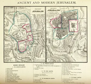
Background imageEarly Maps Collection: Ancient and Modern Jerusalem Map Engraving

Ancient and Modern Jerusalem Map Engraving
Engraved illustration of Ancient and Modern Jerusalem Map Engraving from The Popular Pictorial Bible, Containing the Old and New Testaments, Published in 1862. Copyright has expired on this artwork

Background imageEarly Maps Collection: Map of Ancient Egypt

Map of Ancient Egypt. Date: 1814

Background imageEarly Maps Collection: Oldest map of Palestine, mosaic, dated AD 560, St. Georges Church, Madaba, Jordan

Oldest map of Palestine, mosaic, dated AD 560, St. Georges Church, Madaba, Jordan, Middle East

Background imageEarly Maps Collection: MAP: HAWAII, 1905. Map of the Hawaiian Islands printed in the United States in 1905

MAP: HAWAII, 1905. Map of the Hawaiian Islands printed in the United States in 1905

Background imageEarly Maps Collection: MADABA MAP, 6TH CENTURY. The Madaba Mosaic Map, the oldest known map of the city of Jerusalem

MADABA MAP, 6TH CENTURY. The Madaba Mosaic Map, the oldest known map of the city of Jerusalem, located in the Byzantine Church of Saint George at Madaba, Jordan, 6th century A.D

Background imageEarly Maps Collection: Durers world map, 1515

Durers world map, 1515. Albrecht Durer (1471- 1528) was a German artist. His skillful use of perspective and mathematical proportions made him one of the outstanding artistic figures of the early

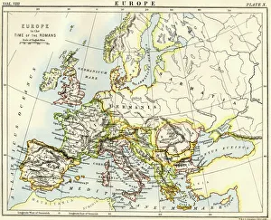
Background imageEarly Maps Collection: Map of Europe under the Roman Empire

Map of Europe under the Roman Empire
Map of Europe in the time of the Roman Empire. Printed color lithograph of a 19th-century illustration
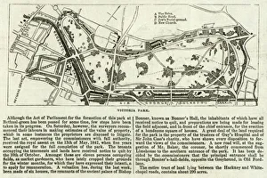
Background imageEarly Maps Collection: Map of Victoria Park

Map of Victoria Park
The proprosed plan of Victoria Park, Bethnal Green. The entire tract of land lying between the Hackney and Whitechapel roads contains about 290 acres
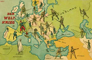
Background imageEarly Maps Collection: World War One Combatants - Map of Europe

World War One Combatants - Map of Europe
The World War. World War One Combatants superimposed on a Map of Europe

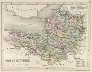
Background imageEarly Maps Collection: Map / Somerset C1857

Map / Somerset C1857
Map of Somerset

Background imageEarly Maps Collection: Map / Suffolk C1857

Map / Suffolk C1857
Map of Suffolk

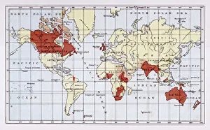
Background imageEarly Maps Collection: British Empire Map 1880

British Empire Map 1880
Map showing the extent of the British Empire circa 1880

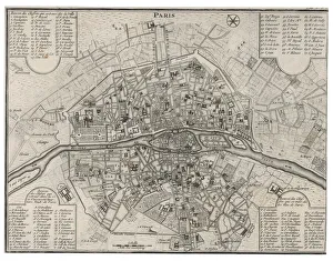
Background imageEarly Maps Collection: Map / Paris 18C

Map / Paris 18C
Detailed map of Paris, showing the many churches

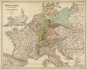
Background imageEarly Maps Collection: Map / Europe / Germany 1871

Map / Europe / Germany 1871
Imperial Germany after the Franco- Prussian War, showing Alsace and Lorraine as part of the country, not to mention huge chunks of Poland in East Prussia

Background imageEarly Maps Collection: Napoleon / St Helena Map

Napoleon / St Helena Map
NAPOLEON I Map of the island of Saint Helena during his captivity

Background imageEarly Maps Collection: Map / Asia / China 1864

Map / Asia / China 1864
CANTON and the PEARL RIVER, including HONG KONG, MACAO, TAIPING, WHAMPOA and other historical locations Date: 1864

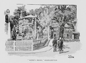
Background imageEarly Maps Collection: 'Kings Head, 'Roehampton (litho)

"Kings Head, "Roehampton (litho)
7188489 " Kings Head, " Roehampton (litho) by Luker, William (1820-92); Private Collection; (add.info.: " Kings Head, " Roehampton)

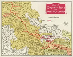
Background imageEarly Maps Collection: METROLAND MAP

METROLAND MAP
A map of Metro-Land, the residential area in Londons northwest hinterland, served by Londons Underground though in these parts most of it runs over ground. Date: 1926

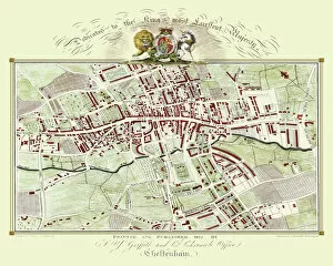
Background imageEarly Maps Collection: Old Map of Cheltenham 1825 by Griffith s

Old Map of Cheltenham 1825 by Griffith s
Fine reproduction in full colour of Griffiths new historical description of Cheltenham and its vicinity originally published in 1825

Background imageEarly Maps Collection: Pictorial History Map of Scotland 1963

Pictorial History Map of Scotland 1963
This is a wonderful pictorial map illustrating the history of Scotland drawn by Leslie Bullock and published in 1963 by Collins Bartholomew as a fold up map

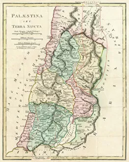
Background imageEarly Maps Collection: Map of Palestine and the Holy Land

Map of Palestine and the Holy Land - all places named in their Latin form. Date: 1806

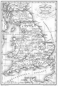
Background imageEarly Maps Collection: Roman Britain Map

Roman Britain Map
A map depicting the network of Roman settlements in Britain

Background imageEarly Maps Collection: MAP OF MACEDONIAN EMPIRE. Map of the Macedonian Empire following the conquests of Alexander

MAP OF MACEDONIAN EMPIRE. Map of the Macedonian Empire following the conquests of Alexander the Great, 4th century B.C

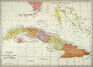
Background imageEarly Maps Collection: MAP: CUBA, 1900. Map of Cuba printed in the United States, c1900

MAP: CUBA, 1900. Map of Cuba printed in the United States, c1900

Background imageEarly Maps Collection: Oronce Fines world map, 1531

Oronce Fines world map, 1531
Oronce Fines world map. Map of the worlds northern and southern hemispheres by the French mathematician and cartographer Oronce Fine (1494-1555)

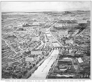
Background imageEarly Maps Collection: Overhead view of Dublin during the Easter Rising

Overhead view of Dublin during the Easter Rising
A birds eye view of Dublin looking westward up the River Liffey, showing positions held by the Sinn Feiners during the Easter Rising in April 1916

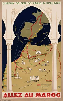
Background imageEarly Maps Collection: Poster for French railways to Morocco

Poster for French railways to Morocco
Poster advertising French railways to Morocco, via Paris, Bordeaux, Toulouse and Madrid, to Tangier, Casablanca, Marrakech, and other exotic places

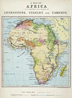
Background imageEarly Maps Collection: Map of Africa illustrating travels of explorers

Map of Africa illustrating travels of explorers
A map of Africa which illustrates the travels of the explorers Livingstone, Stanley and Cameron

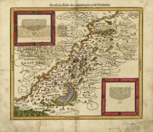
Background imageEarly Maps Collection: Map of Palestine, 1588

Map of Palestine, 1588
16th century map of Palestine. North is towards upper right. Published in 1588, this German map shows the geography of Palestine, centred on the area that later become the state of Israel

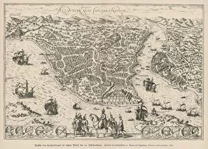
Background imageEarly Maps Collection: Ottoman Empire / Map 16C

Ottoman Empire / Map 16C
Istanbul in the 16th century, after the Turks captured it. The map is entitled Byzantium, now Constantinople

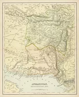
Background imageEarly Maps Collection: Map / Afghanistan C1860S

Map / Afghanistan C1860S
Map of Afghanistan and Beluchistan (note camel routes are measured in days, not miles)

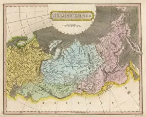
Background imageEarly Maps Collection: Map / Europe / Russia Empire

Map / Europe / Russia Empire
Map of the Russian Empire

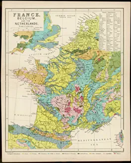
Background imageEarly Maps Collection: Map / France / Belgium / Nethe

Map / France / Belgium / Nethe
Map of France, Belgium and the Netherlands

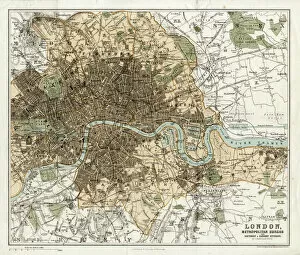
Background imageEarly Maps Collection: MAP / LONDON 1878

MAP / LONDON 1878
Map of London and its suburbs

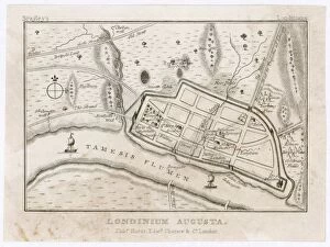
Background imageEarly Maps Collection: London Map / Roman Period

London Map / Roman Period
Map showing Roman London (Londinium) with its grid of straight roads

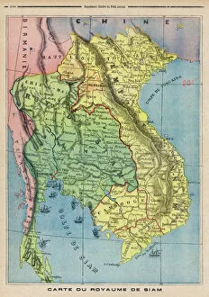
Background imageEarly Maps Collection: Map Siam / Thailand 1893

Map Siam / Thailand 1893
Map showing the Kingdom of Siam, now Thailand

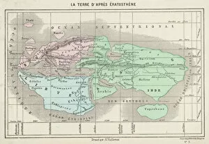
Background imageEarly Maps Collection: Maps / World / Eratosthenes

Maps / World / Eratosthenes
The world as known to Eratosthenes

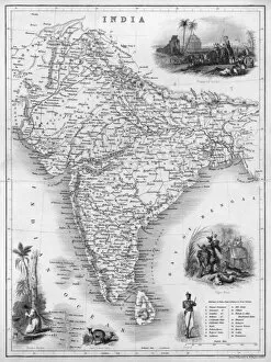
Background imageEarly Maps Collection: Map / Asia / India C1850

Map / Asia / India C1850
India under British rule, about the time of the Mutiny

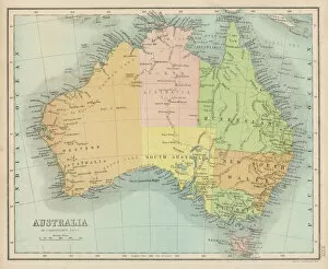
Background imageEarly Maps Collection: Maps / Australia 1860S

Maps / Australia 1860S
Map probably made soon after 1861

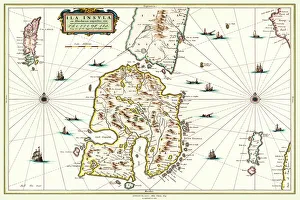
Background imageEarly Maps Collection: Old Map of the Isle of Islay Scotland 1654 by Johan Blaeu from the Atlas Novus

Old Map of the Isle of Islay Scotland 1654 by Johan Blaeu from the Atlas Novus
This detailed and most attractive reproduction map of The Isle of Islay has been carefully art worked from a scan of an antique original

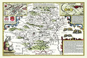
Background imageEarly Maps Collection: Old County Map of Hertfordshire 1611 by John Speed

Old County Map of Hertfordshire 1611 by John Speed
A facimile of John Speeds historical map of Hertfordshire originally published for the " Theatre of the Empire of Great Britain"

Background imageEarly Maps Collection: Kent Historical John Speed 1610 Map

Kent Historical John Speed 1610 Map
A reproduction of John Speeds historical map of the county of Kent. Originally published as part of his atlas called The Theatre of the Empire of Great Britain in 1610

Background imageEarly Maps Collection: Historical World Events map 1971 UK version

Historical World Events map 1971 UK version
A world map originally published in 1971, reproduced from the internationally famousCollins Bartholomew World Through Timehistoric cartographic archive


All Professionally Made to Order for Quick Shipping


-

Early Maps Collection

Early maps, also known as maps and charts, were created by ancient civilizations to navigate their surroundings. These early cartographers used various techniques such as observation, measurement, and estimation to create accurate depictions of the world around them. The earliest known map dates back to 6th century BCE in Babylonia. As time progressed, more advanced mapping techniques were developed including the use of longitude and latitude lines for navigation purposes. Maps have played a significant role in history by aiding explorers in discovering new lands and helping nations establish boundaries. Today, they can valuable artifacts that provide insight into the past and serve as a reminder of how far cartography has come over time.
+

Our beautiful pictures are available as Framed Prints, Photos, Wall Art and Photo Gifts

The Early Maps collection from Media Storehouse is a fascinating assortment of historical maps and charts that offer an insight into the evolution of cartography. Our collection features antique maps dating back to the 16th century, including world maps, regional maps, city plans, and nautical charts. These meticulously crafted pieces are not only visually stunning but also provide valuable information about the geography, topography, and political boundaries of different regions throughout history. The Early Maps collection offers a unique opportunity for art enthusiasts, historians or anyone interested in exploring the past through visual representation. The prints are available in various sizes and formats such as canvas prints or framed wall art making them suitable for any home or office decor. Whether you're looking to add a touch of vintage charm to your living space or seeking inspiration for research projects on historical geography or navigation techniques - our collection has something for everyone.
+

What are Early Maps (Maps and Charts) art prints?

Early Maps art prints are reproductions of historical maps and charts that were created centuries ago. These maps were originally made by cartographers who used various techniques to accurately depict the geography, topography, and other features of different regions around the world. Early Maps art prints offer a glimpse into how people perceived the world in earlier times, as well as providing valuable information about past civilizations, cultures, and trade routes. These art prints are ideal for history buffs, collectors or anyone who appreciates vintage artwork. They can be displayed in homes or offices to add a touch of elegance and sophistication to any space. We offer a wide variety of Early Maps art prints from different eras such as medieval Europe, ancient Rome or China during the Ming dynasty. These beautiful reproductions provide an opportunity for individuals to own a piece of history while also enjoying stunning works of art that showcase incredible craftsmanship from long ago.
+

What Early Maps (Maps and Charts) art prints can I buy from Media Storehouse?

We offer a wide range of early maps and charts art prints for purchase. These include antique world maps, vintage city plans, historical nautical charts, and topographical surveys from various periods in history. Some of the most popular collections available on Media Storehouse are the 16th-century world maps by Gerardus Mercator and Abraham Ortelius, as well as the 18th-century British county maps by John Speed. In addition to these classic pieces, Media Storehouse also has an extensive collection of rare and unique maps that showcase different regions around the globe. Whether you're looking for a map of ancient Rome or a detailed chart of the Caribbean islands from the 17th century, there is something for everyone at Media Storehouse. All art prints are produced using high-quality materials to ensure they look great on any wall. They come in a variety of sizes and finishes to suit your needs. With so many options available, finding the perfect early map or chart print has never been easier.
+

How do I buy Early Maps (Maps and Charts) art prints?

To buy Early Maps art prints from Media Storehouse, you can browse our online collection of maps and charts. Once you have found the print that you like, simply add it to your cart and proceed to checkout. You will be prompted to enter your shipping information and payment details. After completing your purchase, your print will be printed on high-quality paper using archival inks. We offer a wide range of sizes for their prints so that you can choose the perfect size for your space. We also offer framing options if you prefer to receive a framed print rather than an unframed one. Whether you are looking for antique maps or modern interpretations of historical cartography, we have a vast selection of Early Maps art prints available for purchase. Our easy-to-use website makes it simple to find the perfect piece of artwork for any room in your home or office.
+

How much do Early Maps (Maps and Charts) art prints cost?

We offer a wide range of Early Maps art prints that vary in price depending on the size and type of print you choose. Our prices are competitive and affordable, making it easy for anyone to own a piece of history through our collection of vintage maps and charts. Our Early Maps art prints come in various sizes ranging from small to large, so you can find the perfect fit for your home or office space. We also offer different types of paper finishes such as matte or glossy to suit your preference. Whether you're looking for a unique gift or want to add some character to your living space, our Early Maps art prints are an excellent choice. With their intricate details and historical significance, they make for fascinating conversation starters while adding charm to any room.
+

How will my Early Maps (Maps and Charts) art prints be delivered to me?

We take great care in delivering your Early Maps art prints to you. We use high-quality packaging materials to ensure that your prints are protected during transit. Depending on the size of your order, we may use either a sturdy cardboard tube or a flat package with reinforced corners. We work closely with our trusted delivery partners to ensure that your order arrives safely and on time. Our standard delivery service is reliable and efficient, but if you need your order urgently, we also offer express shipping options for an additional fee. Once your order has been dispatched, you will receive a tracking number so that you can monitor its progress online. If there are any issues with the delivery of your print(s), please do not hesitate to contact us - our friendly customer service team will be happy to assist you in resolving any problems as quickly as possible.