Fraud Blocker Skip to main content

Home > Maps and Charts > Early Maps

Early Maps Collection (page 10)

Early maps, also known as maps and charts, were created by ancient civilizations to navigate their surroundings

26,456 items

Background imageEarly Maps Collection: Early map of the Moon, 1635

Early map of the Moon, 1635
Map of the Moon, by Johann Doppelmayr (1671- 1750). This early engraving of the Moon by the German mathematician and astronomer Doppelmayer is thought to date from 1730

Background imageEarly Maps Collection: Ploughing up England

Ploughing up England
Map showing the extent of the Ploughing Up England Campaign designed to maximise farm produce during World War Two

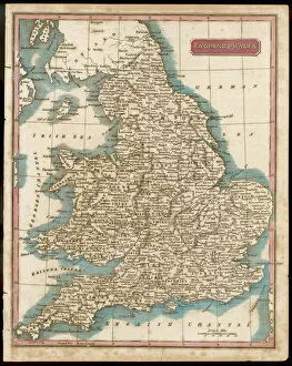
Background imageEarly Maps Collection: Map / England & Wales 1809

Map / England & Wales 1809
ENGLAND AND WALES Hand coloured engraving

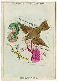
Background imageEarly Maps Collection: The Arrow Star Map

The Arrow Star Map
The Arrow constellation, showing Antinous being attacked by an eagle and also including a dolphin

Background imageEarly Maps Collection: Pegasus Star Map

Pegasus Star Map
The Pegasus and Equuleus constellation

Background imageEarly Maps Collection: Map / Europe / France 1827

Map / Europe / France 1827
Map of France showing the departements

Background imageEarly Maps Collection: Whittaker Star Maps 12

Whittaker Star Maps 12
Including Pegasus

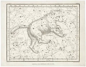
Background imageEarly Maps Collection: Whittaker / Ursa Major

Whittaker / Ursa Major
Including the Ursa Major

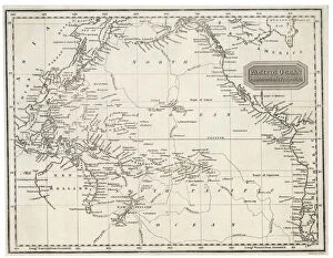
Background imageEarly Maps Collection: Maps / Pacific Ocean

Maps / Pacific Ocean
Map of the Pacific Ocean on Mercators projection

Background imageEarly Maps Collection: Map of Westminster, 1593

Map of Westminster, 1593
Map of Westminster, London, 1593

Background imageEarly Maps Collection: Taurus

Taurus
The Constellation Taurus

Background imageEarly Maps Collection: World Map c. 50AD

World Map c. 50AD
World Map as known to Pomponius Mela, Roman geographer

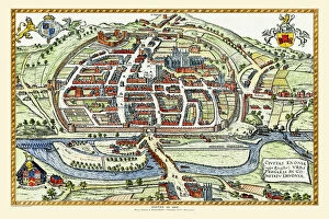
Background imageEarly Maps Collection: Old Map of Exeter by Braun and Hogenburg 1618

Old Map of Exeter by Braun and Hogenburg 1618
A fine reproduction of Frans Hogenbergs city plan of Exeter originally published as one of the many in the city atlas which was intended to be a companion to the earlier Theatrum Orbis Terrarum

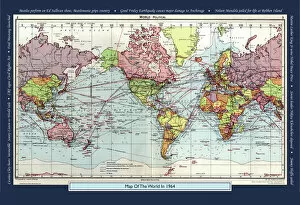
Background imageEarly Maps Collection: Historical World Events map 1964 US version

Historical World Events map 1964 US version
A world map originally published in 1964, reproduced from the internationally famousCollins Bartholomew World Through Timehistoric cartographic archive

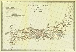
Background imageEarly Maps Collection: Feudal Map of Japan in 1615, (1903). Creator: Unknown

Feudal Map of Japan in 1615, (1903). Creator: Unknown
Feudal Map of Japan in 1615, (1903). The feudal period of Japanese history was a time when powerful families (daimyo) and military warlords (shogun) ruled Japan

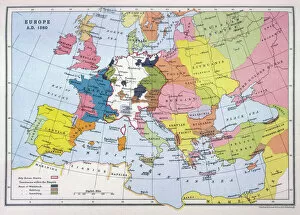
Background imageEarly Maps Collection: Map of Europe in 1360

Map of Europe in 1360
A map of Europe in 1360, showing the boundaries of the Holy Roman Empire

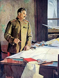
Background imageEarly Maps Collection: Soviet leader Joseph Stalin planning strategy in the Kremlin during the Second World War

Soviet leader Joseph Stalin planning strategy in the Kremlin during the Second World War, 1941-1945 (colour litho)
6029795 Soviet leader Joseph Stalin planning strategy in the Kremlin during the Second World War, 1941-1945 (colour litho) by Russian School (20th century); Private Collection; (add.info)

Background imageEarly Maps Collection: Old Map of Cambridge 1804 by Cole and Roper

Old Map of Cambridge 1804 by Cole and Roper
An attractive and detailed early 19th century reproduction town plan of Cambridge 1804. First published by Cole and Roper as a finely engraved series of county maps

Background imageEarly Maps Collection: Old Map of Exeter 1805 by Cole and Roper

Old Map of Exeter 1805 by Cole and Roper
An attractive and detailed early 19th century reproduction town plan of Exeter 1805. First published by Cole and Roper as a finely engraved series of county maps

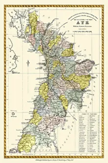
Background imageEarly Maps Collection: Old County Map of Ayr Scotland 1847 by A&C Black

Old County Map of Ayr Scotland 1847 by A&C Black
A finely detailed facimile remastered in full colour from an antique original map of Ayr featured in A&C Blacks Atlas of 1847

Background imageEarly Maps Collection: Historical World Events map 1940 US version

Historical World Events map 1940 US version
A world map originally published in 1940, reproduced from the internationally famousCollins Bartholomew World Through Timehistoric cartographic archive

Background imageEarly Maps Collection: Historical World Events map 1974 UK version

Historical World Events map 1974 UK version
A world map originally published in 1974, reproduced from the internationally famousCollins Bartholomew World Through Timehistoric cartographic archive

Background imageEarly Maps Collection: Map of Russia in the 16th and 17th century, 1914

Map of Russia in the 16th and 17th century, 1914. Private Collection

Background imageEarly Maps Collection: Crocodile and naked woman dancing on ice (litho)

Crocodile and naked woman dancing on ice (litho)
7149274 Crocodile and naked woman dancing on ice (litho) by Kley, Heinrich (1863-1945); Private Collection; (add.info.: Crocodile and naked woman dancing on ice)

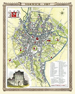
Background imageEarly Maps Collection: Old Map of Norwich 1807 by Cole and Roper

Old Map of Norwich 1807 by Cole and Roper
An attractive and detailed early 19th century reproduction plan of the City of Norwich 1807. First published by Cole and Roper as a finely engraved series of county maps

Background imageEarly Maps Collection: Pictorial History Map of London 1971

Pictorial History Map of London 1971
This is a wonderful pictorial map illustrating the history of London drawn by Leslie Bullock published 1969-1971by Collins Bartholomew as a fold up map

Background imageEarly Maps Collection: Old County Map of Warwickshire 1648 by Johan Blaeu from the Atlas Novus

Old County Map of Warwickshire 1648 by Johan Blaeu from the Atlas Novus
This detailed and most attractive reproduction map of Warwickshire has been carefully art worked from a scan of an antique original

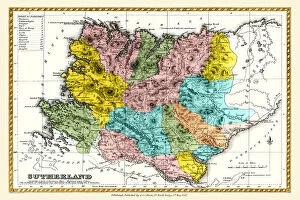
Background imageEarly Maps Collection: Old County Map of Sutherland Scotland 1847 by A&C Black

Old County Map of Sutherland Scotland 1847 by A&C Black
A finely detailed facimile remastered in full colour from an antique original map of Sutherland featured in A&C Blacks Atlas of 1847

Background imageEarly Maps Collection: Old County Map of Caithness Scotland 1847 by A&C Black

Old County Map of Caithness Scotland 1847 by A&C Black
A finely detailed facimile remastered in full colour from an antique original map of Caithness featured in A&C Blacks Atlas of 1847

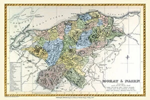
Background imageEarly Maps Collection: Old County Map of Moray and Nairn Scotland 1847 by A&C Black

Old County Map of Moray and Nairn Scotland 1847 by A&C Black
A finely detailed facimile remastered in full colour from an antique original map of Moray and Nairn featured in A&C Blacks Atlas of 1847

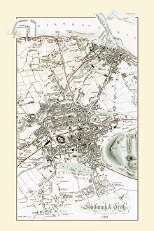
Background imageEarly Maps Collection: Old Map of Edinburgh and Leith 1864 by G. W. Swanson

Old Map of Edinburgh and Leith 1864 by G. W. Swanson
Splendid reproduction map of Edinburgh originally drawn and engraved by G.H.Swanson. The plan of Edinburgh and Leith shows exceptional detail

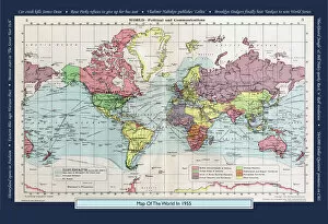
Background imageEarly Maps Collection: Historical World Events map 1955 US version

Historical World Events map 1955 US version
A world map originally published in 1955, reproduced from the internationally famousCollins Bartholomew World Through Timehistoric cartographic archive

Background imageEarly Maps Collection: Feudal Map of Japan between 1564 -73, (1903). Creator: Unknown

Feudal Map of Japan between 1564 -73, (1903). Creator: Unknown
Feudal Map of Japan between 1564 -73, (1903). The feudal period of Japanese history was a time when powerful families (daimyo) and military warlords (shogun) ruled Japan

Background imageEarly Maps Collection: Tidal Observatory, Newlyn Harbour, Cornwall DP221138

Tidal Observatory, Newlyn Harbour, Cornwall DP221138
Tidal Observatory, Newlyn Harbour, Newlyn, Cornwall. General view of tidal observatory lighthouse, shot at dawn, view from north west. Photographed by James O. Davies for Listing Review 2019

Background imageEarly Maps Collection: Antique Map - Biblical Palestine

Antique Map - Biblical Palestine
Antique Map from 1864 of Biblical Palestine

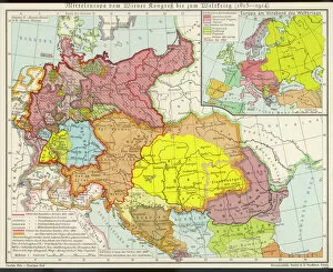
Background imageEarly Maps Collection: Middle Europe Map

Middle Europe Map
Map of Middle Europe from after the Vienna Congress until the start of World War I (1815 - 1914)

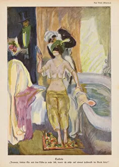
Background imageEarly Maps Collection: Woman performing her toilette with the help of her maid (colour litho)

Woman performing her toilette with the help of her maid (colour litho)
7201395 Woman performing her toilette with the help of her maid (colour litho) by Rieth, Paul (1871-1925); Private Collection; (add.info.: Woman performing her toilette with the help of her maid)

Background imageEarly Maps Collection: Bulgarian fishermen (engraving)

Bulgarian fishermen (engraving)
7200100 Bulgarian fishermen (engraving) by English School, (19th century); Private Collection; (add.info.: Bulgarian fishermen)

Background imageEarly Maps Collection: Advertisement in London and Suburbs Old and New, October 1933 (litho)

Advertisement in London and Suburbs Old and New, October 1933 (litho)
7182825 Advertisement in London and Suburbs Old and New, October 1933 (litho) by English School, (20th century); Private Collection; (add.info)

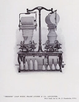
Background imageEarly Maps Collection: 'Premier'loop wheel frame, Stibbe and Co, Leicester (litho)

"Premier"loop wheel frame, Stibbe and Co, Leicester (litho)
7160480 " Premier" loop wheel frame, Stibbe and Co, Leicester (litho) by English School, (20th century); Private Collection; (add.info.: " Premier" loop wheel frame)

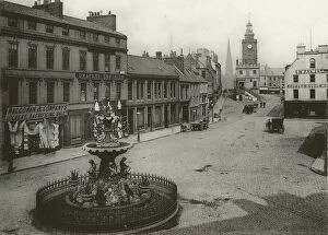
Background imageEarly Maps Collection: Dumfries: High Street from South (b / w photo)

Dumfries: High Street from South (b / w photo)
7167987 Dumfries: High Street from South (b/w photo) by English Photographer, (19th century); Private Collection; (add.info.: High Street from South)

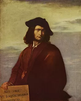
Background imageEarly Maps Collection: Philosophy, self-portrait by Italian artist Salvator Rosa (oil painting)

Philosophy, self-portrait by Italian artist Salvator Rosa (oil painting)
7172079 Philosophy, self-portrait by Italian artist Salvator Rosa (oil painting) by Rosa, Salvator (1615-73) (after); Private Collection; (add.info.: Philosophy)

Background imageEarly Maps Collection: Trick cyclist Diavolo performing a loop the loop at the Royal Aquarium, London (litho)

Trick cyclist Diavolo performing a loop the loop at the Royal Aquarium, London (litho)
7172759 Trick cyclist Diavolo performing a loop the loop at the Royal Aquarium, London (litho) by English School, (20th century); Private Collection; (add.info)

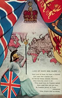
Background imageEarly Maps Collection: Land of Hope and Glory (colour litho)

Land of Hope and Glory (colour litho)
5996702 Land of Hope and Glory (colour litho) by English School, (20th century); Private Collection; (add.info.: Land of Hope and Glory. Postcard, early 20th century.); © Look and Learn

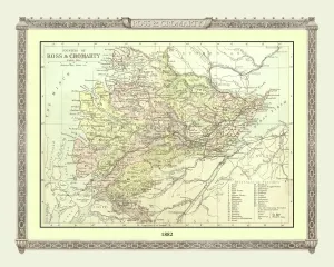
Background imageEarly Maps Collection: Old Map of the Counties of Ross and Cromarty from the Philips Handy Atlas of 1882

Old Map of the Counties of Ross and Cromarty from the Philips Handy Atlas of 1882
PHA026

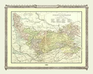
Background imageEarly Maps Collection: Old Map of the Counties of Stirling and Clackmannan from the Philips Handy Atlas of 1882

Old Map of the Counties of Stirling and Clackmannan from the Philips Handy Atlas of 1882
PHA029

Background imageEarly Maps Collection: Old County Map of Suffolk 1836 by Thomas Moule

Old County Map of Suffolk 1836 by Thomas Moule
This is a fine decorative reproduction County Map of Suffolk from the First Edition series of Thomas Moule Maps, originally Published in 1836

Background imageEarly Maps Collection: Old Map of Oxford 1808 by Cole and Roper

Old Map of Oxford 1808 by Cole and Roper
An attractive and detailed early 19th century reproduction plan of the City of Oxford 1808. First published by Cole and Roper as a finely engraved series of county maps


All Professionally Made to Order for Quick Shipping


-

Early Maps Collection

Early maps, also known as maps and charts, were created by ancient civilizations to navigate their surroundings. These early cartographers used various techniques such as observation, measurement, and estimation to create accurate depictions of the world around them. The earliest known map dates back to 6th century BCE in Babylonia. As time progressed, more advanced mapping techniques were developed including the use of longitude and latitude lines for navigation purposes. Maps have played a significant role in history by aiding explorers in discovering new lands and helping nations establish boundaries. Today, they can valuable artifacts that provide insight into the past and serve as a reminder of how far cartography has come over time.
+

Our beautiful Wall Art and Photo Gifts include Framed Prints, Photo Prints, Poster Prints, Canvas Prints, Jigsaw Puzzles, Metal Prints and so much more

The Early Maps collection from Media Storehouse is a fascinating assortment of historical maps and charts that offer an insight into the evolution of cartography. Our collection features antique maps dating back to the 16th century, including world maps, regional maps, city plans, and nautical charts. These meticulously crafted pieces are not only visually stunning but also provide valuable information about the geography, topography, and political boundaries of different regions throughout history. The Early Maps collection offers a unique opportunity for art enthusiasts, historians or anyone interested in exploring the past through visual representation. The prints are available in various sizes and formats such as canvas prints or framed wall art making them suitable for any home or office decor. Whether you're looking to add a touch of vintage charm to your living space or seeking inspiration for research projects on historical geography or navigation techniques - our collection has something for everyone.
+

What are Early Maps (Maps and Charts) art prints?

Early Maps art prints are reproductions of historical maps and charts that were created centuries ago. These maps were originally made by cartographers who used various techniques to accurately depict the geography, topography, and other features of different regions around the world. Early Maps art prints offer a glimpse into how people perceived the world in earlier times, as well as providing valuable information about past civilizations, cultures, and trade routes. These art prints are ideal for history buffs, collectors or anyone who appreciates vintage artwork. They can be displayed in homes or offices to add a touch of elegance and sophistication to any space. We offer a wide variety of Early Maps art prints from different eras such as medieval Europe, ancient Rome or China during the Ming dynasty. These beautiful reproductions provide an opportunity for individuals to own a piece of history while also enjoying stunning works of art that showcase incredible craftsmanship from long ago.
+

What Early Maps (Maps and Charts) art prints can I buy from Media Storehouse?

We offer a wide range of early maps and charts art prints for purchase. These include antique world maps, vintage city plans, historical nautical charts, and topographical surveys from various periods in history. Some of the most popular collections available on Media Storehouse are the 16th-century world maps by Gerardus Mercator and Abraham Ortelius, as well as the 18th-century British county maps by John Speed. In addition to these classic pieces, Media Storehouse also has an extensive collection of rare and unique maps that showcase different regions around the globe. Whether you're looking for a map of ancient Rome or a detailed chart of the Caribbean islands from the 17th century, there is something for everyone at Media Storehouse. All art prints are produced using high-quality materials to ensure they look great on any wall. They come in a variety of sizes and finishes to suit your needs. With so many options available, finding the perfect early map or chart print has never been easier.
+

How do I buy Early Maps (Maps and Charts) art prints?

To buy Early Maps art prints from Media Storehouse, you can browse our online collection of maps and charts. Once you have found the print that you like, simply add it to your cart and proceed to checkout. You will be prompted to enter your shipping information and payment details. After completing your purchase, your print will be printed on high-quality paper using archival inks. We offer a wide range of sizes for their prints so that you can choose the perfect size for your space. We also offer framing options if you prefer to receive a framed print rather than an unframed one. Whether you are looking for antique maps or modern interpretations of historical cartography, we have a vast selection of Early Maps art prints available for purchase. Our easy-to-use website makes it simple to find the perfect piece of artwork for any room in your home or office.
+

How much do Early Maps (Maps and Charts) art prints cost?

We offer a wide range of Early Maps art prints that vary in price depending on the size and type of print you choose. Our prices are competitive and affordable, making it easy for anyone to own a piece of history through our collection of vintage maps and charts. Our Early Maps art prints come in various sizes ranging from small to large, so you can find the perfect fit for your home or office space. We also offer different types of paper finishes such as matte or glossy to suit your preference. Whether you're looking for a unique gift or want to add some character to your living space, our Early Maps art prints are an excellent choice. With their intricate details and historical significance, they make for fascinating conversation starters while adding charm to any room.
+

How will my Early Maps (Maps and Charts) art prints be delivered to me?

We take great care in delivering your Early Maps art prints to you. We use high-quality packaging materials to ensure that your prints are protected during transit. Depending on the size of your order, we may use either a sturdy cardboard tube or a flat package with reinforced corners. We work closely with our trusted delivery partners to ensure that your order arrives safely and on time. Our standard delivery service is reliable and efficient, but if you need your order urgently, we also offer express shipping options for an additional fee. Once your order has been dispatched, you will receive a tracking number so that you can monitor its progress online. If there are any issues with the delivery of your print(s), please do not hesitate to contact us - our friendly customer service team will be happy to assist you in resolving any problems as quickly as possible.