
Croatia Collection
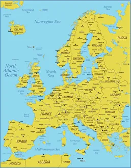
Croatia is a country located in southeastern Europe, bordered by Slovenia, Hungary, Serbia, Bosnia and Herzegovina
Choose a picture from our Croatia Collection for your Wall Art and Photo Gifts
65 items


All Professionally Made to Order for Quick Shipping
-
Croatia Collection
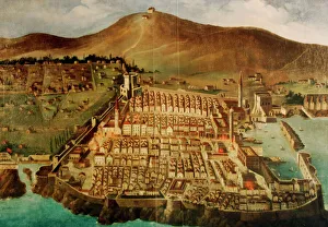
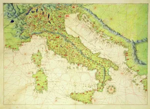
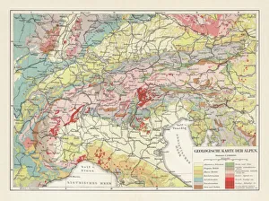
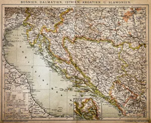
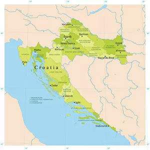
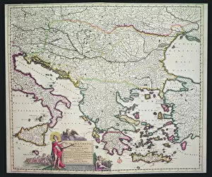
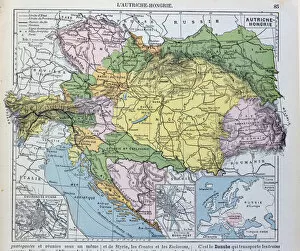
Croatia is a country located in southeastern Europe, bordered by Slovenia, Hungary, Serbia, Bosnia and Herzegovina, and Montenegro and has a population of approximately 4 million people and covers an area of 56,542 square kilometers. The capital city is Zagreb. Croatia's economy relies heavily on tourism due to its beautiful coastline along the Adriatic Sea. The country also has a rich history and culture with many UNESCO World Heritage sites such as Dubrovnik's Old City Walls and Plitvice Lakes National Park. Croatia joined the European Union in 2013 and uses the Croatian Kuna as its currency.
+
Our beautiful pictures are available as Framed Prints, Photos, Wall Art and Photo Gifts
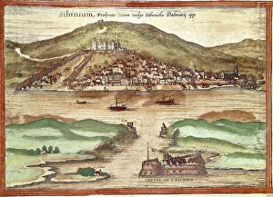
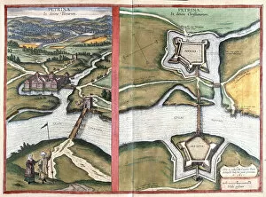
The Croatia collection from Media Storehouse is a stunning assortment of wall art and framed prints that showcase the beauty and history of this European country. Our collection features a range of maps, charts, illustrations, and photographs that capture the unique landscapes, architecture, culture, and traditions of Croatia. From vintage maps depicting the ancient cities to contemporary aerial views of the coastline, each piece in our collection offers a glimpse into the rich heritage of Croatia. Whether you are looking for artwork to decorate your home or office or searching for an exceptional gift for someone who loves travel or history, our collection has something for everyone. Each print is carefully crafted using high-quality materials to ensure long-lasting durability and vibrant colors. With its diverse selection of images spanning different eras and styles, the Croatia collection from Media Storehouse is sure to inspire awe in anyone who appreciates fine artistry.
+
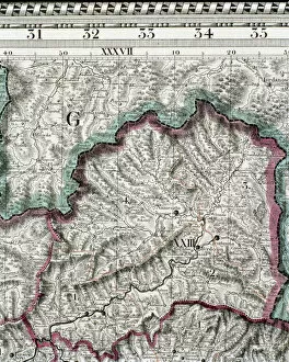
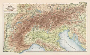
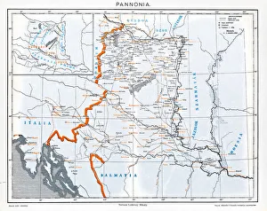
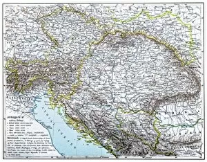
What are Croatia (Maps and Charts) art prints?
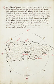
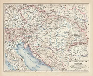
Croatia art prints are a collection of high-quality, visually stunning prints that showcase the beauty and intricacies of Croatia's geography. These prints feature detailed maps and charts of Croatia, highlighting its cities, towns, rivers, mountains, coastlines and other notable landmarks. They are perfect for anyone who wants to explore or learn more about this beautiful country. These art prints are created using state-of-the-art printing technology which ensures that every detail is captured in vivid colors and sharp lines. They can be purchased in a variety of sizes to suit any space or decor style. Whether you're an avid traveler looking to commemorate your trip to Croatia or simply someone who appreciates the beauty of maps as works of art, these prints make a great addition to any home or office. With their timeless appeal and enduring quality, they are sure to be treasured for years to come.
+
What Croatia (Maps and Charts) art prints can I buy from Media Storehouse?
We offer a wide range of Croatia maps and charts art prints that are perfect for decorating your home or office. These art prints feature detailed maps and charts of various regions in Croatia, including its cities, islands, and coastlines. You can choose from a variety of styles, sizes, and formats to suit your personal taste and decor. Some popular options include vintage-style maps that showcase the country's rich history and culture, as well as contemporary designs that highlight its natural beauty and modern infrastructure. Whether you're looking for a large canvas print to make a bold statement or a smaller framed print to add some subtle charm to your space, we have something for everyone. So why not bring some Croatian flair into your home with one of these stunning art prints? With so many options available at Media Storehouse, you're sure to find the perfect piece to complement your style.
+
How do I buy Croatia (Maps and Charts) art prints?
To buy Croatia art prints from Media Storehouse, you can browse our extensive collection of artwork online. Once you have found the print that you would like to purchase, simply add it to your cart and proceed to checkout. During the checkout process, you will be prompted to enter your shipping information and payment details. We offer a variety of sizes for their art prints, so make sure to select the size that best fits your needs. We also offer different framing options if you would like your print framed before delivery. If you have any questions about the purchasing process or need assistance with finding a specific print, we have a customer service team available via phone or email who are happy to help. With our easy-to-use website and wide selection of high-quality artwork, buying Croatia art prints from Media Storehouse is simple and convenient.
+
How much do Croatia (Maps and Charts) art prints cost?
We offer a wide range of Croatia maps and charts art prints that are available at varying prices. Our collection includes high-quality prints featuring detailed maps and charts of different regions in Croatia, including popular tourist destinations like Dubrovnik, Split, and Zagreb. The cost of our Croatia maps and charts art prints depends on several factors such as the size of the print, type of paper used for printing, framing options (if any), among others. We strive to provide affordable pricing while maintaining the highest quality standards for all our products. Our you can choose from a variety of sizes ranging from small to large formats depending on their preferences. Additionally, we offer different types of finishes such as glossy or matte to suit individual tastes. Our Croatia maps and charts art prints are competitively priced without compromising on quality. You can browse through our extensive collection online or visit one of our stores to find the perfect print for their needs.
+
How will my Croatia (Maps and Charts) art prints be delivered to me?
Your Croatia art prints will be delivered to you in a safe and secure manner. We take great care in packaging your order so that it arrives at your doorstep undamaged. Our standard delivery method is through reputable courier services, ensuring that your package is tracked every step of the way until it reaches you. We offer various sizes for our art prints, ranging from small to large formats. Depending on the size of your order, we may use different types of packaging materials such as tubes or flat boxes to ensure its safety during transit. We pride ourselves on providing high-quality products with excellent customer service. If you have any questions about the delivery process or need assistance with tracking your order, please do not hesitate to contact us. We are always happy to help.