
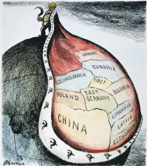
Bulgaria Collection
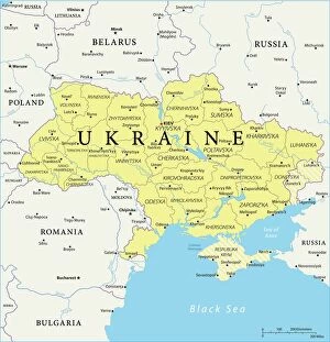
Bulgaria is a country located in southeastern Europe, bordered by Romania to the north, Serbia and North Macedonia to the west, Greece and Turkey to the south
Choose a picture from our Bulgaria Collection for your Wall Art and Photo Gifts
92 items


All Professionally Made to Order for Quick Shipping
-
Bulgaria Collection
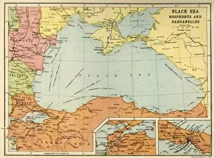
Bulgaria is a country located in southeastern Europe, bordered by Romania to the north, Serbia and North Macedonia to the west, Greece and Turkey to the south, and the Black Sea to the east. The capital city is Sofia. A population of approximately 7 million people and covers an area of 110,994 square kilometers. The official language is Bulgarian and its currency is Lev (BGN). Bulgaria's economy relies heavily on services such as tourism, IT outsourcing, and agriculture. Its major exports include refined petroleum products, wheat flour, sunflower oil, copper ores and concentrates.
+
Our beautiful pictures are available as Framed Prints, Photos, Wall Art and Photo Gifts
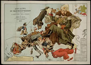
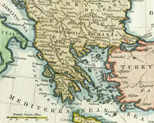
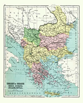
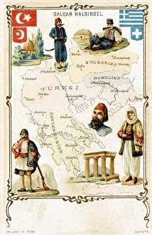
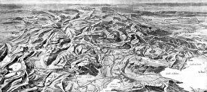
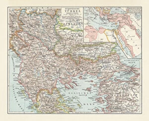
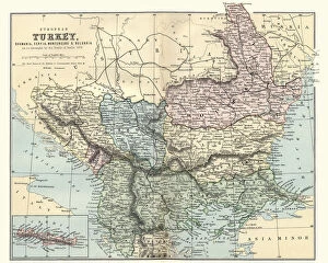
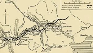
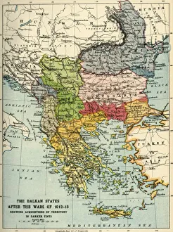
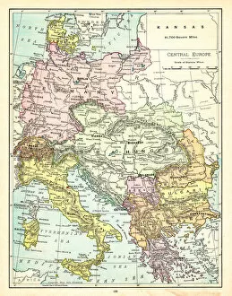
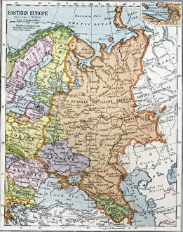
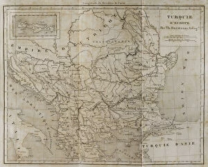
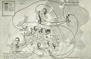
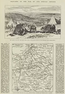
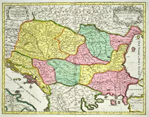
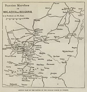
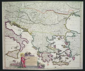
The Bulgaria collection from Media Storehouse is a stunning assortment of wall art and framed prints that showcase the beauty, history, and culture of Bulgaria. Our collection features an array of maps and charts that depict the country's geography, topography, landmarks, and cities in intricate detail. Each piece is carefully crafted with high-quality materials to ensure durability and longevity. Whether you're a history buff or simply looking for beautiful artwork to adorn your walls, our collection has something for everyone. From vintage maps dating back centuries to modern-day satellite imagery, there are plenty of options to choose from. Some notable pieces include detailed city maps of Sofia and Plovdiv, as well as panoramic views of the Black Sea coastline. Additionally, many prints feature Bulgarian text alongside English translations for added authenticity. The Bulgaria collection is a must-have for anyone interested in Bulgarian culture or seeking unique wall decor that showcases their love for travel.
+
What are Bulgaria (Maps and Charts) art prints?
Bulgaria art prints are a collection of high-quality, visually stunning pieces that showcase the beauty and history of Bulgaria. These prints feature detailed maps and charts that highlight different regions, cities, landmarks, and historical events in Bulgaria. They are perfect for anyone who loves geography or wants to learn more about this fascinating country. These art prints are created using state-of-the-art printing technology on premium quality paper. This ensures that each print is vibrant, clear, and long-lasting. The collection includes a variety of sizes to suit any space or decor style. Whether you're looking to decorate your home or office with beautiful artwork or want to give a unique gift to someone special, Bulgaria art prints from Media Storehouse are an excellent choice. With their exceptional quality and attention to detail, these prints will be sure to impress anyone who sees them.
+
What Bulgaria (Maps and Charts) art prints can I buy from Media Storehouse?
We offer a wide range of Bulgaria Maps and Charts art prints that you can buy. These prints showcase the beauty, history, and culture of Bulgaria through various maps and charts. You can choose from vintage maps that depict the country's borders, cities, rivers, mountains, and other geographical features or modern-day charts that show population density, economic indicators or tourist attractions. Media Storehouse also has artistic renditions of Bulgarian landmarks like the Rila Monastery or the Alexander Nevsky Cathedral in Sofia. Additionally, we offer educational posters for children to learn about Bulgaria's geography and history. All these art prints are available in different sizes and formats to suit your preference. Whether you want a framed print for your living room or an unframed poster for your office wall, we have got you covered. If you're looking for high-quality Bulgaria Maps and Charts art prints to decorate your home or office space with stunning visuals of this beautiful country then Media Storehouse is definitely worth checking out.
+
How do I buy Bulgaria (Maps and Charts) art prints?
To buy Bulgaria art prints from Media Storehouse, you can browse our extensive collection of high-quality images online. Once you have found the print that you would like to purchase, simply add it to your cart and proceed to checkout. You will be prompted to enter your shipping information and payment details before completing the order. We offer a variety of sizes and framing options for their prints, so you can choose the best fit for your space. They also provide a range of paper types, including fine art paper and photographic paper, depending on your preference. Whether you are looking for a vintage map or a modern chart of Bulgaria, we have something for everyone. Their selection includes both historical and contemporary pieces from talented artists around the world. With easy ordering and fast delivery times, buying Bulgaria art prints from Media Storehouse is simple and convenient.
+
How much do Bulgaria (Maps and Charts) art prints cost?
We offer a wide range of Bulgaria art prints that are available at varying prices. Our collection includes high-quality reproductions of antique maps and charts depicting the geography, topography, and history of Bulgaria. The price of each print depends on its size, framing options, and other customizations you may choose to add. Our art prints are produced using state-of-the-art printing technology that ensures the highest quality reproduction possible. We use premium materials such as archival paper and inks to ensure that your print will last for years without fading or deteriorating. Whether you're looking for a vintage map to decorate your home or office or want to gift someone who loves Bulgarian history with an authentic piece of artwork, our selection has something for everyone. So browse through our collection today and find the perfect Bulgaria art print at a price that suits your budget.
+
How will my Bulgaria (Maps and Charts) art prints be delivered to me?
Your Bulgaria art prints will be delivered to you in a safe and secure manner. We use high-quality packaging materials to ensure that your artwork arrives at your doorstep in pristine condition. Our team of professionals takes great care when handling your order, from the moment it is printed to the time it is shipped out. We offer various shipping options depending on your location and preferences. You can choose standard delivery or expedited shipping for faster delivery times. Rest assured that we work with trusted carriers who have years of experience delivering packages worldwide. Once your order has been dispatched, you will receive an email notification with tracking information so you can monitor its progress until it reaches you. If there are any issues with the delivery, please don't hesitate to contact our customer service team who will be happy to assist you. We take pride in providing exceptional customer service and ensuring that our customers receive their orders promptly and safely.