Fraud Blocker Skip to main content

Home > Maps and Charts > Belgium

Belgium Collection (page 4)

Belgium is a small country located in Western Europe, bordered by France, Germany

722 items

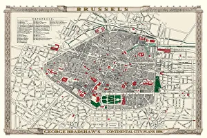
Background imageBelgium Collection: George Bradshaws Plan of Brussels, Belgium 1896

George Bradshaws Plan of Brussels, Belgium 1896
This is a detailed Plan of Brussels showing the streets, canals, principal buildings, railways and railway stations. The walled inner city is differentiated from the outer part of the city
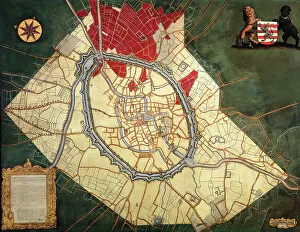
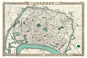
Background imageBelgium Collection: George Bradshaws Plan of Antwerp, Belgium 1896

George Bradshaws Plan of Antwerp, Belgium 1896
This is a detailed Plan of Antwerp showing the streets, canals, principal buildings, railways and railway stations. There is a numbered key to principal buildings and places of interest

Background imageBelgium Collection: Rochdale OL11 5 Map

Rochdale OL11 5 Map
Postcode Sector Map of Rochdale OL11 5

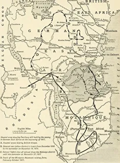
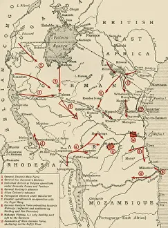
Background imageBelgium Collection: Map illustrating the Closing Phases of the East African Campaign, 1917-18, (c1920)

Map illustrating the Closing Phases of the East African Campaign, 1917-18, (c1920). European powers in Africa during the First World War

Background imageBelgium Collection: The Conquest of the Cameroons, First World War, 1914-1916, (c1920). Creator: Unknown

The Conquest of the Cameroons, First World War, 1914-1916, (c1920). Creator: Unknown
The Conquest of the Cameroons, First World War, 1914-1916, (c1920)....map showing approximately how the colony was cleared of the German troops

Background imageBelgium Collection: Map of Ypres, West Flanders, Belgium, First World War, (c1920). Creator: Unknown

Map of Ypres, West Flanders, Belgium, First World War, (c1920). Creator: Unknown
Map of Ypres, West Flanders, Belgium, First World War, (c1920). The Ypres Salient before the Battle of July 31, 1917: map showing the approximate positions of the Franco-British Line

Background imageBelgium Collection: Colonial possessions in East Africa during the First World War, c1916, (c1920). Creator: Unknown

Colonial possessions in East Africa during the First World War, c1916, (c1920). Creator: Unknown
Colonial possessions in East Africa during the First World War, c1916, (c1920). Map showing German East Africa, British East Africa, the Belgian Congo, Rhodesia, Uganda

Background imageBelgium Collection: Mercator, (1512-1594), 1830. Creator: Unknown

Mercator, (1512-1594), 1830. Creator: Unknown
Mercator, (1512-1594), 1830. Gerardus Mercator (1512-1594) Belgian geographer, cosmographer and cartographer known for his 1569 world map of sailing courses with rhumb lines

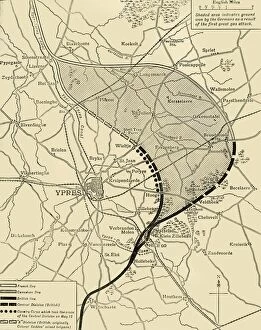
Background imageBelgium Collection: The Ypres Salient before and after the Second Battle of Ypres... First World War, 1915, (c1920)

The Ypres Salient before and after the Second Battle of Ypres... First World War, 1915, (c1920)
The Ypres Salient before and after the Second Battle of Ypres, April 22-May 13, First World War, 1915, (c1920). Map showing positions of the allied forces around Ypres in Belgium: French

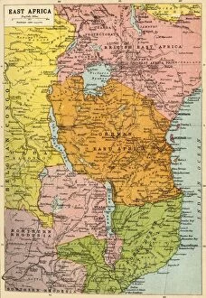
Background imageBelgium Collection: Map of East Africa, First World War, (c1920). Creator: John Bartholomew & Son

Map of East Africa, First World War, (c1920). Creator: John Bartholomew & Son
Map of East Africa, First World War, (c1920). Map showing colonial possessions including the Belgian Congo, British East Africa, German East Africa, Northern Rhodesia and Portuguese East Africa

Background imageBelgium Collection: The First Phase of the Great Retreat... 1914, (c1920). Creator: Unknown

The First Phase of the Great Retreat... 1914, (c1920). Creator: Unknown
The First Phase of the Great Retreat: Plan Showing the British Positions from August 23 to August 28, 1914, (c1920). Map of northern France and Belgium

Background imageBelgium Collection: Map of Belgium and Northern France, c1914, (c1920). Creator: John Bartholomew & Son

Map of Belgium and Northern France, c1914, (c1920). Creator: John Bartholomew & Son
Map of Belgium and Northern France, c1914, (c1920). How the area looked at the start of the First World War. From " The Great World War - A History" Volume I, edited by Frank A Mumby

Background imageBelgium Collection: Map of Holland and Belgium 1896

Map of Holland and Belgium 1896
Andres Allgemeiner Handatlas - Bielefeld und Leipzig 1896

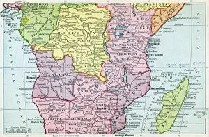
Background imageBelgium Collection: Map Of Central Africa Circa 1930. From The Modern Atlas Of The World Published Circa 1930

Map Of Central Africa Circa 1930. From The Modern Atlas Of The World Published Circa 1930

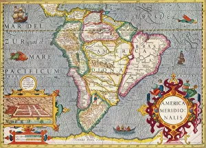
Background imageBelgium Collection: South America (America Meridionalis): from the Atlas of Gerardus Mercator, 1633, (1936)

South America (America Meridionalis): from the Atlas of Gerardus Mercator, 1633, (1936). Artist: Gerardus Mercator
South America (America Meridionalis): from the Atlas of Gerardus Mercator, 1633, (1936). Published at Antwerp by Hondius From The Connoisseur, Vol. 98, edited by H. Granville Fell

Background imageBelgium Collection: 13887000

13887000

Background imageBelgium Collection: 13871081

13871081

Background imageBelgium Collection: 13869893

13869893

Background imageBelgium Collection: 13863147

13863147

Background imageBelgium Collection: 13849201

13849201

Background imageBelgium Collection: 13828497

13828497

Background imageBelgium Collection: 13824114

13824114

Background imageBelgium Collection: Official anti British First Boer War protest card

Official anti British First Boer War protest card
A conflict known also as the Transvaal Rebellion took place between the British and the Boers from 1880 to 1881 The south of Africa was overlaid with European powers competing for colonial territory

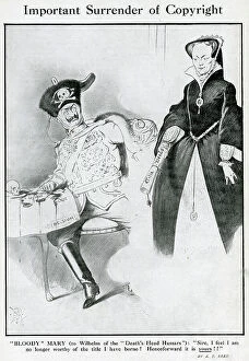
Background imageBelgium Collection: Cartoon, Important Surrender of Copyright, WW1

Cartoon, Important Surrender of Copyright, WW1
Cartoon, Important Surrender of Copyright. Showing Bloody Mary (Queen Mary I of England) handing over her title to Kaiser Wilhelm II of Germany

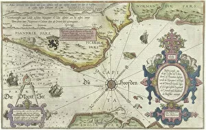
Background imageBelgium Collection: Map of the Coast of Flanders, Normandy and England, 1580-81 (engraving)

Map of the Coast of Flanders, Normandy and England, 1580-81 (engraving)
7415458 Map of the Coast of Flanders, Normandy and England, 1580-81 (engraving) by Doetecum, Joannes van (1530-1605); 32 -- 51.2 cm; Rijksmuseum, Amsterdam

Background imageBelgium Collection: 7419538

7419538

Background imageBelgium Collection: Western Europe, from the series Where Our Exports Go [6321242] (colour litho)

Western Europe, from the series Where Our Exports Go [6321242] (colour litho)
MAN464497 Western Europe, from the series Where Our Exports Go [6321242] (colour litho) by Grimmond, William (1884-1952); Manchester Art Gallery, UK; (add.info.: See 6320722, 452963, 452962, 464497)

Background imageBelgium Collection: Old chromolithograph map of Antwerp, largest city in Belgium

Old chromolithograph map of Antwerp, largest city in Belgium, capital of Antwerp Province in the Flemish Region
Copyright has expired on this artwork. From my own archives, digitally restored

Background imageBelgium Collection: Old chromolithograph map of Brussels, officially the Brussels-Capital Region

Old chromolithograph map of Brussels, officially the Brussels-Capital Region
Copyright has expired on this artwork. From my own archives, digitally restored

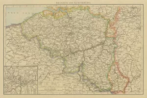
Background imageBelgium Collection: Old chromolithograph map of Belgium and Luxembourg

Old chromolithograph map of Belgium and Luxembourg
Antique Illustration. Copyright has expired on this artwork. From my own archives, digitally restored

Background imageBelgium Collection: Map of Bruges and the Feudal Grounds (oil on canvas)

Map of Bruges and the Feudal Grounds (oil on canvas)
490264 Map of Bruges and the Feudal Grounds (oil on canvas) by Lobberecht, Joannes (18th century) ; Groeningemuseum, Bruges, Belgium; © Art in Flanders

Background imageBelgium Collection: Map of the Liberty of Bruges (oil on canvas)

Map of the Liberty of Bruges (oil on canvas)
490262 Map of the Liberty of Bruges (oil on canvas) by Pourbus, Pieter Jansz. (1523-84); 151x322.2 cm; Groeningemuseum, Bruges

Background imageBelgium Collection: Map of Damme and the Spanish Border Fortresses near Sluis (oil on canvas)

Map of Damme and the Spanish Border Fortresses near Sluis (oil on canvas)
490157 Map of Damme and the Spanish Border Fortresses near Sluis (oil on canvas) by Lobberecht, Jacques (17th century); 132x204.5 cm; Groeningemuseum, Bruges, Belgium; © Art in Flanders

Background imageBelgium Collection: Map of Brugse Vrije, 1571 (oil on canvas)

Map of Brugse Vrije, 1571 (oil on canvas)
6336926 Map of Brugse Vrije, 1571 (oil on canvas) by Pourbus, Pieter Jansz. (1523-84); Groeningemuseum, Bruges, Belgium; © Art in Flanders

Background imageBelgium Collection: Map of the Zwin Area (oil on canvas)

Map of the Zwin Area (oil on canvas)
490039 Map of the Zwin Area (oil on canvas) by Hervy, Jehan de (fl.1472-1507); Groeningemuseum, Bruges, Belgium; (add.info.: See also 490038 & 490040.); © Art in Flanders

Background imageBelgium Collection: Map of the Castellany of Bruges (oil on canvas)

Map of the Castellany of Bruges (oil on canvas)
489859 Map of the Castellany of Bruges (oil on canvas) by Claeissens, Pieter II (fl.1571-d.1623); 322.5x151 cm; Groeningemuseum, Bruges, Belgium; © Art in Flanders

Background imageBelgium Collection: Map of Bruges (oil on canvas)

Map of Bruges (oil on canvas)
490265 Map of Bruges (oil on canvas) by Flemish School, (16th century); Groeningemuseum, Bruges, Belgium; © Art in Flanders

Background imageBelgium Collection: Map of Bruges and the Waterways (oil on canvas)

Map of Bruges and the Waterways (oil on canvas)
490263 Map of Bruges and the Waterways (oil on canvas) by Lobberecht, Joannes (18th century) ; 177x232 cm; Groeningemuseum, Bruges, Belgium; © Art in Flanders

Background imageBelgium Collection: Map of the Zwin Area (oil on canvas)

Map of the Zwin Area (oil on canvas)
490040 Map of the Zwin Area (oil on canvas) by Hervy, Jehan de (fl.1472-1507); Groeningemuseum, Bruges, Belgium; (add.info.: See also 490038 & 490039.); © Art in Flanders

Background imageBelgium Collection: Mercator and Ortelius (oil on canvas)

Mercator and Ortelius (oil on canvas)
471368 Mercator and Ortelius (oil on canvas) by Bellemans, Jozef (Joseph) (1816-88); 175x144 cm; Koninklijk Museum voor Schone Kunsten, Antwerp

Background imageBelgium Collection: Map of the Zwin Area (oil on canvas)

Map of the Zwin Area (oil on canvas)
490038 Map of the Zwin Area (oil on canvas) by Hervy, Jehan de (fl.1472-1507); Groeningemuseum, Bruges, Belgium; (add.info.: See also 490039 & 490040.); © Art in Flanders

Background imageBelgium Collection: The City of Bruges, 1562 (colour litho)

The City of Bruges, 1562 (colour litho)
490348 The City of Bruges, 1562 (colour litho) by Gheeraerts, Marcus, the Elder (c.1520-90); Groeningemuseum, Bruges, Belgium; © Art in Flanders

Background imageBelgium Collection: House facade. Architect G. Decordier. 1932

House facade. Architect G. Decordier. 1932
7141877 House facade. Architect G. Decordier. 1932. by Decordier, Gilbert (1899-1946); (add.info.: Adriaan Brouwerstraat 10, Oudenaarde, Oost-Vlaanderen, Belgium); © Paul Maeyaert

Background imageBelgium Collection: Parish church (Onze-Lieve-Vrouw-Hemelvaartkerk). Interior. Painting. Christmas scene. Simon De Paepe

Parish church (Onze-Lieve-Vrouw-Hemelvaartkerk). Interior. Painting. Christmas scene. Simon De Paepe
7141991 Parish church (Onze-Lieve-Vrouw-Hemelvaartkerk). Interior. Painting. Christmas scene. Simon De Paepe. Origin abbey Ename (?)

Background imageBelgium Collection: Parish church (Parochiekerk Sint-Martinus). 'Our Lady receiving the Rosary from Saint Dominic'

Parish church (Parochiekerk Sint-Martinus). "Our Lady receiving the Rosary from Saint Dominic"
7142436 Parish church (Parochiekerk Sint-Martinus). " Our Lady receiving the Rosary from Saint Dominic". Gustave van de Woestijne. 1900

Background imageBelgium Collection: Town hall. Architect Edward Careels. 1914

Town hall. Architect Edward Careels. 1914
7142323 Town hall. Architect Edward Careels. 1914. by Careels, Edward (1857-1933); (add.info.: Gemeentehuis, Bornem, Antwerpen, Belgium); © Paul Maeyaert. All rights reserved 2022

Background imageBelgium Collection: Parish church (Nederename, Sint-Vedastuskerk). Interior. The high altar. Adoration of the Magi

Parish church (Nederename, Sint-Vedastuskerk). Interior. The high altar. Adoration of the Magi. Simon De Paepe
7142272 Parish church (Nederename, Sint-Vedastuskerk). Interior. The high altar. Adoration of the Magi. Simon De Paepe. Ca 1660-1670

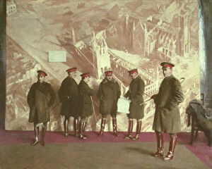
Background imageBelgium Collection: Canadian Headquarters Staff, 1918 (oil on canvas)

Canadian Headquarters Staff, 1918 (oil on canvas)
CIV214930 Canadian Headquarters Staff, 1918 (oil on canvas) by Nicholson, William (1872-1949); 242x292.1 cm; Canadian War Museum, Ottawa, Canada; (add.info.: Generals Richard Turner, Alexander McRae)


All Professionally Made to Order for Quick Shipping


-

Belgium Collection

Belgium is a small country located in Western Europe, bordered by France, Germany, Luxembourg and the Netherlands and has a population of approximately 11 million people and covers an area of 30,528 square kilometers. The capital city is Brussels which also serves as the headquarters for the European Union. Belgium is known for its chocolate, beer and waffles but it's also home to several important institutions such as NATO and the European Parliament. Its economy relies heavily on exports with major industries including chemicals, machinery and equipment manufacturing. The country has three official languages: Dutch (Flemish), French and German with each region having its own distinct culture.
+

Our beautiful Wall Art and Photo Gifts include Framed Prints, Photo Prints, Poster Prints, Canvas Prints, Jigsaw Puzzles, Metal Prints and so much more

The Belgium collection from Media Storehouse is a stunning array of wall art and framed prints that showcase the beauty, history, and culture of this European country. Our collection features an extensive range of maps and charts that highlight the geography, topography, landmarks, cities, towns, rivers, lakes, forests, mountains and other natural wonders of Belgium. These high-quality prints are perfect for anyone who loves to explore new places or has a fascination with cartography. Our collection also includes vintage posters that depict iconic Belgian landmarks such as the Atomium in Brussels or the medieval city of Bruges. These posters offer a glimpse into the past while capturing the timeless charm of these popular tourist destinations. Whether you're looking to decorate your home or office space with beautiful artwork inspired by Belgium's rich cultural heritage or simply want to add some unique pieces to your art collection - our Belgium collection has something for everyone.
+

What are Belgium (Maps and Charts) art prints?

Belgium art prints are a collection of high-quality reproductions of antique maps and charts that depict the geography, topography, and history of Belgium. These prints showcase the intricate details and artistic styles used in creating these historical documents, making them perfect for collectors or anyone interested in Belgian history. The collection includes various types of maps such as political maps, physical maps, road maps, city plans, railway networks as well as nautical charts. The artwork is printed on premium quality paper using advanced printing techniques to ensure that every detail is captured with precision. These art prints serve not only as decorative pieces but also as educational resources for students studying geography or history. They can be framed or mounted to create an eye-catching display in homes or offices. Belgium art prints offer a unique way to explore the rich cultural heritage of this European country through stunning visual representations that have stood the test of time.
+

What Belgium (Maps and Charts) art prints can I buy from Media Storehouse?

We offer a wide range of Belgium maps and charts art prints that you can purchase. These art prints are perfect for those who love to travel or have an interest in geography. The collection includes antique maps, city plans, topographical maps, and more. One popular option is the vintage map of Brussels from 1905 which showcases the layout of the city during that time period. Another great choice is the detailed topographical map of Belgium which highlights its diverse landscape including forests, rivers, and mountains. For those interested in history, Media Storehouse also offers a selection of World War I battlefield maps depicting key locations such as Ypres and Passchendaele. All art prints are available in various sizes to suit your needs and come on high-quality paper or canvas material. With so many options to choose from, there's sure to be a Belgium map or chart print that will fit perfectly into your home decor.
+

How do I buy Belgium (Maps and Charts) art prints?

To buy Belgium art prints from Media Storehouse, you can browse our extensive collection of high-quality images online. Simply search for "Belgium Maps and Charts" in the search bar on our website to find a range of options. Once you have found the print that you like, select your preferred size and framing option if available, add it to your cart, and proceed to checkout. We offer a variety of payment methods including credit card, PayPal or Amazon Pay. We also offer worldwide shipping with various delivery options available depending on your location. Their prints are produced using high-quality printing techniques ensuring that each print is vibrant and long-lasting. Whether you're looking for a vintage map or contemporary chart design, we have something for everyone. Buying Belgium art prints from Media Storehouse is an easy process that allows you to bring beautiful artwork into your home or office space.
+

How much do Belgium (Maps and Charts) art prints cost?

Belgium art prints are available for purchase at Media Storehouse. The cost of these prints varies depending on the size, material, and framing options selected by the customer. However, you can be assured that they will receive high-quality prints that showcase the beauty of Belgium's maps and charts. We offer a wide range of print sizes to choose from, allowing customers to find the perfect fit for their space. Additionally, there are various materials to select from such as canvas or paper which can affect pricing. Customers also have the option to add frames or mountings if desired. We provide an affordable way for individuals to own beautiful pieces of artwork featuring Belgium's maps and charts without breaking their budget. With so many options available at different price points, anyone can find something they love within their budget range.
+

How will my Belgium (Maps and Charts) art prints be delivered to me?

Your Belgium art prints will be delivered to you in a safe and secure manner. We take great care in packaging your artwork so that it arrives at your doorstep undamaged. Your prints will be carefully rolled up and placed inside a sturdy tube, which is then sealed with protective caps on both ends. This ensures that your artwork stays flat during transit and prevents any creases or bends from occurring. We work with trusted shipping partners who provide reliable delivery services worldwide. Depending on your location, we offer various delivery options to suit your needs, including standard shipping or express delivery for urgent orders. Once your order has been dispatched, you will receive an email notification containing tracking information so that you can monitor the progress of your shipment. If you have any questions about the delivery of your Belgium art prints, please don't hesitate to contact our friendly customer service team who are always happy to help.