
Belarus Collection
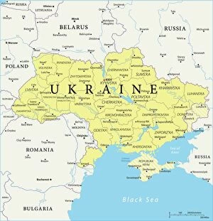
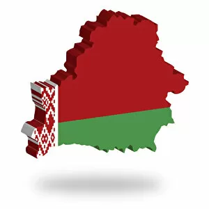
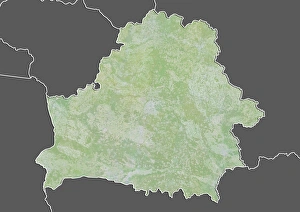
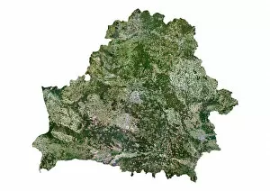
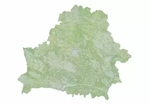
Belarus is a landlocked country located in Eastern Europe, bordered by Russia to the east and northeast, Ukraine to the south, Poland to the west
Choose a picture from our Belarus Collection for your Wall Art and Photo Gifts
26 items


All Professionally Made to Order for Quick Shipping
-
Belarus Collection
Belarus is a landlocked country located in Eastern Europe, bordered by Russia to the east and northeast, Ukraine to the south, Poland to the west, and Lithuania and Latvia to the northwest. The country has a population of approximately 9.5 million people with Minsk as its capital city. A diverse economy that includes agriculture, manufacturing industries such as machinery production and electronics, and services such as tourism. Its political system is authoritarian with limited civil liberties for citizens. It also faces environmental challenges due to pollution from industrial activities and deforestation.
+
Our beautiful pictures are available as Framed Prints, Photos, Wall Art and Photo Gifts
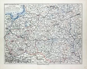
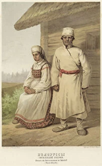
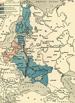
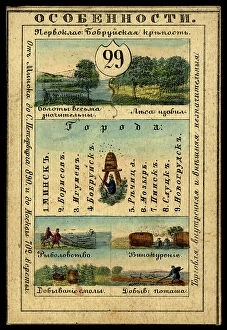
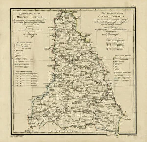
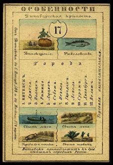
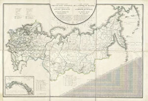
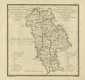
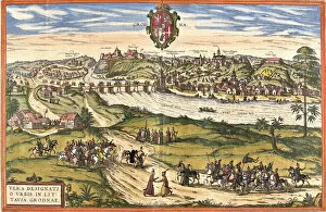
The Belarus collection from Media Storehouse is a stunning array of wall art and framed prints that showcase the beauty, history, and culture of this Eastern European country. Our collection features an extensive range of maps and charts that depict the geography, topography, infrastructure, and landmarks of Belarus in intricate detail. These high-quality prints are available in various sizes to suit different spaces and preferences. Our collection also includes vintage posters that highlight the unique cultural aspects of Belarus such as folk costumes, traditional crafts, festivals, and sports. These posters offer a glimpse into the rich heritage of Belarusian people while adding a touch of nostalgia to any room. The Belarus collection offers an excellent opportunity for art enthusiasts to explore this fascinating country through visually appealing prints that capture its essence perfectly. Whether you're looking for home decor or office art pieces with historical significance or aesthetic appeal - our collection has something for everyone.
+
What are Belarus (Maps and Charts) art prints?
Belarus art prints are high-quality reproductions of vintage maps and charts depicting the geography, topography, and history of Belarus. These prints showcase the intricate details of each map or chart, including landmarks, cities, rivers, mountains, and other geographical features. These art prints are perfect for those who appreciate historical cartography or have an interest in Belarusian culture. They can be used to decorate homes or offices with a unique touch that reflects one's interests. We offer a wide variety of Belarus art prints in different sizes and formats such as canvas or framed print options. Each print is carefully produced using state-of-the-art printing technology to ensure vibrant colors and sharp details that will last for years to come. These art prints offer a fascinating glimpse into the past while also providing an aesthetically pleasing addition to any space.
+
What Belarus (Maps and Charts) art prints can I buy from Media Storehouse?
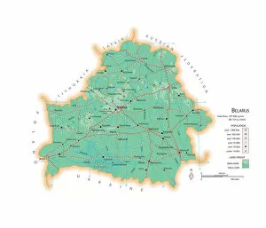
We offer a wide range of Belarus art prints in the form of maps and charts. These prints are perfect for those who love to explore different parts of the world or have an interest in geography. The collection includes various types of maps, such as political, physical, topographical, and road maps that showcase the country's landscape and its cities. Additionally, Media Storehouse also has a selection of historical charts that depict Belarus' past. These include vintage maps from different periods that show how the country's borders have changed over time. All these art prints are available in different sizes and formats to suit your preferences. Whether you want them framed or unframed, on canvas or paper, there is something for everyone at Media Storehouse. So if you're looking to add some Belarusian charm to your home decor or office space, check out our collection today.
+
How do I buy Belarus (Maps and Charts) art prints?
To buy Belarus art prints from Media Storehouse, you can browse our extensive collection of high-quality images online. Once you have found the print that you like, simply select the size and format that suits your needs. You can choose from a range of options including canvas prints, framed prints, or unframed prints. When placing your order, make sure to provide accurate shipping information so that your print arrives safely and on time. If you have any questions about the ordering process or need assistance with selecting the perfect print for your home or office space, don't hesitate to contact our customer service team for help. Buying Belarus art prints from Media Storehouse is a simple and straightforward process that allows you to bring beautiful artwork into your life with ease.
+
How much do Belarus (Maps and Charts) art prints cost?
As a provider of art prints, we offer a wide range of Belarus maps and charts that are available for purchase. The cost of these art prints may vary depending on the size, type, and quality of the print. However, you can expect to find affordable prices that suit their budget. Media Storehouse takes pride in providing high-quality art prints that showcase the beauty and uniqueness of Belarus. These maps and charts are printed using state-of-the-art technology to ensure clarity, sharpness, and accuracy in every detail. Whether you're looking for vintage or modern designs, we have an extensive collection of Belarus maps and charts that cater to different tastes and preferences. With its commitment to customer satisfaction, Media Storehouse ensures that each order is carefully processed with utmost care so you can enjoy their purchases hassle-free.
+
How will my Belarus (Maps and Charts) art prints be delivered to me?
We take great care in delivering your Belarus art prints to you. We use high-quality packaging materials to ensure that your print arrives in perfect condition. Your print will be carefully rolled and placed into a sturdy tube for protection during transit. We work with trusted delivery partners who offer reliable shipping services worldwide. Once your order has been processed, we will provide you with tracking information so that you can keep an eye on the progress of your delivery. Our team is dedicated to ensuring that every customer receives their order in a timely manner and without any damage or issues. If you have any questions about the delivery process or need assistance with tracking your package, please don't hesitate to contact us. We hope that you enjoy your Belarus art print from Media Storehouse.