
Australia Collection
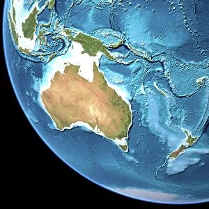
Australia is a vast continent located in the southern hemisphere, surrounded by the Indian and Pacific oceans
Choose a picture from our Australia Collection for your Wall Art and Photo Gifts
760 items


All Professionally Made to Order for Quick Shipping
-
Australia Collection
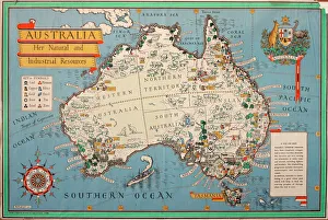
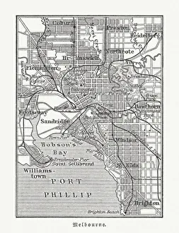
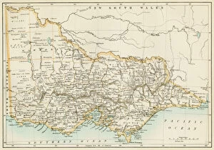
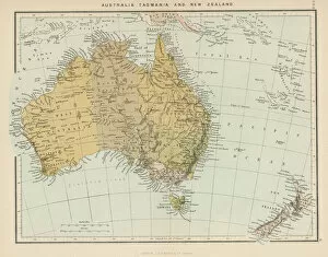
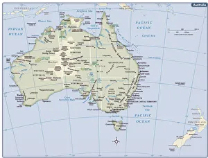
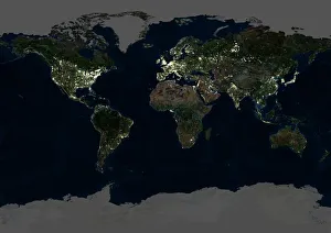
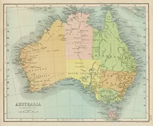
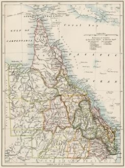
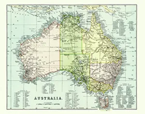
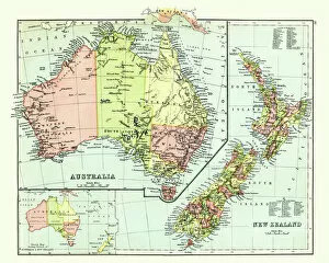
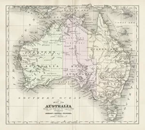
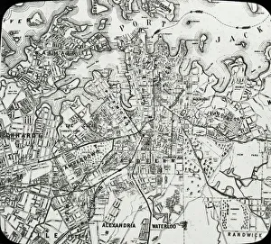
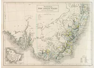
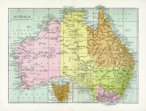
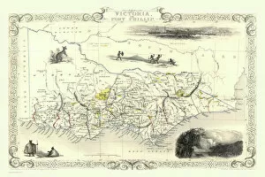
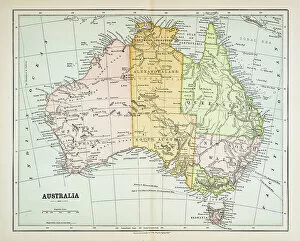
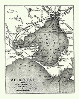
Australia is a vast continent located in the southern hemisphere, surrounded by the Indian and Pacific oceans. The country has a diverse landscape that includes deserts, forests, mountains, and beaches. Australia is home to unique wildlife such as kangaroos, koalas, and wallabies. The population is approximately 25 million people with most living in cities along the eastern coast. The capital city is Canberra while Sydney and Melbourne are the largest cities in terms of population. Maps and charts can be used to explore different regions including its states and territories which include New South Wales, Victoria, Queensland, Western Australia among others.
+
Our beautiful pictures are available as Framed Prints, Photos, Wall Art and Photo Gifts
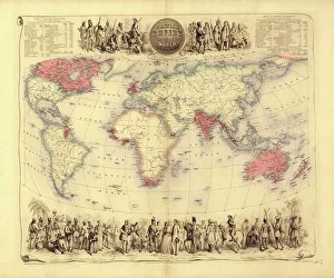
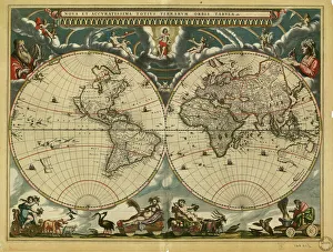
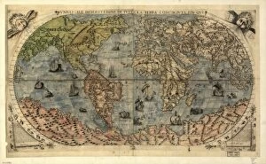
The Australia collection from Media Storehouse is a stunning compilation of wall art and framed prints that showcase the beauty, diversity, and rich history of Australia. Our collection features an extensive range of maps and charts that depict various regions, cities, landmarks, flora, fauna, and geological formations in intricate detail. The artwork captures the essence of Australia's unique landscapes and cultural heritage through vintage illustrations, antique engravings, colorful posters, and contemporary designs. Whether you are a geography enthusiast or simply looking to add some Australian flair to your home or office decor, our collection offers something for everyone. From iconic landmarks like Uluru (Ayers Rock) to lesser-known gems like the Great Barrier Reef Marine Park Authority Map - Coral Sea Commonwealth Marine Reserve 2014 Edition - Large Format Print Poster Wall Art Decor - 36x24 inches; each piece in our collection is meticulously crafted with high-quality materials to ensure long-lasting durability. The Australia collection from Media Storehouse is a must-have for anyone who loves beautiful artwork that celebrates the natural wonders of our world.
+
What are Australia (Maps and Charts) art prints?
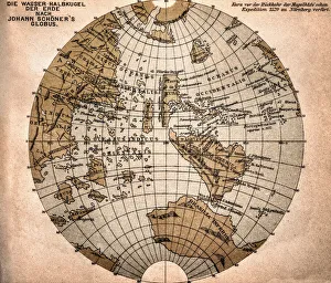
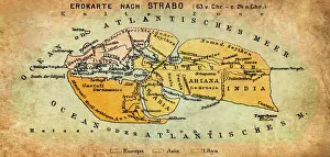
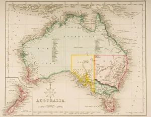
Australia art prints are a collection of high-quality reproductions of antique maps and charts depicting the geography, topography, and history of Australia. These prints showcase the evolution of cartography over time, from early hand-drawn maps to more modern printed versions. The collection includes a wide range of styles and designs, including detailed coastal charts, colorful political maps, and intricate topographical surveys. Each print is carefully reproduced using state-of-the-art printing techniques to ensure that every detail is captured with precision. These art prints are perfect for anyone interested in Australian history or geography or those who simply appreciate beautiful artwork. They make great additions to home decor or office spaces and can be framed to create stunning wall displays. Australia art prints provide an excellent way to explore the rich history and natural beauty of this fascinating country through the lens of cartography.
+
What Australia (Maps and Charts) art prints can I buy from Media Storehouse?
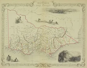
We offer a wide range of Australia maps and charts art prints that you can purchase. You can choose from vintage maps, topographic maps, city street maps, nautical charts, and more. These art prints are available in various sizes to suit your needs and preferences. One popular option is the vintage map of Australia which showcases the country's geography with intricate details such as mountains, rivers, lakes, and cities. Another great choice is the city street map of Sydney or Melbourne that highlights key landmarks and attractions within these bustling metropolitan areas. For those interested in marine navigation or boating enthusiasts, Media Storehouse also offers nautical charts featuring Australian coastlines with detailed information on water depths and hazards. Whether you're looking for decorative pieces for your home or office space or educational resources for schools or libraries, we have a diverse selection of Australia maps and charts art prints to choose from.
+
How do I buy Australia (Maps and Charts) art prints?
To purchase Australia art prints from Media Storehouse, you can browse our online collection of artwork. Once you have found the print that you would like to purchase, simply add it to your cart and proceed to checkout. During the checkout process, you will be prompted to enter your shipping information and payment details. We offer a variety of sizes for their art prints, so be sure to select the size that best fits your needs. We also offer different framing options if you prefer your print framed before delivery. If you have any questions or concerns about purchasing an Australia art print from Media Storehouse, they have a customer service team available to assist with any inquiries. Buying an art print from Media Storehouse is a straightforward process that allows customers access to high-quality prints in various sizes and framing options.
+
How much do Australia (Maps and Charts) art prints cost?
We offer a wide range of Australia maps and charts art prints that are available for purchase. The cost of these prints varies depending on the size and type of print you choose. We have a variety of sizes ranging from small to large, as well as different types such as canvas or framed prints. Our Australia maps and charts art prints are perfect for those who love geography or want to add some unique decor to their home or office space. These high-quality prints showcase the beauty and detail of Australia's landscapes, coastlines, cities, and more. We take pride in offering affordable prices for our customers without compromising on quality. Our team is dedicated to providing excellent customer service and ensuring that your order arrives safely and securely. If you're looking for beautiful Australia maps and charts art prints at reasonable prices, look no further than Media Storehouse.
+
How will my Australia (Maps and Charts) art prints be delivered to me?
We take pride in delivering your Australia art prints with utmost care. We understand that these prints are valuable to you, which is why we ensure that they reach you in perfect condition. Your Australia art prints will be delivered to you through our trusted delivery partners. Depending on your location, the delivery partner may vary. However, rest assured that all our delivery partners are reliable and efficient. We use high-quality packaging materials to protect your art print during transit. Your print will be carefully rolled up and placed inside a sturdy cardboard tube for added protection. Once your order has been dispatched from our warehouse, we will send you an email confirmation along with a tracking number so that you can track the progress of your shipment. Westrive to provide excellent customer service at every step of the way. If you have any questions or concerns about the delivery of your Australia art prints, please do not hesitate to contact us.