Fraud Blocker Skip to main content

Home > Maps and Charts > Americas

Americas Collection (page 42)

"Americas " refers to a collection of maps and charts that depict the geography, topography, climate, demographics, and other aspects of North America

5,437 items

Background imageAmericas Collection: Cartouche depicting La Condamine on a raft on the Amazon

Cartouche depicting La Condamine on a raft on the Amazon
BIF186261 Cartouche depicting La Condamine on a raft on the Amazon, on a map called Carte du detroit appele Pongo de Manseriche dans le Maragnon ou la riviere des Amazones

Background imageAmericas Collection: Map of Virginia, discovered and described by Captain John Smith, 1606

Map of Virginia, discovered and described by Captain John Smith, 1606
STC174211 Map of Virginia, discovered and described by Captain John Smith, 1606, engraved by William Hole (fl. 1607-24), published 1612 (engraving) (see also 174212) by Smith

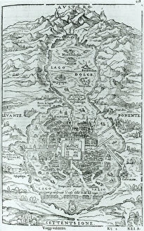
Background imageAmericas Collection: View from the north of the Aztec city of Tenochtitlan, from

View from the north of the Aztec city of Tenochtitlan, from
TRV230404 View from the north of the Aztec city of Tenochtitlan, from Relatione della Citta del Temistitan by Giovanni Battista Ramusio (1485-1557) published in Venice 1606 (engraving) (b/w photo)

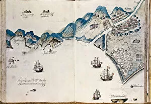
Background imageAmericas Collection: Map of part of New Spain, the coast of Peru and the city of Lima

Map of part of New Spain, the coast of Peru and the city of Lima
AIS5337946 Map of part of New Spain, the coast of Peru and the city of Lima, from " Mapas de las costas de America en el mar del Sur, desde la ltima poblaciAon de espaAnoles en ellas

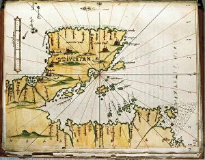
Background imageAmericas Collection: Map of Central America and Peru (map)

Map of Central America and Peru (map)
AIS5391595 Map of Central America and Peru (map) by Santa Cruz, Alonso de (1505-67); Biblioteca Nacional, Madrid, Spain; (add.info.: Colourful manuscript, in Islario General, ca)

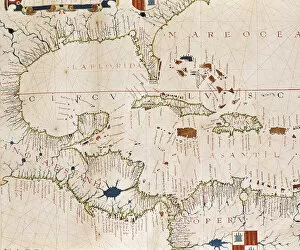
Background imageAmericas Collection: Portulan: Geographic map with the name of the coastline of Cuba, Florida

Portulan: Geographic map with the name of the coastline of Cuba, Florida
AIS5347578 Portulan: Geographic map with the name of the coastline of Cuba, Florida, Central America and North Latin America, Hydrographic Atlas of Fernao VAZ DOURADO (16th century)

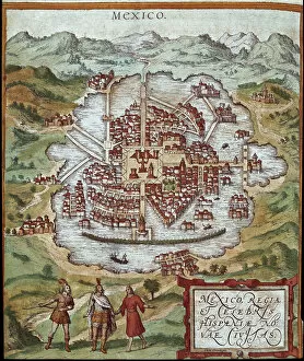
Background imageAmericas Collection: Map of Mexico (engraving, 16th century)

Map of Mexico (engraving, 16th century)
LRI4647122 Map of Mexico (engraving, 16th century) by Hogenberg, Franz (1540-c.1590); Private Collection; (add.info.: Map of Mexico - engraving from " Civitates Orbis Terrarum" by Georg)

Background imageAmericas Collection: Portrait of the President of the United States George Washington (1732-1799

Portrait of the President of the United States George Washington (1732-1799
LRI4623695 Portrait of the President of the United States George Washington (1732-1799) Painting by Giuseppe Perovani (1765-1835) Madrid, Academia de San Fernando by Perovani

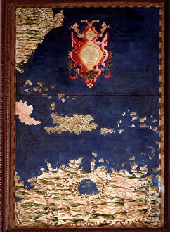
Background imageAmericas Collection: Map of Santo Domingo or Hispaniola, c. 1567. (mural painting)

Map of Santo Domingo or Hispaniola, c. 1567. (mural painting)
LRI4595657 Map of Santo Domingo or Hispaniola, c.1567. (mural painting) by Danti, Egnazio (1536-86); Palazzo Vecchio, Florence

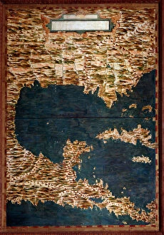
Background imageAmericas Collection: Map of Mexico, Cuba, Florida and Jamaica, c. 1567. (mural painting)

Map of Mexico, Cuba, Florida and Jamaica, c. 1567. (mural painting)
LRI4595645 Map of Mexico, Cuba, Florida and Jamaica, c.1567. (mural painting) by Danti, Egnazio (1536-86); Palazzo Vecchio, Florence, Italy; (add.info.: Mexico, Cuba)

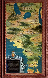
Background imageAmericas Collection: Map of Chile and Magellan Detroit, c. 1581 (mural painting)

Map of Chile and Magellan Detroit, c. 1581 (mural painting)
LRI4595814 Map of Chile and Magellan Detroit, c.1581 (mural painting) by Buonsignori, Stefano (d.1589); Palazzo Vecchio, Florence

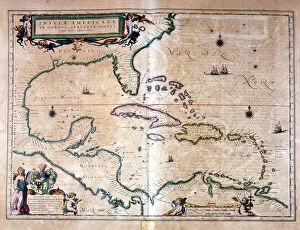
Background imageAmericas Collection: The Caribbean Sea: Gulf of Mexico and Caribbean Sea from the Atlas of Wilhelm Blaeu, 1650

The Caribbean Sea: Gulf of Mexico and Caribbean Sea from the Atlas of Wilhelm Blaeu, 1650
GIA4730820 The Caribbean Sea: Gulf of Mexico and Caribbean Sea from the Atlas of Wilhelm Blaeu, 1650. by Blaeu, Willem (1571-1638); Private Collection; (add.info.: The Caribbean Sea)

Background imageAmericas Collection: Map of Colombia and Peru. 1590

Map of Colombia and Peru. 1590
GIA4711055 Map of Colombia and Peru. 1590. by Unknown Artist, (16th century); Private Collection; (add.info.: Map of Colombia and Peru. 1590.); eGiancarlo Costa; out of copyright

Background imageAmericas Collection: Plan of the 'Spray', a boat on which the American navigator Joshua Slocum

Plan of the "Spray", a boat on which the American navigator Joshua Slocum
GIA4797029 Plan of the " Spray", a boat on which the American navigator Joshua Slocum (1844-1909) began his tour of the world in 1895

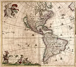
Background imageAmericas Collection: Map of America (etching, 1671)

Map of America (etching, 1671)
LRI4709475 Map of America (etching, 1671) by Wit, Frederick de (1630-1706); Private Collection; (add.info.: Map of America - Strong water extracted from " Theatrum Orbis", 1671)

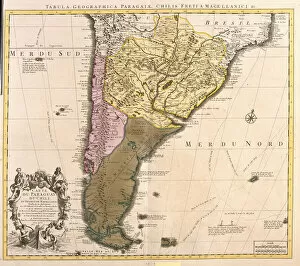
Background imageAmericas Collection: Map of Paraguay, Chile and Magellan Land (Argentina) (etching, 1730)

Map of Paraguay, Chile and Magellan Land (Argentina) (etching, 1730)
LRI4707078 Map of Paraguay, Chile and Magellan Land (Argentina) (etching, 1730) by Delisle, Guillaume (1675-1726); Private Collection; (add.info.: Map of Paraguay)

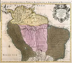
Background imageAmericas Collection: Map of Peru, Guyana, Brazil and the Amazon regions (etching, 1730)

Map of Peru, Guyana, Brazil and the Amazon regions (etching, 1730)
LRI4707065 Map of Peru, Guyana, Brazil and the Amazon regions (etching, 1730) by Delisle, Guillaume (1675-1726); Private Collection; (add.info.: Map of Peru, Guyana)

Background imageAmericas Collection: Map of Mexico and Florida (USA) with the Caribbean Islands (Cuba, Haiti, Jamaica

Map of Mexico and Florida (USA) with the Caribbean Islands (Cuba, Haiti, Jamaica
LRI4707037 Map of Mexico and Florida (USA) with the Caribbean Islands (Cuba, Haiti, Jamaica, Antilles) (etching, 1730) by Delisle

Background imageAmericas Collection: Achille Bazaine (1811-1888) marechal of the Empire in 1864

Achille Bazaine (1811-1888) marechal of the Empire in 1864
JLJ4584982 Achille Bazaine (1811-1888) marechal of the Empire in 1864: portrait of Francois Achille Bazaine (Francois-Achille)

Background imageAmericas Collection: Detailed map of the island of Martinique in the West Indies

Detailed map of the island of Martinique in the West Indies
JLJ4687641 Detailed map of the island of Martinique in the West Indies. Engraving by Matthew Seutter (1678-1757) 18th century Chartres, Musee des Beaux Arts by Seutter

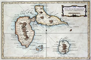
Background imageAmericas Collection: Map of the island of Martinique, the island of Saintes and the island of Marie Galante in

Map of the island of Martinique, the island of Saintes and the island of Marie Galante in
JLJ4687642 Map of the island of Martinique, the island of Saintes and the island of Marie Galante in the West Indies. Engraving of the 19th century Chartres, Musee des Beaux Arts by French School

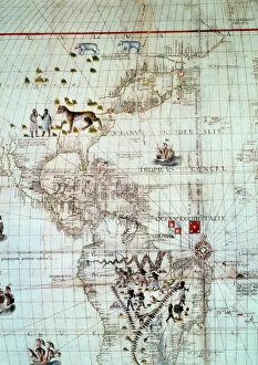
Background imageAmericas Collection: Continent of America. Detail of the world map by Sebastien Cabot, 1544. Paris. BN

Continent of America. Detail of the world map by Sebastien Cabot, 1544. Paris. BN
JLJ4608141 Continent of America. Detail of the world map by Sebastien Cabot, 1544. Paris. BN by Unknown Artist, (16th century); Bibliotheque Nationale, Paris

Background imageAmericas Collection: Map of the Bay of Darien, 1709-13 (colour litho)

Map of the Bay of Darien, 1709-13 (colour litho)
VEN1126513 Map of the Bay of Darien, 1709-13 (colour litho) by Keulen, Gerard van (1678-1726); Biblioteca Angelica, Rome, Italy; (add.info)

Background imageAmericas Collection: Triangle of the meridian of Quito (Ecuador) - in 'Encyclopedia'

Triangle of the meridian of Quito (Ecuador) - in "Encyclopedia"
LSE4102016 Triangle of the meridian of Quito (Ecuador) - in " Encyclopedia" by Diderot et d Alembert, 1751 by French School

Background imageAmericas Collection: Map of Galapagos Islands, discovered by Captain Jean Eaton - in '

Map of Galapagos Islands, discovered by Captain Jean Eaton - in "
LSE4089657 Map of Galapagos Islands, discovered by Captain Jean Eaton - in " Journey to the Southern Lands, to New Holland done in 1699" by Guillaume Dampier (William Dampier)

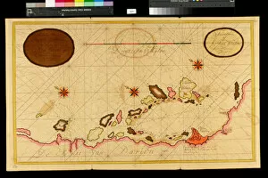
Background imageAmericas Collection: Map of the Bay of Rio de Janeiro, 1709-13 (colour litho)

Map of the Bay of Rio de Janeiro, 1709-13 (colour litho)
VEN3051065 Map of the Bay of Rio de Janeiro, 1709-13 (colour litho) by Keulen, Gerard van (1678-1726); Biblioteca Angelica, Rome, Italy; Photo eMarco Ravenna; Dutch, out of copyright

Background imageAmericas Collection: Harlem, survey of 1888-89 and 1897, ed. of 1900, repr. 1908 (colour litho)

Harlem, survey of 1888-89 and 1897, ed. of 1900, repr. 1908 (colour litho)
6256735 Harlem, survey of 1888-89 and 1897, ed. of 1900, repr. 1908 (colour litho) by American School, (19th century); New York Public Library, USA; American, out of copyright

Background imageAmericas Collection: Boston and environs, c. 1905 (colour litho)

Boston and environs, c. 1905 (colour litho)
6256306 Boston and environs, c.1905 (colour litho) by American School, (20th century); Private Collection; (add.info.: Boston, Geo. H. Walker & Co.); American, out of copyright

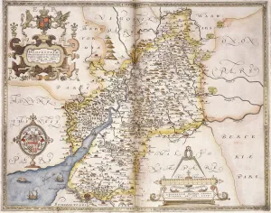
Background imageAmericas Collection: Gloucester(shire), 1579 (hand-coloured engraving)

Gloucester(shire), 1579 (hand-coloured engraving)
985997 Gloucester(shire), 1579 (hand-coloured engraving) by Saxton, Christopher (c.1542-c.1610); 41.5x55 cm; Private Collection; (add.info.: Gloucester(shire); Glocestriae

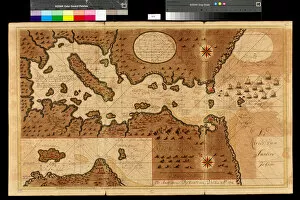
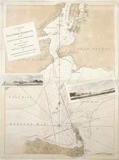
Background imageAmericas Collection: A chart of New York harbour, 1774-1779 (hand coloured etching tinted in sepia

A chart of New York harbour, 1774-1779 (hand coloured etching tinted in sepia
985888 A chart of New York harbour, 1774-1779 (hand coloured etching tinted in sepia, orange and red watercolou) by English School

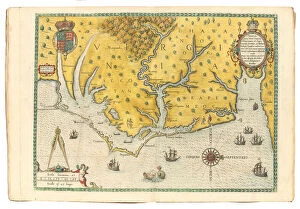
Background imageAmericas Collection: Map of Virginia showing the arrival of Sir Walter Raleighs expedition in 1585

Map of Virginia showing the arrival of Sir Walter Raleighs expedition in 1585
1195464 Map of Virginia showing the arrival of Sir Walter Raleighs expedition in 1585, 1590 (hand-coloured engraving) by White

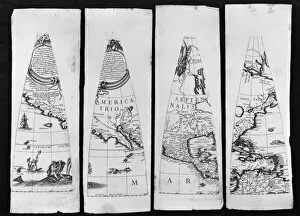
Background imageAmericas Collection: Terrestrial Globe, 1632 (engraving)

Terrestrial Globe, 1632 (engraving)
2654783 Terrestrial Globe, 1632 (engraving) by Greuter, Matthaus (c.1556-1638); each segment 33.5x12.5 cm; Private Collection; Photo eChristies Images; French, out of copyright

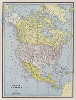
Background imageAmericas Collection: Map of North America (coloured engraving)

Map of North America (coloured engraving)
6014076 Map of North America (coloured engraving) by American School, (19th century); Private Collection; (add.info.: Map of North America)

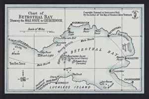
Background imageAmericas Collection: Chart of Betrothal Bay, shewing the Male Route to Churchdoor (colour litho)

Chart of Betrothal Bay, shewing the Male Route to Churchdoor (colour litho)
6032849 Chart of Betrothal Bay, shewing the Male Route to Churchdoor (colour litho) by English School, (19th century); Private Collection; (add.info.: Chart of Betrothal Bay)

Background imageAmericas Collection: Anomalous Weather and Storms, North America (colour litho)

Anomalous Weather and Storms, North America (colour litho)
6015886 Anomalous Weather and Storms, North America (colour litho) by English School, (19th century); Private Collection; (add.info.: Anomalous Weather and Storms, North America)

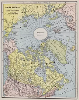
Background imageAmericas Collection: Map of the Arctic (coloured engraving)

Map of the Arctic (coloured engraving)
6014052 Map of the Arctic (coloured engraving) by American School, (19th century); Private Collection; (add.info.: Map of the Arctic)

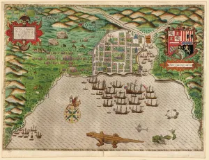
Background imageAmericas Collection: Capture of the Spanish settlement of Santo Domingo in Hispaniola

Capture of the Spanish settlement of Santo Domingo in Hispaniola
5242112 Capture of the Spanish settlement of Santo Domingo in Hispaniola, 1586 (coloured engraving) by Boazio, Baptista (fl.1588-1606); Private Collection; (add.info)

Background imageAmericas Collection: A description of a view of New York, now exhibiting at the Panorama, Leicester Square

A description of a view of New York, now exhibiting at the Panorama, Leicester Square
5897731 A description of a view of New York, now exhibiting at the Panorama, Leicester Square, 1834 (engraving) by Burford, Robert (1791-1861); 28.5x43.5 cm; Private Collection; American

Background imageAmericas Collection: Map of Massachusetts proper: compiled from actual surveys made by order of the General

Map of Massachusetts proper: compiled from actual surveys made by order of the General
5905725 Map of Massachusetts proper: compiled from actual surveys made by order of the General Court and under the inspection of agents of their appointment, 1802 (engraving) by Carleton

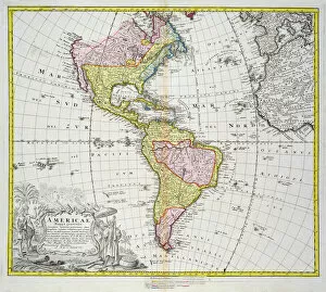
Background imageAmericas Collection: Map of the Americas, published by Homann, 1746 (colour engraving)

Map of the Americas, published by Homann, 1746 (colour engraving)
STC214678 Map of the Americas, published by Homann, 1746 (colour engraving) by Boehm, A. Gottlieb (fl.1746); Private Collection; The Stapleton Collection; German, out of copyright

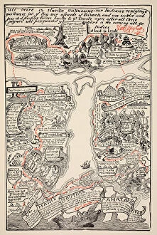
Background imageAmericas Collection: An inciting map of the Turbid Amazon, illustration from

An inciting map of the Turbid Amazon, illustration from
STC405567 An inciting map of the Turbid Amazon, illustration from Just So Stories for Little Children by Rudyard Kipling, pub

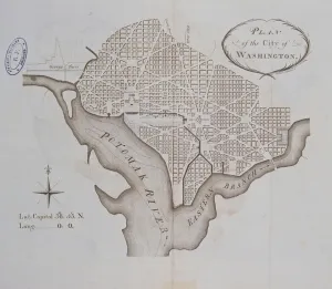
Background imageAmericas Collection: Plan of the City of Washington as originally laid out in 1793 (engraving)

Plan of the City of Washington as originally laid out in 1793 (engraving)
ARH404283 Plan of the City of Washington as originally laid out in 1793 (engraving) by American School, (18th century); Centre Historique des Archives Nationales, Paris

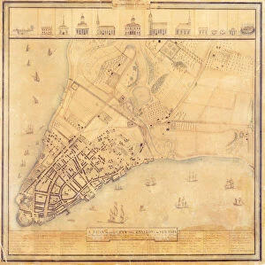
Background imageAmericas Collection: Map of Manhattan, c. 1740 (colour litho)

Map of Manhattan, c. 1740 (colour litho)
NYH412353 Map of Manhattan, c.1740 (colour litho) by Grim, David (18th Century); Collection of the New-York Historical Society, USA; eNew York Historical Society; American, out of copyright

Background imageAmericas Collection: Atlas of the United States, 1824 (litho)

Atlas of the United States, 1824 (litho)
497554 Atlas of the United States, 1824 (litho) by KlinckowstrAom, Axel Leonhard (1775-1837); 44x56 cm; Gilder Lehrman Collection, New York

Background imageAmericas Collection: How the War Commenced, and How Near it is Ended, 1 October 1864 (litho)

How the War Commenced, and How Near it is Ended, 1 October 1864 (litho)
695958 How the War Commenced, and How Near it is Ended, 1 October 1864 (litho) by American School, (19th century); 46.3x29.2 cm; Gilder Lehrman Collection, New York

Background imageAmericas Collection: Sketch showing defences and channels of Charleston Harbour, June 1864 (ink on oilcloth)

Sketch showing defences and channels of Charleston Harbour, June 1864 (ink on oilcloth)
696119 Sketch showing defences and channels of Charleston Harbour, June 1864 (ink on oilcloth) by Bartelle, Charles V. (fl.1864); 37.3x56 cm; Gilder Lehrman Collection, New York

Background imageAmericas Collection: A new and general map of the middle dominion belonging to the United States

A new and general map of the middle dominion belonging to the United States
696116 A new and general map of the middle dominion belonging to the United States, 14th May 1794 (colour litho) by Whittle, James (1757-1818) and Laurie

Background imageAmericas Collection: Pencil illustration of the Cumberland Gap, c. 1862-1865 (litho)

Pencil illustration of the Cumberland Gap, c. 1862-1865 (litho)
696114 Pencil illustration of the Cumberland Gap, c.1862-1865 (litho) by Hopte, John W. (fl.1862-1865); 25.5x31.4 cm; Gilder Lehrman Collection, New York


All Professionally Made to Order for Quick Shipping


-

Americas Collection

"Americas " refers to a collection of maps and charts that depict the geography, topography, climate, demographics, and other aspects of North America, Central America, South America, and the Caribbean. These maps and charts are used for educational purposes in schools and universities as well as by researchers studying various topics related to the Americas. They provide valuable information about landforms such as mountains, rivers, lakes; political boundaries between countries; population density; natural resources distribution; transportation networks; weather patterns among others. The use of these maps has helped people understand the complex nature of this vast region better.
+

Our beautiful pictures are available as Framed Prints, Photos, Wall Art and Photo Gifts

The Americas collection from Media Storehouse is a stunning assortment of wall art and framed prints that showcase the beauty and diversity of North, Central, and South America. Our collection features an extensive range of maps and charts that depict various regions, cities, countries, oceans, mountains, rivers, lakes as well as historical events such as explorations and discoveries. The artwork is available in different sizes to suit any space or decor style. Our collection offers a unique opportunity to explore the rich cultural heritage of the Americas through visually striking images. Whether you are looking for vintage maps or contemporary designs with bold colors or intricate details - our collection has something for everyone. These high-quality prints are perfect for home decoration or office spaces. The Americas collection from Media Storehouse provides an excellent way to appreciate the natural beauty and history of this vast continent while adding a touch of sophistication to your living space.
+

What are Americas (Maps and Charts) art prints?

America's Maps and Charts art prints are a collection of stunningly detailed, high-quality reproductions of historical maps and charts from the United States. These prints showcase the rich history and geography of America, featuring intricate details such as coastlines, rivers, mountains, cities, and landmarks. From antique maps dating back to the 18th century to modern-day topographical charts, this collection offers a wide range of styles and subjects for any decor or interest. Whether you're looking for a vintage map of your hometown or an artistic rendering of the Grand Canyon, there is something for everyone in this extensive collection. Each print is carefully crafted using state-of-the-art printing technology to ensure that every detail is captured with precision and accuracy. They are printed on high-quality paper stock that will last for years to come. America's Maps and Charts art prints make excellent gifts for history buffs or anyone who appreciates fine art. They can be framed or displayed as-is to add a touch of sophistication to any room in your home or office.
+

What Americas (Maps and Charts) art prints can I buy from Media Storehouse?

We offer a wide range of America's maps and charts art prints that you can buy. These include vintage maps, antique charts, historical diagrams, and contemporary cartography designs. You can choose from various sizes and formats such as framed or unframed prints, canvas wraps, or photographic prints. Some of the popular America's maps and charts art prints available at Media Storehouse are the Vintage Map of United States by John Melish (1816), Antique Chart of New York Harbor (1855), Historical Diagram Showing the Growth of American Railroads (1860-1890), Contemporary Map Artwork of Manhattan Island in New York City by Michael Tompsett, among others. Whether you're looking for a unique wall decor for your home or office space or searching for a special gift for someone who loves geography or history, we have plenty to offer when it comes to America's maps and charts art prints.
+

How do I buy Americas (Maps and Charts) art prints?

To buy America's maps and charts art prints from Media Storehouse, you can browse our extensive collection of high-quality images online. Once you have found the artwork that you want to purchase, simply select the size and format that suits your needs. You can choose from a range of options including canvas prints, framed prints, or unframed prints. When making your purchase, be sure to provide accurate shipping information so that your order is delivered promptly and securely. We offer a variety of payment options for your convenience. Whether you are looking for historical maps or contemporary chart art, we have something to suit every taste and budget. Their vast selection of fine art prints ensures that there is always something new to discover in their collection. So if you're looking to add some beautiful map or chart artwork to your home or office decor, look no further than Media Storehouse.
+

How much do Americas (Maps and Charts) art prints cost?

We offer a wide range of America-themed art prints including maps and charts. The cost of our art prints varies depending on the size, material, and framing options chosen by the customer. We provide high-quality paper or canvas options for our customers to choose from. Our America-themed art prints are perfect for those who love history, geography or simply want to add some unique decor to their homes or offices. Our collection includes vintage maps and charts that showcase different regions in America such as New York City, California, Florida among others. We take pride in offering affordable prices without compromising on quality. Our team ensures that every print is produced with precision and care so that you can enjoy it for years to come. If you're looking for beautiful America-themed art prints at reasonable prices then look no further than Media Storehouse.
+

How will my Americas (Maps and Charts) art prints be delivered to me?

We take pride in delivering your Americas art prints with utmost care. We use high-quality packaging materials to ensure that your print arrives in perfect condition. Depending on the size of the print you have ordered, it will be either rolled or flat-packed for delivery. For smaller prints, we use a sturdy cardboard envelope to protect them during transit. Larger prints are carefully wrapped in acid-free tissue paper before being placed inside a strong postal tube. This ensures that they remain safe and secure throughout their journey. We work with trusted courier partners who offer reliable delivery services across the world. Once your order has been dispatched, you will receive an email notification containing tracking information so that you can keep track of its progress. At Media Storehouse, our priority is to deliver your Americas art prints safely and efficiently so that they arrive at your doorstep ready to be enjoyed for years to come.