Fraud Blocker Skip to main content

Home > Maps and Charts > Africa

Africa Collection (page 4)

Africa is the world's second-largest continent

1,675 items

Background imageAfrica Collection: A Map Of Africa As Depicted During The 8Th Century Bc. From In Darkest Africa By Henry M

A Map Of Africa As Depicted During The 8Th Century Bc. From In Darkest Africa By Henry M
UIG5420744 A Map Of Africa As Depicted During The 8Th Century Bc. From In Darkest Africa By Henry M. Stanley Published 1890 - Dans les tenebres de l'Afrique - ©UIG/Leemage

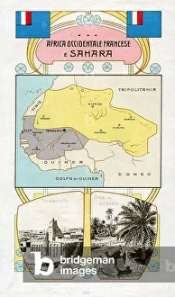
Background imageAfrica Collection: CARTOGRAPHY 'French West Africa and Sahara'

CARTOGRAPHY "French West Africa and Sahara"
6202965 CARTOGRAPHY "French West Africa and Sahara"; (add.info.: CARTOGRAPHY "French West Africa and Sahara". Flag, cartography and view of Tombuctu and an Oasis in the desert)

Background imageAfrica Collection: Colonialism: mapping of the Algiers region (chromolithograph)

Colonialism: mapping of the Algiers region (chromolithograph)
FGL5471170 Colonialism: mapping of the Algiers region (chromolithograph); (add.info.: French vignette from the collection, Edition de la Chocolaterie d'Aiguebelle ", chromolithography)

Background imageAfrica Collection: Vellum chart of Africa, India and the Mediterranean, 1554 (vellum)

Vellum chart of Africa, India and the Mediterranean, 1554 (vellum)
7339652 Vellum chart of Africa, India and the Mediterranean, 1554 (vellum) by Agnese, Battista (c.1500-64); 26x40 cm; National Maritime Museum, London

Background imageAfrica Collection: West coast of Africa, 1826-34 (print)

West coast of Africa, 1826-34 (print)
7339559 West coast of Africa, 1826-34 (print) by Walker, J. & C. (19th century); 21.5x54 cm; National Maritime Museum, London, UK; (add.info.: Creator: Hydrographic Office; E)

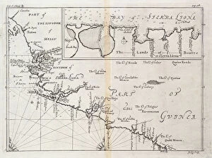
Background imageAfrica Collection: Chart of Sierra Leone, Africa, 1732 (engraving)

Chart of Sierra Leone, Africa, 1732 (engraving)
7339526 Chart of Sierra Leone, Africa, 1732 (engraving) by Kip, Johannes (c.1652-1722); 34x41 cm; National Maritime Museum, London, UK; (add.info.: Creator: J)

Background imageAfrica Collection: Chart of the Guinea coast, Manicongo and Angola as far as the Cape of Good Hope

Chart of the Guinea coast, Manicongo and Angola as far as the Cape of Good Hope, 1596 (coloured engraving)
7339482 Chart of the Guinea coast, Manicongo and Angola as far as the Cape of Good Hope, 1596 (coloured engraving) by Davis, L

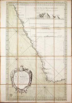
Background imageAfrica Collection: Map of the southwest of Africa, 18th century, 1754 (coloured engraving)

Map of the southwest of Africa, 18th century, 1754 (coloured engraving)
7339407 Map of the southwest of Africa, 18th century, 1754 (coloured engraving) by French School, (18th century); 95x66 cm; National Maritime Museum, London

Background imageAfrica Collection: Chart of the western Mediterrean showing the north African and Spanish coasts, and the Atlantic

Chart of the western Mediterrean showing the north African and Spanish coasts, and the Atlantic
7339123 Chart of the western Mediterrean showing the north African and Spanish coasts, and the Atlantic, 17th century (ink on vellum) by Unknown Artist

Background imageAfrica Collection: Map showing the land of the Hebrews, 1936

Map showing the land of the Hebrews, 1936
7125142 Map showing the land of the Hebrews, 1936; (add.info.: Map showing the land of the Hebrews. From A Short History of the World, published c.1936); Photo © Ken Welsh

Background imageAfrica Collection: Ethnological and Philological map of Africa as it was in the 19th century

Ethnological and Philological map of Africa as it was in the 19th century
478436 Ethnological and Philological map of Africa as it was in the 19th century. From Africa by Keith Johnston, published 1884.; Private Collection

Background imageAfrica Collection: Map of the Countries of Africa, including a detail of the Fortress of Mozambique, Portuguese, c.1700

Map of the Countries of Africa, including a detail of the Fortress of Mozambique, Portuguese, c.1700
BAL42774 Map of the Countries of Africa, including a detail of the Fortress of Mozambique, Portuguese, c.1700; Private Collection; O'Shea Gallery, London, UK

Background imageAfrica Collection: Egypt (colour litho)

Egypt (colour litho)
8653607 Egypt (colour litho) by English School, (19th century); Private Collection; (add.info.: Egypt. Illustration for "The Times" Atlas (Office of "The Times")

Background imageAfrica Collection: Egypt with the Sinai Peninsula and the Journeys of the Israelites (colour litho)

Egypt with the Sinai Peninsula and the Journeys of the Israelites (colour litho)
8643625 Egypt with the Sinai Peninsula and the Journeys of the Israelites (colour litho) by English School, (19th century); Private Collection; (add.info)

Background imageAfrica Collection: Map of the Suez Canal (litho)

Map of the Suez Canal (litho)
8663893 Map of the Suez Canal (litho) by German School, (20th century); Private Collection; (add.info.: Map of the Suez Canal, Egypt)

Background imageAfrica Collection: Geography map: representation of the Atlantic Ocean (or North Sea) with the coasts of the Americas

Geography map: representation of the Atlantic Ocean (or North Sea) with the coasts of the Americas
VEN5030386 Geography map: representation of the Atlantic Ocean (or North Sea) with the coasts of the Americas (South and United States), the Caribbean Sea and the Caribbean

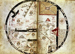
Background imageAfrica Collection: Handwritten map of the world as it was known in the 13th century

Handwritten map of the world as it was known in the 13th century. Mount Sinai is indicated at the top right and in red
GIA5034616 Handwritten map of the world as it was known in the 13th century. Mount Sinai is indicated at the top right and in red. Olympus down and left

Background imageAfrica Collection: World map of Claudius Ptolemaeus (Claude Ptolemee, 90-168 ap JC)

World map of Claudius Ptolemaeus (Claude Ptolemee, 90-168 ap JC), Greek astronomer and astrologer (in red)
NWI4852574 World map of Claudius Ptolemaeus (Claude Ptolemee, 90-168 ap JC), Greek astronomer and astrologer (in red), contrasted with the real positions of cities and countries (in black)

Background imageAfrica Collection: Universal Geography: French colonies of East Africa (Madagascar, Reunion, Somalia)

Universal Geography: French colonies of East Africa (Madagascar, Reunion, Somalia), beg of 20th century (lithograph)
DUV4218009 Universal Geography: French colonies of East Africa (Madagascar, Reunion, Somalia), beg of 20th century (lithograph); 9.5x6.5 cm; (add.info)

Background imageAfrica Collection: Geographic atlas: detail of Juan Oliva's portulan representing the coast of Tunisia

Geographic atlas: detail of Juan Oliva's portulan representing the coast of Tunisia
JEB4874925 Geographic atlas: detail of Juan Oliva's portulan representing the coast of Tunisia. 1593 Municipal Library of Marseille.; (add.info.: Geographic atlas)

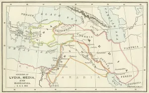
Background imageAfrica Collection: Map of ancient Babylon and the kingdoms of Lydia and Medea (Asia Minor), around 550 BC

Map of ancient Babylon and the kingdoms of Lydia and Medea (Asia Minor), around 550 BC
NWI4859781 Map of ancient Babylon and the kingdoms of Lydia and Medea (Asia Minor), around 550 BC. There are: Arab countries, Armenia, Mesopotamia, Babylon, Thraces, Europe, the Mediterranean Sea

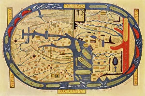
Background imageAfrica Collection: World map of a flat earth, printed by Beatus Rhenanus (Bild aus Rheinau), early 1500 s

World map of a flat earth, printed by Beatus Rhenanus (Bild aus Rheinau), early 1500 s
NWI4901273 World map of a flat earth, printed by Beatus Rhenanus (Bild aus Rheinau), early 1500 s.; (add.info.: World map of a flat earth, printed by Beatus Rhenanus (Bild aus Rheinau)

Background imageAfrica Collection: Map of ancient Egypt Plate from 'History of the world' by Ridpath 1885 Private collection

Map of ancient Egypt Plate from "History of the world" by Ridpath 1885 Private collection
ELD4931850 Map of ancient Egypt Plate from "History of the world" by Ridpath 1885 Private collection; (add.info)

Background imageAfrica Collection: First World War: France, Patriotic Map showing an African soldier of the French colonial army

First World War: France, Patriotic Map showing an African soldier of the French colonial army surprising a German
LUX4739345 First World War: France, Patriotic Map showing an African soldier of the French colonial army surprising a German looting France, 1914, cartoonist: Piflou, Sidi Prusco! Turco Bono

Background imageAfrica Collection: French map of the Transvaal at the outbreak of the Boer War in South Africa, 1899

French map of the Transvaal at the outbreak of the Boer War in South Africa, 1899
3479681 French map of the Transvaal at the outbreak of the Boer War in South Africa, 1899; Universal History Archive/UIG

Background imageAfrica Collection: Map of Cefala, a Roman-Berber town

Map of Cefala, a Roman-Berber town
3507289 Map of Cefala, a Roman-Berber town; (add.info.: Map of Cefala, a Roman-Berber town in the province of Africa Proconsolare. Dated 17th Century.); Universal History Archive
Background imageAfrica Collection: Ancient Christian churches in Abyssinia. Handcoloured copperplate engraving by Antonio Sasso

Ancient Christian churches in Abyssinia. Handcoloured copperplate engraving by Antonio Sasso from Giulio Ferrario's
FLO4619819 Ancient Christian churches in Abyssinia. Handcoloured copperplate engraving by Antonio Sasso from Giulio Ferrario's Ancient and Modern Costumes of all the Peoples of the World

Background imageAfrica Collection: French map of territories controlled by the colonial empires in Africa, 1899

French map of territories controlled by the colonial empires in Africa, 1899
3480879 French map of territories controlled by the colonial empires in Africa, 1899; (add.info.: French map of territories controlled by the colonial empires in Africa 1899)

Background imageAfrica Collection: Map of Southern Africa, c.1900 (engraving)

Map of Southern Africa, c.1900 (engraving)
533065 Map of Southern Africa, c.1900 (engraving); (add.info.: Map of colonial southern Africa, with insets of Cape Town, Johannesburg, and Ladysmith, circa 1902)

Background imageAfrica Collection: Map of Ladysmith, c.1900 (engraving)

Map of Ladysmith, c.1900 (engraving)
533405 Map of Ladysmith, c.1900 (engraving); (add.info.: Map of Ladysmith, South Africa, circa 1902, from the 10th edition of Encyclopaedia Britannica.); Encyclopaedia Britannica/UIG

Background imageAfrica Collection: Map of Johannesburg, c.1900 (engraving)

Map of Johannesburg, c.1900 (engraving)
533402 Map of Johannesburg, c.1900 (engraving); (add.info.: Map of Johannesburg, South Africa, circa 1902, from the 10th edition of Encyclopaedia Britannica.); Encyclopaedia Britannica/UIG

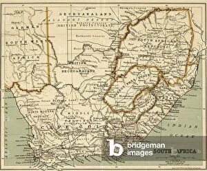
Background imageAfrica Collection: South Africa

South Africa
2902104 South Africa; (add.info.: South Africa, 1899.); Buyenlarge Archive/UIG

Background imageAfrica Collection: A king holding the world. From a 12th century manuscript

A king holding the world. From a 12th century manuscript
1578435 A king holding the world. From a 12th century manuscript; (add.info.: A king holding the world. From a 12th century manuscript.); Universal History Archive/UIG

Background imageAfrica Collection: Map of European odds on the Atlantic Ocean, including Gibraltar, Portugal, Spain, England

Map of European odds on the Atlantic Ocean, including Gibraltar, Portugal, Spain, England, Ireland and Iceland
AIS5350370 Map of European odds on the Atlantic Ocean, including Gibraltar, Portugal, Spain, England, Ireland and Iceland, as well as North Africa

Background imageAfrica Collection: View of the Island of Saint Helena, early 19th century, taken from a recent English map

View of the Island of Saint Helena, early 19th century, taken from a recent English map
FLO4620909 View of the Island of Saint Helena, early 19th century, taken from a recent English map. Handcoloured copperplate engraving by Andrea Bernieri after an illustration by Beaugean from Giulio

Background imageAfrica Collection: White-banded palla butterfly, Palla decius, upper side 1, under side 2, common green charaxes

White-banded palla butterfly, Palla decius, upper side 1, under side 2, common green charaxes, Charaxes eupale 3
FLO4615047 White-banded palla butterfly, Palla decius, upper side 1, under side 2, common green charaxes, Charaxes eupale 3, and African map butterfly, Cyrestis camillus 4

Background imageAfrica Collection: Elevation and plan of the Temple of Hathor at Dendera (Tentyra) Temple complex

Elevation and plan of the Temple of Hathor at Dendera (Tentyra) Temple complex
FLO4620585 Elevation and plan of the Temple of Hathor at Dendera (Tentyra) Temple complex. Handcoloured copperplate engraving by Andrea Bernieri from Giulio Ferrario's Costumes Antique

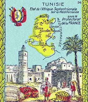
Background imageAfrica Collection: Universal Geography: Tunisia, under the Protectorate of France, beg of 20th century (lithograph)

Universal Geography: Tunisia, under the Protectorate of France, beg of 20th century (lithograph)
DUV4218001 Universal Geography: Tunisia, under the Protectorate of France, beg of 20th century (lithograph); 9.5x6.5 cm; (add.info)

Background imageAfrica Collection: Map of the Moslem Empire, 750 AD, 1936

Map of the Moslem Empire, 750 AD, 1936
7125146 Map of the Moslem Empire, 750 AD, 1936; (add.info.: Map of the Moslem Empire, 750 AD. From A Short History of the World, published c.1936); Photo © Ken Welsh. All rights reserved 2024

Background imageAfrica Collection: Chart of the Atlantic Ocean, with the British, French & Spanish settlements in North America

Chart of the Atlantic Ocean, with the British, French & Spanish settlements in North America and the West Indies
7295390 Chart of the Atlantic Ocean, with the British, French & Spanish settlements in North America and the West Indies, 1753 (engraving) by Jefferys

Background imageAfrica Collection: Geographic atlas: detail of the portulan of Francois Ollive representing Barbarie (Algeria, Tunisia)

Geographic atlas: detail of the portulan of Francois Ollive representing Barbarie (Algeria, Tunisia)
JEB4874959 Geographic atlas: detail of the portulan of Francois Ollive representing Barbarie (Algeria, Tunisia, Tripolitan) and Morocco

Background imageAfrica Collection: Geographic atlas: portulan or nautical map of the Mediterranean Sea and its coasts (Africa)

Geographic atlas: portulan or nautical map of the Mediterranean Sea and its coasts (Africa, Barbaria, Europe)
JEB4874770 Geographic atlas: portulan or nautical map of the Mediterranean Sea and its coasts (Africa, Barbaria, Europe, Middle East). Nautical chart of Augustin Roussin, 1630

Background imageAfrica Collection: Portulan of the Mediterranean Sea and its coasts (Africa, Barbary, Europe, Middle East)

Portulan of the Mediterranean Sea and its coasts (Africa, Barbary, Europe, Middle East)
JEB4874759 Portulan of the Mediterranean Sea and its coasts (Africa, Barbary, Europe, Middle East). Nautical chart by Joan Oliva on parchment, 1593 preserved at the Municipal Library of Marseille

Background imageAfrica Collection: Geographic atlas: portulan or nautical map of the Mediterranean Sea and its coasts (Africa)

Geographic atlas: portulan or nautical map of the Mediterranean Sea and its coasts (Africa, Barbaria, Europe)
JEB4874690 Geographic atlas: portulan or nautical map of the Mediterranean Sea and its coasts (Africa, Barbaria, Europe, Middle East)

Background imageAfrica Collection: Illustration of George Delaw (1871-1938) in Le Lire, 23/04/10 - Old Gauls a blonde head

Illustration of George Delaw (1871-1938) in Le Lire, 23/04/10 - Old Gauls a blonde head - Colonization Colonialism
ICA4846853 Illustration of George Delaw (1871-1938) in Le Lire, 23/04/10 - Old Gauls a blonde head - Colonization Colonialism Colonization Colonies, Teaching, Childhood, Africa

Background imageAfrica Collection: Earth as we imagined it in Antiquity. North and Europe are on the left

Earth as we imagined it in Antiquity. North and Europe are on the left. The East is represented at the top
GIA5036364 Earth as we imagined it in Antiquity. North and Europe are on the left. The East is represented at the top, that is Asia and at the bottom right is Africa

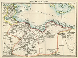
Background imageAfrica Collection: Map of Tripoli (Libya) and Tunisia, circa 1870. 19th century lithography

Map of Tripoli (Libya) and Tunisia, circa 1870. 19th century lithography
NWI4855569 Map of Tripoli (Libya) and Tunisia, circa 1870. 19th century lithography.; (add.info.: Map of Tripoli (Libya) and Tunisia, circa 1870

Background imageAfrica Collection: Map of Alexandria, showing the lighthouse and the entrance to the port of the city in the 16th

Map of Alexandria, showing the lighthouse and the entrance to the port of the city in the 16th century
NWI4862211 Map of Alexandria, showing the lighthouse and the entrance to the port of the city in the 16th century. Colourful engraving of the 19th century.; (add.info.: Map of Alexandria)


All Professionally Made to Order for Quick Shipping


-

Africa Collection

Africa is the world's second-largest continent, covering approximately 30 million square kilometers and has a population of over one billion people and is home to some of the most diverse cultures and languages on earth, and is known for its vast natural resources, including oil, gold, diamonds, and other minerals. However, despite its wealth in resources, many African countries struggle with poverty and political instability. Maps and charts can help us understand the geography as well as economic trends such as trade flows or GDP growth rates and can also highlight issues like climate change or disease outbreaks that affect different regions differently.
+

Our beautiful Wall Art and Photo Gifts include Framed Prints, Photo Prints, Poster Prints, Canvas Prints, Jigsaw Puzzles, Metal Prints and so much more

Media Storehouse offers a vast collection of Africa maps and charts that showcase the beauty and diversity of the continent. Our collection includes vintage maps, political maps, topographical maps, geological charts, and more. These prints are perfect for anyone who loves geography or wants to add an African touch to their home decor. The Africa Maps and Charts collection features high-quality prints that are available in various sizes and formats such as canvas prints, art prints, framed prints, or posters. Customers can choose from different styles ranging from colorful abstract designs to detailed black-and-white illustrations. These stunning pieces of wall art capture the essence of Africa's rich history and culture while providing educational value for those interested in learning about its geography. Whether you're looking to decorate your living room or office space with unique artwork or want to gift someone with a meaningful present related to their interests - our Africa Maps and Charts collection is definitely worth exploring.
+

What are Africa (Maps and Charts) art prints?

Africa art prints are a collection of high-quality, visually stunning artworks that showcase the diverse geography and topography of the African continent. These prints feature detailed maps and charts that highlight various regions, countries, cities, landmarks, and natural wonders across Africa. These art prints are perfect for anyone who has an interest in African history, culture or geography. They can be used to decorate homes or offices with a unique touch of elegance while also serving as educational resources for students studying African geography or history. The Africa art print collection is available in a variety of sizes to suit different needs. The prints are produced using state-of-the-art printing technology on premium quality paper to ensure they last for years without fading or losing their vibrancy. These art prints offer an excellent way to appreciate the beauty and diversity of Africa's landscapes while also learning more about its rich cultural heritage.
+

What Africa (Maps and Charts) art prints can I buy from Media Storehouse?

We offer a wide range of Africa maps and charts art prints that are perfect for anyone looking to add some African flair to their home or office decor. These prints feature detailed maps and charts of various regions in Africa, showcasing the diverse geography, topography, and cultural heritage of this vast continent. Some popular options include vintage-style maps that highlight colonial-era borders and territories, as well as more contemporary designs that showcase modern political boundaries and natural landmarks. You can also find charts depicting wildlife populations, climate patterns, and other fascinating data about different parts of Africa. Whether you're a history buff, nature lover, or simply appreciate beautiful artwork with an African theme, we have something for everyone. With high-quality printing techniques and a variety of sizes available to choose from, these art prints are sure to make a stunning addition to any space.
+

How do I buy Africa (Maps and Charts) art prints?

To buy Africa art prints from Media Storehouse, you can browse our extensive collection of high-quality prints online. Simply search for the specific artwork or artist that you are interested in, or explore their curated collections to discover new pieces. Once you have found a print that you would like to purchase, simply add it to your cart and proceed to checkout. You will be prompted to enter your shipping and payment information, after which your order will be processed. We offer a range of sizes and framing options for their prints, so be sure to choose the one that best suits your needs. Whether you are looking for a small print to display on your desk or a large statement piece for your living room wall, they have something for everyone. Buying Africa art prints from Media Storehouse is an easy and convenient way to bring beautiful artwork into your home or office.
+

How much do Africa (Maps and Charts) art prints cost?

We offer a wide range of Africa maps and charts art prints that are available at varying prices. Our collection features different styles and designs to suit your preferences. The cost of our Africa maps and charts art prints is dependent on several factors such as the size, quality, and type of print you choose. We provide affordable options for those looking for budget-friendly pieces while also offering high-end prints for those who want something more luxurious. Our pricing structure ensures that everyone can find an artwork that fits their budget without compromising on quality. Our Africa maps and charts art prints are perfect for adding a touch of culture to any space in your home or office. They make great gifts too. We take pride in providing our customers with exceptional products at reasonable prices so they can enjoy beautiful artwork without breaking the bank.
+

How will my Africa (Maps and Charts) art prints be delivered to me?

We take great care in ensuring that your Africa art prints are delivered to you in the best possible condition. We use high-quality packaging materials to protect your artwork during transit, including sturdy cardboard tubes for rolled prints and flat cardboard envelopes for smaller sizes. Once your order is processed, our team carefully packs your artwork and sends it out for delivery via a trusted courier service. You will receive a tracking number so that you can follow the progress of your package until it arrives at your doorstep. We understand how important it is to receive your artwork promptly and securely, which is why we work hard to ensure that all orders are dispatched as quickly as possible. Whether you're ordering from within the UK or overseas, we strive to provide a reliable and efficient delivery service every time.