Fraud Blocker Skip to main content

Home > Maps and Charts > Africa

Africa Collection (#31)

Africa is the world's second-largest continent

1,671 Items

Background imageAfrica Collection: Map of Spain and Portugal

Map of Spain and Portugal, with part of southern France and northern Africa. Date: circa 1801

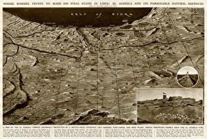
Background imageAfrica Collection: Defences of El Agheila, Libya, by G. H. Davis

Defences of El Agheila, Libya, by G. H. Davis
Where Rommel planned to make his final stand in Libya during the Second World War: El Agheila and its formidable natural defences

Background imageAfrica Collection: Congo map, central Africa from 1895

Congo map, central Africa from 1895
Illustration of a Congo map, central Africa from 1895

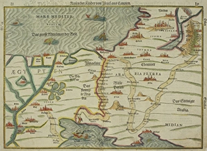
Background imageAfrica Collection: Antique map of holy land with Egypt and Israel

Antique map of holy land with Egypt and Israel

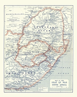
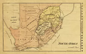
Background imageAfrica Collection: Map of South Africa during the Second Boer War

Map of South Africa during the Second Boer War
Vintage Map of South Africa during the Second Boer War

Background imageAfrica Collection: Probable Settlement of the Descendants of Noah (steel engraving)

Probable Settlement of the Descendants of Noah (steel engraving)
A creased and stained steel engraving of a map which shows The Countries of the Ancient World Exhibiting the Probable Settlement of the Descendants of Noaha, from A System of Geography

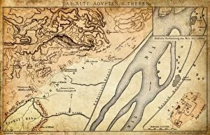
Background imageAfrica Collection: Ancient Egypt Map - Thebes

Ancient Egypt Map - Thebes

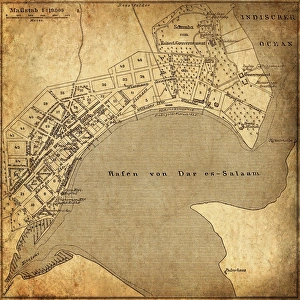
Background imageAfrica Collection: Dar es Salaam, Tanzania

Dar es Salaam, Tanzania
Antique illustration of a Dar es Salaam, Tanzania

Background imageAfrica Collection: Map of Southern Africa, with illustrations showing distinguishing features

Map of Southern Africa, with illustrations showing distinguishing features
Former flag of South Africa

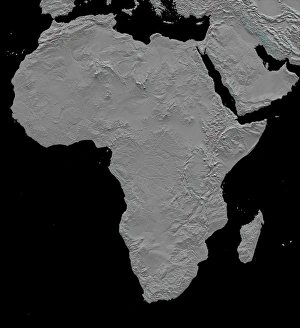
Background imageAfrica Collection: Stereoscopic view of North America

Stereoscopic view of North America
February 2000 - This stereoscopic shaded relief image shows Africas topography as measured by the Shuttle Radar Topography Mission (SRTM) in February 2000

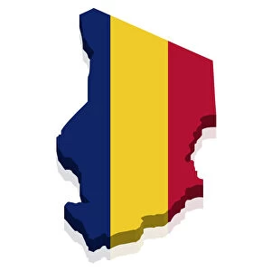
Background imageAfrica Collection: Shape and national flag of the Republic of Chad, 3D computer graphics

Shape and national flag of the Republic of Chad, 3D computer graphics

Background imageAfrica Collection: Map of the Old Continent (Europe, Africa, Asia)

Map of the Old Continent (Europe, Africa, Asia). Engraving by J. vander Schley, from Pierre de Hondt, Histoire Naturelle generale et particuliere avec la description du Cabinet du Roy

Background imageAfrica Collection: Roman Empire, artwork

Roman Empire, artwork
Roman Empire. Computer artwork showing the extent of the Roman Empire (red) during its peak in the 1st Century AD. The Roman Empire reached its greatest extent under the rain of Emperor Trajan
Background imageAfrica Collection: Whole Earth map

Whole Earth map based on satellite data. This is a mosaic of numerous satellite observations of the Earth. Land colours are shaded using topographic data

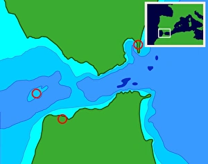
Background imageAfrica Collection: Possible location of Atlantis

Possible location of Atlantis
Possible Atlantis. Computer-generated map of a proposed location of the mythical city of Atlantis on Spartel Island in the Strait of Gibraltar

Background imageAfrica Collection: EXPL2A-00138

EXPL2A-00138
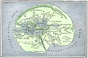
Map of the flat earth according to Herodotus, ancient Greek historian. Hand-colored woodcut of a 19th-century illustration

Background imageAfrica Collection: EXPL2A-00317

EXPL2A-00317
Map of the world according to ancient Greek geographer Eratosthenes. Hand-colored 19th-century woodcut reproduction

Background imageAfrica Collection: Great voyages of the age of exploration

Great voyages of the age of exploration
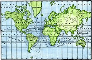
Map of great voyages from 1492 to 1580. Hand-colored woodcut of a 19th-century illustration

Background imageAfrica Collection: Alexandria, Egypt, in the 1500s

Alexandria, Egypt, in the 1500s
Map of Alexandria, showing the lighthouse Pharos at the harbor entrance in the 1500s. Hand-colored 19th-century woodcut reproduction of a medieval illustration

Background imageAfrica Collection: Rome and Carthage, 264 BC

Rome and Carthage, 264 BC
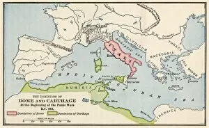
Territories of Rome and Carthage at the outset of the Punic Wars, 264 BC. Color lithograph

Background imageAfrica Collection: Babylonia, Lydia, and Medea in ancient times

Babylonia, Lydia, and Medea in ancient times
Map of ancient Babylonia and of the kingdoms of Lydia and Medea, circa 550 BC. Printed color lithograph of a 19th-century illustration

Background imageAfrica Collection: Sir Alfred Milner

Sir Alfred Milner
Alfred Milner, 1st Viscount Milner (1854 - 1925). British statesman and colonial administrator. Key British Empire figure in the events leading up to and following the Boer War

Background imageAfrica Collection: Map / Nw Africa 1719

Map / Nw Africa 1719
North-west Africa, showing portions of Barbary, land of the Berbers, known to Europeans as barbarians (today Morocco, Tunisia &c)

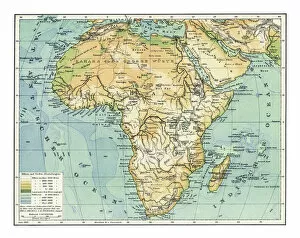
Background imageAfrica Collection: Old chromolithograph map of Africa

Old chromolithograph map of Africa
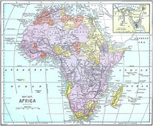
Historical Maps

Background imageAfrica Collection: British Empire Exhibition, Wembley

British Empire Exhibition, Wembley
Pictorial folding poster map of the layout of the British Empire Exhibition at Wembley Park, 1924. The exhibition was intended as a celebration of Imperial goods and achievements

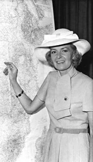
Background imageAfrica Collection: Sheila Scott, English record-breaking aviator

Sheila Scott, English record-breaking aviator
Sheila Scott (Sheila Christine Hopkins, 1922-1988), English aviator who broke over 100 aviation records through her long distance flights. Seen here in dress and hat, pointing at a map of Africa

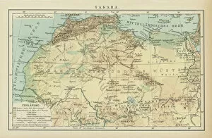
Background imageAfrica Collection: Old map of desert on the African continent - Sahara

Old map of desert on the African continent - Sahara
Antique Maps

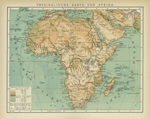
Background imageAfrica Collection: Old map of the continent of Africa

Old map of the continent of Africa
Antique Maps

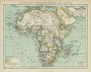
Background imageAfrica Collection: Old map of political map of Africa

Old map of political map of Africa
Antique Maps

Background imageAfrica Collection: Old map of the continent of Africa

Old map of the continent of Africa
Antique Maps

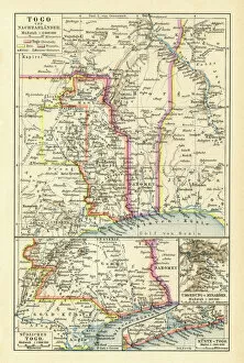
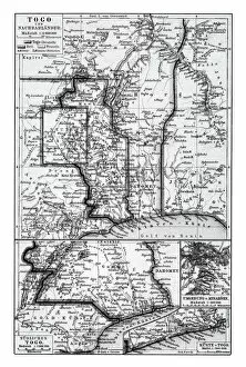
Background imageAfrica Collection: Old chromolithograph map of Togo, country in West Africa

Old chromolithograph map of Togo, country in West Africa
Antique Maps

Background imageAfrica Collection: Old chromolithograph map of Cameroon, country in west-central Africa

Old chromolithograph map of Cameroon, country in west-central Africa
Antique Maps

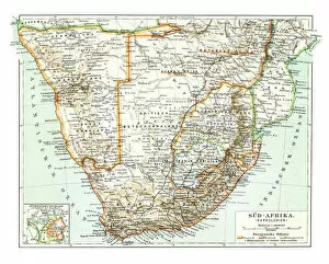
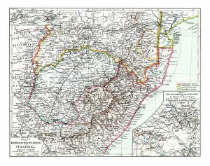
Background imageAfrica Collection: Old chromolithograph map of South Africa

Old chromolithograph map of South Africa
Antique Maps

Background imageAfrica Collection: Old chromolithograph map of South Africa

Old chromolithograph map of South Africa
Antique Maps

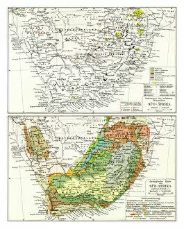
Background imageAfrica Collection: Old chromolithograph map of occurrences of exploitable minerals and geological map in south africa

Old chromolithograph map of occurrences of exploitable minerals and geological map in south africa
Antique Maps

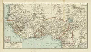
Background imageAfrica Collection: Old chromolithograph map of Upper Guinea and West Sudan - West Africa

Old chromolithograph map of Upper Guinea and West Sudan - West Africa
Antique Maps

Background imageAfrica Collection: Old chromolithograph map of South Africa

Old chromolithograph map of South Africa
Antique Maps

Background imageAfrica Collection: Old chromolithograph map of Upper Guinea and West Sudan - West Africa

Old chromolithograph map of Upper Guinea and West Sudan - West Africa
Antique Maps

Background imageAfrica Collection: Old chromolithograph map of occurrences of exploitable minerals and geological map in south africa

Old chromolithograph map of occurrences of exploitable minerals and geological map in south africa
Antique Maps

Background imageAfrica Collection: Old chromolithograph map of South Africa

Old chromolithograph map of South Africa
Antique Maps

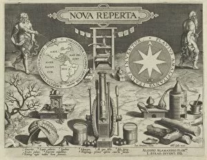
Background imageAfrica Collection: New Inventions of Modern Times [Nova Reperta], Title Plate, ca. 1600. Creator: Jan Collaert I

New Inventions of Modern Times [Nova Reperta], Title Plate, ca. 1600. Creator: Jan Collaert I
New Inventions of Modern Times [Nova Reperta], Title Plate, ca. 1600

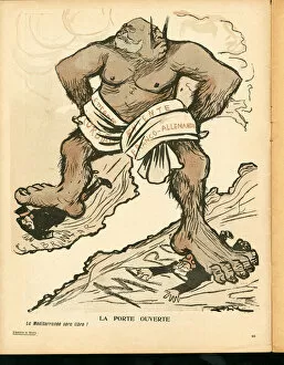
Background imageAfrica Collection: L Assiette au Beurre, number 238, Satirique en couleurs, 1905_10_21: Germany Prussia

L Assiette au Beurre, number 238, Satirique en couleurs, 1905_10_21: Germany Prussia, England Great Britain, Spain
ICA4700050 L Assiette au Beurre, number 238, Satirique en couleurs, 1905_10_21: Germany Prussia, England Great Britain, Spain, President of the Republic, Morocco, Entente cordial

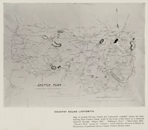
Background imageAfrica Collection: Country round Ladysmith (b / w photo)

Country round Ladysmith (b / w photo)
7160191 Country round Ladysmith (b/w photo) by Kisch, David Henry (1847-1902); Private Collection; (add.info.: Country round Ladysmith)

Background imageAfrica Collection: Relief of Ladysmith (b / w photo)

Relief of Ladysmith (b / w photo)
7202543 Relief of Ladysmith (b/w photo) by Kisch, David Henry (1847-1902); Private Collection; (add.info.: Relief of Ladysmith)

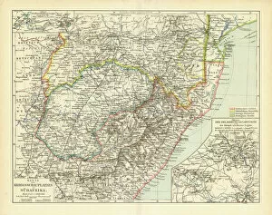
Background imageAfrica Collection: 1899 map of South Africa at the time of the Second Boer War. Such was the interest in the progress

1899 map of South Africa at the time of the Second Boer War. Such was the interest in the progress of the war that maps like this were produced with a number of flags of both sides in the margin


All Professionally Made to Order for Quick Shipping


-

Africa Collection

Africa is the world's second-largest continent, covering approximately 30 million square kilometers and has a population of over one billion people and is home to some of the most diverse cultures and languages on earth, and is known for its vast natural resources, including oil, gold, diamonds, and other minerals. However, despite its wealth in resources, many African countries struggle with poverty and political instability. Maps and charts can help us understand the geography as well as economic trends such as trade flows or GDP growth rates and can also highlight issues like climate change or disease outbreaks that affect different regions differently.
+

Our beautiful Wall Art and Photo Gifts include Framed Prints, Photo Prints, Poster Prints, Canvas Prints, Jigsaw Puzzles, Metal Prints and so much more

Media Storehouse offers a vast collection of Africa maps and charts that showcase the beauty and diversity of the continent. Our collection includes vintage maps, political maps, topographical maps, geological charts, and more. These prints are perfect for anyone who loves geography or wants to add an African touch to their home decor. The Africa Maps and Charts collection features high-quality prints that are available in various sizes and formats such as canvas prints, art prints, framed prints, or posters. Customers can choose from different styles ranging from colorful abstract designs to detailed black-and-white illustrations. These stunning pieces of wall art capture the essence of Africa's rich history and culture while providing educational value for those interested in learning about its geography. Whether you're looking to decorate your living room or office space with unique artwork or want to gift someone with a meaningful present related to their interests - our Africa Maps and Charts collection is definitely worth exploring.
+

What are Africa (Maps and Charts) art prints?

Africa art prints are a collection of high-quality, visually stunning artworks that showcase the diverse geography and topography of the African continent. These prints feature detailed maps and charts that highlight various regions, countries, cities, landmarks, and natural wonders across Africa. These art prints are perfect for anyone who has an interest in African history, culture or geography. They can be used to decorate homes or offices with a unique touch of elegance while also serving as educational resources for students studying African geography or history. The Africa art print collection is available in a variety of sizes to suit different needs. The prints are produced using state-of-the-art printing technology on premium quality paper to ensure they last for years without fading or losing their vibrancy. These art prints offer an excellent way to appreciate the beauty and diversity of Africa's landscapes while also learning more about its rich cultural heritage.
+

What Africa (Maps and Charts) art prints can I buy from Media Storehouse?

We offer a wide range of Africa maps and charts art prints that are perfect for anyone looking to add some African flair to their home or office decor. These prints feature detailed maps and charts of various regions in Africa, showcasing the diverse geography, topography, and cultural heritage of this vast continent. Some popular options include vintage-style maps that highlight colonial-era borders and territories, as well as more contemporary designs that showcase modern political boundaries and natural landmarks. You can also find charts depicting wildlife populations, climate patterns, and other fascinating data about different parts of Africa. Whether you're a history buff, nature lover, or simply appreciate beautiful artwork with an African theme, we have something for everyone. With high-quality printing techniques and a variety of sizes available to choose from, these art prints are sure to make a stunning addition to any space.
+

How do I buy Africa (Maps and Charts) art prints?

To buy Africa art prints from Media Storehouse, you can browse our extensive collection of high-quality prints online. Simply search for the specific artwork or artist that you are interested in, or explore their curated collections to discover new pieces. Once you have found a print that you would like to purchase, simply add it to your cart and proceed to checkout. You will be prompted to enter your shipping and payment information, after which your order will be processed. We offer a range of sizes and framing options for their prints, so be sure to choose the one that best suits your needs. Whether you are looking for a small print to display on your desk or a large statement piece for your living room wall, they have something for everyone. Buying Africa art prints from Media Storehouse is an easy and convenient way to bring beautiful artwork into your home or office.
+

How much do Africa (Maps and Charts) art prints cost?

We offer a wide range of Africa maps and charts art prints that are available at varying prices. Our collection features different styles and designs to suit your preferences. The cost of our Africa maps and charts art prints is dependent on several factors such as the size, quality, and type of print you choose. We provide affordable options for those looking for budget-friendly pieces while also offering high-end prints for those who want something more luxurious. Our pricing structure ensures that everyone can find an artwork that fits their budget without compromising on quality. Our Africa maps and charts art prints are perfect for adding a touch of culture to any space in your home or office. They make great gifts too. We take pride in providing our customers with exceptional products at reasonable prices so they can enjoy beautiful artwork without breaking the bank.
+

How will my Africa (Maps and Charts) art prints be delivered to me?

We take great care in ensuring that your Africa art prints are delivered to you in the best possible condition. We use high-quality packaging materials to protect your artwork during transit, including sturdy cardboard tubes for rolled prints and flat cardboard envelopes for smaller sizes. Once your order is processed, our team carefully packs your artwork and sends it out for delivery via a trusted courier service. You will receive a tracking number so that you can follow the progress of your package until it arrives at your doorstep. We understand how important it is to receive your artwork promptly and securely, which is why we work hard to ensure that all orders are dispatched as quickly as possible. Whether you're ordering from within the UK or overseas, we strive to provide a reliable and efficient delivery service every time.