Home > Europe > United Kingdom > England > London > Boroughs > Merton
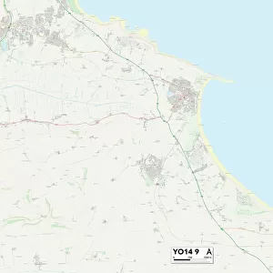
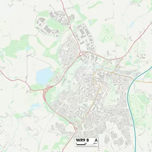
Worcester WR4 9 Map

![]()
Wall Art and Photo Gifts from Map Marketing
Worcester WR4 9 Map
Postcode Sector Map of Worcester WR4 9
Media ID 19982708
Acacia Close Alder Close Amberley Close Ambleside Drive Ash Avenue Avon Close Avon Road Balliol Road Birch Avenue Bisley Close Blackthorn Road Borrowdale Drive Brickfields Brindley Road Burford Close Buttermere Drive Carters Close Cartmel Close Cedar Avenue Chedworth Close Cherwell Close Cheviot Close Chiltern Close Christchurch Road Coniston Close Coopers Close Cotswold Way Cromwell Street Derwent Close Dove Close Dunster Close Edgeworth Close Ennerdale Close Eskdale Close Fairfield Close Furness Close Gardeners Close Goldsmith Road Grasmere Drive Gresley Road Hall Close Hawthorn Road Hazel Close Highland Road Keble Close Kentmere Close Kenwood Avenue Kenwood Close Keswick Drive Kirkstone Drive Laburnum Road Langdale Close Langdale Drive Larch Road Laurel Road Lilac Avenue Lime Avenue Linden Road Maple Avenue Martindale Close May Avenue Mendip Close Merton Close Millers Close Oak Avenue Oakridge Close Oriel Close Patterdale Drive Penrith Close Pine Way Poplar Avenue Potters Close Prestbury Close Redwood Close Rose Avenue Rowan Avenue Rydal Close Salters Close Scafell Close Selsey Close Skiddaw Close Somerville Road Stanway Close Sycamore Road Tanners Close Thirlmere Close Thorn Avenue Tiverton Close Turners Close Ullswater Close Walnut Avenue Wheelwright Close Windermere Drive Wolsey Close Woodmancote Worcester Brantwood Conway
FEATURES IN THESE COLLECTIONS
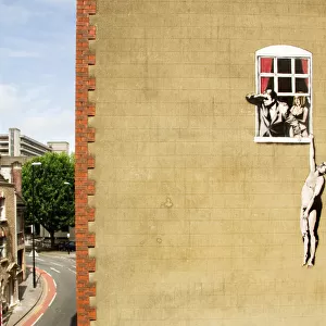
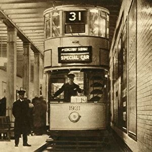
> Architecture
> Tunnels
> Europe
> United Kingdom
> England
> Avon
> Europe
> United Kingdom
> England
> London
> Boroughs
> Merton
> Europe
> United Kingdom
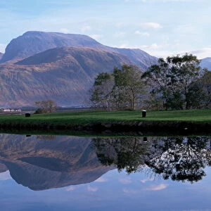
> Scotland
> Highlands
> Related Images
> Map Marketing
> Postcode Sector Maps
> WR - Worcester
> Maps and Charts
> Related Images
MADE IN THE UK
Safe Shipping with 30 Day Money Back Guarantee
FREE PERSONALISATION*
We are proud to offer a range of customisation features including Personalised Captions, Color Filters and Picture Zoom Tools
SECURE PAYMENTS
We happily accept a wide range of payment options so you can pay for the things you need in the way that is most convenient for you
* Options may vary by product and licensing agreement. Zoomed Pictures can be adjusted in the Basket.