Home > Europe > United Kingdom > England > Bristol > Barton Hill
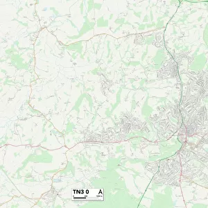
Stroud GL6 0 Map

![]()
Wall Art and Photo Gifts from Map Marketing
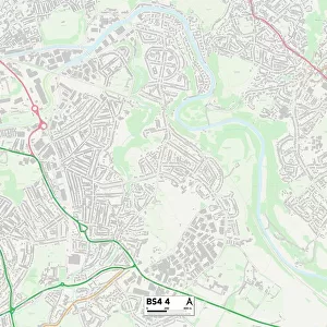
Stroud GL6 0 Map
Postcode Sector Map of Stroud GL6 0
Media ID 19970468
Barn Close Barton Close Bath Road Beechwood Close Brewery Lane Bridge Street Burma Road Cherry Tree Close Chestnut Close Church Road Church Street Churchill Close Churchill Road Dark Lane Fountain Street George Street Hay Lane Hayes Road Hazel Court Homefield Horsley Road Jubilee Road Market Street Meadow Bank Newmarket Newmarket Road Old School Close Orchard Mead Park Road Pike Lane Spring Hill Springhill Close Star Hill Station Road Stroud The Ridings The Street Upper Park Road Valley View Vicarage Gardens Whitecroft Whiteway Wood End Lane Wood Lane Chestnut Hill Forest Green Horsley Nailsworth Old Market
FEATURES IN THESE COLLECTIONS
> Africa
> Egypt
> Related Images
> Arts
> Landscape paintings
> Forest and woodland scenes
> Forest artwork
> Arts
> Portraits
> Pop art gallery
> Street art portraits
> Asia
> Myanmar
> Related Images
> Europe
> United Kingdom
> England
> Bristol
> Barton Hill
> Europe
> United Kingdom
> England
> Bristol
> Bristol
> Map Marketing
> Postcode Sector Maps
> GL - Gloucester
> Maps and Charts
> Related Images
> Maps and Charts
> Star Charts
MADE IN THE UK
Safe Shipping with 30 Day Money Back Guarantee
FREE PERSONALISATION*
We are proud to offer a range of customisation features including Personalised Captions, Color Filters and Picture Zoom Tools
SECURE PAYMENTS
We happily accept a wide range of payment options so you can pay for the things you need in the way that is most convenient for you
* Options may vary by product and licensing agreement. Zoomed Pictures can be adjusted in the Basket.