Home > Europe > United Kingdom > England > London > Art > Venues > St Pauls Church
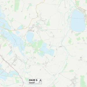
South Oxfordshire OX49 5 Map

![]()
Wall Art and Photo Gifts from Map Marketing
South Oxfordshire OX49 5 Map
Postcode Sector Map of South Oxfordshire OX49 5
Media ID 19978498
Ash Close Barley Close Beech Close Blenheim Road Brook Street Brookside Castle Road Chapel Street Chestnut Place Chiltern Gardens Church Lane Church Street Court Close Easington Greenfield Hall Close High Street Hill Road Howe Road London Road Love Lane Manor Close New Road Old School Place Red Lane Saunders Close School Lane South Oxfordshire Spring Lane Springfield Close St Leonards Close Station Road Sycamore Close The Green The Meadows Town Farm Close Watlington Road Weston Road Willow Close Aston Rowant Upperton
FEATURES IN THESE COLLECTIONS
> Arts
> Portraits
> Pop art gallery
> Street art portraits
> Europe
> United Kingdom
> England
> London
> Art
> Venues
> St Pauls Church
> Europe
> United Kingdom
> England
> London
> Related Images
> Europe
> United Kingdom
> England
> London
> Sights
> Green Park
> Europe
> United Kingdom
> England
> London
> Sights
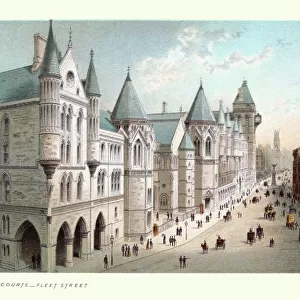
> High Court
> Europe
> United Kingdom
> England
> London
> Sights
> St Pauls Cathedral
> Europe
> United Kingdom
> England
> Oxfordshire
> Aston Rowant
> Europe
> United Kingdom
> England
> Oxfordshire
> Aston
> Europe
> United Kingdom
> England
> Oxfordshire
> Britwell Salome
> Europe
> United Kingdom
> England
> Oxfordshire
> Chinnor
> Map Marketing
> Postcode Sector Maps
> OX - Oxford
MADE IN THE UK
Safe Shipping with 30 Day Money Back Guarantee
FREE PERSONALISATION*
We are proud to offer a range of customisation features including Personalised Captions, Color Filters and Picture Zoom Tools
SECURE PAYMENTS
We happily accept a wide range of payment options so you can pay for the things you need in the way that is most convenient for you
* Options may vary by product and licensing agreement. Zoomed Pictures can be adjusted in the Basket.