Home > Europe > United Kingdom > England > London > Boroughs > Richmond upon Thames
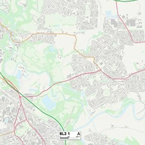
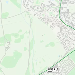
Richmond upon Thames SW14 7 Map

![]()
Wall Art and Photo Gifts from Map Marketing
Richmond upon Thames SW14 7 Map
Postcode Sector Map of Richmond upon Thames SW14 7
Media ID 19982130
Albany Close Beechcroft Road Bexhill Road Carlton Road Chestnut Mews Christchurch Road Clifford Avenue Colston Road Connaught Avenue Cromwell Place Derby Road Earl Road Elm Road Firs Avenue Hanson Close Kingsway Langdale Close Longfield Drive Observatory Road Ormonde Road Palmers Road Palmerston Road Parklands Close Pembroke Gardens Percival Road Richmond Upon Thames Rosemary Lane Rutland Close Ship Lane Spencer Gardens St Leonards Road Stanley Road The Mall Uplands Close Waldeck Road Warren Avenue Wayside Well Lane Martindale
FEATURES IN THESE COLLECTIONS
> Animals
> Mammals
> Muridae
> Little Wood Mouse
> Europe
> United Kingdom
> England
> London
> Boroughs
> Richmond upon Thames
> Europe
> United Kingdom
> England
> Rutland
> Related Images
> Europe
> United Kingdom
> Wales
> Pembrokeshire
> Pembroke
> Map Marketing
> Postcode Sector Maps
> SW - London SW
> Maps and Charts
> Related Images
MADE IN THE UK
Safe Shipping with 30 Day Money Back Guarantee
FREE PERSONALISATION*
We are proud to offer a range of customisation features including Personalised Captions, Color Filters and Picture Zoom Tools
SECURE PAYMENTS
We happily accept a wide range of payment options so you can pay for the things you need in the way that is most convenient for you
* Options may vary by product and licensing agreement. Zoomed Pictures can be adjusted in the Basket.