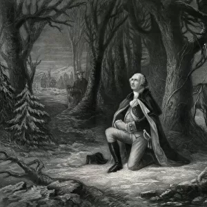
Home > Europe > United Kingdom > England > London > Politics > Arthur Balfour
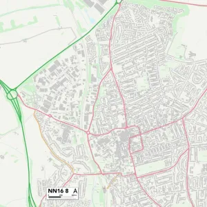
Northampton NN2 6 Map

![]()
Wall Art and Photo Gifts from Map Marketing
Northampton NN2 6 Map
Postcode Sector Map of Northampton NN2 6
Media ID 19975900
Adelaide Street Arnold Road Arthur Street Baker Street Balfour Road Balmoral Place Balmoral Road Barrack Road Branksome Avenue Brick Kiln Lane Burleigh Road Cambridge Street Cartwright Road Cecil Road Clarence Avenue Essex Street Freehold Street Garfield Close Garfield Street Gordon Street Green End Hampton Street Homestead Way Horsley Road Kensington Close Knights Lane Leslie Road Lincoln Street Manor Road Mill Lane Mill Road Norfolk Street Norfolk Terrace Northampton Northcote Street Queens Park Salisbury Street St Georges Avenue St Pauls Road Stanhope Road Stanley Street Studland Road The Green The Rise Thornton Road Tollgate Close Trinity Avenue Vicarage Close Vicarage Lane Washington Street Hester Street
FEATURES IN THESE COLLECTIONS
> Arts
> Artists
> B
> George Baker
> Arts
> Artists
> P
> Gordon Parks
> Arts
> Artists
> W
> George Washington
> Arts
> Artists
> W
> Georges Washington
> Arts
> Portraits
> Pop art gallery
> Street art portraits
> Europe
> United Kingdom
> England
> Essex
> Baker Street
> Europe
> United Kingdom
> England
> Essex
> Mill Green
> Europe
> United Kingdom
> England
> Essex
> Related Images
> Europe
> United Kingdom
> England
> London
> Politics
> Arthur Balfour
> Europe
> United Kingdom
> England
> Norfolk
> Lower Green
> Map Marketing
> Postcode Sector Maps
> NN - Northampton
MADE IN THE UK
Safe Shipping with 30 Day Money Back Guarantee
FREE PERSONALISATION*
We are proud to offer a range of customisation features including Personalised Captions, Color Filters and Picture Zoom Tools
SECURE PAYMENTS
We happily accept a wide range of payment options so you can pay for the things you need in the way that is most convenient for you
* Options may vary by product and licensing agreement. Zoomed Pictures can be adjusted in the Basket.