Home > Europe > United Kingdom > England > Cumberland
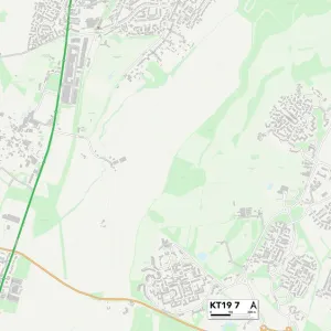
Kingston upon Thames KT9 1 Map

![]()
Wall Art and Photo Gifts from Map Marketing
Kingston upon Thames KT9 1 Map
Postcode Sector Map of Kingston upon Thames KT9 1
Media ID 19973072
Albury Road Angus Close Apple Grove Ash Court Beechcroft Road Beverley Close Buckland Road Cecil Close Chantry Road Clayton Road Coniston Way Cox Lane Cricketers Close Cumberland Drive Devon Way Dorset Close Drake Road Elm Road Fircroft Road Glen Road Grange Road Green End Greenlands Holmwood Road Hook Hook Road Hunters Road Hurst Close Jubilee Way Kingston Upon Thames Lynton Close Meadow Way Moor Lane Moorfield Road Mount Road North Parade Oaklands Close Orchard Gardens Orchard Road Pear Tree Close Priory Road Roebuck Road Romney Close Rosemary Gardens Selwood Road Sherborne Road Somerset Avenue St Pauls Close Station Road The Causeway The Oaks Tudor Close
FEATURES IN THESE COLLECTIONS
> Europe
> United Kingdom
> England
> Cumberland
> Europe
> United Kingdom
> England
> Devon
> Ash
> Europe
> United Kingdom
> England
> Devon
> Babbacombe
> Europe
> United Kingdom
> England
> Devon
> Buckland
> Europe
> United Kingdom
> England
> Devon
> Kingston
> Europe
> United Kingdom
> England
> Devon
> Lynton
> Europe
> United Kingdom
> England
> Devon
> Related Images
> Europe
> United Kingdom
> England
> Devon
> Rosemary Lane
> Europe
> United Kingdom
> England
> Dorset
> Grove
> Europe
> United Kingdom
> England
> Dorset
> Kingston
> Map Marketing
> Postcode Sector Maps
> KT - Kingston upon Thames
MADE IN THE UK
Safe Shipping with 30 Day Money Back Guarantee
FREE PERSONALISATION*
We are proud to offer a range of customisation features including Personalised Captions, Color Filters and Picture Zoom Tools
SECURE PAYMENTS
We happily accept a wide range of payment options so you can pay for the things you need in the way that is most convenient for you
* Options may vary by product and licensing agreement. Zoomed Pictures can be adjusted in the Basket.