Home > Europe > United Kingdom > England > London > Towns > West Green
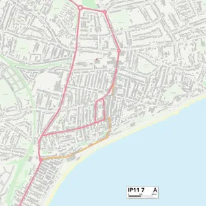
Breckland IP26 5 Map

![]()
Wall Art and Photo Gifts from Map Marketing
Breckland IP26 5 Map
Postcode Sector Map of Breckland IP26 5
Media ID 19971870
Ashburton Road Breckland Cherry Tree Close Church Lane Common Drove Cross Lane Crown Road Fir Close Glebe Close Green Lane Hall Lane Hawthorne Drive High Street Hythe Road Lawrence Close Little London Little London Lane London Lane Normandy Close Pinfold Lane Riverside School Lane School Road St Andrews Close St Leonards Street Swaffham Road Thetford Road Tithe Barn Close Vicarage Close Vicarage Road Walnut Close Walnut Drive West End Westgate Street White Hart Street Brecklands Stanford
FEATURES IN THESE COLLECTIONS
> Arts
> Artists
> W
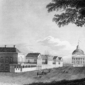
> Stanford White
> Arts
> Portraits
> Pop art gallery
> Street art portraits
> Europe
> United Kingdom
> England
> London
> Related Images
> Europe
> United Kingdom
> England
> London
> Sights
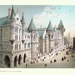
> High Court
> Europe
> United Kingdom
> England
> London
> Towns
> Church End
> Europe
> United Kingdom
> England
> London
> Towns
> West Green
> Europe
> United Kingdom
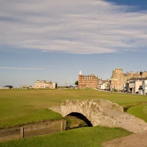
> Scotland
> Fife
> St Andrews
> Map Marketing
> Postcode Sector Maps
> IP - Ipswich
> Maps and Charts
> Related Images
MADE IN THE UK
Safe Shipping with 30 Day Money Back Guarantee
FREE PERSONALISATION*
We are proud to offer a range of customisation features including Personalised Captions, Color Filters and Picture Zoom Tools
SECURE PAYMENTS
We happily accept a wide range of payment options so you can pay for the things you need in the way that is most convenient for you
* Options may vary by product and licensing agreement. Zoomed Pictures can be adjusted in the Basket.