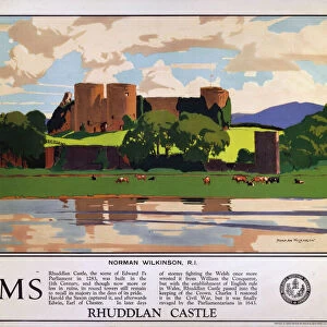
Home > Europe > United Kingdom > Wales > Denbighshire > Rhuddlan
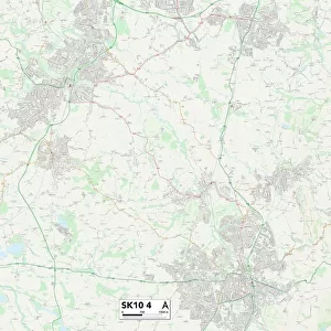
High Peak SK23 6 Map

![]()
Wall Art and Photo Gifts from Map Marketing
High Peak SK23 6 Map
Postcode Sector Map of High Peak SK23 6
Media ID 19981150
Ash Grove Belle Vue Buxton Road Derwent Drive Devonshire Drive Forge Road Granby Avenue Green Lane Hartington Drive Hawthorn Close Hayfield Road High Peak Lower Lane Mill Court Princes Road Rutland Way Sandy Lane St Marys Close Station Road The Sidings
FEATURES IN THESE COLLECTIONS
> Europe
> United Kingdom
> England
> Rutland
> Related Images
> Europe
> United Kingdom
> Wales
> Denbighshire
> Rhuddlan
> Map Marketing
> Postcode Sector Maps
> SK - Stockport
> Maps and Charts
> Related Images
MADE IN THE UK
Safe Shipping with 30 Day Money Back Guarantee
FREE PERSONALISATION*
We are proud to offer a range of customisation features including Personalised Captions, Color Filters and Picture Zoom Tools
SECURE PAYMENTS
We happily accept a wide range of payment options so you can pay for the things you need in the way that is most convenient for you
* Options may vary by product and licensing agreement. Zoomed Pictures can be adjusted in the Basket.