Home > Europe > United Kingdom > England > London > Boroughs > Haringey
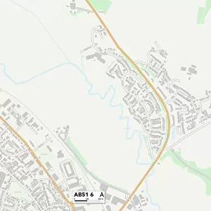
Haringey N17 9 Map

![]()
Wall Art and Photo Gifts from Map Marketing
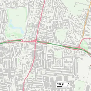
Haringey N17 9 Map
Postcode Sector Map of Haringey N17 9
Media ID 19976184
Albion Road Ambleside Close Ashley Road Bream Close Brook Street Bruce Grove Buller Road Burdock Road Carew Road Circular Road Cromer Road Cygnet Way Dawlish Road Devon Close Factory Lane Ferry Lane Forest Road Hale Road Hamilton Close Hanbury Road Haringey Havelock Road High Road Holcombe Road Hollington Road Junction Road Kimberley Road Ladysmith Road Mafeking Road Malvern Road Montague Road Park View Road Parkhurst Road Rosebery Avenue Seymour Avenue Somerset Road Spencer Road St Marys Close Station Road Stoneleigh Road Waterside Way Windsor Road Wycombe Road
FEATURES IN THESE COLLECTIONS
> Animals
> Insects
> Hemiptera
> Green Scale
> Arts
> Artists
> W
> Wilson Wilson
> Arts
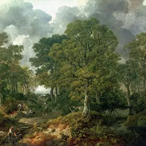
> Landscape paintings
> Forest and woodland scenes
> Forest artwork
> Arts
> Portraits
> Pop art gallery
> Street art portraits
> Europe
> United Kingdom
> England
> Devon
> Cross Green
> Europe
> United Kingdom
> England
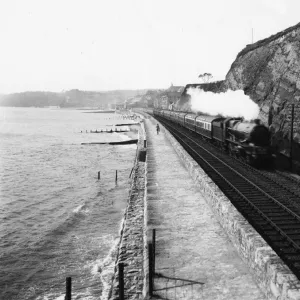
> Devon
> Dawlish
> Europe
> United Kingdom
> England
> Devon
> Holcombe
> Europe
> United Kingdom
> England
> Devon
> Related Images
> Europe
> United Kingdom
> England
> London
> Boroughs
> Haringey
> Europe
> United Kingdom
> England
> Somerset
> Cross
> Map Marketing
> Postcode Sector Maps
> N - London N
MADE IN THE UK
Safe Shipping with 30 Day Money Back Guarantee
FREE PERSONALISATION*
We are proud to offer a range of customisation features including Personalised Captions, Color Filters and Picture Zoom Tools
SECURE PAYMENTS
We happily accept a wide range of payment options so you can pay for the things you need in the way that is most convenient for you
* Options may vary by product and licensing agreement. Zoomed Pictures can be adjusted in the Basket.