Home > Africa > Kenya > Maps
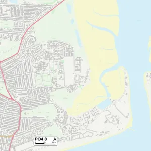
Hampshire PO16 9 Map

![]()
Wall Art and Photo Gifts from Map Marketing
Hampshire PO16 9 Map
Postcode Sector Map of Hampshire PO16 9
Media ID 19976696
Albion Close Alton Grove Berry Close Castle Grove Castle Street Castle View Road Central Road Church Road Coral Close Cow Lane Cranleigh Road Grove Avenue Hampshire Harbour View Hospital Lane Jubilee Road Kenwood Road King George Road Lonsdale Avenue Marlborough Grove Merton Avenue Myrtle Avenue Nelson Avenue Neville Avenue Norman Close Orchard Grove Priory Gardens Queen Mary Road Seafield Road Shrubbery Close Southfields Sunningdale Road The Keep Thistle Close Waterside Lane Webb Road Wellington Grove Westbrook Road White Hart Lane Windmill Grove Windsor Road York Gardens Whitehaven
FEATURES IN THESE COLLECTIONS
> Africa
> Kenya
> Related Images
> Animals
> Farm
> Cattle
> Related Images
> Animals
> Mammals
> Muridae
> House Mouse
> Arts
> Artists
> N
> John Norman
> Arts
> Artists
> R
> Roman Roman
> Arts
> Artists
> V
> George Vincent
> Arts
> Artists
> W
> George White
> Arts
> Artists
> W
> John White
> Arts
> Portraits
> Pop art gallery
> Street art portraits
> Map Marketing
> Postcode Sector Maps
> PO - Portsmouth
MADE IN THE UK
Safe Shipping with 30 Day Money Back Guarantee
FREE PERSONALISATION*
We are proud to offer a range of customisation features including Personalised Captions, Color Filters and Picture Zoom Tools
SECURE PAYMENTS
We happily accept a wide range of payment options so you can pay for the things you need in the way that is most convenient for you
* Options may vary by product and licensing agreement. Zoomed Pictures can be adjusted in the Basket.