Home > Europe > United Kingdom > Wales > Flintshire > Broughton
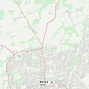
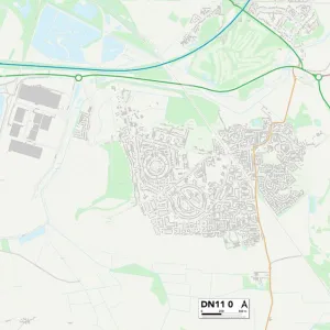
Doncaster DN4 7 Map

![]()
Wall Art and Photo Gifts from Map Marketing
Doncaster DN4 7 Map
Postcode Sector Map of Doncaster DN4 7
Media ID 19968504
A638 Alston Close Alston Road Bawtry Road Boswell Road Brierley Road Broughton Road Burnham Close Carr Lane Conway Court Doncaster Fairfield Close Hallam Close Harcourt Close Honeysuckle Close Howden Close Kentmere Drive Lindrick Close Lindsey Close Long Close Longfield Drive Middlefield Road Oaklands Drive Portland Road Roxby Close Short Lane St Wilfrids Road The Hollows Warren Lane Welton Close Wentworth Grove Whitton Close
FEATURES IN THESE COLLECTIONS
> Europe
> United Kingdom
> Wales
> Flintshire
> Broughton
> Map Marketing
> Postcode Sector Maps
> DN - Doncaster
> Maps and Charts
> Related Images
MADE IN THE UK
Safe Shipping with 30 Day Money Back Guarantee
FREE PERSONALISATION*
We are proud to offer a range of customisation features including Personalised Captions, Color Filters and Picture Zoom Tools
SECURE PAYMENTS
We happily accept a wide range of payment options so you can pay for the things you need in the way that is most convenient for you
* Options may vary by product and licensing agreement. Zoomed Pictures can be adjusted in the Basket.