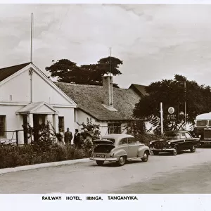
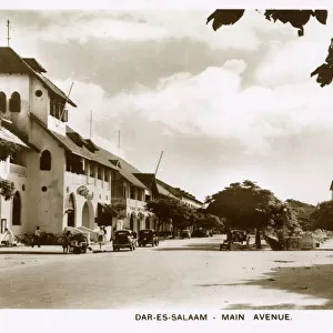
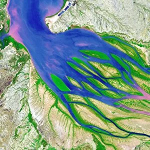
Home > Africa > Democratic Republic of the Congo > Lakes > Lake Tanganyika
Photo Mug : Map of East Africa, First World War, (c1920). Creator: John Bartholomew & Son
. Creator: John Bartholomew & Son")
. Creator: John Bartholomew & Son")

![]()
Home Decor from Heritage Images
Map of East Africa, First World War, (c1920). Creator: John Bartholomew & Son
Map of East Africa, First World War, (c1920). Map showing colonial possessions including the Belgian Congo, British East Africa, German East Africa, Northern Rhodesia and Portuguese East Africa. From " The Great World War - A History" Volume III, edited by Frank A Mumby. [The Gresham Publishing Company Ltd, London, c1920]
Heritage Images features heritage image collections
Media ID 19175453
© The Print Collector/Heritage Images
Bartholomew Bartholomew And Co Bartholomew Co Bartholomew John Son Belgian Congo British East Africa Congo Frank Arthur Frank Arthur Mumby German East Africa German East African Campaign German Empire Gresham Publishing Co Ltd Gresham Publishing Company Imperial Imperialism Jg Bartholomew John And Son John Bartholomew And Co John Bartholomew And Son John Bartholomew And Son Ltd John Bartholomew Co John Bartholomew Son John Bartholomew Son Ltd John Son Keystone Archives Lake Tanganyika Africa Lake Victoria Mozambique Mumby Mumby Frank Arthur Occupied Territory Southern Rhodesia Tanzania Territorial Territory The Great World War A History Theatre Of War Victoria Nyanza Zanzibar Lake Tanganyika Northern Rhodesia
Photo Mug
Add a touch of history to your daily routine with our Media Storehouse Photo Mug featuring a vintage map of East Africa from John Bartholomew & Son, circa 1920. This unique mug showcases an intriguing First World War era map, depicting colonial possessions including the Belgian Congo, British East Africa, German East Africa, Northern Rhodesia, and Portuguese East Africa. Perfect for history enthusiasts, travelers, or anyone who appreciates the beauty of old maps, this mug is not only functional but also a conversation starter. Embrace the past while enjoying your favorite hot beverage.
A personalised photo mug blends sentimentality with functionality, making an ideal gift for cherished loved ones, close friends, or valued colleagues. Preview may show both sides of the same mug.
Elevate your coffee or tea experience with our premium white ceramic mug. Its wide, comfortable handle makes drinking easy, and you can rely on it to be both microwave and dishwasher safe. Sold in single units, preview may show both sides of the same mug so you can see how the picture wraps around.
Mug Size is 9.5cm high x 8cm diameter (3.7" x 3.1")
These are individually made so all sizes are approximate
FEATURES IN THESE COLLECTIONS
> Africa
> Democratic Republic of the Congo
> Lakes
> Lake Tanganyika
> Africa
> Democratic Republic of the Congo
> Lakes
> Related Images
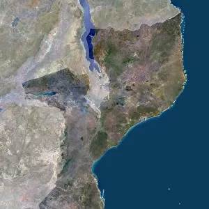
> Africa
> Mozambique
> Lakes
> Related Images
> Africa
> Mozambique
> Maps
> Africa
> Mozambique
> Related Images
> Africa
> Related Images
> Africa
> Republic of the Congo
> Lakes
> Related Images
> Africa
> Tanzania
> Lakes
> Lake Tanganyika
> Africa
> Tanzania
> Lakes
> Lake Victoria
> Africa
> Tanzania
> Lakes
> Related Images
EDITORS COMMENTS
This print showcases a Map of East Africa during the First World War, created by John Bartholomew & Son around 1920. The map provides a fascinating glimpse into the colonial possessions of various nations in the region at that time. It highlights territories such as the Belgian Congo, British East Africa, German East Africa, Northern Rhodesia, and Portuguese East Africa. The vibrant colors used in this map bring to life the concept of imperialism and colonialism prevalent during this era. It serves as a visual representation of how European powers divided and controlled vast areas of land on the African continent. The inclusion of geographical features like Lake Tanganyika and Lake Victoria adds depth to this historical document. These bodies of water played significant roles in shaping military strategies during the German East African Campaign. Taken from "The Great World War - A History". Volume III edited by Frank A Mumby, published by The Gresham Publishing Company Ltd in London around 1920, this print is not just an ordinary map but also a valuable piece of history. It offers insights into political boundaries, imperial ambitions, and territorial disputes that defined East Africa during one of humanity's most devastating conflicts – World War I. With its rich details and historical significance, this print by John Bartholomew & Son is sure to captivate anyone interested in exploring the complex dynamics between European powers and African territories during early 20th century colonialism.
MADE IN THE UK
Safe Shipping with 30 Day Money Back Guarantee
FREE PERSONALISATION*
We are proud to offer a range of customisation features including Personalised Captions, Color Filters and Picture Zoom Tools
SECURE PAYMENTS
We happily accept a wide range of payment options so you can pay for the things you need in the way that is most convenient for you
* Options may vary by product and licensing agreement. Zoomed Pictures can be adjusted in the Basket.