Fraud Blocker Skip to main content

Western Hemisphere Collection (page 4)

Exploring the vast wonders of the Western Hemisphere, we embark on a journey through time and space

Background imageWestern Hemisphere Collection: Topographic views of the world

Topographic views of the world
These images of the world were generated with data from the Shuttle Radar Topography Mission (SRTM), and show the Earth as it would be viewed from a point in space centered over the Americas

Background imageWestern Hemisphere Collection: Full Earth showing South America

Full Earth showing South America (with stars)

Background imageWestern Hemisphere Collection: Image comparison of iconic views of planet Earth

Image comparison of iconic views of planet Earth. Top row left to right: Blue Marble 1972 Photograph, Blue Marble 2002, Aqua Marble 2005

Background imageWestern Hemisphere Collection: The Earth shown at the outer edges of the known solar system

The Earth shown at the outer edges of the known solar system
In this artists visualization, the Earth is shown at the outer edges of the known solar system. The Earth is so far away that the Sun appears as an extremely bright star instead of the large

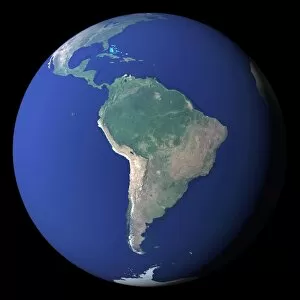
Background imageWestern Hemisphere Collection: South America

South America

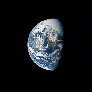
Background imageWestern Hemisphere Collection: View of Earth taken from the Apollo 13 spacecraft

View of Earth taken from the Apollo 13 spacecraft
April 17, 1970 - View of Earth taken from the Apollo 13 spacecraft during its trans-Earth journey home. The most visible land mass includes southwestern United States and northwestern Mexico

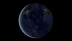
Background imageWestern Hemisphere Collection: Digital composite of Earths city lights at night, centered over the Atlantic Ocean

Digital composite of Earths city lights at night, centered over the Atlantic Ocean. Visible are parts North and South America, Europe, and Africa

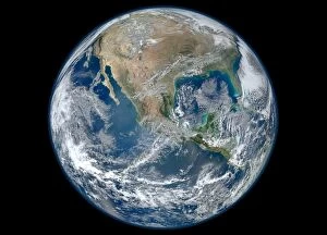
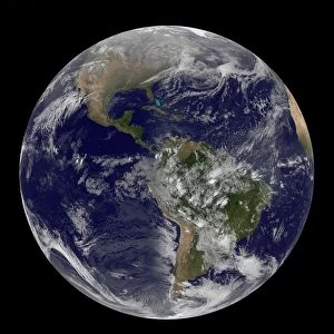
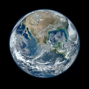
Background imageWestern Hemisphere Collection: Full Earth showing North America and Mexico

Full Earth showing North America and Mexico
January 4, 2012 - A Blue Marble image of Earth showing North America and Mexico

Background imageWestern Hemisphere Collection: Digital composite of a comet heading towards Earth

Digital composite of a comet heading towards Earth

Background imageWestern Hemisphere Collection: Artists concept of the Earth, Pluto, Charon, and Earths moon to scale

Artists concept of the Earth, Pluto, Charon, and Earths moon to scale (from left to right). Pluto has a diameter that is less than a fifth of the Earths and is smaller than Earths moon

Background imageWestern Hemisphere Collection: The Blue Marble Next Generation Earth showing North America

The Blue Marble Next Generation Earth showing North America
The Blue Marble Next Generation data set provides a monthly global cloud-free true-color picture of the Earths landcover at a 500-meter spatial resolution

Background imageWestern Hemisphere Collection: Satellite view of the first day of spring in the northern hemisphere

Satellite view of the first day of spring in the northern hemisphere
March 20, 2014 - Satellite view of the first day of spring in the northern hemisphere

Background imageWestern Hemisphere Collection: Earth with clouds and sea ice from September 15, 2008

Earth with clouds and sea ice from September 15, 2008

Background imageWestern Hemisphere Collection: 3D rendering of planet Earth, arctic view centered on North Pole

3D rendering of planet Earth, arctic view centered on North Pole
3D rendering of planet Earth with clouds, arctic view centered on North Pole

Background imageWestern Hemisphere Collection: View of Hurricane Frances on a partial view of Earth

View of Hurricane Frances on a partial view of Earth
September 1, 2004 - View of Hurricane Frances on a partial view of Earth

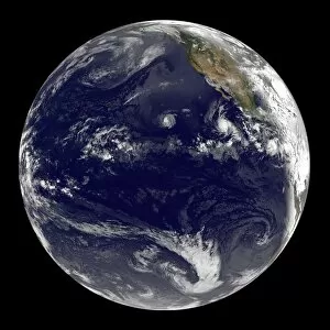
Background imageWestern Hemisphere Collection: View of Earth showing three tropical cyclones in the Pacific Ocean

View of Earth showing three tropical cyclones in the Pacific Ocean
July 10, 2012 - View of full Earth showing three tropical cyclones spinning in the eastern Pacific Ocean. Tropical Storm Daniel is farthest west, followed by Hurricane Emilia

Background imageWestern Hemisphere Collection: The Blue Marble Next Generation Earth showing the United States, Canada and Greenland

The Blue Marble Next Generation Earth showing the United States, Canada and Greenland
The Blue Marble Next Generation data set provides a monthly global cloud-free true-color picture of the Earths landcover at a 500-meter spatial resolution

Background imageWestern Hemisphere Collection: View of plant growth on planet Earth

View of plant growth on planet Earth
View of South America and portions of North America and Africa showing plant growth. In this image, the plants on Earth look red

Background imageWestern Hemisphere Collection: Pool table with balls and one of them as planet Earth

Pool table with balls and one of them as planet Earth. Close-up on Americas view

Background imageWestern Hemisphere Collection: Illustration comparing the size of extrasolar planet Gliese 581 c with that of the Earth

Illustration comparing the size of extrasolar planet Gliese 581 c with that of the Earth
Illustration comparing the size of extrasolar planet Gliese 581 c (right) with that of the Earth (left). Gliese 581 c is believed to be about five times more massive than the Earth with a diameter

Background imageWestern Hemisphere Collection: Planet Earth 90 million years ago during the Late Cretaceous Period

Planet Earth 90 million years ago during the Late Cretaceous Period
This is how the western hemisphere of the Earth may have appeared 90 million years ago during the Late Cretaceous period. During this period continental drift

Background imageWestern Hemisphere Collection: Full Earth at night showing city lights centered on Australia and Oceania

Full Earth at night showing city lights centered on Australia and Oceania

Background imageWestern Hemisphere Collection: Stylized Earth globe with grid, centered on Atlantic Ocean

Stylized Earth globe with grid, centered on Atlantic Ocean, with North America, South America, Europe and Africa partially visible

Background imageWestern Hemisphere Collection: PAN-AMERICAN CONFERENCE. Convening of the First International Conference of American

PAN-AMERICAN CONFERENCE. Convening of the First International Conference of American States at the Wallach Mansion in Washington D.C. 2 October, 1889. Secretary of State James G

Background imageWestern Hemisphere Collection: WESTERN HEMISPHERE, 1596. Theodore de Brys map of the western hemisphere, 1596

WESTERN HEMISPHERE, 1596. Theodore de Brys map of the western hemisphere, 1596, surrounded by the explorers (clockwise from top left) Columbus, Vespucci, Pizarro, and Magellan

Background imageWestern Hemisphere Collection: WESTERN HEMISPHERE, 1576. Map of the Western Hemisphere from Sir Humphrey Gilbert s

WESTERN HEMISPHERE, 1576. Map of the Western Hemisphere from Sir Humphrey Gilbert s
WESTERN HEMISPHERE, 1576. Map of the Western Hemisphere from Sir Humphrey Gilberts Discourse of a Discoverie for a new passage to Cataia, 1576

Background imageWestern Hemisphere Collection: Adler Planetarium Projector

Adler Planetarium Projector
Chicago, Illinois: May 6, 1930 The projector at the newly finished Adler Planetarium. L-R are Professor Phillip Fox, first director of the planetarium; Joseph Beuttas, builder; Ernest Grunsfeld Jr

Background imageWestern Hemisphere Collection: World map Drawn from Observations Made at the Academy of Sciences by Guillaume Delisle

World map Drawn from Observations Made at the Academy of Sciences by Guillaume Delisle, by Claude-Auguste Berey
Cartography, 18th century. World map drawn from observations made at the Academy of Sciences. Created by Guillaume Delisle, Paris, 1700. Copperplate by Claude-Auguste Berey. 49 x 77 cm

Background imageWestern Hemisphere Collection: Earth, satellite image C013 / 9951

Earth, satellite image C013 / 9951
Earth. Composite satellite image of Earths Western hemisphere, showing the Americas from a perspective of 12, 740 kilometres away

Background imageWestern Hemisphere Collection: SHEET MUSIC COVER, 1942. American sheet music cover, 1942, for Viva Roosevelt

SHEET MUSIC COVER, 1942. American sheet music cover, 1942, for Viva Roosevelt!, a song urging the support of Latin American countries for U.S

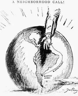
Background imageWestern Hemisphere Collection: A Neighborhood Call! American cartoon, 1936, commenting on U. S. President Franklin D

A Neighborhood Call! American cartoon, 1936, commenting on U. S. President Franklin D
INTER-AMERICAN CONFERENCE. A Neighborhood Call! American cartoon, 1936, commenting on U.S. President Franklin D. Roosevelts promotion of the Inter-American Conference in Buenos Aires, Argentina

Background imageWestern Hemisphere Collection: NAMING OF AMERICA, 1507. The printing of Martin Waldseem├╝llers Cosmographiae Introductio at St

NAMING OF AMERICA, 1507. The printing of Martin Waldseem├╝llers Cosmographiae Introductio at St. Di

Background imageWestern Hemisphere Collection: W. HEMISPHERE MAP, 1596. Theodore de Brys map of the western hemisphere

W. HEMISPHERE MAP, 1596. Theodore de Brys map of the western hemisphere, 1596, surrounded by the explorers (clockwise from top left) Columbus, Vespucci, Pizarro, and Magellan

Background imageWestern Hemisphere Collection: NEW WORLD MAP, 1616. English map of the western hemisphere published by John Speed in 1616

NEW WORLD MAP, 1616. English map of the western hemisphere published by John Speed in 1616. California appears as a huge island and the views along both sides are of natives in fanciful costumes

Background imageWestern Hemisphere Collection: WORLD MAP, 1529. The Western Hemisphere in the world map by Franciscus Monachus

WORLD MAP, 1529. The Western Hemisphere in the world map by Franciscus Monachus, from De orbis situ, Antwerp, 1529. North America is misrepresented as an extension of Asia


All Professionally Made to Order for Quick Shipping

Exploring the vast wonders of the Western Hemisphere, we embark on a journey through time and space. A 17th-century map of the New World transports us to an era of discovery, where intrepid explorers set sail in search of new lands and treasures. As we navigate this historical cartographic masterpiece, we marvel at its intricate details and imagine the excitement that must have filled those early adventurers. Transitioning from ancient maps to modern technology, a 3D conceptual image brings the world to our fingertips. With just a swipe or tap, we can explore every corner of this hemisphere - from Antarctica's icy landscapes to the vibrant Antarctic Peninsula with its majestic Port Lockroy. Shifting our focus from nature's wonders to human creations, an urban landscape emerges before us. An Amsterdam canal captures our attention as it winds through picturesque buildings and bridges, reflecting centuries-old architectural splendor. Delving into political history, a thought-provoking cartoon depicts Uncle Sam straddling both Americas while brandishing a big stick labeled Monroe Doctrine. This iconic representation reminds us of America's influential role in shaping policies across the Western Hemisphere during the early 20th century. Turning towards spirituality, Saint Rose of Lima appears before us—a symbol of devotion and faith in Peru. Her presence serves as a reminder that religion has played an integral part in shaping cultures throughout this hemisphere for centuries. Returning to maps once more, we encounter various depictions showcasing different eras: a Western Hemisphere map illustrating geopolitical boundaries; another from 1871 offering insights into past territorial divisions; and even one captured by Apollo 16 astronauts—an awe-inspiring view of Earth from space—reminding us how interconnected our planet truly is. Lastly, we stumble upon an exquisite French map dating back to 1550 which showcases Central and South America with meticulous detail—a testament to cartographers' artistry during that period. These captivating hints invite us on an extraordinary voyage through time, space, and human imagination.