
Weather Forecasting Collection
Weather forecasting has come a long way since the early days of Captain Robert Fitzroy and Charles Darwin's expeditions


All Professionally Made to Order for Quick Shipping
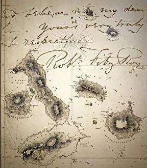
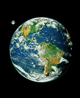
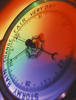
Weather forecasting has come a long way since the early days of Captain Robert Fitzroy and Charles Darwin's expeditions. From the mesmerizing images of our planet taken by Whole Earth (Blue Marble 2000) to the meticulously detailed Galapagos Admiralty map, we have witnessed an evolution in meteorology that continues to shape our understanding of weather patterns. In 1843, Captain Fitzroy introduced the world to his revolutionary Aneroid barometer, a device that accurately measured atmospheric pressure and became an essential tool for weather prediction. This breakthrough paved the way for more precise forecasts and increased safety at sea. Fast forward to February 21st, 1941, where we find ourselves amidst World War II. Meteorological Assistants played a crucial role in measuring wind speed for the Royal Air Force (R. A. F. ), providing vital information for strategic military operations. The collaboration between these assistants and R. A. F pilots exemplified how weather forecasting was not only about predicting storms but also saving lives on the battlefield. During this tumultuous time, even women joined forces as W. A. A. F meteorologists released met balloons on October 9th, 1941. These brave individuals contributed significantly to gathering data about upper-level winds which helped forecasters make accurate predictions across various altitudes. Across continents like the United States, advancements in technology brought forth sophisticated instruments such as measuring cylinders and wind instruments integrated into comprehensive weather station equipment. Among these tools stood gold-rimmed barometers and maximum-minimum thermometers - symbols of precision measurement that aided meteorologists in their quest for accurate forecasts. Today's a testament to human ingenuity combined with cutting-edge technology. From satellite imagery capturing breathtaking views of our planet from space to computer models crunching vast amounts of data within seconds - it is awe-inspiring how far we've come since those early days depicted by Fitzroy Beagle's Admiralty map or Captain Robert Fitzroy's Darwins capn.