
Town Planning Collection
"Exploring the Evolution of Town Planning: From Ancient Maps to Modern Marvels" Step back in time with The Hereford Mappa Mundi


All Professionally Made to Order for Quick Shipping
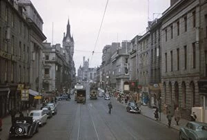
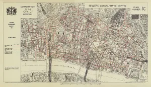
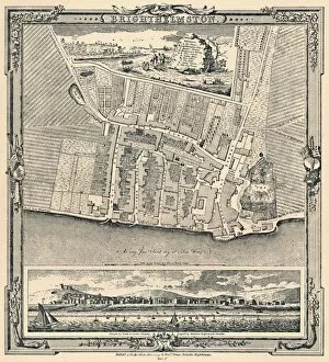
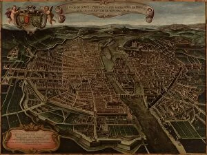
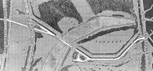
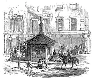
"Exploring the Evolution of Town Planning: From Ancient Maps to Modern Marvels" Step back in time with The Hereford Mappa Mundi, a captivating medieval map from 1285 that showcases early town planning efforts. Created by Richard de Bello, this masterpiece offers a glimpse into how cities were organized and developed centuries ago. Fast forward to the 1960s in Aberdeen, Scotland, where Union Street stands as a testament to urban growth. Captured by CM Dixon, this snapshot captures the city's transformation and highlights the importance of thoughtful town planning in accommodating expanding populations. Delving underground reveals another aspect - sewer depths in London during World War II. A color lithograph from 1944 provides insight into the intricate network beneath our feet and emphasizes the significance of efficient infrastructure for maintaining healthy cities. London's relationship with its iconic river is beautifully depicted in an 18th-century illustration titled "London and the Thames. " This artwork showcases how urban development has always been intricately connected to waterways, shaping both transportation networks and architectural landscapes. Moving on to Burlington House on Piccadilly, we witness Johannes Kip's stunning portrayal of early 18th-century architecture. This grand structure exemplifies meticulous town planning that aimed to create harmonious cityscapes while preserving historical heritage. Returning once again to Aberdeen's Union Street but now set in the swinging sixties, CM Dixon captures a vibrant atmosphere reflecting modernization trends. It serves as a reminder that successful town planning must adapt to changing times while retaining community character. Venturing across continents brings us to Beijing City Planning Museum's Olympic Stadium—a marvel of contemporary urban design showcased within China's bustling capital. Its inclusion signifies how global cities embrace innovative approaches when envisioning their future landscapes. Traveling back through time takes us next to Brighthelmston—an enchanting coastal destination captured in 1779 but reimagined through artistry in 1939.