Fraud Blocker Skip to main content

Topography Collection (page 2)

"Exploring the World's Varied Topography

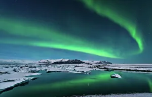
Background imageTopography Collection: The northern lights dance over the glacier lagoon in Iceland

The northern lights dance over the glacier lagoon in Iceland

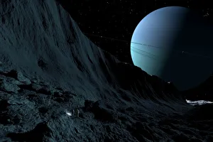
Background imageTopography Collection: A gigantic scarp on the surface of Uranus moon, Miranda

A gigantic scarp on the surface of Uranus moon, Miranda. It is the sheerest known cliff in the solar system. It may be 3 miles high

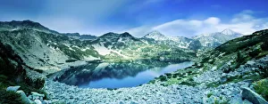
Background imageTopography Collection: View of Ribno Banderishko Lake in Pirin National Park, Bulgaria

View of Ribno Banderishko Lake in Pirin National Park, Bulgaria
Panoramic view of Ribno Banderishko Lake in Pirin National Park, Bansko, Bulgaria

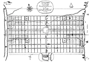
Background imageTopography Collection: The first engraved plan of the city of Philadelphia by Thomas Holme, 1683

The first engraved plan of the city of Philadelphia by Thomas Holme, 1683
PHILADELPHIA: MAP, 1683. The first engraved plan of the city of Philadelphia by Thomas Holme, 1683

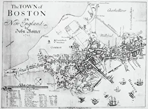
Background imageTopography Collection: BOSTON MAP, 1722. A map of Boston, Massachusetts, by John Bonner. Line engraving, 1722

BOSTON MAP, 1722. A map of Boston, Massachusetts, by John Bonner. Line engraving, 1722

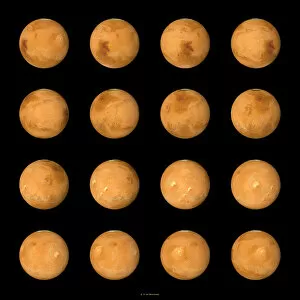
Background imageTopography Collection: Mars, composite satellite images

Mars, composite satellite images
Mars. Composite satellite images of the surface of Mars from multiple aspects. North is at top. Mars is the fourth planet from the Sun, and is a rocky desert world

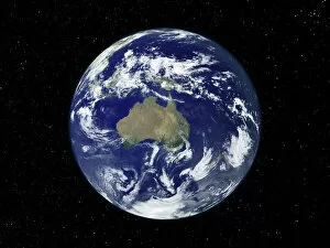
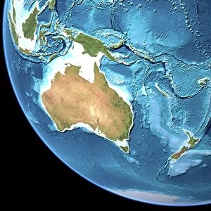
Background imageTopography Collection: Australia, satellite image

Australia, satellite image
Australia. Satellite image of the Earth, set against a background of stars, centred on the island continent of Australia. North is at top. Clouds (white) are seen in the atmosphere

Background imageTopography Collection: Australia, satellite image

Australia, satellite image. North is at top. Australia is the worlds smallest continent. It is located in the southern hemisphere, southeast of Asia

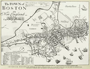
Background imageTopography Collection: BOSTON MAP, 1722. Engraved facsimile by George G. Smith, 1835, of a map of Boston, Massachusetts

BOSTON MAP, 1722. Engraved facsimile by George G. Smith, 1835, of a map of Boston, Massachusetts, by John Bonner, first printed in 1722, showing changes in the citys topography through 1769

Background imageTopography Collection: Australia, topographic map

Australia, topographic map. Highlands and lowlands of the continents are shown as ridges and flat areas. Southeast Asia (top left), New Zealand (lower right) and Antarctica (bottom right)

Background imageTopography Collection: Venus radar map, North Pole

Venus radar map, North Pole
Venus radar map, centred on the Venusian North Pole. The map is colour-coded for altitude, going from low altitude (purple) through blue, green, yellow and orange to high altitude (red)

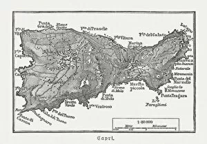
Background imageTopography Collection: Map of Capri, Italian island, wood engraving published in 1897

Map of Capri, Italian island, wood engraving published in 1897
Map of Capri, Italian island. Wood engraving, published in 1897

Background imageTopography Collection: 1855, Colton Map of Scandinavia, Norway, Sweden, Finland, topography, cartography

1855, Colton Map of Scandinavia, Norway, Sweden, Finland, topography, cartography
1855, Colton Map of Scandinavia, Norway, Sweden, Finland

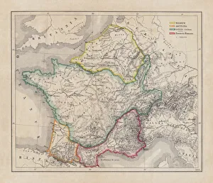
Background imageTopography Collection: Gaul in the time of Julius Caesar, published in 1867

Gaul in the time of Julius Caesar, published in 1867
Gaul in the time of Roman politican Gaius Iulius Caesar (100 - 44 BC). Steel engraving with hand-colored borderlines and Latin legend, published in 1867

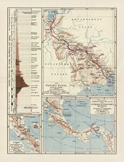
Background imageTopography Collection: Panama Canal Project, lithograph, published in 1880

Panama Canal Project, lithograph, published in 1880
Ancient map of the Panama Canal Project. Lithograph, published in 1880

Background imageTopography Collection: Map of ancient Abruzzo, by Giovan Battista Pacichelli, engraving, 1702

Map of ancient Abruzzo, by Giovan Battista Pacichelli, engraving, 1702
Cartography, Italy, 18th century. Ancient Abruzzo. From The Kingdom of Naples in perspective by Giovan Battista Pacichelli, 1702. Engraving

Background imageTopography Collection: The Siege of Colchester by the Lord Fairfax, as it was with the line and outworks 1648

The Siege of Colchester by the Lord Fairfax, as it was with the line and outworks 1648
5923308 The Siege of Colchester by the Lord Fairfax, as it was with the line and outworks 1648 (engraving) by Unknown Artist, (17th century); National Army Museum

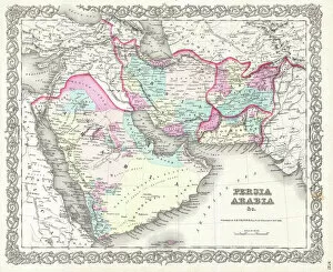
Background imageTopography Collection: 1855, Colton Map of Persia, Afghanistan, and Arabia, topography, cartography, geography

1855, Colton Map of Persia, Afghanistan, and Arabia, topography, cartography, geography
1855, Colton Map of Persia, Afghanistan, and Arabia

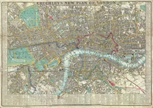
Background imageTopography Collection: 1848, Crutchley Pocket Map or Plan of London, England, topography, cartography, geography

1848, Crutchley Pocket Map or Plan of London, England, topography, cartography, geography
1848, Crutchley Pocket Map or Plan of London, England

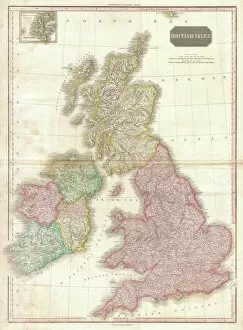
Background imageTopography Collection: 1818, Pinkerton Map of the British Isles, England, Scotland, Ireland, John Pinkerton

1818, Pinkerton Map of the British Isles, England, Scotland, Ireland, John Pinkerton, 1758 - 1826, Scottish antiquarian, cartographer, UK

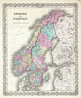
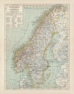
Background imageTopography Collection: Sweden and Norway, lithograph, published in 1878

Sweden and Norway, lithograph, published in 1878
Ancient map of Sweden and Norway. Lithograph, published in 1878
Background imageTopography Collection: Ofu Island, Manua'a island group, American Samoa, South Pacific

Ofu Island, Manua'a island group, American Samoa, South Pacific
Ofu Island, ManuA'a island group, American Samoa, South Pacific

Background imageTopography Collection: BOSTON MAP, 1903. A map of Boston, Massachusetts. Engraving, 1903

BOSTON MAP, 1903. A map of Boston, Massachusetts. Engraving, 1903

Background imageTopography Collection: Earth, topographic and bathymetric map

Earth, topographic and bathymetric map. This map is centred on the Pacific Ocean, at longitude 140 degrees west. Highlands and lowlands of the continents are shown as ridges and flat areas

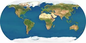
Background imageTopography Collection: Whole Earth, satellite image

Whole Earth, satellite image. This map is centred on the Greenwich meridian, at zero degrees latitude. Arctic and Antarctic ice is white, oceans are blue and land is green and brown

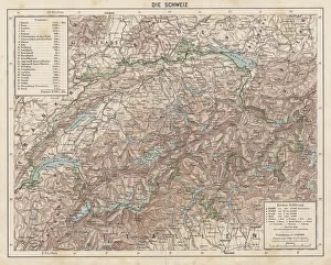
Background imageTopography Collection: Switzerland, Topographic map, published in 1881

Switzerland, Topographic map, published in 1881
Topographic map of Switzerland. Facsimile, published in 1881

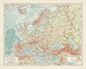
Background imageTopography Collection: Topographic map of Europe, lithograph, published in 1897

Topographic map of Europe, lithograph, published in 1897
Topographic map of Europe. Lithograph, published in 1897

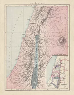
Background imageTopography Collection: Historical map of Palestine with the twelve tribes of Israel

Historical map of Palestine with the twelve tribes of Israel. Colored steel engraving, published in 1886

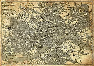
Background imageTopography Collection: Map of Newcastle Upon Tyne

Map of Newcastle Upon Tyne
Antique illustration of old Newcastle Upon Tyne map

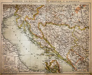
Background imageTopography Collection: Bosnia, dalmatia, istria, croatia, slavonia

Bosnia, dalmatia, istria, croatia, slavonia
Antique illustration of a Bosnia, dalmatia, istria, croatia, slavonia map

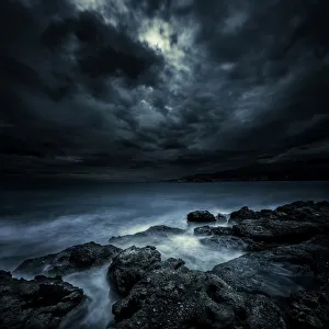
Background imageTopography Collection: Black rocks protruding through rough seas with stormy clouds, Crete, Greece

Black rocks protruding through rough seas with stormy clouds, Crete, Greece

Background imageTopography Collection: A group of Bulgarians

A group of Bulgarians. Date: 1880s

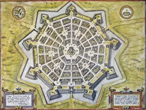
Background imageTopography Collection: Engraved map, 1598, of the heavily-fortified city of Palmanova, Italy

Engraved map, 1598, of the heavily-fortified city of Palmanova, Italy, built by the Venetians near the Adriatic to
ITALY: PALMANOVA MAP, 1598. Engraved map, 1598, of the heavily-fortified city of Palmanova, Italy, built by the Venetians near the Adriatic to prevent Turkish invasions

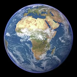
Background imageTopography Collection: Africa, satellite image

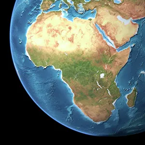
Africa, satellite image
Africa. Satellite image of the Earth centred on Africa. Clouds are white, oceans are blue and land is green and brown. Also seen are Europe (top) Asia (upper right), the Indian Ocean (right)

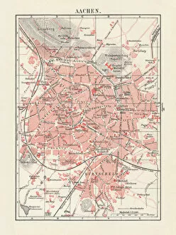
Background imageTopography Collection: City map of Aachen, Germany, lithograph, published in 1897

City map of Aachen, Germany, lithograph, published in 1897
City map of Aachen, Germany. Lithograph, published in 1897

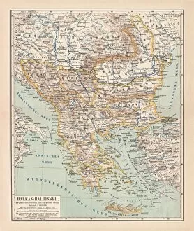
Background imageTopography Collection: Balkan Peninsula in 1878, lithograph

Balkan Peninsula in 1878, lithograph
Ancient map Balkan. The political classification of the Balkan Peninsula after the Treaty of Berlin in 1878. Lithograph, published in 1878
Background imageTopography Collection: City map of London, lithograph, lithograph, published in 1877

City map of London, lithograph, lithograph, published in 1877
City map of London, United Kingdom. Lithograph, published in 1877

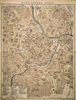
Background imageTopography Collection: Vienna inner city

Vienna inner city
Antique map of Vienna from 1898

Background imageTopography Collection: Loch na h-Achlaise Reflections, Rannoch Moor Scotland

Loch na h-Achlaise Reflections, Rannoch Moor Scotland
Spectacular dramatic weather creates a moody atmosphere over the Mountains of Loch na h-Achlaise. The tranquil water of the loch reflects the distant mountains, islands of trees

Background imageTopography Collection: Saturn seen from the surface of its moon, Rhea

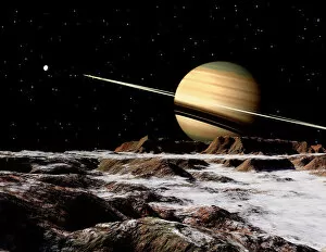
Saturn seen from the surface of its moon, Rhea. It is the largest of Saturns airless satellites. It was discovered in 1672 by Giovanni Cassini

Background imageTopography Collection: Map of The Kingdom of Naples, by Giovan Battista Pacichelli, engraving, 1702

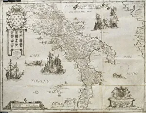
Map of The Kingdom of Naples, by Giovan Battista Pacichelli, engraving, 1702
Cartography, Italy, 18th century. The Kingdom of Naples. From The Kingdom of Naples in perspective by Giovan Battista Pacichelli, 1702. Engraving

Background imageTopography Collection: Map of America by Gerardo Mercatore, 1512-1594

Map of America by Gerardo Mercatore, 1512-1594
Cartography, 16th century. Map of America by Gerardo Mercatore (1512-1594)

Background imageTopography Collection: BOSTON: MAP, 1775-1776. Map of Boston, Massachusetts, and the surrounding area, 1775-1776

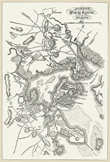
BOSTON: MAP, 1775-1776. Map of Boston, Massachusetts, and the surrounding area, 1775-1776. Line engraving, 19th century

Background imageTopography Collection: Africa, topographic map

Africa, topographic map. Highlands and lowlands of the continents are shown as ridges and flat areas. Southern Europe and the Middle East are also seen at top and upper right respectively

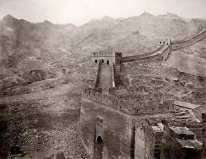
Background imageTopography Collection: China c. 1880s - Great Wall of China top of the Nankow Pass

China c. 1880s - Great Wall of China top of the Nankow Pass
Vintage 19th century photograph China c.1880s - Great Wall of China at the top of the Nankow Pass

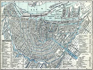
Background imageTopography Collection: Map of city Amsterdam Netherlands from 1881

Map of city Amsterdam Netherlands from 1881 Original edition from my own archives Source : Illustriertes Konversations Lexikon 1881

Background imageTopography Collection: Lake Vyrnwy

Lake Vyrnwy
Colour lantern slide depicting Lake Vywnry in Wales. Date: circa 1890s

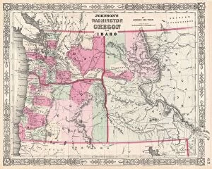
Background imageTopography Collection: 1864, Johnson Map of Washington, Oregon, and Idaho, topography, cartography, geography

1864, Johnson Map of Washington, Oregon, and Idaho, topography, cartography, geography
1864, Johnson Map of Washington, Oregon, and Idaho


All Professionally Made to Order for Quick Shipping

"Exploring the World's Varied Topography: From Ancient Greece to Antarctica" Embark on a captivating journey through time and space as we delve into the fascinating realm of topography. This 150 caption takes you across continents, from Cyprus to Africa, Portugal to Wales, and beyond. Let's begin our expedition with a glimpse into history - an intriguing Map of Cyprus published in 1880. Its intricate details transport us back in time, unraveling the island's rich geographical tapestry. Next, we navigate towards Africa where a Political Map unveils the diverse nations that shape this vast continent. The contours and boundaries guide us through its majestic landscapes and vibrant cultures. Venturing westward, we encounter a Map of Portugal which showcases not only its cities but also reveals hidden gems nestled within its topographical wonders. It beckons explorers to uncover its secrets. As we traverse further northwards, three Welsh women dressed in traditional costumes capture our attention. Their attire reflects both their cultural heritage and the unique topography that surrounds them. Turning our gaze towards Scotland, James Craig's 1768 map presents Edinburgh's New Town for the first time. This pioneering plan intertwines urban development with meticulous attention to topographic features – shaping one of Europe's most enchanting cities. Across the Atlantic Ocean lies Plymouth, Massachusetts - Samuel de Champlain’s map from his 1605 expedition guides us through this historic settlement site. The rugged beauty of Plymouth is etched onto this map like a testament to human resilience against nature’s challenges. Our exploration now takes an icy turn as we discover Antarctica adorned with illustrations of sea gulls, penguins, elephant seals, and shrimp amidst towering ice formations. This juxtaposition between wildlife and man-made structures highlights how humanity has left imprints even on Earth’s harshest terrains. The turquoise waters surrounding Providenciales Island in Turks & Caicos come alive on a mural map depicting Grace Bay.