Fraud Blocker Skip to main content

Survey Collection (page 5)

"Unveiling the Past: A Journey through Time with Historical Surveys" Step into a world of captivating history as we delve into the fascinating realm of surveys

Background imageSurvey Collection: Iceberg Canon, Colorado River, Looking Above, 1871. Creator: Tim O'Sullivan

Iceberg Canon, Colorado River, Looking Above, 1871. Creator: Tim O'Sullivan
Iceberg Canon, Colorado River, Looking Above, 1871. Albumen print, no. 15 from the album "Geographical & Geological Explorations & Surveys West of the 100th Meridian, " vol. 2

Background imageSurvey Collection: Head of Canon de Chelle, Looking Down. Walls about 1200 feet in height, 1873

Head of Canon de Chelle, Looking Down. Walls about 1200 feet in height, 1873. Creator: Tim O'Sullivan
Head of Canon de Chelle, Looking Down. Walls about 1200 feet in height, 1873. Albumen print, No. 16 from the album "Geographical & Geological Explorations & Surveys West of the 100th Meridian

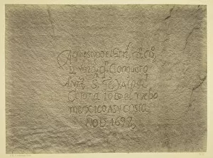
Background imageSurvey Collection: Historic Spanish Record of the Conquest, South Side of Inscription Rock... 1873

Historic Spanish Record of the Conquest, South Side of Inscription Rock... 1873. Creator: Tim O'Sullivan
Historic Spanish Record of the Conquest, South Side of Inscription Rock, N.M. Geographical & Geological Explorations & Surveys West of the 100th Meridian. Expedition of 1873. -Lieut. Geo. M

Background imageSurvey Collection: Entrance to Black Canon, Colorado River, 1871. Creator: Tim O'Sullivan

Entrance to Black Canon, Colorado River, 1871. Creator: Tim O'Sullivan
Entrance to Black Canon, Colorado River, 1871. Albumen print, from the album "Geographical & Geological Explorations & Surveys West of the 100th Meridian, " vol. 2

Background imageSurvey Collection: Cereus giganteus, Arizona, 1871. Creator: Tim O Sullivan

Cereus giganteus, Arizona, 1871. Creator: Tim O Sullivan
Cereus giganteus, Arizona, 1871. Albumen print, from the album " Geographical & Geological Explorations & Surveys West of the 100th Meridian, " vol. 2

Background imageSurvey Collection: Cooleys Park, Sierra Blanca Range, Arizona, 1873. Creator: Tim O Sullivan

Cooleys Park, Sierra Blanca Range, Arizona, 1873. Creator: Tim O Sullivan
Cooleys Park, Sierra Blanca Range, Arizona, 1873. Albumen print, from the album " Geographical & Geological Explorations & Surveys West of the 100th Meridian, " vol. 1

Background imageSurvey Collection: Canyon de Chelle, Walls of the Grand Canyon, about 1200 feet in height, 1873

Canyon de Chelle, Walls of the Grand Canyon, about 1200 feet in height, 1873. Albumen print, from the album " Geographical & Geological Explorations & Surveys West of the 100th Meridian

Background imageSurvey Collection: Canon of the Colorado River, near Mouth of San Juan River, Arizona, 1873. Creator: Tim O'Sullivan

Canon of the Colorado River, near Mouth of San Juan River, Arizona, 1873. Creator: Tim O'Sullivan
Canon of the Colorado River, near Mouth of San Juan River, Arizona, 1873. Albumen print, from the album "Geographical & Geological Explorations & Surveys West of the 100th Meridian, " vol. 2

Background imageSurvey Collection: Bluff Opposite Big Horn Camp, Black Canon, Colorado River, 1871. Creator: Tim O'Sullivan

Bluff Opposite Big Horn Camp, Black Canon, Colorado River, 1871. Creator: Tim O'Sullivan
Bluff Opposite Big Horn Camp, Black Canon, Colorado River, 1871. Albumen print, from the album "Geographical & Geological Explorations & Surveys West of the 100th Meridian, " vol. 1

Background imageSurvey Collection: Black Canon, looking above from Mirror Bar, 1871. Creator: Tim O'Sullivan

Black Canon, looking above from Mirror Bar, 1871. Creator: Tim O'Sullivan
Black Canon, looking above from Mirror Bar, 1871. Albumen print, from the album "Geographical & Geological Explorations & Surveys West of the 100th Meridian, " vol. 2

Background imageSurvey Collection: Black Canon, Colorado River, Looking Below, Near Camp 7, 1871. Creator: Tim O'Sullivan

Black Canon, Colorado River, Looking Below, Near Camp 7, 1871. Creator: Tim O'Sullivan
Black Canon, Colorado River, Looking Below, Near Camp 7, 1871. Albumen print, from the album "Geographical & Geological Explorations & Surveys West of the 100th Meridian, " vol. 1

Background imageSurvey Collection: Black Canon, Colorado River, Looking Above from Camp 7, 1871. Creator: Tim O'Sullivan

Black Canon, Colorado River, Looking Above from Camp 7, 1871. Creator: Tim O'Sullivan
Black Canon, Colorado River, Looking Above from Camp 7, 1871. Albumen print, from the album "Geographical & Geological Explorations & Surveys West of the 100th Meridian, " vol. 1

Background imageSurvey Collection: Black Canon, Colorado River, looking below from Big Horn Camp, 1871. Creator: Tim O'Sullivan

Black Canon, Colorado River, looking below from Big Horn Camp, 1871. Creator: Tim O'Sullivan
Black Canon, Colorado River, looking below from Big Horn Camp, 1871. Albumen print, from the album "Geographical & Geological Explorations & Surveys West of the 100th Meridian, " vol. 1

Background imageSurvey Collection: Black Canon, Colorado River, from Camp 8, Looking Above, 1871. Creator: Tim O'Sullivan

Black Canon, Colorado River, from Camp 8, Looking Above, 1871. Creator: Tim O'Sullivan
Black Canon, Colorado River, from Camp 8, Looking Above, 1871. Albumen print, from the album "Geographical & Geological Explorations & Surveys West of the 100th Meridian, " vol. 1

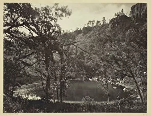
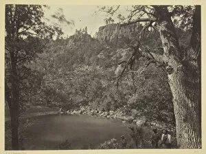
Background imageSurvey Collection: Apache Lake, Sierra Blanca Range, Arizona, 1873. Creator: Tim O Sullivan

Apache Lake, Sierra Blanca Range, Arizona, 1873. Creator: Tim O Sullivan
Apache Lake, Sierra Blanca Range, Arizona, 1873. Albumen print, from the album " Geographical & Geological Explorations & Surveys West of the 100th Meridian, " vol. 1

Background imageSurvey Collection: Alpine Lake, in the Sierra Nevada, California, 1871. Creator: Tim O Sullivan

Alpine Lake, in the Sierra Nevada, California, 1871. Creator: Tim O Sullivan
Alpine Lake, in the Sierra Nevada, California, 1871. Albumen print, from the album " Geographical & Geological Explorations & Surveys West of the 100th Meridian, " vol. 2

Background imageSurvey Collection: Aboriginal Life Among the Navajoe Indians, Near Old Fort Defiance, N. M. 1873

Aboriginal Life Among the Navajoe Indians, Near Old Fort Defiance, N. M. 1873
Aboriginal Life Among the Navajoe Indians, Near Old Fort Defiance, N.M. 1873. Albumen print, from the album " Geographical & Geological Explorations & Surveys West of the 100th Meridian

Background imageSurvey Collection: Water Rhyolites, Near Logan Springs, Nevada, 1871. Creator: Tim O'Sullivan

Water Rhyolites, Near Logan Springs, Nevada, 1871. Creator: Tim O'Sullivan
Water Rhyolites, Near Logan Springs, Nevada, 1871. Albumen print, from the album "Geographical & Geological Explorations & Surveys West of the 100th Meridian, " vol. 2

Background imageSurvey Collection: View on Apache Lake, Sierra Blanca Range, Arizona, 1873. Creator: Tim O Sullivan

View on Apache Lake, Sierra Blanca Range, Arizona, 1873. Creator: Tim O Sullivan
View on Apache Lake, Sierra Blanca Range, Arizona, 1873. Albumen print, from the album " Geographical & Geological Explorations & Surveys West of the 100th Meridian, " vol. 1

Background imageSurvey Collection: The South Side of Inscription Rock, 1873. Creator: Tim O Sullivan

The South Side of Inscription Rock, 1873. Creator: Tim O Sullivan
The South Side of Inscription Rock, 1873. Albumen print, from the album " Geographical & Geological Explorations & Surveys West of the 100th Meridian, " vol. 2

Background imageSurvey Collection: Snow Peaks, Bull Run Mining District, Nevada, 1871. Creator: Tim O Sullivan

Snow Peaks, Bull Run Mining District, Nevada, 1871. Creator: Tim O Sullivan
Snow Peaks, Bull Run Mining District, Nevada, 1871. Albumen print, from the album " Geographical & Geological Explorations & Surveys West of the 100th Meridian, " vol. 1

Background imageSurvey Collection: Section of the South Side of Zuni Pueblo, N. M. 1873. Creator: Tim O Sullivan

Section of the South Side of Zuni Pueblo, N. M. 1873. Creator: Tim O Sullivan
Section of the South Side of Zuni Pueblo, N.M. 1873. Albumen print, from the album " Geographical & Geological Explorations & Surveys West of the 100th Meridian, " vol. 2

Background imageSurvey Collection: Distant View of Camp Apache, Arizona, 1873. Creator: Tim O Sullivan

Distant View of Camp Apache, Arizona, 1873. Creator: Tim O Sullivan
Distant View of Camp Apache, Arizona, 1873. Albumen print, from the album " Geographical & Geological Explorations & Surveys West of the 100th Meridian, " vol. 1

Background imageSurvey Collection: Black Canon, Colorado River, looking below near Camp 7. Explorations in Nevada and Arizona... 1871

Black Canon, Colorado River, looking below near Camp 7. Explorations in Nevada and Arizona... 1871
Black Canon, Colorado River, looking below near Camp 7. Explorations in Nevada and Arizona, Expedition of 1871. Lieut. Geo. M. Wheeler, Com'd'g. 1871

Background imageSurvey Collection: USFC Steamer 'Albatross'Survey of Fishing Banks from Newport to Newfoundland

USFC Steamer "Albatross"Survey of Fishing Banks from Newport to Newfoundland
USFC Steamer " Albatross" Survey of Fishing Banks from Newport to Newfoundland, 1885. Dry dock

Background imageSurvey Collection: USFC Steamer 'Albatross'Survey of the Bahamas, 1886

USFC Steamer "Albatross"Survey of the Bahamas, 1886
USFC Steamer " Albatross" Survey of the Bahamas, 1886. Sailing vessels, and timber on the dock side

Background imageSurvey Collection: Manantico Bleach and Dye Works, Hexamer General Surveys, Volume 12

Manantico Bleach and Dye Works, Hexamer General Surveys, Volume 12
3512879 Manantico Bleach and Dye Works, Hexamer General Surveys, Volume 12, Plate 1101 (colour litho) by Hexamer, Ernest (1827-1912); Free Library of Philadelphia; (add.info.: Facility Name)

Background imageSurvey Collection: Page 37c Plan of the harbour of St. Lucia

Page 37c Plan of the harbour of St. Lucia
5670304 Page 37c Plan of the harbour of St. Lucia by Unknown artist, (18th century); Mitchell Library, State Library of New South Wales; (add.info.: Original Sketches, Drawings)

Background imageSurvey Collection: Page 25b / b Profile of unidentified Pacific Island showing a lagoon, 1768-75 (w / c)

Page 25b / b Profile of unidentified Pacific Island showing a lagoon, 1768-75 (w / c)
5670284 Page 25b/b Profile of unidentified Pacific Island showing a lagoon, 1768-75 (w/c) by Hodges, William (1744-97); Mitchell Library

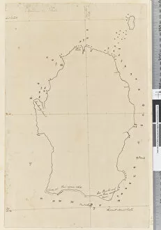
Background imageSurvey Collection: Page 38a Map of S. Andehman Island (pen & ink)

Page 38a Map of S. Andehman Island (pen & ink)
5670305 Page 38a Map of S. Andehman Island (pen & ink) by Unknown artist, (18th century); Mitchell Library, State Library of New South Wales; (add.info.: Original Sketches, Drawings)

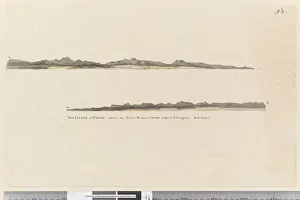
Background imageSurvey Collection: Page 3 Profile of the Island of St. Jago, Cape Verde Island

Page 3 Profile of the Island of St. Jago, Cape Verde Island
5670252 Page 3 Profile of the Island of St. Jago, Cape Verde Island. Titled The Island of St Jago where the point D bears WSW distant 3 leagues

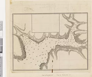
Background imageSurvey Collection: ib. A Plan of the Harbour of Croque in Newfoundland, 1763 (pen & ink and wash)
ib. A Plan of the Harbour of Croque in Newfoundland, 1763 (pen & ink and wash)
5670246 ib. A Plan of the Harbour of Croque in Newfoundland, 1763 (pen & ink and wash) by Cook, James (1728-79); Mitchell Library, State Library of New South Wales; (add.info.: Original Sketches)

Background imageSurvey Collection: Map: Rome, with its Environs, according to the Survey of Baron Moltke, in 1845 and 1846

Map: Rome, with its Environs, according to the Survey of Baron Moltke, in 1845 and 1846
6004717 Map: Rome, with its Environs, according to the Survey of Baron Moltke, in 1845 and 1846, drawn by Augustus Petermann (colour litho) by English School

Background imageSurvey Collection: Map of the City of New-York, 1854 (engraving, ink on paper)

Map of the City of New-York, 1854 (engraving, ink on paper)
1079219 Map of the City of New-York, 1854 (engraving, ink on paper) by Hayward, George (c.1800-72); Collection of the New-York Historical Society

Background imageSurvey Collection: New York City Map, 1857, 1857 (black ink on paper, colour wash)

New York City Map, 1857, 1857 (black ink on paper, colour wash)
1079240 New York City Map, 1857, 1857 (black ink on paper, colour wash) by American School, (19th century); 38x66, on sheet 43x74 cm; Collection of the New-York Historical Society

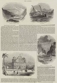
Background imageSurvey Collection: Recent Survey of the Azores (engraving)

Recent Survey of the Azores (engraving)
1101054 Recent Survey of the Azores (engraving) by English School, (19th century); Private Collection; (add.info.: Recent Survey of the Azores)

Background imageSurvey Collection: Title page to A Survey of London by John Stow

Title page to A Survey of London by John Stow
497299 Title page to A Survey of London by John Stow, published in 1598 (printed paper) by English School, (16th century); Private Collection; (add.info.: John Stow (1525-1605)); English

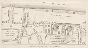
Background imageSurvey Collection: Plan of Bankside, Southwark (engraving)

Plan of Bankside, Southwark (engraving)
602833 Plan of Bankside, Southwark (engraving) by English School, (19th century); Private Collection; (add.info.: Plan of Bankside, Southwark, London, with the Bull and Bear Baiting)

Background imageSurvey Collection: Philadelphia in 1886 (colour litho)

Philadelphia in 1886 (colour litho)
483714 Philadelphia in 1886 (colour litho) by Burk, William, and McFetridge, John (fl.1886); 104x183 cm; Free Library of Philadelphia; eFree Library of Philadelphia; Map Collection

Background imageSurvey Collection: Domesday Book - the larger volume

Domesday Book - the larger volume
English Social History - The Domesday Book - the larger volume. A manuscript record of the Great Survey of much of England and parts of Wales completed in 1086 by order of King William the Conqueror

Background imageSurvey Collection: Public Record Office - Domesday Book and chest

Public Record Office - Domesday Book and chest
Public Record Office - Domesday Book (two volumes) and chest. A manuscript record of the Great Survey of much of England and parts of Wales completed in 1086 by order of King William the Conqueror

Background imageSurvey Collection: Sinai - group of Bedouin at the Convent of St Katherine, Catherine

Sinai - group of Bedouin at the Convent of St Katherine, Catherine
Vintage 19th century photograph: Sergeant James McDonald (active 1865-9). Ordnance survey of the Peninsula of Sinai by the Royal Engineers - group of Bedouin at the Convent of St Katherine, Catherine

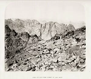
Background imageSurvey Collection: Sinai - Jebel ed Deir from the summit of Jebel Musa

Sinai - Jebel ed Deir from the summit of Jebel Musa
Vintage 19th century photograph: Sergeant James McDonald (active 1865-9). Ordnance survey of the Peninsula of Sinai by the Royal Engineers - : Jebel ed Deir from the summit of Jebel Musa

Background imageSurvey Collection: Sinai - Wady Serabit el Khadim

Sinai - Wady Serabit el Khadim
Vintage 19th century photograph: Sergeant James McDonald (active 1865-9). Ordnance survey of the Peninsula of Sinai by the Royal Engineers - Wady Serabit el Khadim

Background imageSurvey Collection: Sina - inscribed rock, Wady Aleyat

Sina - inscribed rock, Wady Aleyat
Vintage 19th century photograph: Sergeant James McDonald (active 1865-9). Ordnance survey of the Peninsula of Sinai by the Royal Engineers - inscribed rock, Wady Aleyat

Background imageSurvey Collection: Sinai - Egyptian ruins, Serabit el Khadim

Sinai - Egyptian ruins, Serabit el Khadim
Vintage 19th century photograph: Vintage 19th century photograph: Sergeant James McDonald (active 1865-9). Ordnance survey of the Peninsula of Sinai by the Royal Engineers - Egyptian ruins

Background imageSurvey Collection: Sinai - tombs in a jorf, Wady Feiran

Sinai - tombs in a jorf, Wady Feiran
Vintage 19th century photograph: Sergeant James McDonald (active 1865-9). Ordnance survey of the Peninsula of Sinai by the Royal Engineers - tombs in a jorf, Wady Feiran

Background imageSurvey Collection: Sinai - ruined convent of the twelve apostles, Wady Leja

Sinai - ruined convent of the twelve apostles, Wady Leja
Vintage 19th century photograph: Sergeant James McDonald (active 1865-9). Ordnance survey of the Peninsula of Sinai by the Royal Engineers - ruined convent of the twelve apostles, Wady Leja


All Professionally Made to Order for Quick Shipping

"Unveiling the Past: A Journey through Time with Historical Surveys" Step into a world of captivating history as we delve into the fascinating realm of surveys. From ancient maps to intricate engravings, these snapshots from the past offer glimpses into bygone eras and forgotten landscapes. Transport yourself to 1797 Dublin with the "Map of the City of Dublin, " where every street corner holds secrets waiting to be discovered. Or explore the British Islands through a "Geological Map, " revealing nature's hidden treasures beneath our feet. Marvel at an "Exact Delineation" of London and Westminster, capturing the essence of bustling streets and vibrant suburbs in an enchanting engraving. Travel back in time to Hong Kong's vibrant streetscape in the 1890s, immersing yourself in its rich cultural tapestry. Witness Cornwall's industrial heritage unfold before your eyes with images showcasing surface buildings from Basset Mines or Halwill Barton. These snapshots transport us to pivotal moments that shaped communities and industries alike. Discover Cowden Furnace's layout within Kent, unraveling its historical significance piece by piece. Immerse yourself further into England's past with Nottinghamshire's entry from The Domesday Book or Surrey’s own chapter within this monumental record. Journey beyond borders as you encounter Judaism’s sacred Torah scroll case wrapped in black silk—a poignant reminder of traditions preserved across continents throughout history. Finally, gaze upon a detailed woodblock print depicting London Wall East—Smithfield area—from Civitas Londinium; it offers a glimpse into medieval city life that once thrived along these ancient fortifications. Join us on this extraordinary voyage through time as we uncover stories etched onto parchment and engraved within our collective memory—the surveyors' legacy forever imprinted on our world.