
Spokane River Collection
"Journey through Time: Exploring the Magnificent Spokane River" Step back in time to the 1880s, when Spokane, Washington was just beginning to flourish


All Professionally Made to Order for Quick Shipping
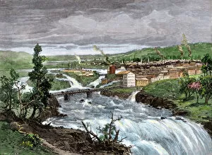
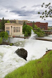
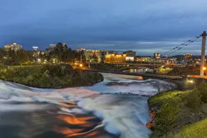
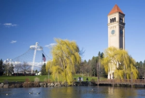
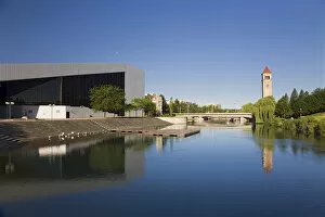
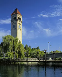
"Journey through Time: Exploring the Magnificent Spokane River" Step back in time to the 1880s, when Spokane, Washington was just beginning to flourish. The mighty Spokane River played a vital role in shaping the city's history and continues to captivate visitors today. One iconic moment etched into memory is the major flood that engulfed Riverfront Park. Witnessing this natural phenomenon must have been both awe-inspiring and terrifying for early settlers as they watched the river swell beyond its banks. Intriguingly, an old photograph from around 1897 showcases Spokane Falls with a bridge connecting it to Riverfront Park. This image transports us to a bygone era where people strolled across this historic structure, marveling at nature's power. Fast forward a few years, and we find ourselves standing on Gonzaga University's Burlington Northern walking bridge over the mesmerizing Spokane River. Imagine students crossing this bridge daily, surrounded by breathtaking views of their beloved city. Another snapshot from approximately 1900 reveals dusk descending upon Spokane Falls. As darkness blankets the landscape, one can only imagine how locals marveled at this enchanting sight while going about their evening routines. To navigate through modern-day Spokane with ease, consult our detailed street map of Washington State's gem - complete with alluring blue lines representing rivers like our beloved Spokane River. Riverfront Park remains a cherished gathering place for residents and tourists alike. From here, you can enjoy panoramic vistas across the sparkling waters of the majestic Spokane River while admiring landmarks such as the Clock Tower and "the U. " As day turns into nightfall once again in picturesque Riverfront Park along the banks of our beloved river, let yourself be enchanted by twinkling lights reflecting off its tranquil surface. The Clock Tower stands tall as a sentinel guarding these precious moments spent beside the captivating Spokane River. So come immerse yourself in history and beauty.