Fraud Blocker Skip to main content

Sea Chart Collection

"Unveiling the Secrets of the Sea: A Journey through Historic Sea Charts" Embark on a voyage through time and explore the captivating world of sea charts

Background imageSea Chart Collection: Map of Africa showing its most recent discoveries with the Island of St

Map of Africa showing its most recent discoveries with the Island of St
XOS1765717 Map of Africa showing its most recent discoveries with the Island of St. Helena inset from Mitchells new general atlas, 1863 (colour engraving) by American School
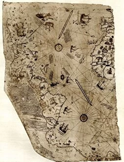
Background imageSea Chart Collection: The new world revealed to Islam in 1513. The map of the Atlantic, work of Admiral

The new world revealed to Islam in 1513. The map of the Atlantic, work of Admiral Piri Reis, the celebrated Turkish cartographer

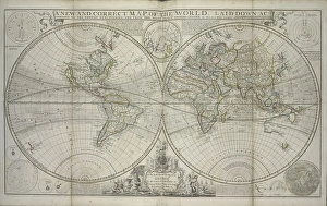
Background imageSea Chart Collection: A new and correct map of the world laid down according to the newest discoveries

A new and correct map of the world laid down according to the newest discoveries
XOS1765728 A new and correct map of the world laid down according to the newest discoveries and from the most exact observations, 1736 (hand coloured print) by Moll

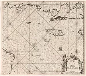
Background imageSea Chart Collection: Sea chart of the south coast of Cuba and Jamaica, Jan Luyken, Claes Jansz Voogt

Sea chart of the south coast of Cuba and Jamaica, Jan Luyken, Claes Jansz Voogt, Johannes van Keulen (I), 1684 - 1799

Background imageSea Chart Collection: Catalan Atlas (reproduction)

Catalan Atlas (reproduction)
5054662 Catalan Atlas (reproduction) by Cresques, Abraham (1325-87) (after); (add.info.: Reproduction of 1375 World map made in Majorca)

Background imageSea Chart Collection: Catalan Atlas, Sheet 10, 1375 (pen with coloured inks on parchment)

Catalan Atlas, Sheet 10, 1375 (pen with coloured inks on parchment)
5054670 Catalan Atlas, Sheet 10, 1375 (pen with coloured inks on parchment) by Cresques, Abraham (1325-87); Bibliotheque Nationale, Paris, France; (add.info.: World map made in Majorca)

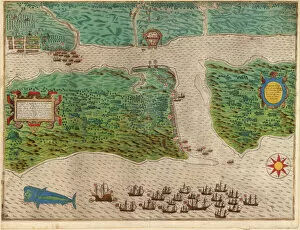
Background imageSea Chart Collection: Raid on the Spanish settlement of St Augustine in Florida, 1586 (coloured engraving)

Raid on the Spanish settlement of St Augustine in Florida, 1586 (coloured engraving)
5242109 Raid on the Spanish settlement of St Augustine in Florida, 1586 (coloured engraving) by Boazio, Baptista (fl.1588-1606); Private Collection; (add.info)

Background imageSea Chart Collection: Catalan Atlas, Sheet 9, 1375 (pen and coloured inks on parchment)

Catalan Atlas, Sheet 9, 1375 (pen and coloured inks on parchment)
5054647 Catalan Atlas, Sheet 9, 1375 (pen and coloured inks on parchment) by Cresques, Abraham (1325-87); Bibliotheque Nationale, Paris, France; (add.info.: World map made in Majorca)

Background imageSea Chart Collection: Catalan Atlas, Sheet 12, 1375 (pen and coloured inks on parchment)

Catalan Atlas, Sheet 12, 1375 (pen and coloured inks on parchment)
5054646 Catalan Atlas, Sheet 12, 1375 (pen and coloured inks on parchment) by Cresques, Abraham (1325-87); Bibliotheque Nationale, Paris, France; (add.info.: World map made in Majorca)

Background imageSea Chart Collection: Catalan Atlas, Sheet 11, 1375 (pen with coloured inks on parchment)

Catalan Atlas, Sheet 11, 1375 (pen with coloured inks on parchment)
5054644 Catalan Atlas, Sheet 11, 1375 (pen with coloured inks on parchment) by Cresques, Abraham (1325-87); Bibliotheque Nationale, Paris, France; (add.info.: World map made in Majorca)

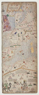
Background imageSea Chart Collection: Four vellum leaves of the Catalan Atlas, 1375 (pen and coloured inks on parchment)

Four vellum leaves of the Catalan Atlas, 1375 (pen and coloured inks on parchment)
5895292 Four vellum leaves of the Catalan Atlas, 1375 (pen and coloured inks on parchment) by Cresques, Abraham (1325-87); Bibliotheque Nationale, Paris

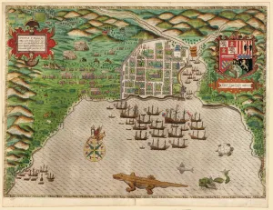
Background imageSea Chart Collection: Capture of the Spanish settlement of Santo Domingo in Hispaniola

Capture of the Spanish settlement of Santo Domingo in Hispaniola
5242112 Capture of the Spanish settlement of Santo Domingo in Hispaniola, 1586 (coloured engraving) by Boazio, Baptista (fl.1588-1606); Private Collection; (add.info)

Background imageSea Chart Collection: Catalan Atlas, Sheet 8 (pen with coloured inks on parchment)

Catalan Atlas, Sheet 8 (pen with coloured inks on parchment)
5054649 Catalan Atlas, Sheet 8 (pen with coloured inks on parchment) by Cresques, Abraham (1325-87); Bibliotheque Nationale, Paris, France; (add.info.: World map made in Majorca)

Background imageSea Chart Collection: Catalan Atlas, Sheet 2, 1375 (pen with coloured inks on parchment)

Catalan Atlas, Sheet 2, 1375 (pen with coloured inks on parchment)
5054640 Catalan Atlas, Sheet 2, 1375 (pen with coloured inks on parchment) by Cresques, Abraham (1325-87); Bibliotheque Nationale, Paris

Background imageSea Chart Collection: Catalan Atlas, Sheet 6, 1375 (pen with coloured inks on parchment)

Catalan Atlas, Sheet 6, 1375 (pen with coloured inks on parchment)
5054638 Catalan Atlas, Sheet 6, 1375 (pen with coloured inks on parchment) by Cresques, Abraham (1325-87); Bibliotheque Nationale, Paris, France; (add.info.: World map made in Majorca)

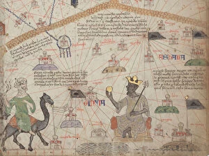
Background imageSea Chart Collection: Detail from the Catalan Atlas, Sheet 6, showing the Western Sahara and Mansa Musa

Detail from the Catalan Atlas, Sheet 6, showing the Western Sahara and Mansa Musa
5054637 Detail from the Catalan Atlas, Sheet 6, showing the Western Sahara and Mansa Musa, 1375 (pen with coloured inks on parchment) by Cresques, Abraham (1325-87); Bibliotheque Nationale, Paris

Background imageSea Chart Collection: Map of East Africa and Madagascar, 1596 (hand coloured engraving)

Map of East Africa and Madagascar, 1596 (hand coloured engraving)
STC239178 Map of East Africa and Madagascar, 1596 (hand coloured engraving) by Langren, Arnold Florent van (1571-1644); 39x56 cm; Private Collection; (add.info)

Background imageSea Chart Collection: Catalan Atlas, Sheet 7 and 8, 1375 (pen with coloured inks on parchment)

Catalan Atlas, Sheet 7 and 8, 1375 (pen with coloured inks on parchment)
5054639 Catalan Atlas, Sheet 7 and 8, 1375 (pen with coloured inks on parchment) by Cresques, Abraham (1325-87); Bibliotheque Nationale, Paris, France; (add.info.: World map made in Majorca)

Background imageSea Chart Collection: The Battle of Cartagena de Indias, 1586 (coloured engraving)

The Battle of Cartagena de Indias, 1586 (coloured engraving)
5242113 The Battle of Cartagena de Indias, 1586 (coloured engraving) by Boazio, Baptista (fl.1588-1606); Private Collection; (add.info)

Background imageSea Chart Collection: Route of Drakes voyage across the Atlantic Ocean, 1586 (coloured engraving)

Route of Drakes voyage across the Atlantic Ocean, 1586 (coloured engraving)
5242110 Route of Drakes voyage across the Atlantic Ocean, 1586 (coloured engraving) by Boazio, Baptista (fl.1588-1606); Private Collection; (add.info)

Background imageSea Chart Collection: Sea chart East of India (Indonesia) (Double-page), c. 1658 (hand-coloured engraving)

Sea chart East of India (Indonesia) (Double-page), c. 1658 (hand-coloured engraving)
986260 Sea chart East of India (Indonesia) (Double-page), c.1658 (hand-coloured engraving) by Dutch School, (17th century); 56x66 cm; Private Collection; (add.info)

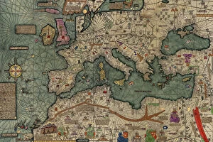
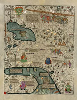
Background imageSea Chart Collection: North Africa, Europe and the Middle East from the Catalan Atlas (reproduction)

North Africa, Europe and the Middle East from the Catalan Atlas (reproduction)
5054659 North Africa, Europe and the Middle East from the Catalan Atlas (reproduction) by Cresques, Abraham (1325-87) (after); (add.info)

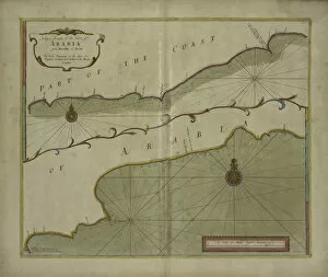
Background imageSea Chart Collection: A Large Draught of the Coast of Arabia from Maculla to Dofar, 1703 (colour engraving)

A Large Draught of the Coast of Arabia from Maculla to Dofar, 1703 (colour engraving)
5242478 A Large Draught of the Coast of Arabia from Maculla to Dofar, 1703 (colour engraving) by Nicholls, Sutton (fl.1700-40); New York Public Library

Background imageSea Chart Collection: Antique map of Channel, 1666 (colour engraving)

Antique map of Channel, 1666 (colour engraving)
5242477 Antique map of Channel, 1666 (colour engraving) by Goos, Pieter (1616-1675); New York Public Library, USA; (add.info.: Het Canaal tusschen Engeland en Vrancriick); Dutch, out of copyright

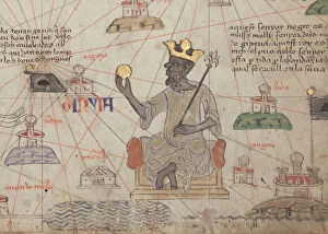
Background imageSea Chart Collection: Detail from the Catalan Atlas, Sheet 6, showing Mansa Musa enthroned

Detail from the Catalan Atlas, Sheet 6, showing Mansa Musa enthroned
5043052 Detail from the Catalan Atlas, Sheet 6, showing Mansa Musa enthroned, 1375 (pen with coloured inks on parchment) by Cresques, Abraham (1325-87); Bibliotheque Nationale, Paris

Background imageSea Chart Collection: Catalan Atlas (reproduction)

Catalan Atlas (reproduction)
5054666 Catalan Atlas (reproduction) by Cresques, Abraham (1325-87) (after); (add.info.: Reproduction of 1375 World map made in Majorca)

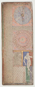
Background imageSea Chart Collection: Catalan Atlas, Sheet 1, 1375 (pen and coloured inks on parchment)

Catalan Atlas, Sheet 1, 1375 (pen and coloured inks on parchment)
5054645 Catalan Atlas, Sheet 1, 1375 (pen and coloured inks on parchment) by Cresques, Abraham (1325-87); Bibliotheque Nationale, Paris

Background imageSea Chart Collection: Catalan Atlas, Sheet 5, 1375 (pen and coloured inks on parchment)

Catalan Atlas, Sheet 5, 1375 (pen and coloured inks on parchment)
5054641 Catalan Atlas, Sheet 5, 1375 (pen and coloured inks on parchment) by Cresques, Abraham (1325-87); Bibliotheque Nationale, Paris, France; (add.info.: World map made in Majorca)

Background imageSea Chart Collection: Catalan Atlas, Sheet 7, 1375 (pen and coloured inks on parchment)

Catalan Atlas, Sheet 7, 1375 (pen and coloured inks on parchment)
5054643 Catalan Atlas, Sheet 7, 1375 (pen and coloured inks on parchment) by Cresques, Abraham (1325-87); Bibliotheque Nationale, Paris, France; (add.info.: World map made in Majorca)

Background imageSea Chart Collection: Cathay, China from the Catalan Atlas (reproduction)

Cathay, China from the Catalan Atlas (reproduction)
5054664 Cathay, China from the Catalan Atlas (reproduction) by Cresques, Abraham (1325-87) (after); (add.info.: Detail from the reproduction of 1375 World map made in Majorca)

Background imageSea Chart Collection: Catalan Atlas, Sheet 4 (pen with coloured inks on parchment)

Catalan Atlas, Sheet 4 (pen with coloured inks on parchment)
5054648 Catalan Atlas, Sheet 4 (pen with coloured inks on parchment) by Cresques, Abraham (1325-87); Bibliotheque Nationale, Paris

Background imageSea Chart Collection: Catalan Atlas, Sheet 3, 1375 (pen and coloured inks on parchment)

Catalan Atlas, Sheet 3, 1375 (pen and coloured inks on parchment)
5054642 Catalan Atlas, Sheet 3, 1375 (pen and coloured inks on parchment) by Cresques, Abraham (1325-87); Bibliotheque Nationale, Paris

Background imageSea Chart Collection: Sea chart island Sardinia part coast North Africa Passport map

Sea chart island Sardinia part coast North Africa Passport map
Sea chart of the island of Sardinia and a part of the coast of North Africa Passport map of the sea coasts of the eyland Sardinia with the coast of Barbaria, between the sea C. de Ferro and C. Bona

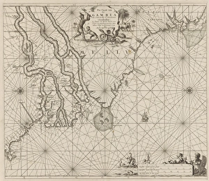
Background imageSea Chart Collection: Sea chart coast Gambia part Senegal Guinea Sierra Leone Pas caarte

Sea chart coast Gambia part Senegal Guinea Sierra Leone Pas caarte
Sea chart of the coast of The Gambia and part of the coast of Senegal, Guinea and Sierra Leone Pas caarte of Rio Gambia from C

Background imageSea Chart Collection: Sea chart part Bay Biscay Bilbao New Pascaart

Sea chart part Bay Biscay Bilbao New Pascaart
Sea chart of part of the Bay of Biscay near Bilbao New Pascaart of the Sea coast of Biscay and Asturias between Bilbao and Luarca (title on object)

Background imageSea Chart Collection: Sea chart part coast Brazil Pass chart sea shores

Sea chart part coast Brazil Pass chart sea shores
Sea chart of part of the coast of Brazil Pass chart of the sea shores of Brazil, between Rio das Contas and Cabo S. Thome (title on object), Sea chart of part of the coast of Brazil

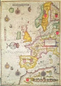
Background imageSea Chart Collection: A Generall carde, and description of the sea coastes of Europe, and navigation in

A Generall carde, and description of the sea coastes of Europe, and navigation in
XCF306029 A Generall carde, and description of the sea coastes of Europe, and navigation in this book conteyned (hand coloured engraving) by Hondius, Jodocus (1567-1611); Private Collection; Dutch

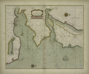
Background imageSea Chart Collection: A chart of the East coast of Scotland from a sea-atlas containing an hydrographical

A chart of the East coast of Scotland from a sea-atlas containing an hydrographical
XOS1765726 A chart of the East coast of Scotland from a sea-atlas containing an hydrographical description of most of the sea-coasts of the known parts of the world by Samuel Thornton

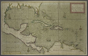
Background imageSea Chart Collection: Trading map of the West Indies, 1707 (hand coloured print)

Trading map of the West Indies, 1707 (hand coloured print)
XOS1765725 Trading map of the West Indies, 1707 (hand coloured print) by English School, (18th century); New York Public Library

Background imageSea Chart Collection: A new and correct map of the world from an atlas of the sea, 1707 (hand coloured print)

A new and correct map of the world from an atlas of the sea, 1707 (hand coloured print)
XOS1765724 A new and correct map of the world from an atlas of the sea, 1707 (hand coloured print) by English School, (18th century); New York Public Library

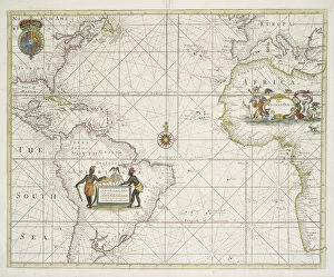
Background imageSea Chart Collection: The Atlantic or Western Ocean from the West-India atlas, 1775 (coloured engraving)

The Atlantic or Western Ocean from the West-India atlas, 1775 (coloured engraving)
XOS1765723 The Atlantic or Western Ocean from the West-India atlas, 1775 (coloured engraving) by Jefferys, Thomas (c.1719-71); New York Public Library

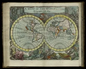
Background imageSea Chart Collection: A map of the world from Atlas maritimus by John Seller, 1682 (hand coloured engraving)

A map of the world from Atlas maritimus by John Seller, 1682 (hand coloured engraving)
XOS1765722 A map of the world from Atlas maritimus by John Seller, 1682 (hand coloured engraving) by Seller, John (1632-97); 12x14 cm; New York Public Library

Background imageSea Chart Collection: Chart of the Western (now Atlantic) Ocean with rhumb lines by Jeremiah Seller, 1705

Chart of the Western (now Atlantic) Ocean with rhumb lines by Jeremiah Seller, 1705
XOS1765721 Chart of the Western (now Atlantic) Ocean with rhumb lines by Jeremiah Seller, 1705 (hand coloured print) by English School, (18th century); 42x53 cm; New York Public Library

Background imageSea Chart Collection: Territorial holdings of the Dutch West India Company, 1710 (hand coloured print

Territorial holdings of the Dutch West India Company, 1710 (hand coloured print
XOS1765720 Territorial holdings of the Dutch West India Company, 1710 (hand coloured print on vellum) by Bleau, Guillaume & Jean (17th century); 77.3x95.2 cm; New York Public Library

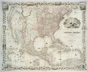
Background imageSea Chart Collection: Map of the United States of America, British provinces, Mexico, West Indies and Central America

Map of the United States of America, British provinces, Mexico, West Indies and Central America
XOS1765719 Map of the United States of America, British provinces, Mexico, West Indies and Central America, 1850 (hand coloured print) by American School

Background imageSea Chart Collection: A map of New England and New York from John Speeds Theatre of the Empire of Great Britain

A map of New England and New York from John Speeds Theatre of the Empire of Great Britain
XOS1765718 A map of New England and New York from John Speeds Theatre of the Empire of Great Britain, 1676 (colour print) by Speed, John (1552-1629); 38x48 cm; New York Public Library


All Professionally Made to Order for Quick Shipping

"Unveiling the Secrets of the Sea: A Journey through Historic Sea Charts" Embark on a voyage through time and explore the captivating world of sea charts. These intricate maps have guided sailors, explorers, and adventurers for centuries, revealing the wonders of our planet's vast oceans. One such chart is a Map of Africa showcasing its most recent discoveries, including the Island of St. This meticulously crafted map provides a glimpse into the evolving knowledge of this magnificent continent. Another remarkable creation is "A new and correct map of the world laid down according to the newest discoveries. " It unveils an ever-expanding understanding of our globe as explorations unraveled its mysteries. In 1513, Islam was introduced to The New World through an extraordinary Atlantic map created by Admiral Piri Reis. This masterpiece not only depicts uncharted territories but also signifies cultural exchanges that shaped history. Jan Luyken and Claes Jansz Voogt's sea chart showcases Cuba and Jamaica's south coast with meticulous detail. Their artistry brings these Caribbean gems to life, inviting us to imagine sailing along their shores. The vibrant colored engraving depicting Santiago in Cape Verde captures a pivotal moment in history - its capture in 1585 reveals European powers' ambitions during an era marked by fierce competition for global dominance. Traveling back even further in time takes us to 1375 when cartographers produced awe-inspiring works like Sheet 10 from Catalan Atlas. Crafted with pen and colored inks on parchment, it offers insights into medieval perceptions of geography. Sheet 9 from Catalan Atlas presents another fascinating chapter with its intricate details etched onto parchment using pen and colored inks. Each stroke tells stories about ancient lands waiting to be explored. Continuing this journey through time leads us to Sheet 12 from Catalan Atlas - yet another testament to human curiosity about distant realms beyond known horizons. Its delicate beauty invites contemplation.