Fraud Blocker Skip to main content

Satellite Image Collection (page 4)

"Exploring the vastness of our universe, satellite images capture breathtaking views that redefine our perspective

Background imageSatellite Image Collection: Extratropical storm Katia, 2011

Extratropical storm Katia, 2011
Extratropical storm Katia. Satellite image of the remains of Hurricane Katia approaching the UK as an extratropical storm on 11 September 2011. North is at top

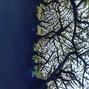
Background imageSatellite Image Collection: Chilean fjords

Chilean fjords, satellite image. During the last ice age, glaciers on the southern tip of Chile gouged out deep valleys. When the ice age ended the glaciers melted and the sea level rose
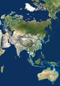
Background imageSatellite Image Collection: Asia

Asia. Satellite image centred on Asia. The North Pole is at upper right. Water is blue, vegetation is green, arid areas are brown, and snow and ice are white

Background imageSatellite Image Collection: North America

North America, coloured satellite image. North is at top. Vegetation is green, bare earth is brown, water is blue and snow and ice are white

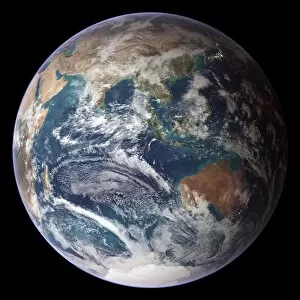
Background imageSatellite Image Collection: Blue Marble image of Earth (2005)

Blue Marble image of Earth (2005)
Blue Marble image of Earth. Composite satellite image of Earths eastern hemisphere, centred on the Indian Ocean. North is at top

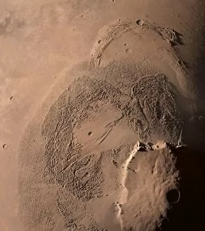
Background imageSatellite Image Collection: Olympus Mons and surroundings, Mars

Olympus Mons and surroundings, Mars
Olympus Mond, the largest volcano in our solar system. North of its mountain is a rough tongue called Lycus Sulci, a valley with some craters called Diacria Patera and a bow in the north

Background imageSatellite Image Collection: Central Europe at night, satellite image

Central Europe at night, satellite image
Central Europe at night. Satellite image showing Central Europe and parts of Western Europe at night. City lights (yellow) show areas of dense population. International borders are shown in white

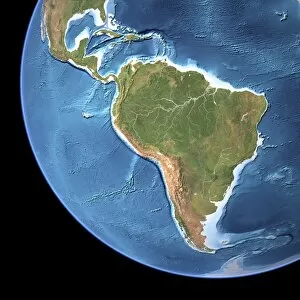
Background imageSatellite Image Collection: South America, topographic map

South America, topographic map. Highlands and lowlands of the continents are also shown, as ridges and flat areas. North America and the Caribbean (top left) and Antarctica (bottom right)

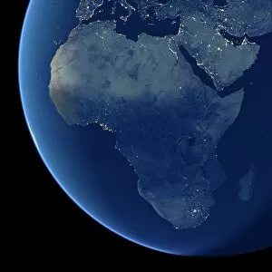
Background imageSatellite Image Collection: Africa at night, satellite image

Africa at night, satellite image. City lights (yellow) show areas of dense population, particularly in Europe and the Middle East (top)

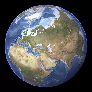
Background imageSatellite Image Collection: Eurasia, topographic map

Eurasia, topographic map. This map is centred on Russia, with Europe at centre left and East Asia at right. The North Pole (upper left), with Greenland shown in white

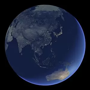
Background imageSatellite Image Collection: East Asia at night, satellite image

East Asia at night, satellite image
East Asia at night. Satellite image of the Earth at night, centred over China. City lights (yellow) show areas of dense population

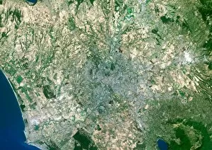
Background imageSatellite Image Collection: Rome, satellite image

Rome, satellite image. North is at top. Vegetationis green, bare ground is brown, urban areas aregrey and water is blue. Rome is the capital cityof Italy

Background imageSatellite Image Collection: London from the ISS

London from the ISS
London, UK, photographed from theInternational Space Station. North is at right.The River Thames flows eastwards down centre. Thebright white circle at lower left is theMillennium Dome

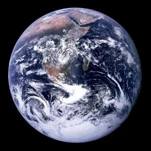
Background imageSatellite Image Collection: Us-Nasa-Earth-Longest Zday

Us-Nasa-Earth-Longest Zday
This 1972 NASA photo shows a view of the Earth as seen by the Apollo 17 astronauts. NASA announced 22 January, 2002 that all days are not created equal

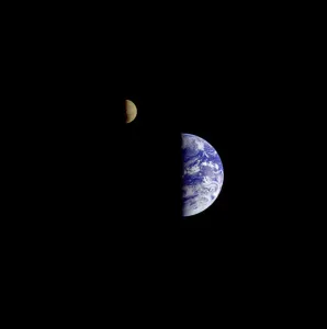
Background imageSatellite Image Collection: Us-Space-Earth-Moon

Us-Space-Earth-Moon
This 16 December, 1992 NASA file image captured 8 days after its encounter with Earth, the Galileo spacecraft looked back from a distance of about 6.2 million kilometers (3.9 million miles)

Background imageSatellite Image Collection: Credit Provided by the SeaWiFS Project, NASA / Goddard Space Flight Centre, and ORBIMAGE The cold

Credit Provided by the SeaWiFS Project, NASA / Goddard Space Flight Centre, and ORBIMAGE The cold
Credit Provided by the SeaWiFS Project, NASA/Goddard Space Flight Centre, and ORBIMAGE The cold, productive waters of the Greenland Sea and Norwegian Sea are revealed in this SeaWiFS image

Background imageSatellite Image Collection: Barents Sea July 19th, 2003, as seen by MODIS. Image courtesy of Jacques Descloitres

Barents Sea July 19th, 2003, as seen by MODIS. Image courtesy of Jacques Descloitres, MODIS Land Rapid Response Team at NASA GSFC

Background imageSatellite Image Collection: false-colour images feature the Indus River Valley, a lush oasis of vegetation made

false-colour images feature the Indus River Valley, a lush oasis of vegetation made possible by the Indus River, which is visible as a thin black thread heading toward the Arabian Sea in

Background imageSatellite Image Collection: An intense winter storm raced across the Mediterranean on November 13 and 14, 2004

An intense winter storm raced across the Mediterranean on November 13 and 14, 2004. Gale-force winds sank three ships off Algiers, Algeria, and heavy rain drenched the country

Background imageSatellite Image Collection: Satellite view of the land mass of Turkey and the Black Sea

Satellite view of the land mass of Turkey and the Black Sea

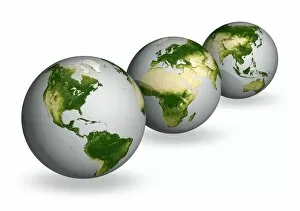
Background imageSatellite Image Collection: Earth vegetation globes, artworks C018 / 3559

Earth vegetation globes, artworks C018 / 3559
Earth vegetation globes. Artwork of Earth globes with vegetation cover pictured as a scale, or index of greenness. Greenness is based on several factors: the number and type of plants

Background imageSatellite Image Collection: Europe

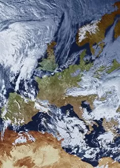
Europe, coloured satellite image. North is at top. Water is blue, vegetation is green, arid land is brown and clouds, snow and ice are white

Background imageSatellite Image Collection: Solar eruption, SOHO image

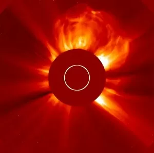
Solar eruption, SOHO image
Solar eruption. SOHO (Solar and Heliospheric Observatory) image of a huge coronal mass ejection (CME) from the Sun. The solar disc is obscured to prevent the image being over-exposed

Background imageSatellite Image Collection: Curiosity debris on Mars, satellite image C014 / 4941

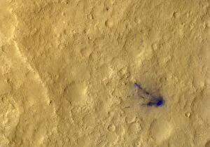
Curiosity debris on Mars, satellite image C014 / 4941
Curiosity debris on Mars. Colour-enhanced satellite image of impact marks (blue) caused by debris from the landing of NASAs Curiosity rover on Mars

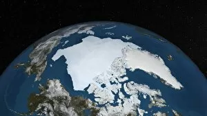
Background imageSatellite Image Collection: Arctic ice minimum extent, 2012

Arctic ice minimum extent, 2012
Arctic ice minimum extent. Satellite image showing the Arctic polar ice cap at its annual minimum extent on 16th September 2012

Background imageSatellite Image Collection: Columbia Glacier, Alaska, 1989

Columbia Glacier, Alaska, 1989
Columbia Glacier, Alaska. False-colour satellite image of the Columbia Glacier, Alaska, USA, taken in 1989. Columbia Glacier descends from an ice field (top) 3, 050 metres above sea level

Background imageSatellite Image Collection: Solar activity, SDO ultraviolet image

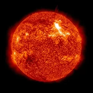
Solar activity, SDO ultraviolet image
Solar activity, Solar Dynamics Observatory (SDO) ultraviolet image. The SDO is an Earth-orbiting spacecraft launched in 2010 by NASA and used to observe the Sun

Background imageSatellite Image Collection: Arctic ice minimum extent, 2013 C017 / 3623

Arctic ice minimum extent, 2013 C017 / 3623
Arctic ice minimum extent. Satellite image showing the Arctic polar ice cap at its annual minimum extent on 12th September 2013

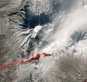
Background imageSatellite Image Collection: Plosky Tolbachik volcano erupting, 2013 C016 / 9732

Plosky Tolbachik volcano erupting, 2013 C016 / 9732
Plosky Tolbachik volcano erupting, satellite image. North is at top. This volcano (3682 metres) is located in Russias far eastern Kamchatka Peninsula

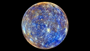
Background imageSatellite Image Collection: Mercury hemisphere, MESSENGER image C016 / 9721

Mercury hemisphere, MESSENGER image C016 / 9721
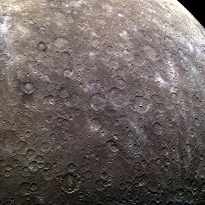
Mercury hemisphere, MESSENGER image. North is at top. This image is centred at longitude 40 degrees West. The colours show chemical and mineralogical differences between the rocks

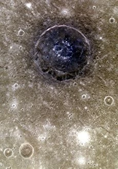
Background imageSatellite Image Collection: Atget crater, Mercury, MESSENGER image C016 / 9719

Atget crater, Mercury, MESSENGER image C016 / 9719
Atget crater on Mercury, MESSENGER image. North is at top. This crater, 100 kilometres across, is located in the Caloris Basin on Mercury, the planet closest to the Sun

Background imageSatellite Image Collection: Saturns north pole region, Cassini image

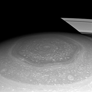
Saturns north pole region, Cassini image. This north polar hexagon region of the gas giant planet Saturn is in sunlight as spring comes to the planets northern hemisphere

Background imageSatellite Image Collection: Craters on Mercury, MESSENGER image C016 / 9720

Craters on Mercury, MESSENGER image C016 / 9720
Craters on Mercury, MESSENGER image. North is towards top left. This area, over 1900 kilometres across, consists mostly of as-yet unnamed craters in the eastern part of the Solitudo Persephones

Background imageSatellite Image Collection: Jebel Uweinat mountains, satellite image C016 / 9731

Jebel Uweinat mountains, satellite image C016 / 9731
Jebel Uweinat mountains, satellite image. North is at top. This mountain range (peak elevation: 1934 metres) is located on the Egyptian-Sudanese-Libyan border

Background imageSatellite Image Collection: Mercury hemispheres, MESSENGER images C016 / 9723

Mercury hemispheres, MESSENGER images C016 / 9723
Mercury hemispheres, MESSENGER images. Monochrome (left) and colour-filtered (right) images of a hemisphere of Mercury. North is at top and the hemispheres are centred at longitude 285 degrees West

Background imageSatellite Image Collection: Cloud vortex street, satellite image

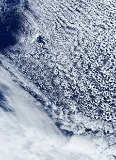
Cloud vortex street, satellite image. North is at top. The island of Jan Mayen (white, upper left) is located in the Arctic Ocean

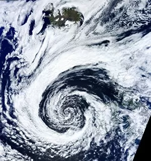
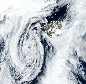
Background imageSatellite Image Collection: Low pressure, Iceland, satellite image

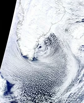
Low pressure, Iceland, satellite image. North is at top. The swirl of clouds (lower left) marks an area of low pressure that is centred south-west of Iceland (upper right)

Background imageSatellite Image Collection: Low pressure, UK, satellite image

Low pressure, UK, satellite image. North is at top, with land areas outlined in black. The swirl of clouds at lower centre is a lower pressure system centred over South-West England

Background imageSatellite Image Collection: Cloud streets, Greenland, satellite image

Cloud streets, Greenland, satellite image. North is at top, with Greenland and Iceland outlined in black. Cloud streets are parallel lines of clouds aligned with the wind

Background imageSatellite Image Collection: Cloud streets, Black Sea, satellite image

Cloud streets, Black Sea, satellite image. North is at top, with the Black Sea outlined in black. Cloud streets are parallel lines of clouds aligned with the wind

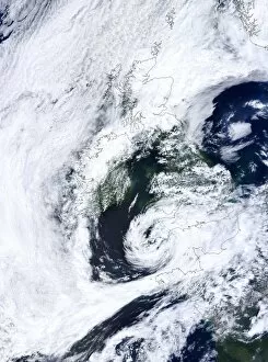
Background imageSatellite Image Collection: Atlantic low pressure, satellite image

Atlantic low pressure, satellite image. North is at top, and land areas are outlined in black. The swirl of cloud at lower centre is a low pressure system centred west of Ireland and the UK

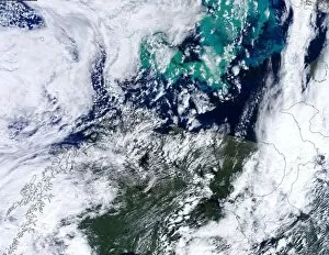
Background imageSatellite Image Collection: Barents Sea algal bloom, satellite image

Barents Sea algal bloom, satellite image. North is at top, with land areas outlined in black. Algal blooms (green, top) have formed in the Barents Sea off northern Scandinavia (lower left)

Background imageSatellite Image Collection: US-Mexico border, Sonoran Desert C016 / 6318

US-Mexico border, Sonoran Desert C016 / 6318
US-Mexico border, north-western Sonoran Desert. North is towards upper right. Farm fields (green) lie between the Salton Sea in California (top) and the Colorado River Delta in Mexico (bottom)

Background imageSatellite Image Collection: New Mexico, USA C016 / 6357

New Mexico, USA C016 / 6357
New Mexico, USA, from Earth orbit. North is towards upper right. At lower right is White Sands National Monument (white), with the Carrizozo Malpais lava flow (dark)


All Professionally Made to Order for Quick Shipping

"Exploring the vastness of our universe, satellite images capture breathtaking views that redefine our perspective. Inspired by Voyager 1's iconic 'Pale Blue Dot' image, we witness the beauty and fragility of Earth from space. From the British Isles to Europe at night, these satellite images reveal a tapestry of lights illuminating cities and towns across continents. Marvel at the mesmerizing glow as darkness blankets Europe or gaze in awe at the captivating sight of our entire planet aglow during nighttime. Delve into Tenerife's intricate landscapes, where satellite imagery unveils its hidden wonders with stunning clarity. Venturing beyond our home planet, New Horizons grants us an extraordinary glimpse into Jupiter and its moon Io – a celestial dance frozen in time. Witnessing Earth from afar reminds us of its remarkable diversity; behold Scotland's rugged terrain captured through a lens high above. Satellite imagery also unravels nature's grandeur: observe awe-inspiring solar prominences erupting from the sun’s surface like fiery tendrils reaching towards infinity. In January 2010, witness Mother Nature transforming the United Kingdom into a winter wonderland as snow blankets every corner. Finally, explore North America at night through satellite lenses – an ethereal spectacle showcasing bustling metropolises intertwined with serene natural landscapes under starlit skies. " Note.